Thier d'Hodimont is a climb in the region Pays de Herve. It is 1.8 km long and bridges 98 m of vertical ascent with an average gradient of 5.4%, resulting in a difficulty score of 67. The top of the ascent is located at 273 m above sea level. Climbfinder users shared 6 reviews of this climb and uploaded 16 photos.
Road name: Thier d'Hodimont
3.0 by WouterThis is an automatic translation, the original language is: Dutch.The road starts from Verviers' busy outgoing roads. The road itself is very wide and actually looks like one where it should also be busy, yet this was not the case with me. Good road surface and ok percentages.... read more

Welcome! Please activate your account if you would like to share something. Look for the verification email in your inbox.
If you want to upload your photos, you need to create an account. It only takes 1 minute and it's completely free.
The road starts from Verviers' busy outgoing roads. The road itself is very wide and actually looks like one where it should also be busy, yet this was not the case with me. Good road surface and ok percentages.
De weg start vanuit de drukke uitgaande wegen van Verviers. De weg zelf is heel breed en lijkt eigenlijk één waar het ook druk zou moeten zijn, maar toch was dit bij mij niet het geval. Goed wegdek en ok percentages.
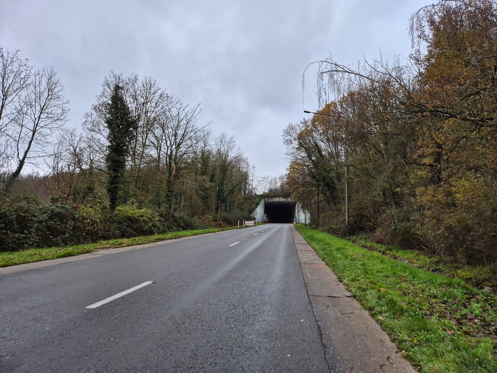
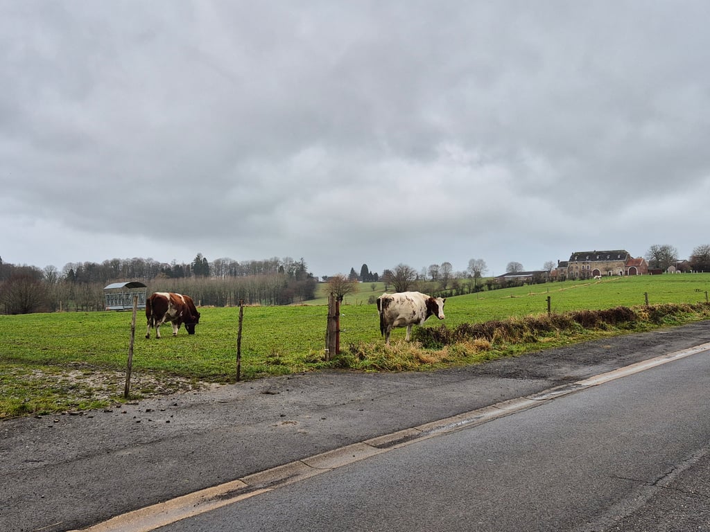
Climb that is firmly located but nicely regular towards the top. The section under the motorway bridge is steep and the tunnel is dark and noisy, so not really pleasant. After that, the area is wooded but not really attractive with a large car garage you cycle around. As a climb, however, it does run nicely and at the top of the climb you suddenly find yourself in beautiful rural surroundings, so 3 stars for that reason.
Klim die stevig bevindt maar lekker regelmatig nar boven loopt. Het stuk onder de autowegbrug is steil en de tunnel is donker en gehorig, dus niet echt prettig. Daarna is de omgeving wel bosrijk maar ook niet echt aantrekkelijk met een grote autogarage waar je omheen fietst. Als klim loopt ie echter wel lekker en bovenaan de klim kom je ineens in een prachtige landelijke omgeving, dus daarom toch 3 sterren.
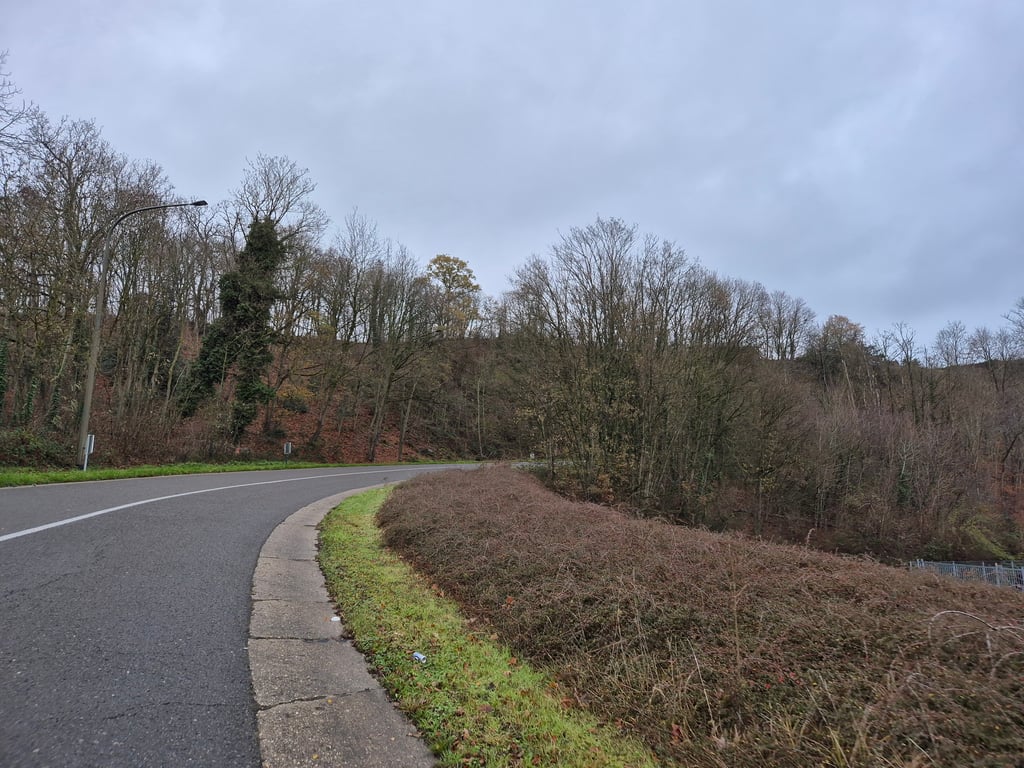
A pleasant climb, and more difficult than it looks! It never climbs too steeply, but it does climb for a long time! The road is wide, and fortunately so, as there can be quite a lot of traffic.
Montée agréable, et plus difficile qu'elle n'en paraît ! Ca ne monte jamais de façon exagérée, mais cela monte durant longtemps ! La route est large, et heureusement car il peut y avoir pas mal de trafic.
Quite busy with traffic which was a pity because otherwise this is quite a nice climb. For me it was the last one of the day and then you feel it quite a bit because although the percentages are not too bad, the steep part of the slope goes on for a really long time. Pleasant scenery and in the bend at the end of the steeper section there is a viewpoint slightly to the right.
Nogal druk met verkeer wat jammer was want voor de rest is dit best een lekkere klim. Het was voor mij de laatste van de dag en dan voel je hem best wel want hoewel de percentages meevallen gaat het steile deel van de helling echt wel lang door. Aangename omgeving en in de bocht aan het eind van het steilere stuk is er iets naar rechts een uitzichtpunt.
A wide road, on Sunday this climb done so there was little people on the track. On Strava, the KOM is still feasible here :-)
Een brede weg, op zondag deze klim gedaan dus er was weinig volk op de baan. Op Strava is de KOM hier zeker nog haalbaar :-)
A much steeper and more enjoyable alternative is to take the small road straight ahead at the third roundabout: Montagne de l'Invasion, with the road sign indicating a gradient of 19%.
Een veel steilere en leukere variant is om bij de derde rotonde het kleine weggetje rechtdoor in te rijden: Montagne de l’Invasion, met het verkeersbord wat een stijgingspercentage van 19% aangeeft.
| 7 km/h | 00:15:29 |
| 11 km/h | 00:09:51 |
| 15 km/h | 00:07:13 |
| 19 km/h | 00:05:42 |
This page is better in the app