View on map
© MapLibre | OpenStreetMap contributors
1%
2%
4%
6%
8%
10%
12%
15%
20%

Speelberg

3.0
4 reviews | Elevation profile | 2 photos
Tips nearby
Speelberg
Speelberg
transparant thumb
transparant thumb
transparant thumb
transparant thumb
transparant thumb
transparant thumb
Your achievable time
Calculating based on your best performances...
Relaxed
Maximum
W/kg
W/kg
W/kg
Analyse your climbing performance
Detailed insight into your climbing performance & automatically check off climbs
Based on your best performances.
Your best attempt:
Number of attempts:
Elevation profile Speelberg
cobbles (along the entire length)

Statistics

Difficulty points 60
Length 0.3 km
Average gradient 9.5%
Steepest 100 metres 14.9%
Total ascent 32 m

Short recap

Hidden gem
Cobbles
#63 toughest climb of Flanders
#93 most elevation gain of Druivenstreek
#35 average steepest climb of Flanders
Feedback about this climb?
Show climbs nearby Export to GPS device

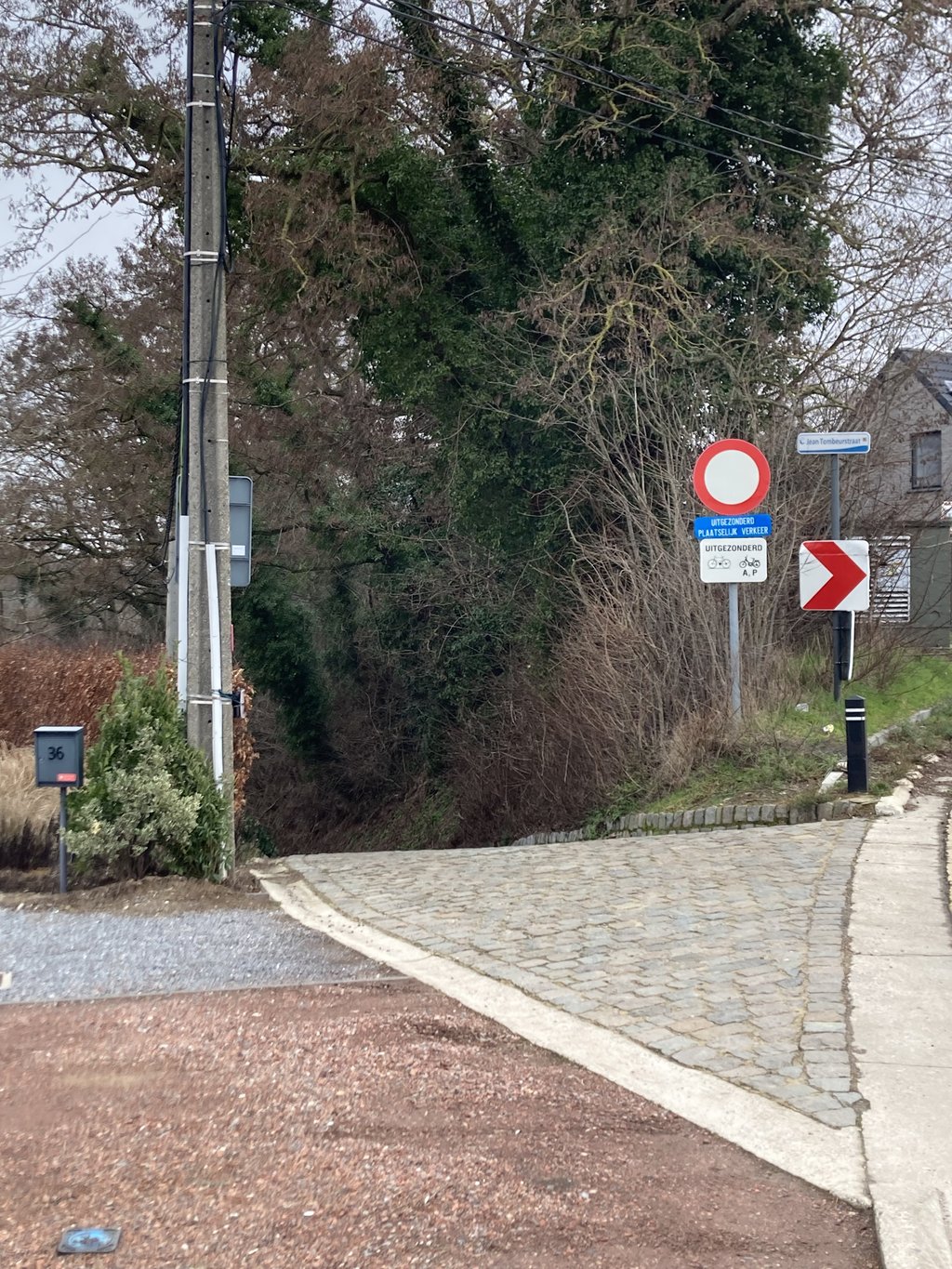
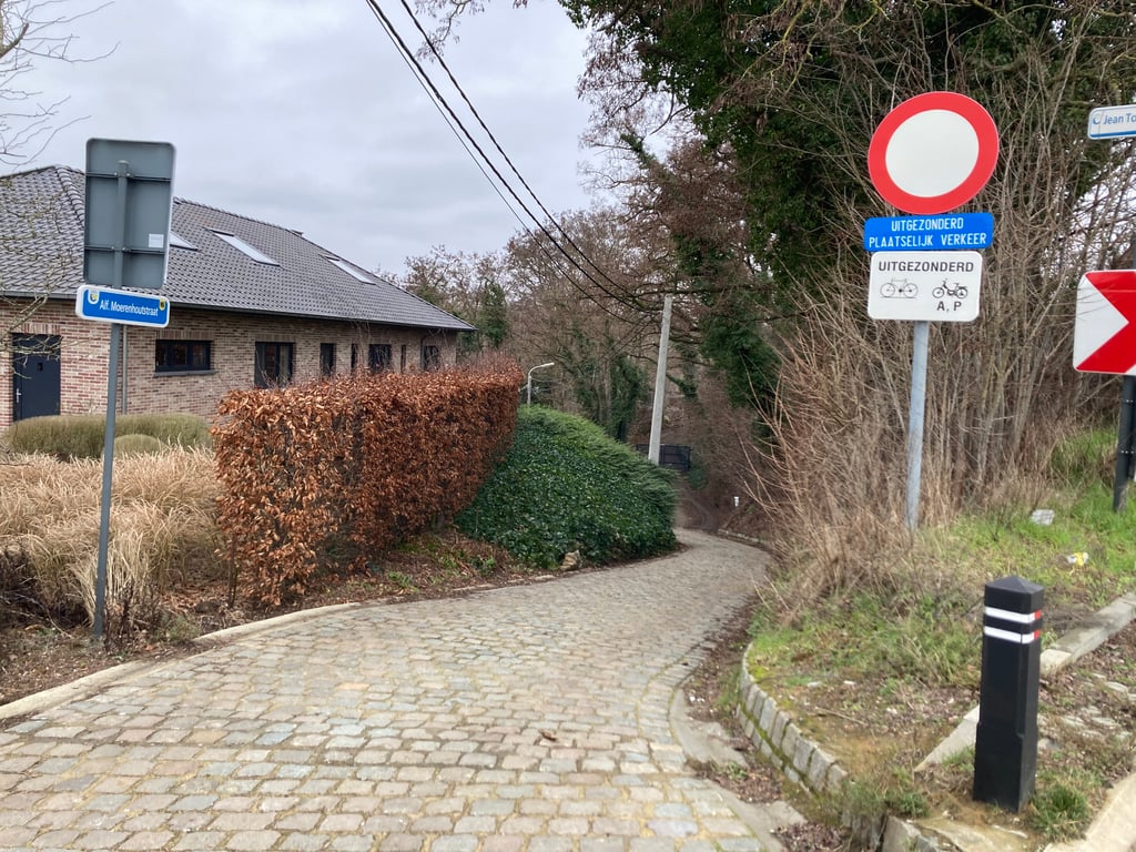
Speelberg is a climb in the region Druivenstreek. It is 0.3 km long and bridges 32 m of vertical ascent with an average gradient of 9.5%, resulting in a difficulty score of 60. The top of the ascent is located at 89 m above sea level. Climbfinder users shared 4 reviews of this climb and uploaded 2 photos.

Road name: Alfons Moerenhoutstraat

This is an automatic translation, the original language is: French.
Note that this street is now paved, after being closed for many months due to construction... Curious initiative. Maybe they want to make the Flèche Brabançonne pass through there? Having said that, the cobblestones are regularly placed and do not significantly increase the degree of difficulty of the bump.... read more

Photos (2)

Speelberg
Speelberg
transparant thumb
transparant thumb
transparant thumb
transparant thumb

Your uploads (max 4)

Welcome! Please activate your account if you would like to share something. Look for the verification email in your inbox.

If you want to upload your photos, you need to create an account. It only takes 1 minute and it's completely free.

  • Receive free climbfinder goodies for your reviews & photos.
  • Create a bucket list and check off conquered climbs.
  • Add missing climbs.
Continue with GoogleContinue with Google Continue with FacebookContinue with Facebook Continue with AppleContinue with Apple Sign up with email
By signing up you agree to our terms of service and confirm that you have read our privacy & content policy.

Reviews (4)

5.0
4.0
3.0
2.0
1.0
Ossie158
4 y 3.0
This is an automatic translation, the original language is: Dutch. Show original

Seems not to be too bad down there, but it keeps getting steeper. Still unknown gem if you like cobblestones. Also forest environment is beautiful. Better alternative vd hagaard.

Lijkt mee te vallen beneden maar blijft alsmaar steiler oplopen. Tochwel onbekender juweeltje als je van kasseien houdt. Ook bosomgeving is mooi. Beter alternatief vd hagaard.

Dashboard
Franck_Pastor
5 y 3.0
This is an automatic translation, the original language is: French. Show original

Note that this street is now paved, after being closed for many months due to construction... Curious initiative. Maybe they want to make the Flèche Brabançonne pass through there? Having said that, the cobblestones are regularly placed and do not significantly increase the degree of difficulty of the bump.

À noter que cette rue est maintenant pavée, après avoir été fermée pendant de long mois pour cause de travaux… Curieuse initiative. Peut-être veulent-ils faire passer la Flèche Brabançonne par là ? Ceci dit, les pavés sont régulièrement disposés et n'augmentent pas significativement le degré de difficulté de la bosse.

Dashboard
Rogier
5 y
This is an automatic translation, the original language is: French. Show original

We have added the cobblestones to the profile. Thank you very much for this information

Nous avons ajouté les pavés au profil. Merci beaucoup pour cette information

Dashboard
Franck_Pastor
5 y 3.0
This is an automatic translation, the original language is: French. Show original

Very narrow street (difficult even for a bike and a car to pass each other!) whose slope increases regularly until it reaches its peak just at the top. Beware, the aforementioned summit is an intersection that is only correctly seen at the very last moment. So you have to be very careful - in case a vehicle comes on your left...

Rue très étroite (difficile même pour un vélo et une voiture de s'y croiser !) dont la pente augmente régulièrement jusqu'à atteindre son pic juste au sommet. Attention, ledit sommet est une intersection qu'on ne voit correctement qu'au tout dernier moment. Il faut donc être y très prudent — au cas où un véhicule arrive sur votre gauche…

Dashboard

Climbing times

7 km/h 00:02:52
11 km/h 00:01:49
15 km/h 00:01:20
19 km/h 00:01:03

Road surface condition

100% 0% 0%
Based on 2 votes
Share your knowledge. What was the road condition during your ascent?

Traffic

100% 0% 0%
Based on 2 votes
Your experience counts. How much traffic did you encounter during the climb?

Frequently Asked Questions

You don't need special gearing for Speelberg. The slope isn't long or steep enough to require much shifting down. You can conquer this climb on power alone. However, a compact gearing system with a smallest front chainring of 34 and largest rear sprocket of 28 or 30 is always nice if you enjoy cycling uphill. This helps maintain a smooth cadence.

Speelberg falls into the 5th category. With good fitness, you can ride it up with speed and power. If you have less training, shift down and climb smoothly.

Speelberg is 0.3 km long.

The average gradient of Speelberg is 9.5%.

Speelberg has a steepest segment with an average gradient of 14.9%.

The summit of Speelberg is at 89 m.

At a slow pace of 7 km/h, it takes about 00:02:52 to climb Speelberg. At 11 km/h the time is 00:01:49, and at 15 km/h 00:01:20. For the fastest cyclists, 00:01:03 is an achievable time.

Speelberg is located in the region Druivenstreek in Belgium.

This page is better in the app

Climbfinder app
Climbfinder
(Free)
Open