| Hidden gem |
| Gravel |
| #100 toughest climb of Belgian Ardennes |
| #30 average steepest climb of Belgium |
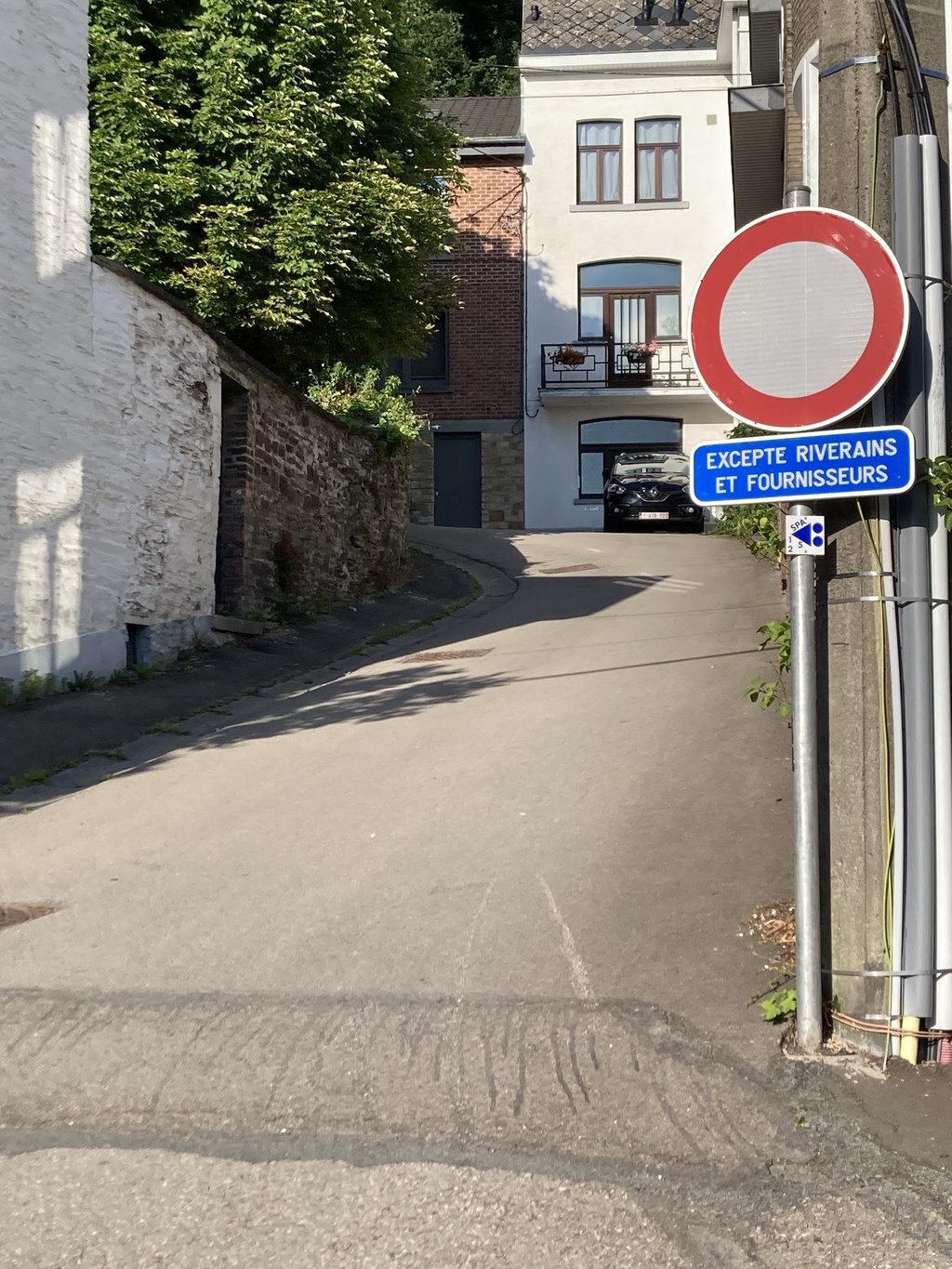
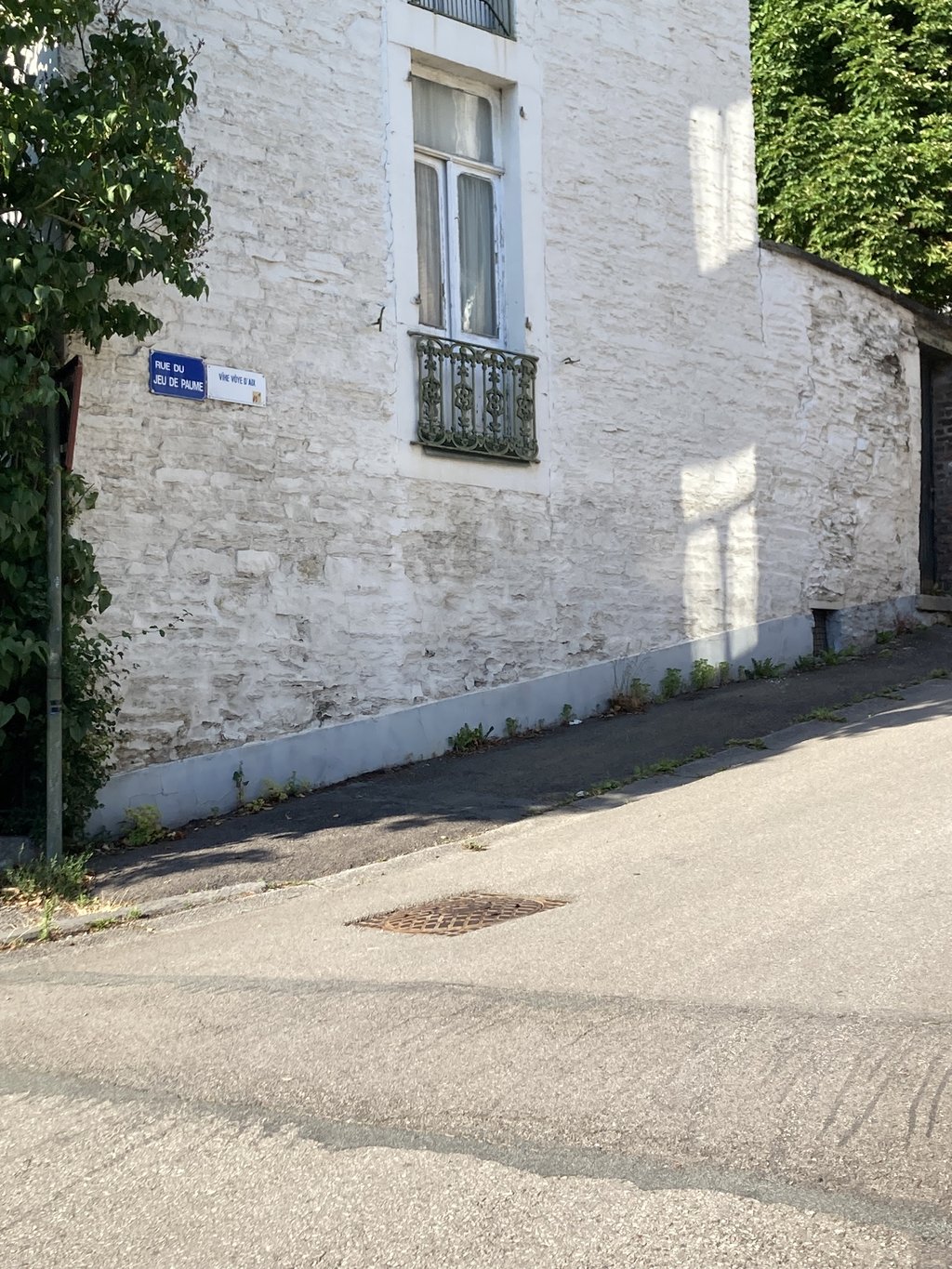
Rue du Jeu de Paume is a climb in the region Valleys of the Vesdre, de l'Amblève et de l'Ourthe. It is 0.8 km long and bridges 99 m of vertical ascent with an average gradient of 12.5%, resulting in a difficulty score of 164. The top of the ascent is located at 354 m above sea level. Climbfinder users shared 2 reviews of this climb and uploaded 2 photos.
Road name: Rue du Jeu de Paume
3.0 by Franck_PastorThis is an automatic translation, the original language is: French.This very steep climb is listed in the Cotacol encyclopaedia at no. 811, for the asphalt section. At the time, according to the commentary in the encyclopaedia, the gravel section was to be paved... 35 years later, we're still waiting! :-/... read more
Welcome! Please activate your account if you would like to share something. Look for the verification email in your inbox.
If you want to upload your photos, you need to create an account. It only takes 1 minute and it's completely free.
This very steep climb is listed in the Cotacol encyclopaedia at no. 811, for the asphalt section. At the time, according to the commentary in the encyclopaedia, the gravel section was to be paved... 35 years later, we're still waiting! :-/
Cette côte très raide est répertoriée dans l'encyclopédie Cotacol au n°811, pour sa partie bitumée. À l'époque, d'après le commentaire figurant sur l'encyclopédie, il était question de revêtir en dur la partie en gravel… 35 ans après, on attend toujours ! :-/
During a training ride in the Ardennes we were almost back at the starting point. Only a small threshold on the route map. At least that's what it looked like on paper...
In real life? From the moment you turn into the small road it goes up with terrible percentages. Because the first few hundred meters are always in a "bend" you never see the end and it remains mollemalen upwards.
Along the way I got the nickname Courage from a bunch of playing kids.
Once at the house it flattens out a bit, but the surface makes place for gravel (passable on 25mm contis).
A little more pedalling and then crying out at the top.
Beautiful side street!
Tijdens een trainingsrondje in de Ardennen waren we bijna terug bij de startplaats. Alleen nog een kleine drempel op de routekaart. Zo zag het er op papier iig uit. ..
In het echt? Vanaf het moment dat je het kleine straatje indraait gaat het met verschrikkelijke percentages omhoog. Omdat de eerste paar honderd meter eigenlijk steeds in een "bocht" lopen zie je eigenlijk nooit het einde en blijft het mollemalen naar boven.
Onderweg nog de bijnaam Courage gekregen van een stel spelende kinderen.
Eenmaal bij het huis wordt het wat vlakker, maar maakt de ondergrond plaats voor gravel (goed begaanbaar op 25mm contis).
Even doortrappen nog en vervolgens uithuilen aan de top.
Prachtig zijstraatje!
| 7 km/h | 00:06:48 |
| 11 km/h | 00:04:19 |
| 15 km/h | 00:03:10 |
| 19 km/h | 00:02:30 |
This page is better in the app