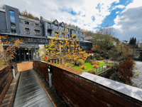
Route de Tillet from Remagne is a climb in the region Forest of Saint-Hubert. It is 1.3 km long and bridges 68 m of vertical ascent with an average gradient of 5.3%, resulting in a difficulty score of 49. The top of the ascent is located at 504 m above sea level. Climbfinder users shared 1 review/story of this climb and uploaded 0 photos.
Road names: Remagne & Rue d'Erlonfouet
4.0 by GriezwardThis is an automatic translation, the original language is: Dutch.Climb into the Great Forest of Saint-Hubert via the Route de Tillet from Remagne. The climb starts off steep, levels off slightly in the middle and then continues as a longer, gentler stretch towards the summit. Known as the Cotacol climb.... read more

Welcome! Please activate your account if you would like to share something. Look for the verification email in your inbox.
If you want to upload your photos, you need to create an account. It only takes 1 minute and it's completely free.
 Continue with Google
 Continue with Facebook
 Continue with Apple
Sign up with email
Continue with Apple
Sign up with email
Climb into the Great Forest of Saint-Hubert via the Route de Tillet from Remagne. The climb starts off steep, levels off slightly in the middle and then continues as a longer, gentler stretch towards the summit. Known as the Cotacol climb.
Klim in het Grote woud van Saint-Hubert via Route de Tillet vanuit Remagne. De helling begint stevig, vlakt in het midden iets af en loopt daarna uit in een langere, geleidelijkere strook richting de top. Bekend als Cotacol-klim.
| 7 km/h | 00:11:01 |
| 11 km/h | 00:07:01 |
| 15 km/h | 00:05:08 |
| 19 km/h | 00:04:03 |
This page is better in the app