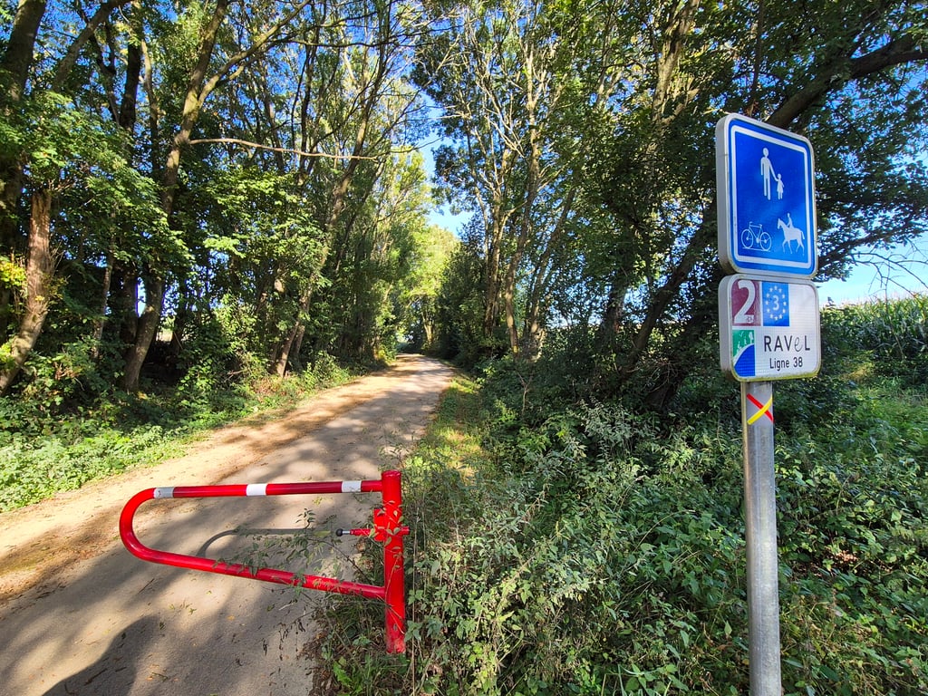
RAVeL Ligne 38 from Hombourg is a climb in the region Pays de Herve. It is 2.9 km long and bridges 69 m of vertical ascent with an average gradient of 2.4%, resulting in a difficulty score of 22. The top of the ascent is located at 280 m above sea level. Climbfinder users shared 4 reviews of this climb and uploaded 8 photos.
Road name: RAVeL Ligne 38 Hombourg Aubel
2.0 by NoahColinThis is an automatic translation, the original language is: French.Another easy ascent of the Ravel not long not steep more made to enjoy... read more

Welcome! Please activate your account if you would like to share something. Look for the verification email in your inbox.
If you want to upload your photos, you need to create an account. It only takes 1 minute and it's completely free.
Another easy ascent of the Ravel not long not steep more made to enjoy
Encore une remontée facile du Ravel pas long pas pentu plus fait pour profiter
Very nice, nice car-free climbing but none of it is really special either. It's false flat. Would do it though if you are in the area, because who doesn't want to cycle car-free on a good cycle path?
Heel leuk, lekker autovrij klimmen maar echt bijzonder is het ook allemaal niet. Het is vals plat. Zou het wel doen als je in de buurt bent, want wie wil er niet autovrij fietsen over een goed fietspad?
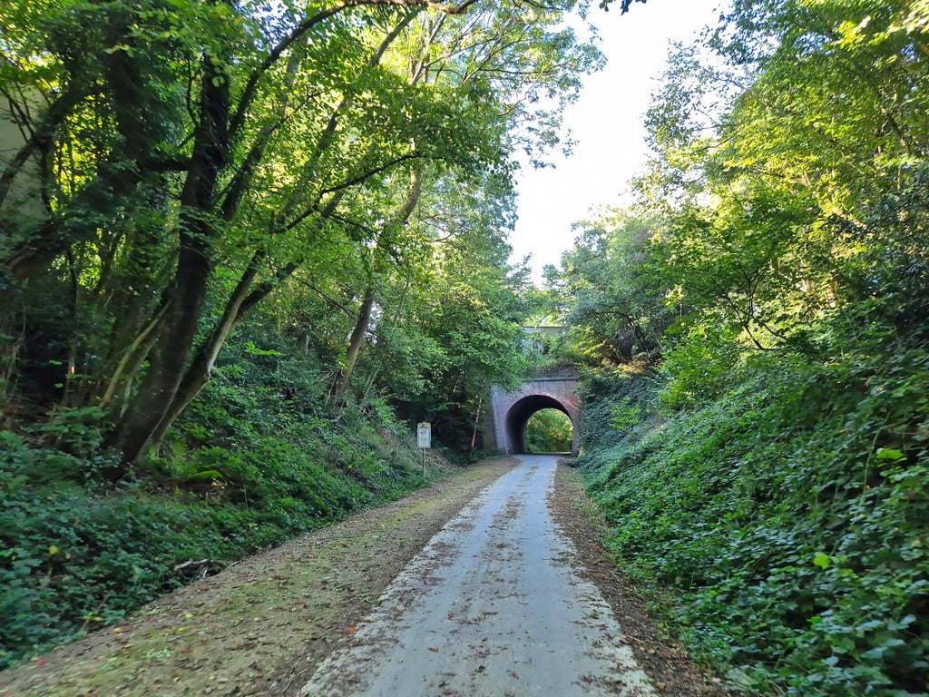
Longer climb over Ligne 38 from Rue de la Station near Hombourg towards Aubel. The climb can be considered false flat. Towards the little tunnel that passes under Hagelstein, it gets a bit steeper without becoming really difficult....
Langere klim over Ligne 38 vanaf Rue de la Station bij Hombourg richting Aubel. De klim is te beschouwen als vals plat. Richting het tunneltje dat onder Hagelstein doorloopt wordt het een stukje steiler zonder echt moeilijk te worden..
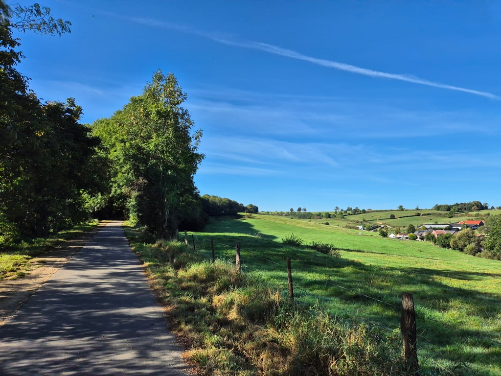
Long and quite a nice climb on a beautiful free-flowing (and almost new) asphalt bike path. The bike path runs along the route of an old railroad so certain elevation changes will be "smoothed out" as you ride in an incision or over an embankment. So all in all you can consider this climb a runner but towards the end the percentage definitely increases. You ride mostly in an overgrown strip but regularly there are beautiful views. Towards the end, you can also see nicely the ridge you are about to ride up.
At the highest point (at the viaduct) you can - just before it - via a short staircase to the road to Remersdaal. Another option is to follow the cycle path down towards Aubel. Then you can also quickly turn left to return to the regular road network.
Overall, the climb is a relaxed runner where you do bridge a considerable height difference. Because of the nice and quiet bike path and the surroundings 4 stars.
Lange en best fraaie klim over een prachtig vrijliggend (en vrijwel nieuw) asfaltfietspad. Het fietspad loopt over het traject van een oude spoorlijn dus bepaalde hoogteverschillen zullen worden "glad gestreken", omdat je in een insnijding of over een talud rijdt. Al met al kan je deze klim dus wel als een loper beschouwen maar tegen het eind neemt het percentage zeker toe. Je rijdt veelal in een begroeide strook maar regelmatig zijn er fraaie uitzichten. Tegen het eind zie je ook mooi de heuvelrug waar je tegenop gaat rijden.
Op het hoogste punt (bij het viaduct) kan je - iets daarvoor - via een kort trappetje naar de weg naar Remersdaal. Andere optie is het fietspad volgen omlaag richting Aubel. Dan kan je ook al snel linksaf naar het reguliere wegennet terugkeren.
Overall is de klim een relaxte loper waar je wel een behoorlijk hoogteverschil mee overbrugt. Vanwege het mooie en rustige fietspad en de omgeving 4 sterren.
| 7 km/h | 00:24:48 |
| 11 km/h | 00:15:47 |
| 15 km/h | 00:11:34 |
| 19 km/h | 00:09:08 |
This page is better in the app