Rampe de Renoupré is a climb in the region Pays de Herve. It is 1.6 km long and bridges 113 m of vertical ascent with an average gradient of 7%, resulting in a difficulty score of 86. The top of the ascent is located at 290 m above sea level. Climbfinder users shared 5 reviews of this climb and uploaded 17 photos.
Road names: Rampe de Renoupré, Rue Henripré & Route du Village
3.0 by JarinThis is an automatic translation, the original language is: Dutch.Beautiful hidden climb to Andrimont. Climb leads you through a wooded area after a very steep start with more pleasant climbing percentages. Therefore definitely a nicer alternative to the Cote de Andrimont which ends in the same village. ... read more

Welcome! Please activate your account if you would like to share something. Look for the verification email in your inbox.
If you want to upload your photos, you need to create an account. It only takes 1 minute and it's completely free.
Beautiful hidden climb to Andrimont. Climb leads you through a wooded area after a very steep start with more pleasant climbing percentages. Therefore definitely a nicer alternative to the Cote de Andrimont which ends in the same village.
Prachtige verscholen klim naar Andrimont. Klim leidt je na een zeer steil begin met aangenamere klimpercentages door een bosrijke omgeving. Daarom zeker een mooier alternatief voor de Cote de Andrimont die in hetzelfde dorp uitkomt.
A pleasant climb, with the foot of the hill the main difficulty, although the rest is not bad either!
Montée agréable, dont le pied constitue la principale difficulté, bien que le reste ne soit pas mal non plus !
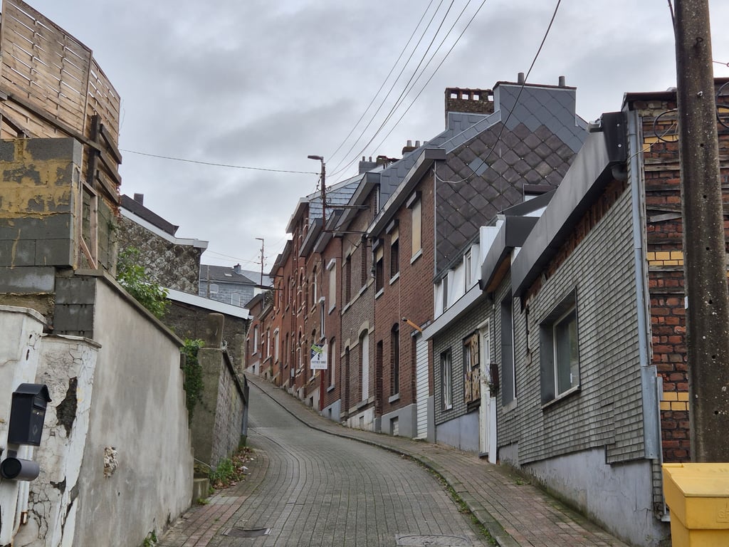
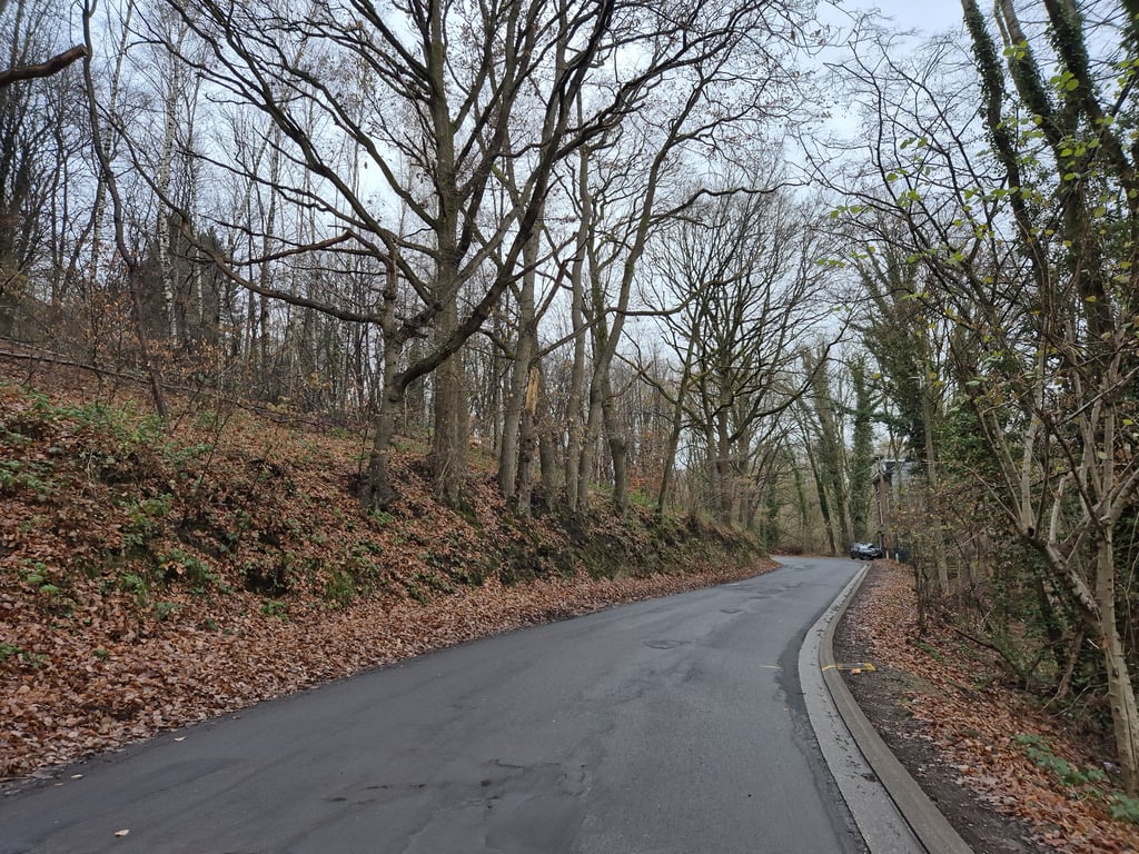
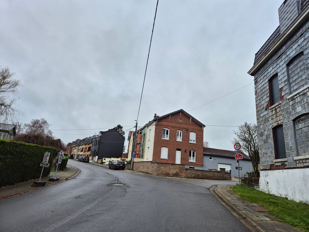
Climb that starts very steep as you cycle up for a small cobbled street. At the end of this you come to a very clear T-junction where other traffic can't really go fast, so turning left shouldn't normally be a problem. This is followed by a partly winding runner that runs partly past houses and partly through woods to Andrimont. The slope continues to the end.
Klim die behoorlijk steil begint als je door een klein klinkerstraatje (deze begint met een forse drempel maar daar kan je net omheen) omhoog fietst. Op het eind daarvan kom je op een zeer overzichtelijke T-splitsing waarbij het andere verkeer niet echt hard kan rijden, dus linksaf slaan zou normaal geen probleem moeten zijn. Daarna volgt een deels bochtige loper die deels langs huizen en deels door bos naar Andrimont loopt. De helling blijft tot het eind doorlopen.
As the graph indicates - very steep start! Middle part quite quiet for being so close to Verviers, end quite less so.
We then drove towards Henri-Chapelle, which was quite a good connection.
Zoals de grafiek aangeeft - heel steil begin! Middenstuk vrij rustig om zo dicht tegen Verviers te zitten, einde heel wat minder.
Wij zijn hierna richting Henri-Chapelle gereden, en dat was best een goede verbinding.
Yet the best climb in the agglomeration of Verviers. Especially the many bends makes this climb also fun to descend.
Toch wel de leukste beklimming in de agglomeratie van Verviers. Met name de vele bochtjes maakt deze beklimming ook leuk om af te dalen.
| 7 km/h | 00:13:50 |
| 11 km/h | 00:08:48 |
| 15 km/h | 00:06:27 |
| 19 km/h | 00:05:06 |
This page is better in the app