Raffelberg from Leefdaal is a climb in the region Dijleland. It is 0.9 km long and bridges 39 m of vertical ascent with an average gradient of 4.1%, resulting in a difficulty score of 17. The top of the ascent is located at 90 m above sea level. Climbfinder users shared 11 reviews of this climb and uploaded 2 photos.
Road name: Raffelberg
4.0 by MV_079This is an automatic translation, the original language is: Dutch.Done during the Brabantse Pijl tour. Nice climb through a hollow road. Asphalt in the first few metres is awful, but after that it is OK.... read more
Welcome! Please activate your account if you would like to share something. Look for the verification email in your inbox.
If you want to upload your photos, you need to create an account. It only takes 1 minute and it's completely free.
Not too long, but a pleasant, steady climb. It’s also very peaceful and the road is in good condition.
Niet te lange maar leuke constante klim. Ook zeer rustig met een goede weg.
A lovely climb with no traffic – well worth a go if you’re in the area
Mooie klim met geen verkeer, leuk om te doen als je in de buurt bent
Not too steep, which means you'll be riding it faster than you'd like.
One on which your fellow riders can become quieter. As others have mentioned, it can be slippery after rain. Plan it on your route if you need to pass it, but not as an end in itself.
Niet te stijl waardoor je hem al vlugger op rijd dan je zou willen.
Eentje waarop je groepsgenoten al eens wat stiller kunnen worden. Zoals anderen reeds aankaarten, slijk kan hier al eens blijven liggen na regen. Plan hem op je route als je er moet passeren, maar geen eind doel op zich
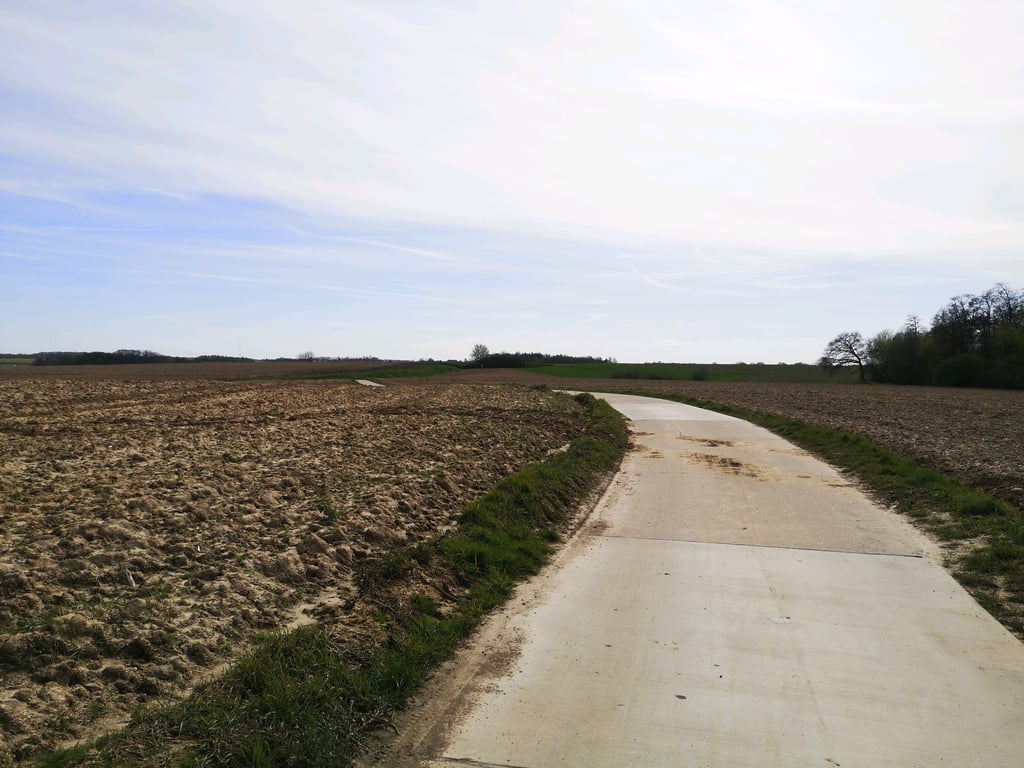
Hollow road that climbs gradually uphill. A good warm-up for the more explosive slopes ahead. The road is bad at times though
Holle weg die geleidelijk bergop gaat. Een goede opwarmer voor de meer explosieve hellingen die verderop liggen. De weg is soms wel slecht
Cool climb to learn to dose. Hollow road is handsome, there amid all the crowds (E 40)
Toffe klim om te leren doseren. Holle weg is knap, daar te midden van al de drukte (E 40)
Done during the Brabantse Pijl tour. Nice climb through a hollow road. Asphalt in the first few metres is awful, but after that it is OK.
Gedaan tijdens de toertocht van de Brabantse Pijl. Mooie klim door een holle weg. Asfalt op de eerste meters is om te janken, daarna gaat het wel weer
The climb is indeed very aesthetic, but should be avoided in wet weather, if you don't want your bike to look like a pile of mud: the earth easily drips from the embankments and the surrounding fields to cover the road.
Montée en effet très esthétique, mais à éviter par temps humide, si on ne veut pas voir son vélo ressembler à un tas de boue : la terre dégouline en effet très facilement des talus et des champs environnants pour venir tapisser la route.
Not very difficult in its percentage but long and especially very beautiful.
The view at the top is worth it!
Pas très difficile dans son pourcentage mais longue et surtout très belle.
La vue au sommet vaut le coup!
Not a difficult climb and very pleasant because the setting is bucolic: through small copses and fields. Very amusing!
Montée pas difficile et très agréable car le cadre est bucolique : à travers des petits bosquets et des champs. Très amusant !
It is also a nice climb, a small path through the hills. There are more difficult climbs in the area but this definitely one of the nicer ones.
Het is ook een mooie beklimming, een klein pad door de heuvels. Er zijn moeilijker beklimmingen in de buurt maar dit zeker een van de mooier.
Still one of the longer slopes in the area. Also nice that the longer it gets the heavier it gets.
Toch een van de iets langere hellingen van de buurt. Ook leuk dat hij hoe langer hoe zwaarder wordt.
| 7 km/h | 00:08:04 |
| 11 km/h | 00:05:08 |
| 15 km/h | 00:03:46 |
| 19 km/h | 00:02:58 |
This page is better in the app