Tips nearby


Plettenberg from Wittem is a climb in the region South Limburg. It is 1.1 km long and bridges 41 m of vertical ascent with an average gradient of 3.8%, resulting in a difficulty score of 17. The top of the ascent is located at 139 m above sea level. Climbfinder users shared 7 reviews of this climb and uploaded 7 photos.
Road names: Van Plettenbergweg & Wittemerweg
3.0 by PinoThis is an automatic translation, the original language is: Dutch.Nice way to get to Eijs from Gulpen. Was quiet when we drove it.... read more
Welcome! Please activate your account if you would like to share something. Look for the verification email in your inbox.
If you want to upload your photos, you need to create an account. It only takes 1 minute and it's completely free.
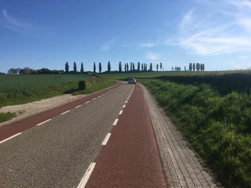
Climb over the main road from monastery Wittem to Eys. This climb is more gradual than the one from Eys. The percentages increase only slowly. The steepest part is just before the point where you see the famous cypress trees on the plateau to the left.
Klim over de doorgaande weg vanaf klooster Wittem naar Eys. Deze klim loopt geleidelijker dan die vanuit Eys. De percentages lopen maar langzaam op. Het steilste stuk zit net voor het punt waar je links op het plateau de bekende cypressen ziet staan.
Because of its location between big brothers like the Eyserbosweg, Kruisberg and Gulperberg, the Plettenberg is quickly seen as a connecting route. But still one you can feel very well. You ride on the big track where it slowly gets steeper. I had the tendency to want to ride too fast and to use a gear that was too heavy. I'll never forget the images from the Tour de France 2006 when Valverde fell here and had to leave the race.
Door de ligging tussen grote broers als de Eyserbosweg, Kruisberg en Gulperberg wordt de Plettenberg snel gezien als verbindingsroute. Maar toch wel eentje die je goed kunt voelen. Je rijdt over de grote baan waar het langzaam maar zeker steeds steiler wordt. Ik had daardoor de neiging te hard willen blijven rijden en op een te zwaar verzet te forceren. Overigens vergeet ik ook nooit de beelden uit de Tour de France 2006 toen Valverde hier viel en de wedstrijd moest verlaten.
Nice climb along an unfortunately busy road. The climb starts relaxed and then flattens out quite a bit. The last part is a lot spicier. For some extra altitude meters you can turn right on the Karstraat towards the Kruisberg (NB: last part is gravel).
Leuke klim langs een helaas drukke weg. De klim begint relaxed en vlakt daarna behoorlijk af. Het laatste stuk is dan weer een stuk pittiger. Voor wat extra hoogtemeters kan je bovenop rechtsaf de Karstraat pakken richting de Kruisberg (NB: Laatste stuk hiervan is gravel).
Nice climb if you want the shortest route from Wittem to Eys. If you come from Wahlwiller I would cycle the Kruisberg to Eys. If you have a headwind on this climb it can be quite tough. After the descent to Eys look carefully because the Eyserbosweg is one of the first roads you'll encounter in Eys.
Leuk klimmetje als je de kortste route van Wittem naar Eys wilt. Als je van Wahlwiller komt zou ik de via de Kruisberg naar Eys fietsen. Als je op deze klim een beste tegenwind hebt kan hij nog wel pittig worden. Goed kijken na de afdaling naar Eys want de Eyserbosweg is een van de eerste wegen die tegenkomt in Eys.
Because it is fairly flat at the start, you almost do not realize that it is rising. It is better to look around you and enjoy the view, than to necessarily go full speed ahead. Unless you want to wake up your legs for the Eyserbosweg that often follows.
Omdat ie bij de start vrij vlak is, heb je bijna niet door dat het stijgt. Hier kun je beter rustig om je heen kijken en genieten van het uitzicht, dan per se volle bak opknallen. Tenzij je je benen wakker wil schudden voor de Eyserbosweg die er vaak op volgt.
This is your warming-up for the Eyserbosweg.
Dit is je opwarmer voor de Eyserbosweg.
| 7 km/h | 00:09:14 |
| 11 km/h | 00:05:52 |
| 15 km/h | 00:04:18 |
| 19 km/h | 00:03:24 |
This page is better in the app