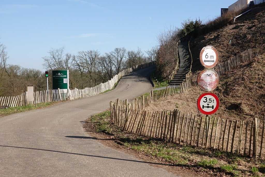
Motte van Montferland is a climb in the region Montferland. It is 1 km long and bridges 31 m of vertical ascent with an average gradient of 3.1%, resulting in a difficulty score of 17. The top of the ascent is located at 66 m above sea level. Climbfinder users shared 9 reviews of this climb and uploaded 25 photos.
This is an automatic translation, the original language is: Dutch.
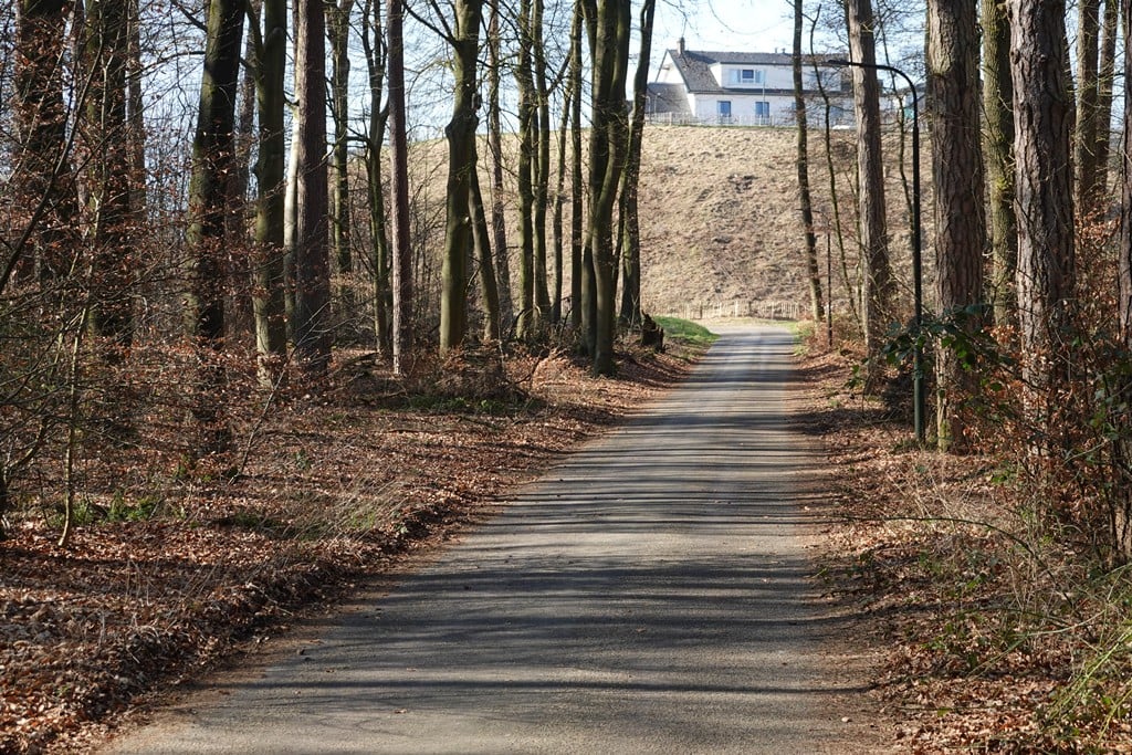
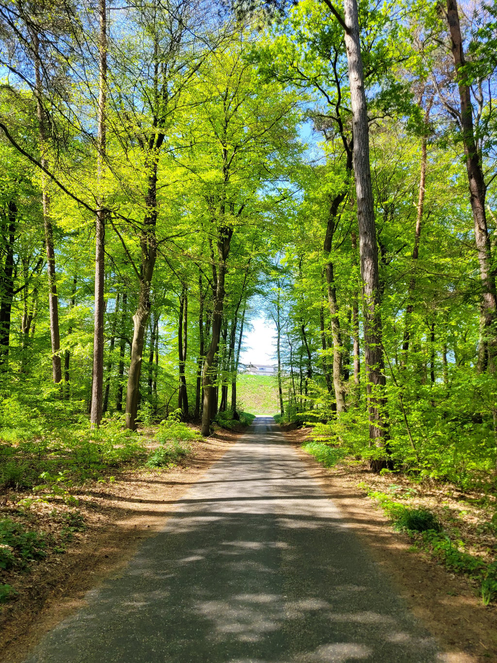
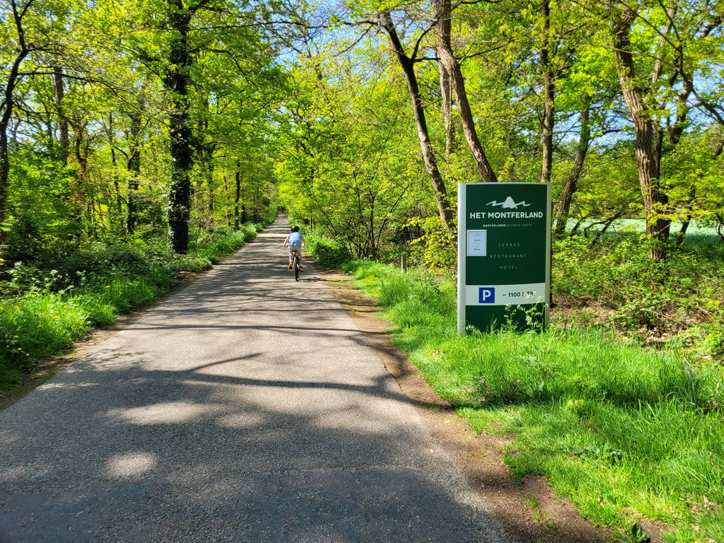
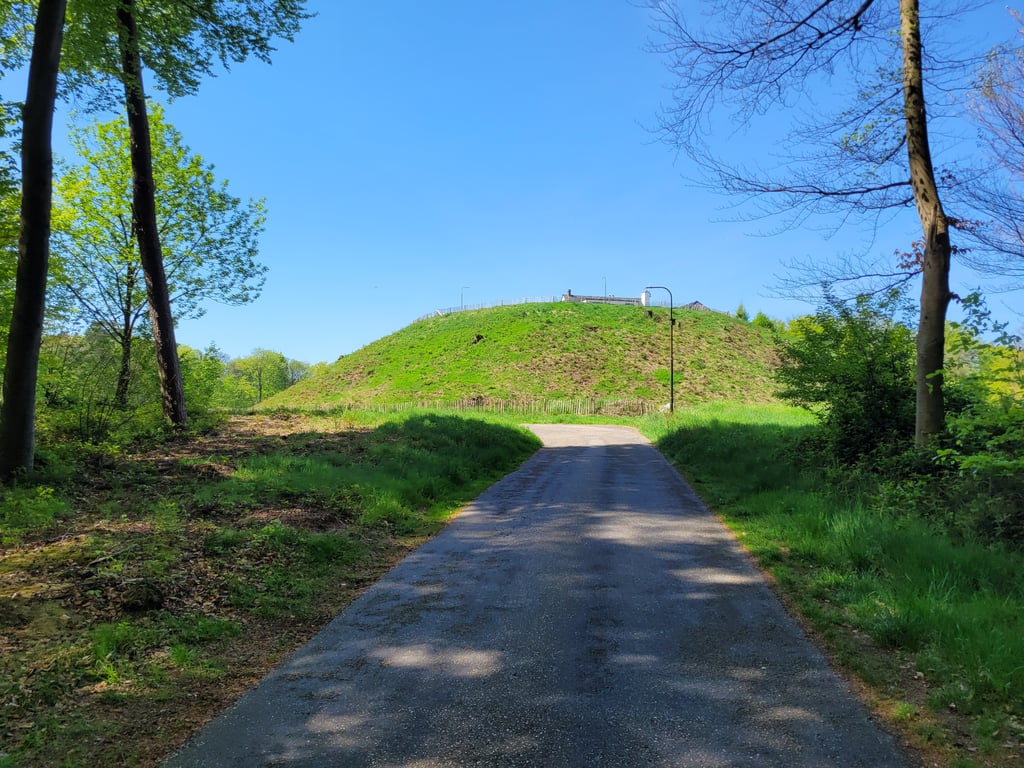
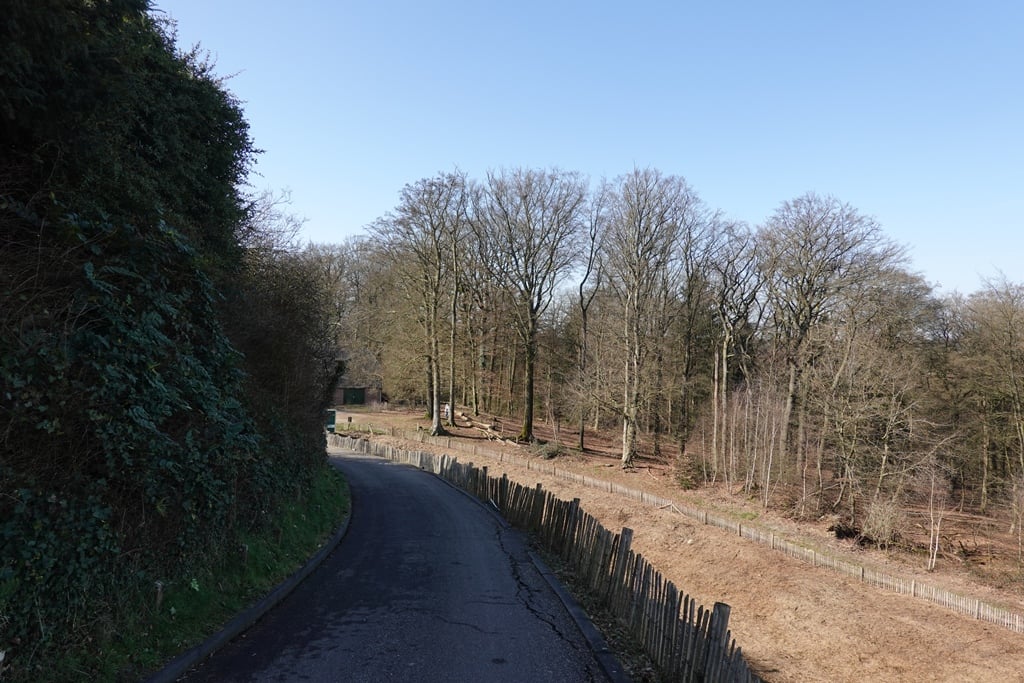
This is truly a hidden gem. The approach is a road through a dark forest, which acts as a gateway in time to another world with its own atmosphere. The Motte itself breathes history and offers a beautiful view of the surroundings....read more
Photos (25)
Welcome! Please activate your account if you would like to share something. Look for the verification email in your inbox.
This is an automatic translation, the original language is: Dutch.
Show original
A friend of mine described the Motte as the 'Mont Ventoux' of the Netherlands, to me it rather made me think of a small version of the VAM mountain, but the fact is dst it is a fun climb in an otherwise almost flat landscape. Especially in combination with the wall of Zeddam, it is a nice long climb. The middle section is almost flat, but the last section to the restaurant is a real calf bite; do watch out for motorised traffic as the last section is narrow and obscured by a bend. The view at the top is beautiful and you can take a rest on a lovely terrace. Definitely a 'highlight' in the area!
Een vriend van mij omschreef de Motte als de 'Mont Ventoux' van Nederland, mij liet ie me eerder aan een kleine versie van de VAM berg denken, maar feit is dst het een leuke klim in een verder nagenoeg vlak landschap is. Zeker in combinatie met de muur van Zeddam is het een leuke lange klim. Het middenstuk is nagenoeg vlak, maar het laatste stuk naar het restaurant is een echte kuitenbijter; wel uitkijken voor gemotoriseerd verkeer want het laatste stuk is smal en onoverzichtelijk door een bocht. Het uitzicht bovenop is mooi en je kunt er op een prachtig terras even uitrusten. Absoluut een 'hoogtepunt' in de omgeving!
This is an automatic translation, the original language is: Dutch.
Show original
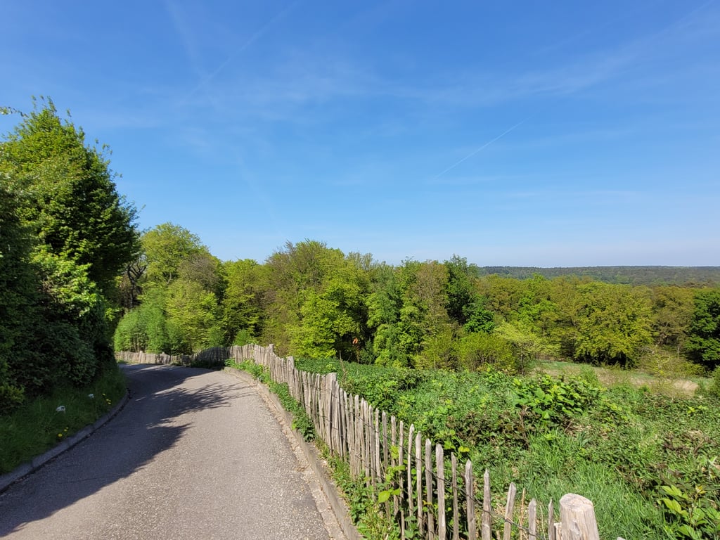
A gentle run-up (both in terms of percentage and traffic) along a lane where the motte comes into view nicely. Left around it then then the final steep bit which is so short that it is at most a bit of leg tightening. Beautiful scenery.
Een rustige aanloop (zowel qua percentage als verkeer) over een laan waarbij de motte mooi in beeld komt. Links er omheen dan dan het laatste steile stukje wat zo kort is dat het hooguit even de benen aanspannen is. Mooie omgeving.
This is an automatic translation, the original language is: Dutch.
Show original
Done one a while back. If you're a bit practised then this one really doesn't have to be a problem. The percentage at the end looks shocking but due to the 'length' it can be done with two fingers in the nose. You do have to stay up to speed otherwise it becomes a tricky story.
Tijdje terug een keertje gedaan. Als je een beetje geoefend bent dan hoeft deze echt geen probleem te zijn. Het percentage op het einde ziet er schrikbarend uit maar door de 'lengte' met twee vingers in de neus te halen. Je moet wel op snelheid blijven anders word het een lastig verhaal.
This is an automatic translation, the original language is: Dutch.
Show original
Without this site, I would never have known that there was a climb here. The climb itself is nothing until the end. It goes up slightly, but you already see where you have to go in a relatively short distance. Then comes the finale, the present: a steeply inclined road of about 100 metres. If you change down too late, it will be difficult. In fact, it is always easy to get to the top. At the top, a nice view, possibly a cup of coffee and then back again.
Zonder deze site had ik nooit geweten dat hier een klimmetje lag. De klim op zich stelt tot het einde niks voor. Het loopt licht omhoog, maar je ziet al waar je heen moet in relatief korte afstand. Dan volgt het slot, het cadeautje: een steil hellende weg van zo'n 100 meter. Als je te laat terugschakelt, krijg je het lastig. Eigenlijk altijd eenvoudig boven gekomen. Boven een mooi uitzicht, eventueel een bakkie koffie en dan weer terug.
This is an automatic translation, the original language is: Dutch.
Show original
A nice climb with a surprising end. As soon as you come out of the forest you see the restaurant and the road in front of you turning uphill. The surprise you see looming very late and if you do not know what you get for your choice you are too late with downshifting and it becomes a struggle to get to the top.
Een leuk klimmetje met een verrassend einde. Zo gauw je het bos uitkomt zie je het restaurant leggen en je ziet de weg voor je omhoog draaien. De verrassing zie je heel laat voor je opdoemen en als je niet weet wat je voor je kiezen krijgt ben je te laat met terugschakelen en wordt het stoempen om boven te komen.
This is an automatic translation, the original language is: Dutch.
Show original
This is truly a hidden gem. The approach is a road through a dark forest, which acts as a gateway in time to another world with its own atmosphere. The Motte itself breathes history and offers a beautiful view of the surroundings.
Dit is met recht een verborgen parel. De aanloop is een weg door een donker bos, dat fungeert als een poort in de tijd naar een andere wereld met een heel eigen sfeer. De Motte zelf ademt historie en biedt een prachtig uitzicht over de omgeving.
This is an automatic translation, the original language is: Dutch.
Show original
At first it looks like an insignificant piece of false flat on a forest road. It's really a place where you can park your car and go for a walk in the forest, but where there's not much to see or do by bike. But then you come out of the woods, at a bend. There's a steep hill in front of you and you see that it winds up in a long curve. The last part is steep and short and ends unexpectedly on restaurant grounds. Nowadays it is private/not publicly accessible and it is not meant to be raced on and then turned around and quickly descended again, as it is also a parking lot. The recommendation to get something there when it's open is a good one though if you do want to go on it!
Lijkt in het begin een onbeduidend stuk vals plat op een bosweg. Echt een plek waar parkeerplaatsen staan om in het bos te gaan wandelen, maar waar verder niet veel te zien of te doen is met de fiets. Maar dan kom je het bos uit, bij een bocht. Er staat een steile heuvel voor je en je ziet dat het met een lange bocht omhoog slingert. Het laatste stuk is steil en kort en eindigt onverwacht op het terrein van restaurant. Tegenwoordig is het privé/niet openbaar toegankelijk en is het niet de bedoeling om erop te racen en dan om te draaien en weer snel af te dalen, want het is ook een parkeerplaats. De aanrader om er wat te halen als het open is, is wel een goede als je er toch op wilt gaan!
Share your knowledge. What was the road condition during your ascent?
Traffic
100% 0% 0%
Based on 4 votes
Your experience counts. How much traffic did you encounter during the climb?
Frequently Asked Questions
You don't need special gearing for Motte van Montferland. The slope isn't long or steep enough to require much shifting down. You can conquer this climb on power alone. However, a compact gearing system with a smallest front chainring of 34 and largest rear sprocket of 28 or 30 is always nice if you enjoy cycling uphill. This helps maintain a smooth cadence.
Motte van Montferland is not tough enough to be assigned a mountain category. This means that even untrained cyclists can reach the top without any problems on this climb.
Motte van Montferland is 1 km long.
The average gradient of Motte van Montferland is 3.1%.
Motte van Montferland has a steepest segment with an average gradient of 9.5%.
The summit of Motte van Montferland is at 66 m.
At a slow pace of 7 km/h, it takes about 00:08:36 to climb Motte van Montferland. At 11 km/h the time is 00:05:28, and at 15 km/h 00:04:01. For the fastest cyclists, 00:03:10 is an achievable time.