View on map
© MapLibre | OpenStreetMap contributors
1%
2%
4%
6%
8%
10%
12%
15%
20%

Miggianella

4.0
1 review/story | Elevation profile | 0 photos
Tips nearby
Your achievable time
Calculating based on your best performances...
Relaxed
Maximum
W/kg
W/kg
W/kg
Analyse your climbing performance
Detailed insight into your climbing performance & automatically check off climbs
Based on your best performances.
Your best attempt:
Number of attempts:
Elevation profile Miggianella

Statistics

Difficulty points 176
Length 0.8 km
Average gradient 13.9%
Steepest 100 metres 21.9%
Total ascent 106 m

Short recap

Hidden gem
5 hairpin turns
#94 toughest climb of Verbano-Cusio-Ossola
#98 average steepest climb of Alps
Feedback about this climb?
Show climbs nearby Export to GPS device

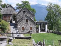
Miggianella is a climb in the region Verbano-Cusio-Ossola. It is 0.8 km long and bridges 106 m of vertical ascent with an average gradient of 13.9%, resulting in a difficulty score of 176. The top of the ascent is located at 562 m above sea level. Climbfinder users shared 1 review/story of this climb and uploaded 0 photos.

Great climb through the forest from the main road in the Valle Anzasca to the tiny villave of Miggianella. The tarmac is fine and there is very little traffic on the road. Some very steep sections though! From the top you can see Monte Rosa on a clear day. ... read more

Photos (0)

transparant thumb
transparant thumb
transparant thumb
transparant thumb
transparant thumb
transparant thumb

Your uploads (max 4)

Welcome! Please activate your account if you would like to share something. Look for the verification email in your inbox.

If you want to upload your photos, you need to create an account. It only takes 1 minute and it's completely free.

  • Receive free climbfinder goodies for your reviews & photos.
  • Create a bucket list and check off conquered climbs.
  • Add missing climbs.
Continue with GoogleContinue with Google Continue with FacebookContinue with Facebook Continue with AppleContinue with Apple Sign up with email
By signing up you agree to our terms of service and confirm that you have read our privacy & content policy.

Reviews (1)

5.0
4.0
3.0
2.0
1.0
MartinoPiccolo
1 y 4.0

Great climb through the forest from the main road in the Valle Anzasca to the tiny villave of Miggianella. The tarmac is fine and there is very little traffic on the road. Some very steep sections though! From the top you can see Monte Rosa on a clear day.

Dashboard

Climbing times

7 km/h 00:06:32
11 km/h 00:04:10
15 km/h 00:03:03
19 km/h 00:02:24

Road surface condition

0% 0% 0%
Based on 0 votes
Share your knowledge. What was the road condition during your ascent?

Traffic

0% 0% 0%
Based on 0 votes
Your experience counts. How much traffic did you encounter during the climb?

Frequently Asked Questions

Miggianella is a challenging ascent. For this type of climbing, we recommend mountain gearing, specifically a compact system. This means a small front chainring of 34 teeth, combined with a rear cassette where, depending on your level, strength, and experience, you choose a sprocket with 30, 32, or even 34 teeth. Remember that a smooth cadence is always more efficient!

Miggianella is a 3rd-category climb. Almost anyone can handle this climb, as long as you have a bike with climbing gears. If you have little training, you will probably need to shift down significantly. For experienced riders, Miggianella is not a problem.

Miggianella is 0.8 km long.

The average gradient of Miggianella is 13.9%.

Miggianella has a steepest segment with an average gradient of 21.9%.

The summit of Miggianella is at 562 m.

At a slow pace of 7 km/h, it takes about 00:06:32 to climb Miggianella. At 11 km/h the time is 00:04:10, and at 15 km/h 00:03:03. For the fastest cyclists, 00:02:24 is an achievable time.

Miggianella is located in the region Verbano-Cusio-Ossola in Italy.

This page is better in the app

Climbfinder app
Climbfinder
(Free)
Open