Côte de l'M de Bomerée is a climb in the region Thudinie. It is 2.4 km long and bridges 92 m of vertical ascent with an average gradient of 3.8%, resulting in a difficulty score of 41. The top of the ascent is located at 214 m above sea level. Climbfinder users shared 4 reviews of this climb and uploaded 3 photos.
This is an automatic translation, the original language is: Dutch.
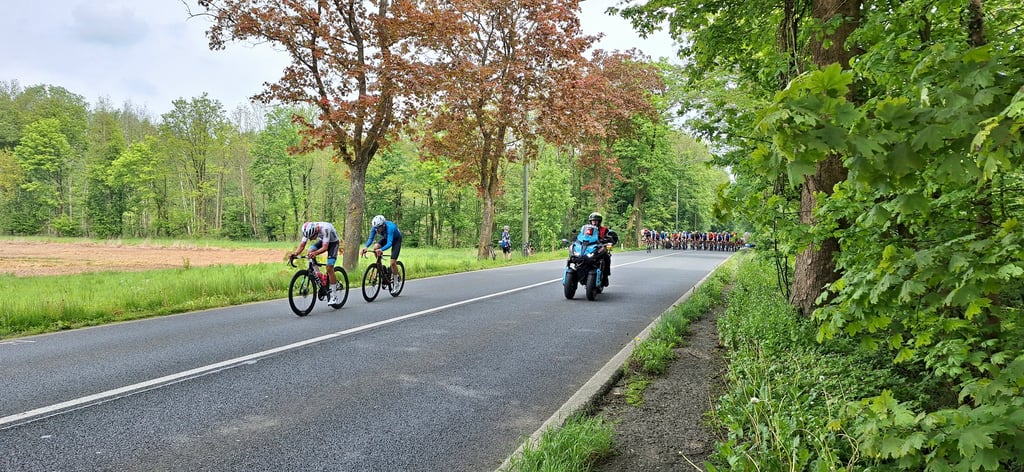
Long, steady climb along a busy connecting road, with some turns and the well-known "M" loop that brings some variety. The gradient remains fairly constant with no real tough sections, making it mainly a matter of keeping a leisurely pace to the top....read more
Photos (3)
Welcome! Please activate your account if you would like to share something. Look for the verification email in your inbox.
This is an automatic translation, the original language is: Dutch.
Show original
Long, steady climb along a busy connecting road, with some turns and the well-known "M" loop that brings some variety. The gradient remains fairly constant with no real tough sections, making it mainly a matter of keeping a leisurely pace to the top.
Lange, gelijkmatige klim langs een drukke verbindingsweg, met enkele bochten en de bekende “M”-lus die wat afwisseling brengt. De helling blijft vrij constant zonder echte zware stukken, waardoor het vooral een kwestie is van rustig tempo houden tot boven.
This is an automatic translation, the original language is: French.
Show original
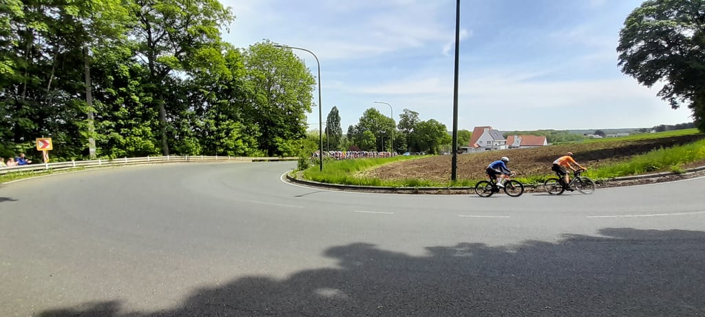
It's a great climb with some nice twists and turns, inevitably to make the famous M, the road is in good condition and there's plenty of traffic too.
The start is steep and after the M there is a long straight stretch with a slight climb and trees.
C'est une belle côte à faire avec de beaux tournants, forcement pour dessiner le fameux M, la route est en bon état et aussi du trafic.
Le début est pentu et après le M une longue ligne doite en légère montée et arborée
Share your knowledge. What was the road condition during your ascent?
Traffic
0% 100% 0%
Based on 2 votes
Your experience counts. How much traffic did you encounter during the climb?
Frequently Asked Questions
You don't need special gearing for Côte de l'M de Bomerée. The slope isn't long or steep enough to require much shifting down. You can conquer this climb on power alone. However, a compact gearing system with a smallest front chainring of 34 and largest rear sprocket of 28 or 30 is always nice if you enjoy cycling uphill. This helps maintain a smooth cadence.
Côte de l'M de Bomerée falls into the 5th category. With good fitness, you can ride it up with speed and power. If you have less training, shift down and climb smoothly.
Côte de l'M de Bomerée is 2.4 km long.
The average gradient of Côte de l'M de Bomerée is 3.8%.
Côte de l'M de Bomerée has a steepest segment with an average gradient of 6.1%.
The summit of Côte de l'M de Bomerée is at 214 m.
At a slow pace of 7 km/h, it takes about 00:20:49 to climb Côte de l'M de Bomerée. At 11 km/h the time is 00:13:15, and at 15 km/h 00:09:43. For the fastest cyclists, 00:07:40 is an achievable time.
Côte de l'M de Bomerée is located in the region Thudinie in Belgium.