View on map
© MapLibre | OpenStreetMap contributors
1%
2%
4%
6%
8%
10%
12%
15%
20%

Lichtenberg from Thalham

3.0
1 review/story | Elevation profile | 3 photos
Tips nearby
Lichtenberg from Thalham
transparant thumb
transparant thumb
transparant thumb
transparant thumb
transparant thumb
Your achievable time
Calculating based on your best performances...
Relaxed
Maximum
W/kg
W/kg
W/kg
Analyse your climbing performance
Detailed insight into your climbing performance & automatically check off climbs
Based on your best performances.
Your best attempt:
Number of attempts:
Elevation profile Lichtenberg from Thalham
paved
gravel

Statistics

Difficulty points 261
Length 3.5 km
Average gradient 8.3%
Steepest 100 metres 12%
Total ascent 290 m
Feedback about this climb?
Show climbs nearby Export to GPS device

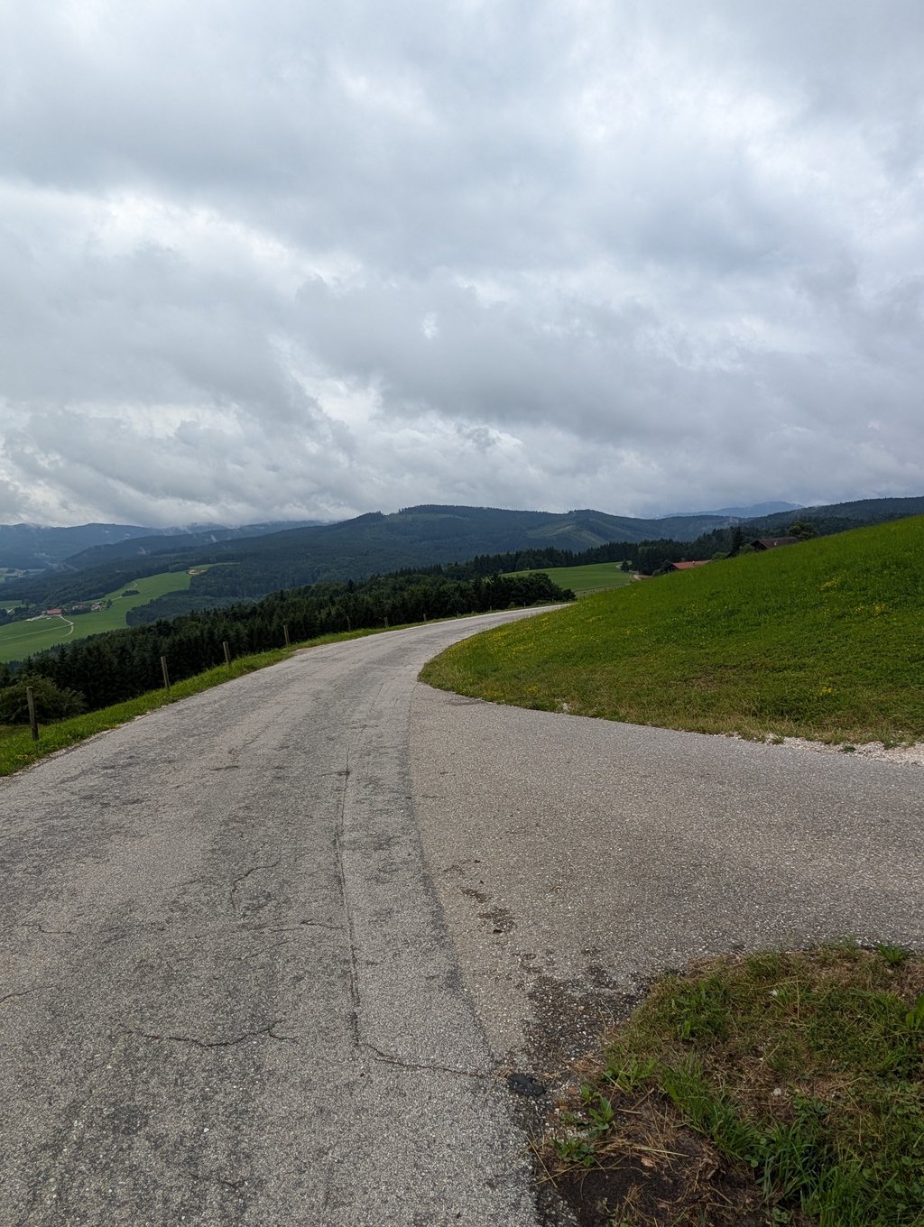
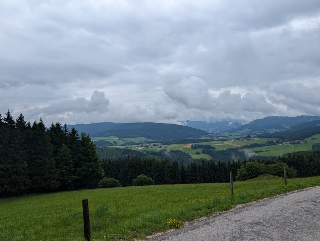
Lichtenberg from Thalham is a climb in the region Upper Austria. It is 3.5 km long and bridges 290 m of vertical ascent with an average gradient of 8.3%, resulting in a difficulty score of 261. The top of the ascent is located at 850 m above sea level. Climbfinder users shared 1 review/story of this climb and uploaded 3 photos.

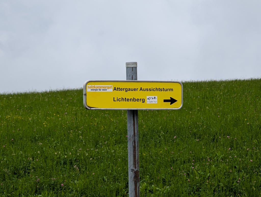
Road names: Lichtenberg & Forststraße Lichtenbergkuppe

This is an automatic translation, the original language is: Dutch.
This is a tough climb, leading you through a forest at the top. You have firm percentages. M'n GPS even indicated 20% at one point. Percentages against 15% are easily reached at times. I drove it up on a rainy day, so traffic was moderate. Actually, only tourists come here too, wanting to enjoy the view (why do they do that by car anyway?), but with me, so there was almost no traffic. The road surface is Austrian TOP and at the top you have a nice view. Very nice training area. But so... read more

Photos (3)

Lichtenberg from Thalham
transparant thumb
transparant thumb
transparant thumb

Your uploads (max 4)

Welcome! Please activate your account if you would like to share something. Look for the verification email in your inbox.

If you want to upload your photos, you need to create an account. It only takes 1 minute and it's completely free.

  • Receive free climbfinder goodies for your reviews & photos.
  • Create a bucket list and check off conquered climbs.
  • Add missing climbs.
Continue with GoogleContinue with Google Continue with FacebookContinue with Facebook Continue with AppleContinue with Apple Sign up with email
By signing up you agree to our terms of service and confirm that you have read our privacy & content policy.

Reviews (1)

5.0
4.0
3.0
2.0
1.0
Joeri_Laureys
11 Mo 3.0
This is an automatic translation, the original language is: Dutch. Show original

This is a tough climb, leading you through a forest at the top. You have firm percentages. M'n GPS even indicated 20% at one point. Percentages against 15% are easily reached at times.
I drove it up on a rainy day, so traffic was moderate. Actually, only tourists come here too, wanting to enjoy the view (why do they do that by car anyway?), but with me, so there was almost no traffic. The road surface is Austrian TOP and at the top you have a nice view. Very nice training area.
But so beware, without training kilometres, this thing can hurt you!

Dit is een stevige klim, die je op de top door een bos leidt. Je hebt stevige percentages. M'n GPS gaf op een bepaald moment zelfs 20% aan. Percentages tegen de 15% haal je bij momenten makkelijk.
Ik reed hem op een regenachtige dag naar boven, dus het verkeer was matig. Eigenlijk komen hier ook alleen maar toeristen, die van het uitzicht willen genieten (waarom doen ze dat eigenlijk met de auto?), maar bij mij was er dus bijna geen verkeer. Het wegdek is Oostenrijks TOP en op de top heb je een mooi vergezicht. Zeer leuk trainingsgebied.
Maar let dus op, zonder trainingskilometers, kan dit ding je pijn doen!

Dashboard

Climbing times

7 km/h 00:30:04
11 km/h 00:19:08
15 km/h 00:14:02
19 km/h 00:11:04

Road surface condition

0% 100% 0%
Based on 1 vote
Share your knowledge. What was the road condition during your ascent?

Traffic

100% 0% 0%
Based on 1 vote
Your experience counts. How much traffic did you encounter during the climb?

Frequently Asked Questions

Lichtenberg can be cycled from 6 sides. Lichtenberg via Truchtlingen is the most popular side, but the summit can also be reached via Lichtenberg from Pabigen, Lichtenberg from Röth, Lichtenberg via Egg, Lichtenberg from Frankenmarkt & Lichtenberg from Thalham.

Lichtenberg from Thalham is a challenging ascent. For this type of climbing, we recommend mountain gearing, specifically a compact system. This means a small front chainring of 34 teeth, combined with a rear cassette where, depending on your level, strength, and experience, you choose a sprocket with 30, 32, or even 34 teeth. Remember that a smooth cadence is always more efficient!

Lichtenberg from Thalham is a 3rd-category climb. Almost anyone can handle this climb, as long as you have a bike with climbing gears. If you have little training, you will probably need to shift down significantly. For experienced riders, Lichtenberg from Thalham is not a problem.

Lichtenberg from Thalham is 3.5 km long.

The average gradient of Lichtenberg from Thalham is 8.3%.

Lichtenberg from Thalham has a steepest segment with an average gradient of 12%.

The summit of Lichtenberg from Thalham is at 850 m.

At a slow pace of 7 km/h, it takes about 00:30:04 to climb Lichtenberg from Thalham. At 11 km/h the time is 00:19:08, and at 15 km/h 00:14:02. For the fastest cyclists, 00:11:04 is an achievable time.

Lichtenberg from Thalham is located in the region Upper Austria in Austria.

This page is better in the app

Climbfinder app
Climbfinder
(Free)
Open