View on map
© MapLibre | OpenStreetMap contributors
1%
2%
4%
6%
8%
10%
12%
15%
20%

Brandweg

3.0
1 review/story | Elevation profile | 4 photos
In some places the road surface of this climb is bad, but it can be ridden with a road bike.
Tips nearby
Brandweg
Brandweg
Brandweg
Brandweg
transparant thumb
transparant thumb
transparant thumb
transparant thumb
Your achievable time
Calculating based on your best performances...
Relaxed
Maximum
W/kg
W/kg
W/kg
Analyse your climbing performance
Detailed insight into your climbing performance & automatically check off climbs
Based on your best performances.
Your best attempt:
Number of attempts:
Elevation profile Brandweg

Statistics

Difficulty points 16
Length 0.4 km
Average gradient 6%
Steepest 100 metres 8.2%
Total ascent 25 m

Short recap

Bad road
Feedback about this climb?
Show climbs nearby Export to GPS device

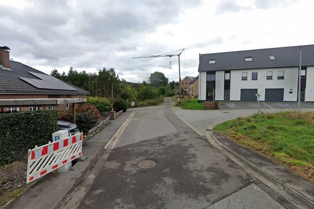
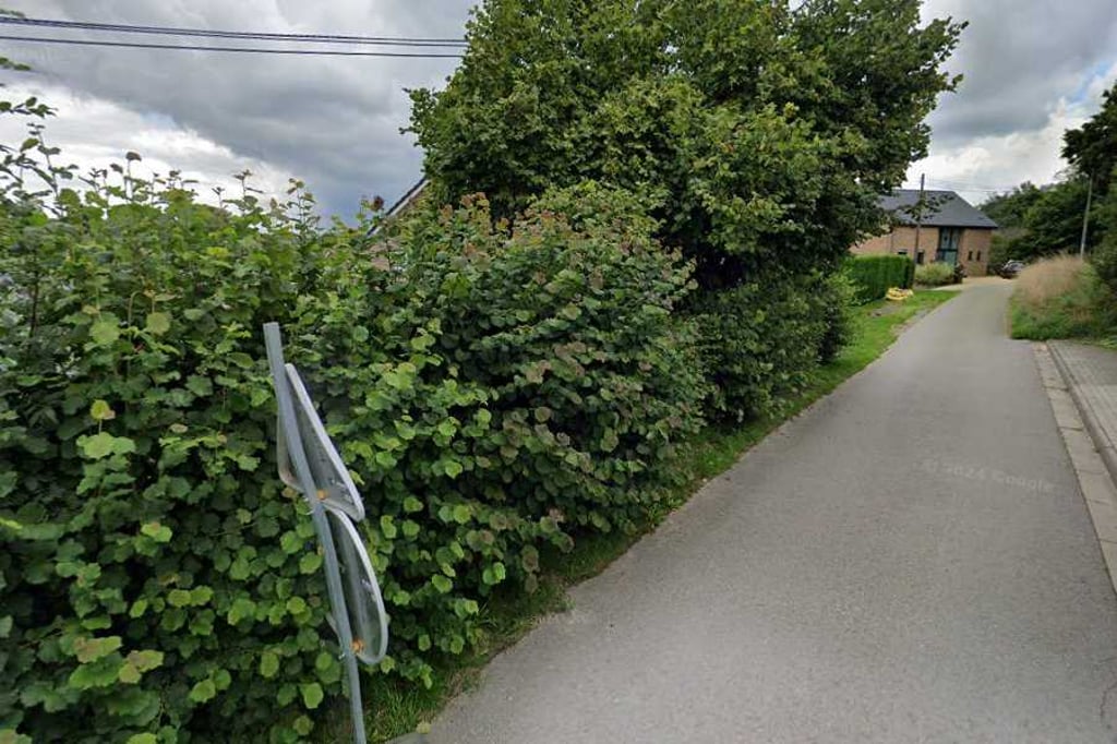
Brandweg is a climb in the region Pays de Herve. It is 0.4 km long and bridges 25 m of vertical ascent with an average gradient of 6%, resulting in a difficulty score of 16. The top of the ascent is located at 220 m above sea level. Climbfinder users shared 1 review/story of this climb and uploaded 4 photos.

Road names: Brandweg & Rue du Sablon
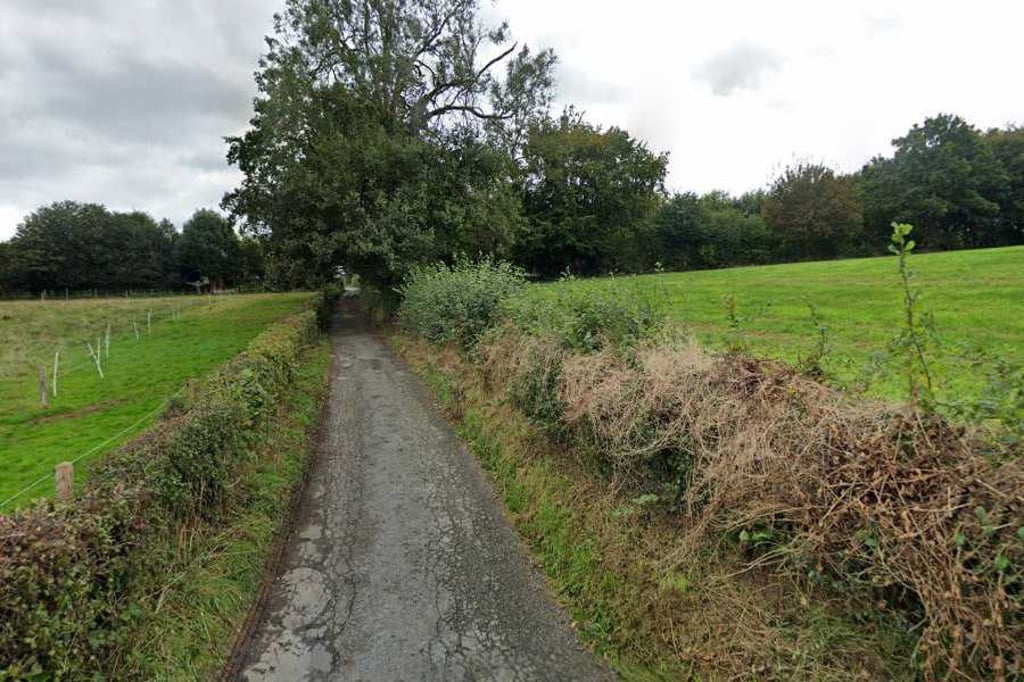
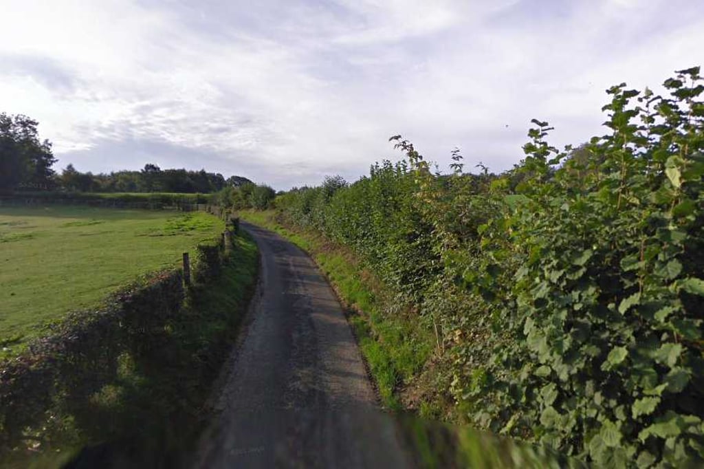
3.0 by BikerJohan
This is an automatic translation, the original language is: Dutch.
Fairly unknown climb in the eastern part of the built-up area of Gemmnich. The summit is the same as the climbs via Bieneheide and Rue Nouvelaer. You reach the start of this climb from Rue de Moresnet via Rue Stein or the Wittenweg. After this, the climb starts at the junction with the Brandweg. The first 300 metres the gradient rises smoothly. This is followed by a section of false flat over 400 metres. The last stretch to the summit, the gradient then rises again. From the top, you get the des... read more

Photos (4)

Brandweg
Brandweg
Brandweg
Brandweg
transparant thumb
transparant thumb

Your uploads (max 4)

Welcome! Please activate your account if you would like to share something. Look for the verification email in your inbox.

If you want to upload your photos, you need to create an account. It only takes 1 minute and it's completely free.

  • Receive free climbfinder goodies for your reviews & photos.
  • Create a bucket list and check off conquered climbs.
  • Add missing climbs.
Continue with GoogleContinue with Google Continue with FacebookContinue with Facebook Continue with AppleContinue with Apple Sign up with email
By signing up you agree to our terms of service and confirm that you have read our privacy & content policy.

Reviews (1)

5.0
4.0
3.0
2.0
1.0
BikerJohan
1 y 3.0
This is an automatic translation, the original language is: Dutch. Show original

Fairly unknown climb in the eastern part of the built-up area of Gemmnich. The summit is the same as the climbs via Bieneheide and Rue Nouvelaer. You reach the start of this climb from Rue de Moresnet via Rue Stein or the Wittenweg. After this, the climb starts at the junction with the Brandweg. The first 300 metres the gradient rises smoothly. This is followed by a section of false flat over 400 metres. The last stretch to the summit, the gradient then rises again. From the top, you get the descent from Rue du Sablon to Moresnet-Chapelle.

Redelijk onbekende/leuke klim in het oostelijk deel van de bebouwing van Gemmenich. De top is hetzelfde als de beklimmingen van Langenstein via Bieneheide en Rue Nouvelaer. Je bereikt het begin van deze klim vanaf Rue de Moresnet via Rue Stein of de Wittenweg. De klim begint hierna op de splitsing met de Brandweg. De eerste 300 meter loopt het stijgingspercentage vlot op. Hierna volgt over 400 meter een stuk vals plat. Het laatste stuk tot de top loopt het stijgingspercentage dan weer op. Vanaf de top krijg je de afdaling van Rue du Sablon naar Moresnet-Chapelle.

Dashboard

Climbing times

7 km/h 00:03:31
11 km/h 00:02:14
15 km/h 00:01:38
19 km/h 00:01:18

Road surface condition

0% 0% 0%
Based on 0 votes
Share your knowledge. What was the road condition during your ascent?

Traffic

0% 0% 0%
Based on 0 votes
Your experience counts. How much traffic did you encounter during the climb?

Frequently Asked Questions

You don't need special gearing for Brandweg. The slope isn't long or steep enough to require much shifting down. You can conquer this climb on power alone. However, a compact gearing system with a smallest front chainring of 34 and largest rear sprocket of 28 or 30 is always nice if you enjoy cycling uphill. This helps maintain a smooth cadence.

Brandweg is not tough enough to be assigned a mountain category. This means that even untrained cyclists can reach the top without any problems on this climb.

Brandweg is 0.4 km long.

The average gradient of Brandweg is 6%.

Brandweg has a steepest segment with an average gradient of 8.2%.

The summit of Brandweg is at 220 m.

At a slow pace of 7 km/h, it takes about 00:03:31 to climb Brandweg. At 11 km/h the time is 00:02:14, and at 15 km/h 00:01:38. For the fastest cyclists, 00:01:18 is an achievable time.

Brandweg is located in the region Liège Province in Belgium.

This page is better in the app

Climbfinder app
Climbfinder
(Free)
Open