Tips nearby


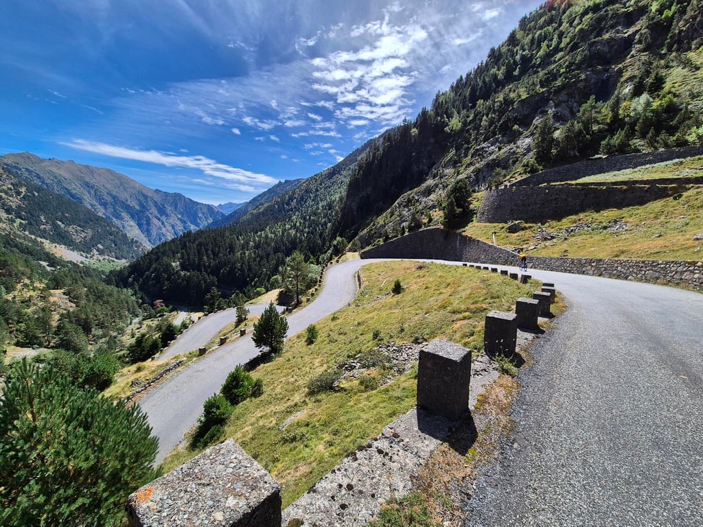
Lac d'Aumar / Lac d'Aubert from Saint Lary Soulan is a climb in the region Hautes-Pyrénées. It is 24 km long and bridges 1403 m of vertical ascent with an average gradient of 5.8%, resulting in a difficulty score of 1005. The top of the ascent is located at 2200 m above sea level. Climbfinder users shared 12 reviews of this climb and uploaded 32 photos.
Road names: D929 & D177
5.0 by patrickbaertThis is an automatic translation, the original language is: Dutch.Lac d'Aubert and Lac d'Aumar are two adjacent lakes of the different which, like Lac de Cap de Long (see Climbfinder) are located in the nature reserve Néouville, and can be reached by bike. Both routes initially start in St.Lary Soulan with a relative "warming up" run on a wide road following the river upstream. From the turnoff in Fabian the Route des Lacs becomes a narrow bumpy tarmac road and while climbing you can enjoy the waterfalls, flora and fauna. After 18 km and ... read more
Welcome! Please activate your account if you would like to share something. Look for the verification email in your inbox.
If you want to upload your photos, you need to create an account. It only takes 1 minute and it's completely free.
A magnificent climb in one of the most beautiful parts of the Pyrenees; the route is deceptively tough as there are numerous flat sections and consequently many gradients of 11–12%, most of the climb takes place on a narrow, winding road, which can be a nuisance at busy times, so it is advisable to do it on a weekday and outside school holiday periods; take care on the descent as the road is in poor condition
Magnifique ascension dans un des endroits les plus beaux des Pyrénées, le profil est traître car il y a de nombreux replat et donc de nombreux passages à 11 12 %, la majeure partie de l’Ascension se fait sur une route étroite et sinueuse, ce qui peut être embêtant en période de fortes affluence donc il est conseillé de la faire en semaine et hors période de vacances scolaire, attention à la descente la route est abîmé
This ascent is 25 km from Saint Lary soulan, terminus Lac d'Aubert in the Néouvielle sanctuary - Pyrenees National Park! It's best done out of season during the week, to take full advantage of the panoramic views, the beautiful autumn colours and the light traffic! The road is narrow and winding all the way to the junction with Cap de Long and then above the Orédon dam, where you can enjoy magnificent views and the blue of the water! A must-do for both the sporting challenge and the enchanting dazzle of the surroundings.
Cette ascension fait 25 km depuis Saint Lary soulan , terminus Lac d'Aubert dans le sanctuaire du Néouvielle- parc national des Pyrénées ! A réaliser hors saison en semaine , pour profiter pleinement du panorama, des belles couleurs d'automne et de la faible circulation automobile ! La route étroite et sinueuse jusqu'à l'intersection avec cap de long puis au dessus du barrage d'Orédon .Les différents points de vue sont magnifiques, comme le bleu de l'eau ! A faire absolument pour le defi sportif comme pour l'éblouissement enchanteur des lieux.
It's a magnificent climb, well worth the diversions, the scenery is fantastic all the way and the arrival at the lake is a reward well worth the effort. Be careful on the way down, though, as the road is rotten and almost dangerous in places, especially at the bridges over the Neste.
Magnifique, l’ascension vaut le détour, les paysages sont fantastiques tout le long et l’arrivée au lac est une récompense largement à la hauteur des efforts fournis. Attention à la descente par contre, la route est pourrie, c’est limite dangereux par endroits notamment au niveau des ponts sur la Neste.
What a magnificent climb! It actually only really starts from Fabian. There's a great little eatery there to have coffee beforehand and treat yourself to something stronger afterwards. On top of the mountain, nothing was open when we were there. Also, the road to Lac de Cap was closed due to works. But again: the climb is stunning! Thick 5 stars! Do it!
Wat een schitterende klim! Hij begint feitelijk pas echt vanaf Fabian. Daar zit een prima eettentje om vooraf koffie te doen en achteraf jezelf te trakteren op wat sterkers. Bovenop de berg was er niets open toen wij er waren. Ook was de weg naar Lac de Cap dicht vanwege werkzaamheden. Maar nogmaals: de klim is schitterend! Dik 5 sterren! Doen!
In regards to scenery, you are hard pressed to find a more beautiful HC ride around the Pyrenees. Spectacular! Some parts of the road are a little meh, but just be a bit more careful on the descent. A must do!
Done in November when the road was closed, there's no-one there and the lights are magnificent. Be careful though, there may be black ice on some bends.
Fait en novembre alors que la route était fermée, il n'y a personne et les lumières sont somptueuses. Attention par contre il peut y avoir du verglas dans certains virages
Ridden on 19/07/2024
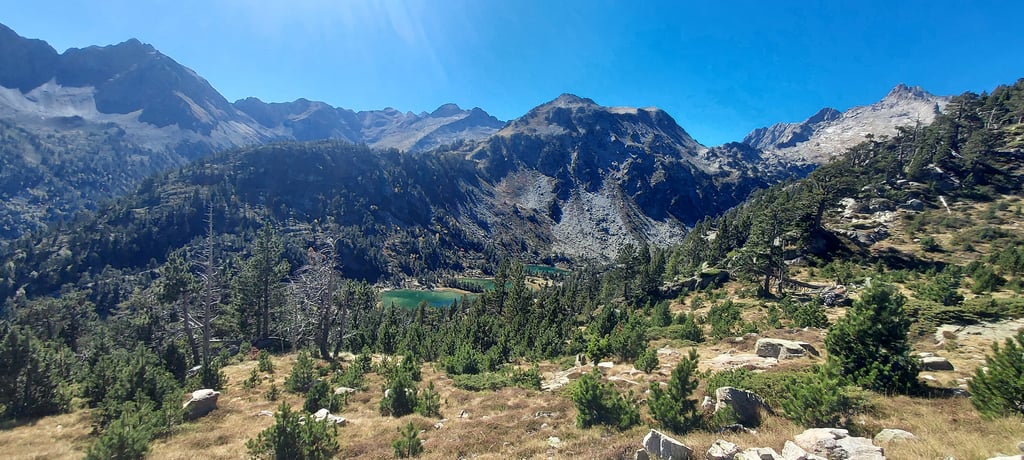
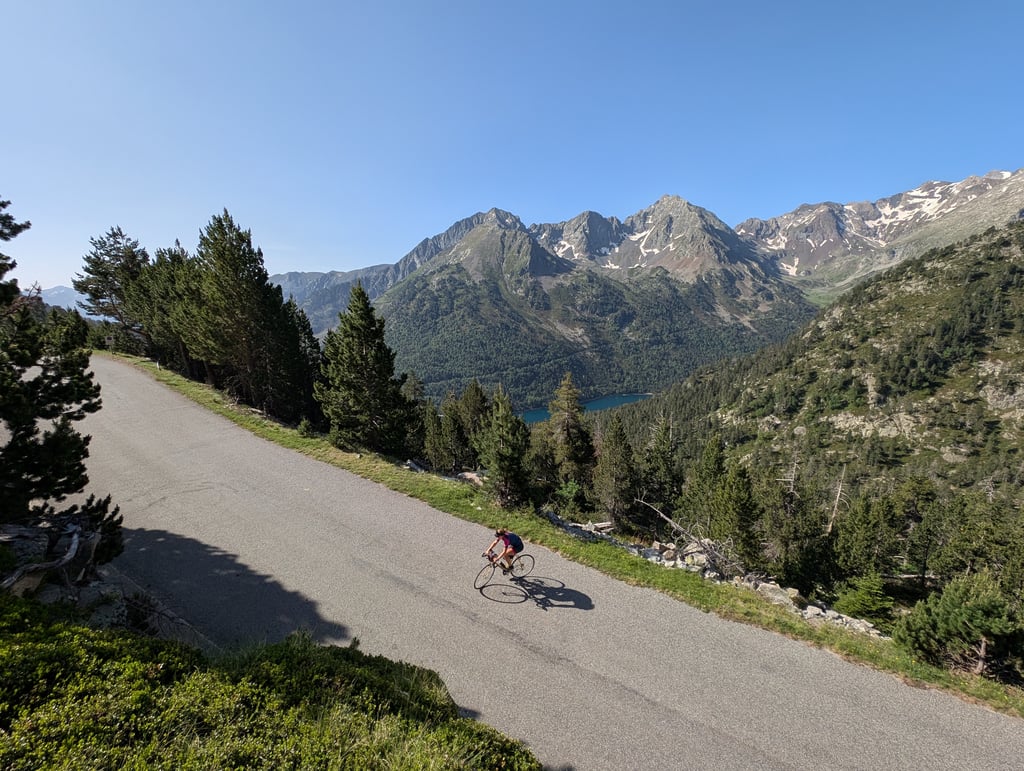
The first 7km from Saint-Lary-Soulan are slightly uphill but one makes quite a few altimeters anyway. Then near Bourdasse comes the turn-off towards Lac d'Aumar. The road suddenly becomes narrower and bumpy and this continues until the beautiful Lac d'Oredon. To avoid the heat of the day, I left Saint-Lary-Soulan at 8am but despite the early hour it was quite busy with car traffic on this road ; mainly hikers driving up to the car park at Lac d'Oredon or Lac d'Aumar.
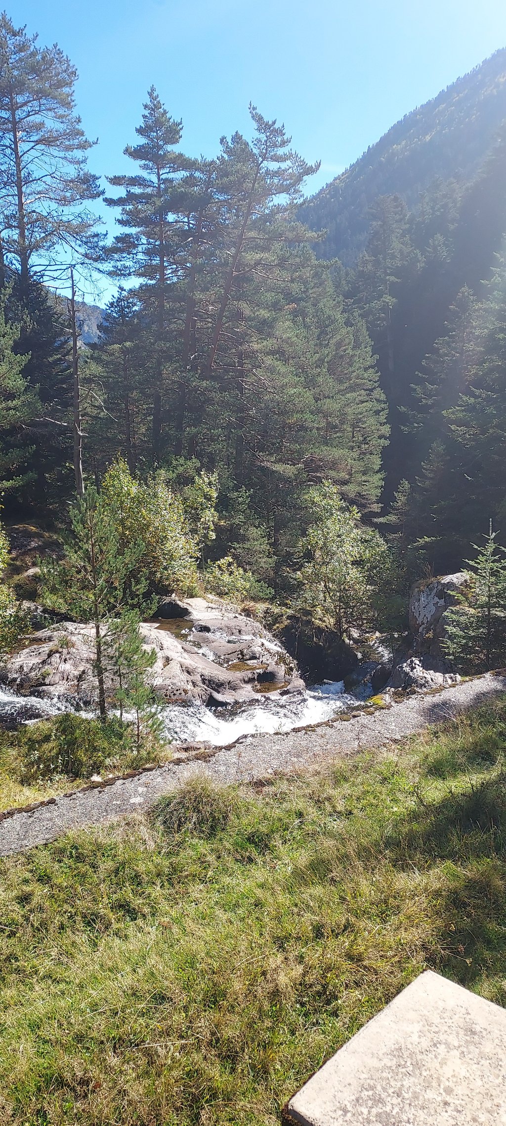
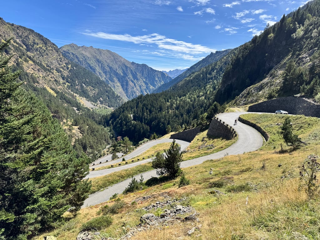
The valley is super green with waterfalls and the series of short consecutive hairpin bends make a nice view from above.
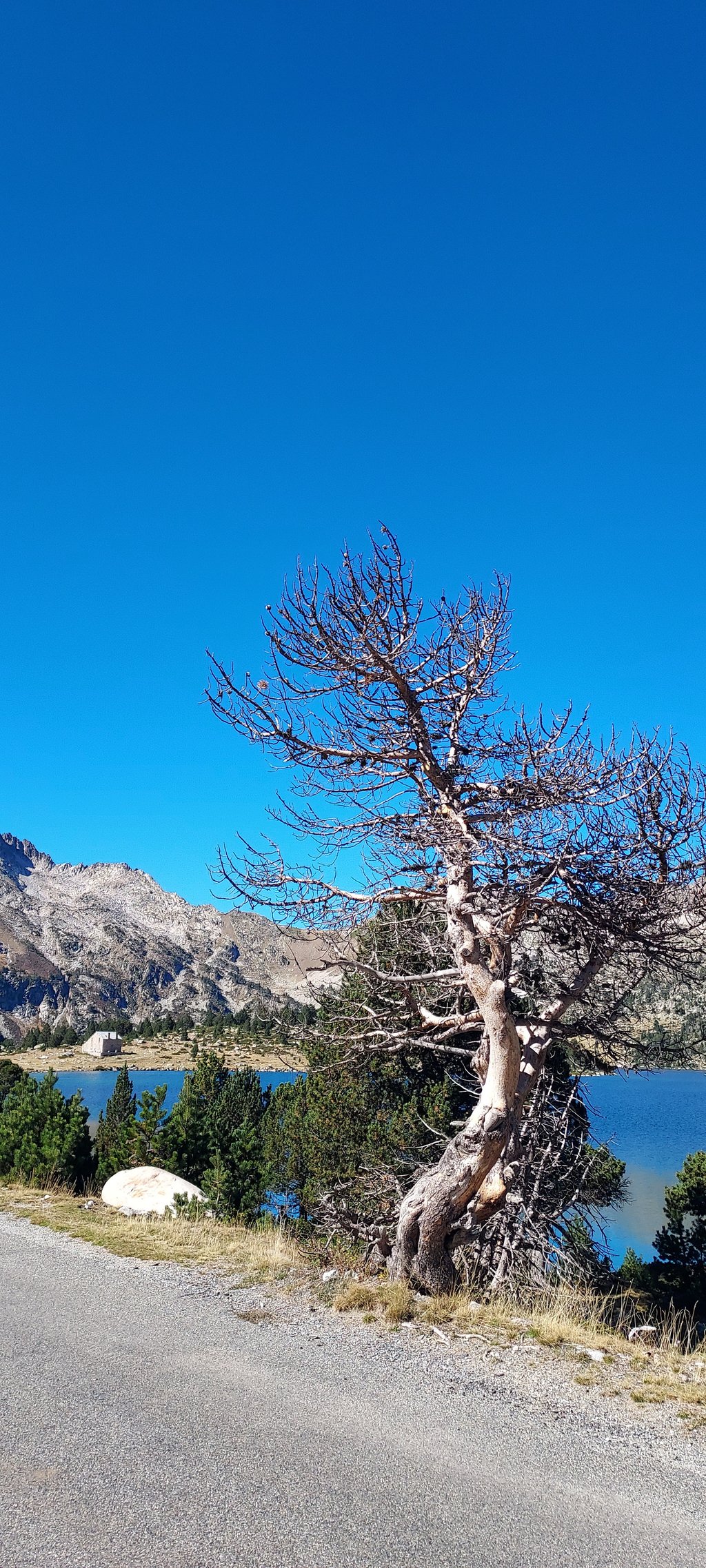
The last 4km from Lac d'Oredon to Lac d'Aumar are much quieter and the road is also wider and slightly less bumpy than the previous kilometres.
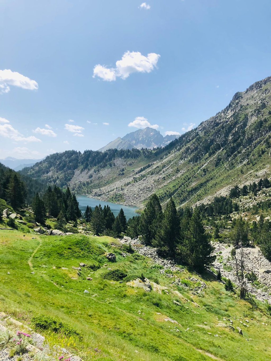
From Lac d'Aumar, it is another short descent to Lac d'Aubert. Both lakes are in a sublime setting and are a real hidden gem!
Attention : risk full descent due to the bumpy road surface and blind bends on a road that is too narrow (!!)
Gereden op 19/07/2024
De eerste 7km vanaf Saint-Lary-Soulan verlopen licht oplopend maar men maakt desalniettemin toch al redelijk wat hoogtemeters. Dan volgt nabij Bourdasse de afslag richting Lac d’Aumar. De weg wordt plots smaller en hobbelig en dit gaat door tot het mooie Lac d’Oredon. Om de warmte van de dag te ontwijken vertrok ik om 8u uit Saint-Lary-Soulan maar desondanks het vroege uur was het best heel druk met auto verkeer op deze weg ; voornamelijk wandelaars die tot de parking bij Lac d’Oredon of Lac d’Aumar rijden.
De vallei is super groen met watervallen en de reeks kort opeenvolgende haarspeldbochtjes maken een fraai zicht van bovenaf.
De laatste 4km vanaf het Lac d’Oredon tot het Lac d’Aumar zijn veel rustiger en de weg is ook breder en iets minder hobbelig dan de voorafgaande kilometers.
Vanaf het Lac d’Aumar is het nog een klein stukje dalen naar het Lac d’Aubert. Beide meren liggen in een sublieme omgeving en zijn écht een verborgen parel !
Let op : risico volle afdaling door het hobbelige wegdek én door blinde bochten op een te smalle weg (!!)
Carried out on 11/08/23 after Cap de Long.
The positive points => Magnificent views, it's impossible to get bored of them (already done on a hike)?
No cars after the tollgate at Lac d'Orédon
Nice descent to Orédon
Steady ascent
Negative points: no signposting
Lots of traffic
The descent from Orédon to Fabian is quite bumpy"
Effectué le 11/08/23 après le Cap de Long.
Les points positifs => Vues magnifiques, comment s'en lasser (déjà fait en rando pédestre) ?
Pas de voitures après le péage du Lac d'Orédon
Belle descente jusqu'à Orédon
Montée régulière
Les points négatifs => Aucune indication kilométrique
Pas mal de circulation
Descente d'Orédon à Fabian assez "cabossée"
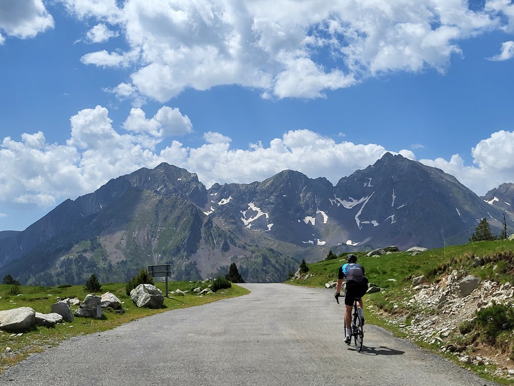
Either fork - to the twin lakes or the dam lake - is worth it. The graphs do not make a lot of sense, but as a French guy said - on another climb - "Welcome to France". Somewhere 3/4 up, before picking either fork, there's a spectacular series of hairpins. There's also a sharp downhill at the fork and on the way to the twin lake and there's a downhill - shown correctly on the graph - from the first to the second lake. So, the actual "summit" or highest point is probably above 2200 meters. This fork is closed for motorized traffic, at least between 9:30 and 18:00.
This was my first ride on my road bike in the mountains (I am used to freeriding with my mountain bike). I know this road well because I live in the area and yet I feel like I discovered it from another angle. I loved it, this autumn climb is magical. A must do if you are passing through, the final climb after the lake of Orédon stings well but it is worth it 🤩. On the other hand, I don't agree with the difference in altitude indicated on the site, my gps and my girlfriend's gps announced 1480m of difference in altitude (different brands and models)
Ce fut ma première sortie avec mon vélo de route en montagne (habituée au freeride avec mon vtt). Je connais bien cette route puisque j'habite dans le coin et pourtant, j'ai l'impression de l'avoir découverte sous un autre angle. J'ai adoré, cette montée en automne est magique. A faire absolument si vous êtes de passage, la montée finale après le lac d'Orédon pique bien mais elle en vaut la peine 🤩. En revanche, pas d'accord avec le dénivelé indiqué sur le site, mon gps ainsi que celui de ma copine nous ont annoncé 1480m de dénivelé (marques et modèles différents)
Most beautiful climb in the Pyrenees. Beautiful long climb with just after halfway a short hairpin session.
View on the top is beautiful. Very busy with cars's who park themselves above for a walk.
Mooiste beklimming in de Pyreneeën. Prachtige lange klim met net na halverwege een korte haarspeldsessie.
Uitzicht op de top is prachtig. Wel heel druk met auto's die zichzelf boven parkeren voor een wandeling.
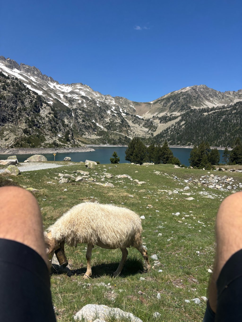
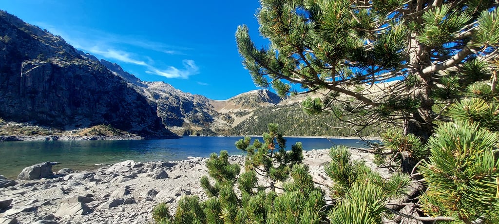
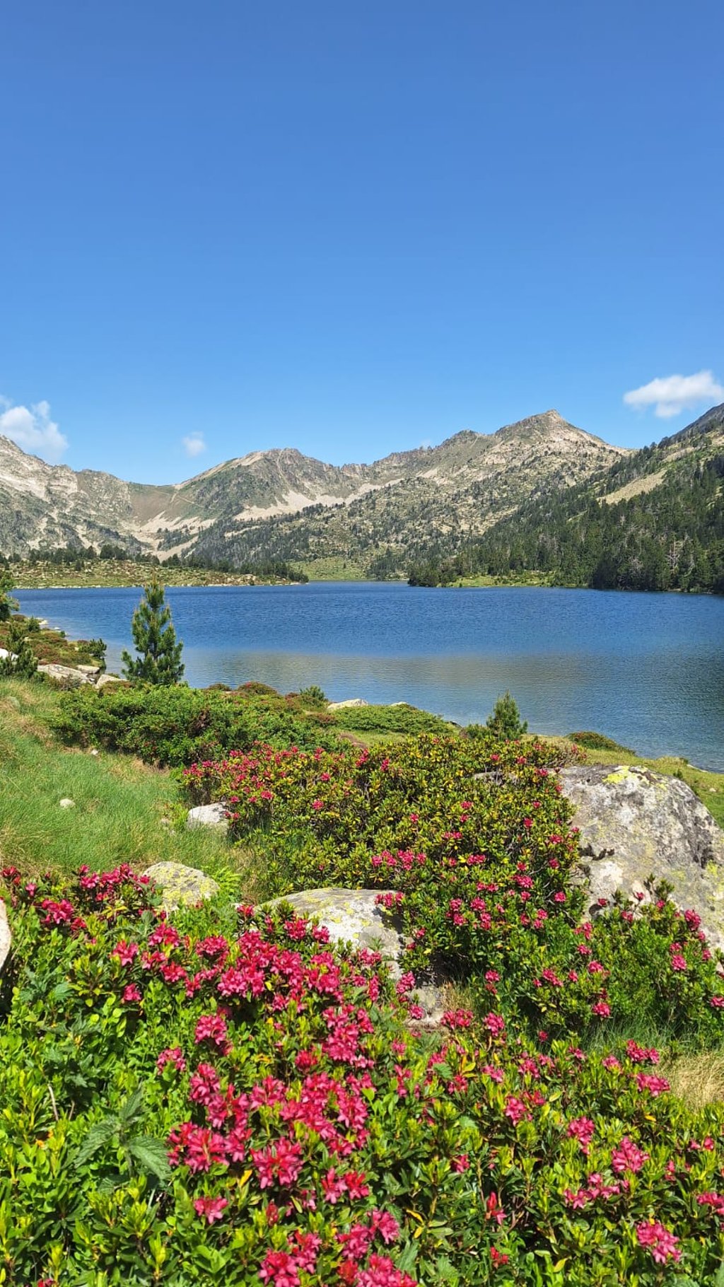
Lac d'Aubert and Lac d'Aumar are two adjacent lakes of the different which, like Lac de Cap de Long (see Climbfinder) are located in the nature reserve Néouville, and can be reached by bike.
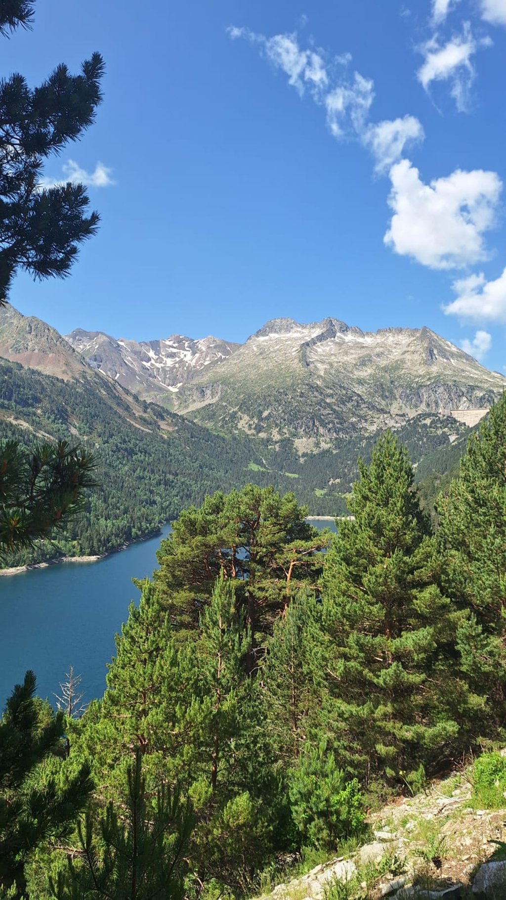
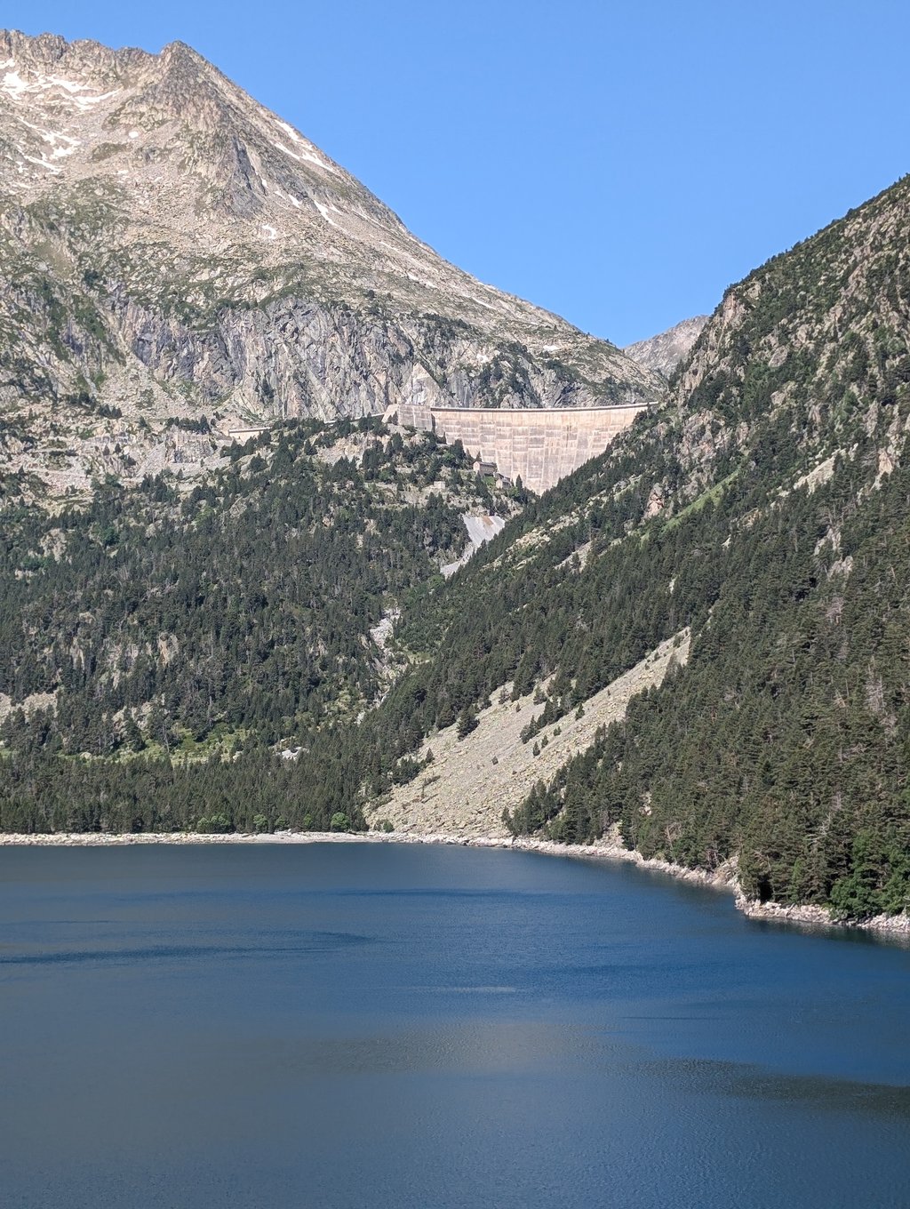
Both routes initially start in St.Lary Soulan with a relative "warming up" run on a wide road following the river upstream. From the turnoff in Fabian the Route des Lacs becomes a narrow bumpy tarmac road and while climbing you can enjoy the waterfalls, flora and fauna. After 18 km and a series of hairpin bends you turn right (leaving Cap de Long route) downhill for a while over the narrow dam of Lac d'Orédon to after the toll point (car-péage) back firmly uphill cycling in a literally and figuratively breathtaking high mountain landscape of lakes located between forest and rocks (tree line 2000m.). Nowhere is the view disturbed by ski lifts, cable cars, crash barriers or buildings. The highest point (2200m) is passed by the lac d'Aumar and then you descend slightly to the end point at the lac d'Aubert, with a 360° panorama of natural beauty.
Supplies only in réfuge lac d'Orédon. Last part of the route there was a car ban between 9.30/18.30 hours,
there was only a bus every 30 minutes.
Perfect to combine with Cap de Long climb!
Hidden lesser known gem is a must for any mountain cyclist (bucket list!!!).
Let the Tour stay away from here so the anonymity is preserved as well as the unspoiled natural beauty of the area.
One of the most beautiful routes cycled so far.
Lac d'Aubert en Lac d'Aumar zijn twee naast elkaar liggende meren van de verschillende die, net zoals Lac de Cap de Long (zie Climbfinder) gelegen zijn in het natuurreservaat Néouville, en per fiets te bereiken zijn.
Beide aanvankelijk gelijklopende routes starten in St.Lary Soulan met een relatief "warming up" aanloop op brede weg stroomopwaarts de rivier volgend. Vanaf de afslag in Fabian wordt de "Route des Lacs" smal hobbelig asfalt en is het al klimmend genieten van watervallen , flora en fauna. Na 18 km en een reeks op elkaar gestapelde haarspeldbochten draai je rechts af (verlaten Cap de Long route) even bergaf over de smalle dam van Lac d'Orédon om na het tol punt (auto-péage) terug stevig bergop te fietsen in een letterlijk en figuurlijk adembenemend hooggebergte landschap van meren gelegen tussen woud en rotsen (boomgrens 2000m.). Nergens wordt het zicht verstoort door skiliften,kabelbanen,vangrails of gebouwen. Het hoogste punt (2200m) fiets je voorbij aan lac d'Aumar om dan licht dalend het eindpunt aan lac d'Aubert,met een 360° panorama van natuurpracht,te bereiken.
Bevoorrading alleen in réfuge lac d'Orédon. Laatste deel van de route was er een autoverbod tussen 9.30/18.30 uur,
er reed alleen een busje om de 30 minuten.
Perfect te combineren met Cap de Long klim!
Verborgen minder bekende parel is een must voor elke bergfietser (bucket list!!!).
Laat de Tour hier wegblijven zodat de anonimiteit bewaart blijft alsook de ongerepte natuurschoonheid van het gebied.
Een van de mooiste routes tot nu toe gefietst.
| 7 km/h | 03:25:38 |
| 11 km/h | 02:10:51 |
| 15 km/h | 01:35:57 |
| 19 km/h | 01:15:45 |
This page is better in the app