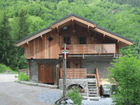
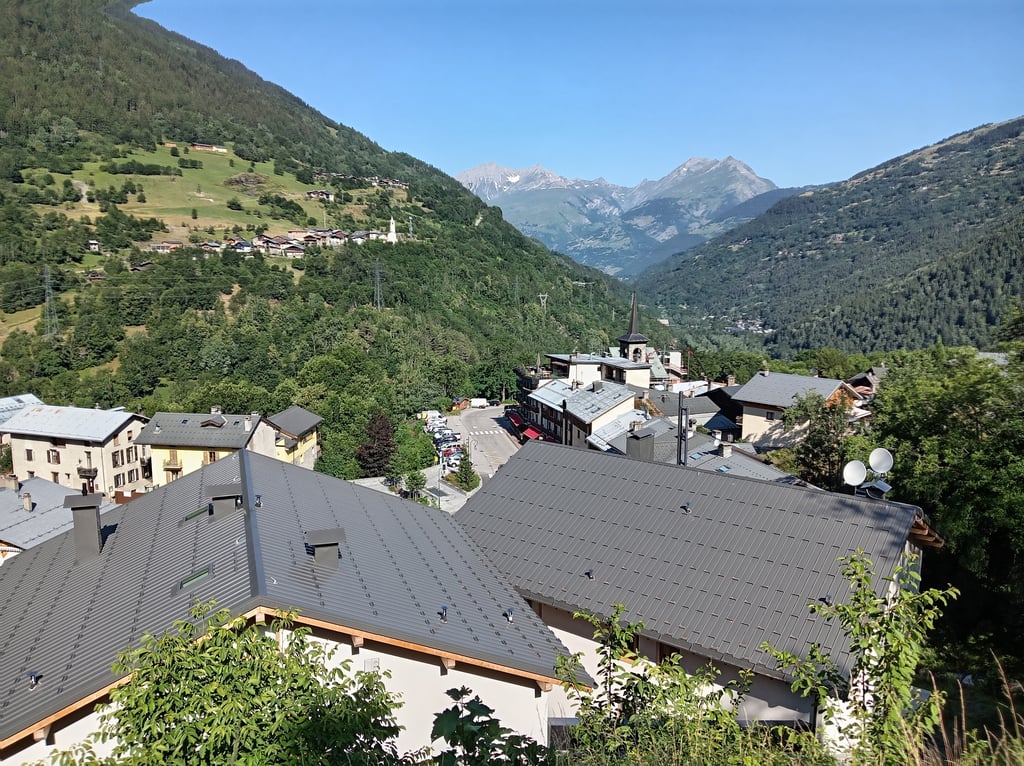
La Savonne from Sainte Foy Tarentaise is a climb in the region Savoie. It is 7.1 km long and bridges 707 m of vertical ascent with an average gradient of 9.9%, resulting in a difficulty score of 779. The top of the ascent is located at 1773 m above sea level. Climbfinder users shared 2 reviews of this climb and uploaded 8 photos.
Road name: D94
4.0 by SiardThis is an automatic translation, the original language is: Dutch.This climb feels like an assault on your legs. In the beginning, the road surface is good and the gradient easy to do. After the drop La Masure the climb really starts to take shape. The altimeters fly by the ears because of the high percentage of steepness. The route is largely through the forest, so you cycle in the shade. The road surface varies a bit, from good to with cracks. Descending carefully is the motto for the entire stretch up to La Masure. Before La Crôte you have a few hundred m... read more

Welcome! Please activate your account if you would like to share something. Look for the verification email in your inbox.
If you want to upload your photos, you need to create an account. It only takes 1 minute and it's completely free.
Taken very early on 25 June 2026 (Departure 6.55 am)
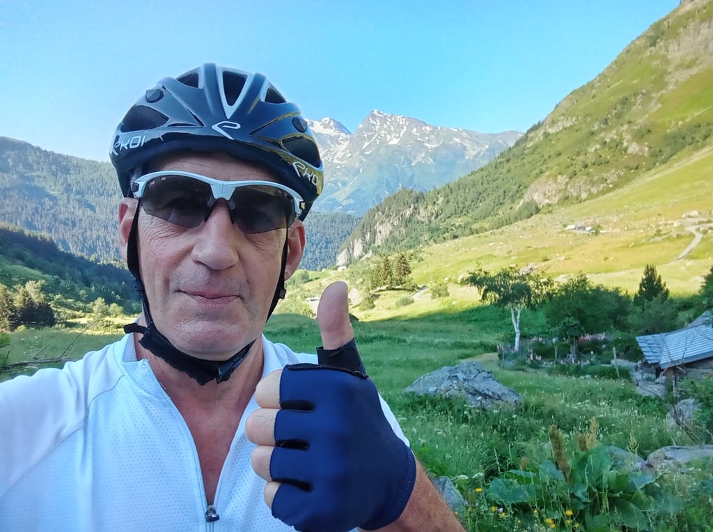
As I live near Albertville, I got up at 4 am to be in Bourg-Saint-Maurice very early to avoid the heatwave that’s currently raging.
I did, however, wait a while in the car before setting off as I found the temperature rather cool (15°) – we’re no longer used to that.
Looking at the route profile, I was expecting to tackle some difficult climbs, but I was surprised by just how tough it actually was. Fortunately, I’used to handling this sort of effort; otherwise I wouldn’t have made it – 34×38, sometimes at 50 revolutions per minute.
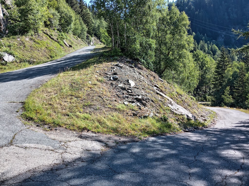
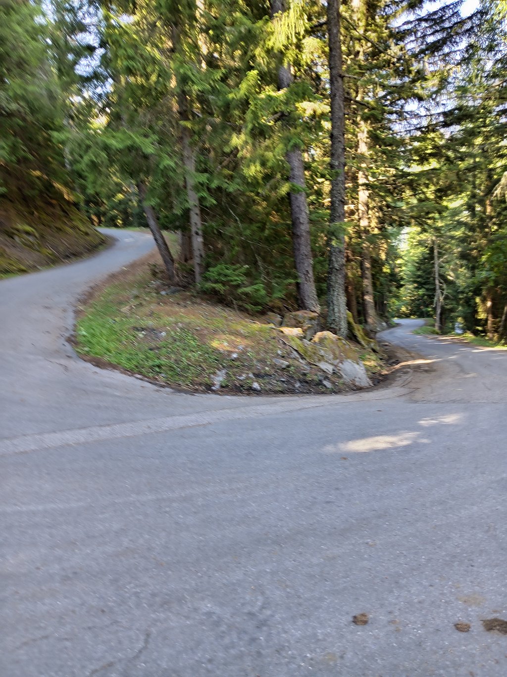
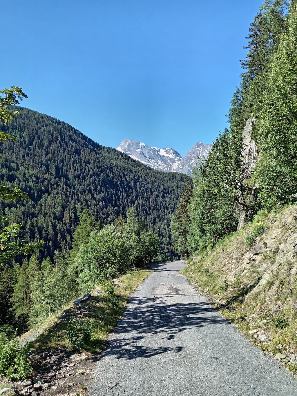
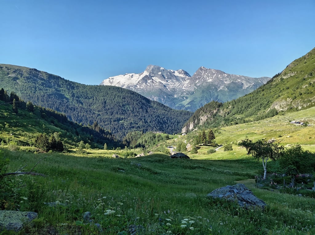
Much of the climb is in theshade, but it’s best to tackle it in the morning. Up to La Masure it’s manageable, despite gradients of 9–10 per cent already; shortly after leaving the hamlet, the real challenge begins with gradients that are at times daunting, ranging from 12 to 16 per cent right up to the second hamlet (Le Plan du Pré), where there is a drinking water reservoir on the left.
From Le Plan du Pré to Le Crot (the third hamlet), the gradients remain steep; crossing Le Crot is the only moment of real, albeit brief, respite, because after that it’s every man for himself.
An elderly lady in a car had the bright idea of overtaking me just before a hairpin bend on the right, and I could see her car rising above me, which gave me a glimpse of just how impressively steep the slope was.
The gradients remain steep almost right up to the end.
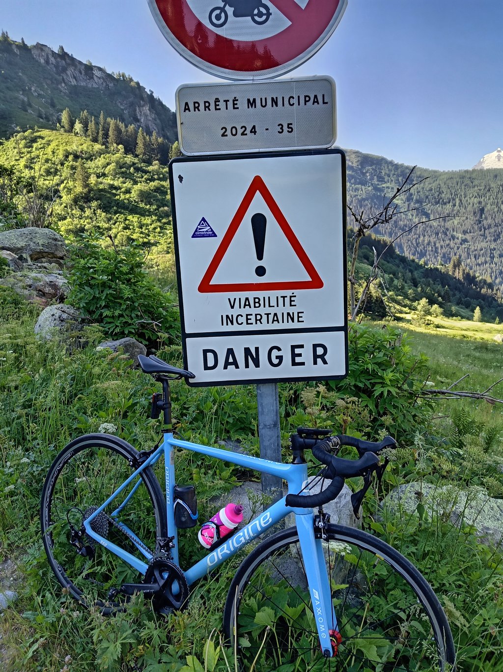
It’s worth noting that the tarmac ends a few hundred metres before the point indicated on Climbfinder; it’s really wild up there. I didn’t see a single resident in La Savonne; all the houses looked abandoned.
At this time of year, a huge flock of several hundred sheep (guarded by Patou dogs, so be wary) stretches across several hairpin bends; their bleating accompanies you for a few hundred metres – it’sit’s simply beautiful.
From spring right through to the end of summer, the winter sports resorts are one huge building site, and the road linking Bourg-Saint-Maurice to Val d’Isère and Tignes is a veritable motorway; from early in the morning, a string of vans belonging totradespeople of all kinds and construction lorries (from the smallest to the largest) pose a real danger to motorcyclists, so if your base camp is in Bourg-Saint-Maurice, I’d advise you to take a detour via Villaroger to reach the foot of La Savonne – 1.2 km after the Seez exit roundabout – a short 4.5 km climb along a quiet little mountain road that leads to the heart of Sainte-Foix-Tarentaise.
Please note that the road surface varies greatly from good to poor; you’ll need to be careful on the descent, especially as the gradient pulls you downwards.
Enjoy the climb and stay safe.
I know it’s not right, but I stuck the little Climbfinder sticker on the road sign at the top… food for thought
Fait le 25 juin 2026 de très bonne heure ( Départ 6h55 )
Habitant proche d'Albertville je me suis levé à 4h pour être à Bourg St Maurice très tôt afin d'éviter la canicule qui sévit en ce moment.
J'ai malgré tout attendu un peu dans la voiture avant de partir car j'ai trouvé la température fraîche ( 15° ) on n'est plus habitué.
À la vue du profil Je m'attendais à affronter des pentes difficiles mais j'ai été surpris par la difficulté réelle, heureusement que j'ai l'habitude de gérer ce type d'effort car sinon je ne passais pas, 34*38 parfois à 50 Tours/minutes .
Une grande partie de l'ascension est à l'ombre mais il vaut mieux la faire le matin, jusqu'à la Masure c'est gérable malgré déjà du 9-10%, un peu après la sortie du hameau les choses sérieuses commencent avec des pourcentages parfois affolants entre 12 et 16% jusqu'au 2ème hameau ( Le Plan du Pré ) où il y a un bassin d'eau potable sur la gauche.
Plan du Pré au Crot ( 3ème hameau ) toujours de forts pourcentages, la traversée du Crot est le seul moment de vrai mais court répit car ensuite s'est sauve qui peut ,
Une petite Grand-mère en voiture a eue la bonne idée de me doubler juste avant un lacet sur la droite et j'apercevais sa voiture qui s"élevait au dessus de moi ce qui me laissait entrevoir l’impressionnante difficulté de la pente.
Toujours des pourcentages élevés quasi jusqu'au final.
À savoir que le bitume disparaît quelques centaines de mètre avant le point indiqué sur Climbfinder, c'est vraiment sauvage là haut, je n'ai aperçu aucun habitant à La Savonne, toutes les maisons paraissaient abandonnées.
À cette époque de l'année un immense troupeau de moutons de plusieurs centaines de bêtes ( gardé par des patous donc méfiance ) s'étale sur plusieurs lacets , leurs bêlements vous accompagnent sur quelques centaines de mètres, c'est juste beau.
À partir du printemps et jusqu'à la fin de l'été les stations de sport d'hiver sont un énorme chantier et la Rte qui relie Bourg St Maurice à Val d'Isère et Tignes est une véritable autoroute, dès le matin de bonne heure une kyrielle de camionnettes d'artisans de toutes sortes et de camions de chantier ( du plus petit au plus gros ) présentent un réel danger pour les 2 roues donc si votre camp de base est situé à Bourg Saint Maurice, je vous conseille pour rejoindre le pied de la Savonne de dévier par Villaroger 1,2km après le rond point de sortie de Seez, une courte montée de 4,5 km sur une petite Rte de montagne au calme qui rejoint le cœur de Sainte Foix Tarentaise.
À signaler que le revêtement de la chaussée est très changeant de bon à mauvais, il faudra être prudent dans la descente surtout avec la pente qui vous tire vers le bas.
Bonne grimpée et soyez prudent.
Je sais que ce n'est pas bien, mais j'ai collé le petit autocollant Climbfinder sur le panneau routier au sommet...à méditer
This climb feels like an assault on your legs. In the beginning, the road surface is good and the gradient easy to do. After the drop La Masure the climb really starts to take shape. The altimeters fly by the ears because of the high percentage of steepness. The route is largely through the forest, so you cycle in the shade. The road surface varies a bit, from good to with cracks. Descending carefully is the motto for the entire stretch up to La Masure.
Before La Crôte you have a few hundred meters to catch your breath. The last part to La Crôte is hard work. After La Crôte it's another 2km of stumbling, but the view is beautiful! With a MTB it is possible to cycle even further up.
All in all a wonderful climb to cycle, a guarantee for burning legs when you arrive at the top.
At about 1.5km before the 'top' is for 5 to 10m unpaved road, caution is advised!
Deze beklimming voelt als een aanslag op je benen. In het begin is het wegdek goed en het steigingspercentage nog goed te doen. Na het drop La Masure begint de klim echt vorm te krijgen. De hoogtemeters vliegen je om de oren vanwege het hoge steigingspercentage. De route loopt hier grotendeels door het bos, dus je fietst in de schaduw. Het wegdek wisselt wat, van goed tot wegdek met veel scheuren erin. Voorzichtig afdalen is het devies voor het gehele stuk tot aan La Masure.
Voor La Crôte heb je een een paar honderd meter om op adem te komen. Het laatste stukje tot La Crôte is doorbijten. Na La Crôte is het nog 2km bikkelen, maar het uitzicht is prachtig! Met een MTB is het mogelijk om nog verder omhoog te fietsen.
Al met al een heerlijke beklimming om te fietsen, een garantie voor brandende benen als je boven komt.
Op ongeveer 1,5km voor de 'top' zit voor 5 à 10m onverhard wegdek, voorzichtigheid geboden!
| 7 km/h | 01:01:15 |
| 11 km/h | 00:38:58 |
| 15 km/h | 00:28:35 |
| 19 km/h | 00:22:33 |
This page is better in the app