View on map
© MapLibre | OpenStreetMap contributors
1%
2%
4%
6%
8%
10%
12%
15%
20%

La Hoguenne

4.0
3 reviews | Elevation profile | 2 photos
Tips nearby
La Hoguenne
La Hoguenne
transparant thumb
transparant thumb
transparant thumb
transparant thumb
transparant thumb
transparant thumb
Your achievable time
Calculating based on your best performances...
Relaxed
Maximum
W/kg
W/kg
W/kg
Analyse your climbing performance
Detailed insight into your climbing performance & automatically check off climbs
Based on your best performances.
Your best attempt:
Number of attempts:
Elevation profile La Hoguenne

Statistics

Difficulty points 52
Length 1.3 km
Average gradient 5.1%
Steepest 100 metres 16.2%
Total ascent 67 m

Short recap

Beautiful scenery
Hidden gem
#75 toughest climb of Hainaut Province
#60 most elevation gain of Pays des Collines
#47 average steepest climb of Pays des Collines
Feedback about this climb?
Show climbs nearby Export to GPS device

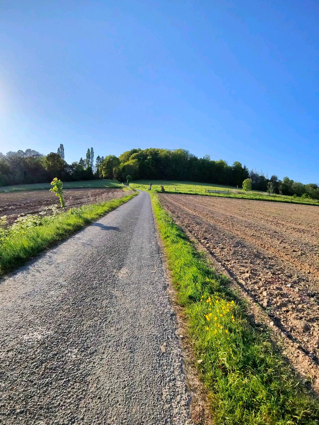
La Hoguenne is a climb in the region Pays des Collines. It is 1.3 km long and bridges 67 m of vertical ascent with an average gradient of 5.1%, resulting in a difficulty score of 52. The top of the ascent is located at 133 m above sea level. Climbfinder users shared 3 reviews of this climb and uploaded 2 photos.

Road name: Rue Hoguenne

4.0 by Maikel1989
This is an automatic translation, the original language is: Dutch.
This is highly recommended. It starts easily with a few bends on bad road surfaces. After that, however, you cross straight across the field. Because the road just goes through a field it may seem less steep but the steepest part is really not to be underestimated. At the top, you then reach the road across the ridge, where many other climbs also end. You then also have fantastic views.... read more

Photos (2)

La Hoguenne
La Hoguenne
transparant thumb
transparant thumb
transparant thumb
transparant thumb

Your uploads (max 4)

Welcome! Please activate your account if you would like to share something. Look for the verification email in your inbox.

If you want to upload your photos, you need to create an account. It only takes 1 minute and it's completely free.

  • Receive free climbfinder goodies for your reviews & photos.
  • Create a bucket list and check off conquered climbs.
  • Add missing climbs.
Continue with GoogleContinue with Google Continue with FacebookContinue with Facebook Continue with AppleContinue with Apple Sign up with email
By signing up you agree to our terms of service and confirm that you have read our privacy & content policy.

Reviews (3)

5.0
4.0
3.0
2.0
1.0
Maikel1989
1 y 4.0
This is an automatic translation, the original language is: Dutch. Show original

This is highly recommended. It starts easily with a few bends on bad road surfaces. After that, however, you cross straight across the field. Because the road just goes through a field it may seem less steep but the steepest part is really not to be underestimated. At the top, you then reach the road across the ridge, where many other climbs also end. You then also have fantastic views.

Dit is een aanrader. Het begint makkelijk met een paar bochtjes over slecht wegdek. Daarna steek je echter recht het veld over. Doordat de weg gewoon door een veld gaat lijkt het mogelijks minder steil maar het steilste stuk is echt niet te onderschatten. Boven kom je dan bij de weg over de rug, waar vele andere beklimmingen ook op uitkomen. Je hebt er dan ook een fantastisch uitzicht.

Dashboard
gdemoutiez
5 y 4.0
This is an automatic translation, the original language is: French. Show original

I recommend this climb because it is in the middle of an area with a lot of other climbs so you don't have to drive a lot of miles to find others

Je recommande cette montée car elle se trouve au milieu d'une région avec un tas d'autre montée donc pas besoin de faire beaucoup de kilomètres pour en trouver d'autres

Dashboard
Simon-45
5 y 4.0
This is an automatic translation, the original language is: Dutch. Show original

Nice climb with beautiful views over the valley. Runs pretty well until the steep part that you do not expect on sight. No traffic on typical 'French' asphalt.

Mooie beklimming met prachtige uitzichten over de vallei. Loopt vrij goed tot het steile stuk dat je op het zicht niet verwacht. Geen verkeer op typisch 'Frans' asfalt.

La Hoguenne
Dashboard

Climbing times

7 km/h 00:11:10
11 km/h 00:07:06
15 km/h 00:05:12
19 km/h 00:04:06

Road surface condition

0% 100% 0%
Based on 1 vote
Share your knowledge. What was the road condition during your ascent?

Traffic

100% 0% 0%
Based on 1 vote
Your experience counts. How much traffic did you encounter during the climb?

Frequently Asked Questions

You don't need special gearing for La Hoguenne. The slope isn't long or steep enough to require much shifting down. You can conquer this climb on power alone. However, a compact gearing system with a smallest front chainring of 34 and largest rear sprocket of 28 or 30 is always nice if you enjoy cycling uphill. This helps maintain a smooth cadence.

La Hoguenne falls into the 5th category. With good fitness, you can ride it up with speed and power. If you have less training, shift down and climb smoothly.

La Hoguenne is 1.3 km long.

The average gradient of La Hoguenne is 5.1%.

La Hoguenne has a steepest segment with an average gradient of 16.2%.

The summit of La Hoguenne is at 133 m.

At a slow pace of 7 km/h, it takes about 00:11:10 to climb La Hoguenne. At 11 km/h the time is 00:07:06, and at 15 km/h 00:05:12. For the fastest cyclists, 00:04:06 is an achievable time.

La Hoguenne is located in the region Hainaut Province in Belgium.

This page is better in the app

Climbfinder app
Climbfinder
(Free)
Open