La Bianca from Talamona is a climb in the region Sondrio. It is 8.6 km long and bridges 1035 m of vertical ascent with an average gradient of 12%, resulting in a difficulty score of 1380. The top of the ascent is located at 1277 m above sea level. Climbfinder users shared 2 reviews of this climb and uploaded 3 photos.
Road names: Via Roma, Via Roncaiola & Strada per La Bianca
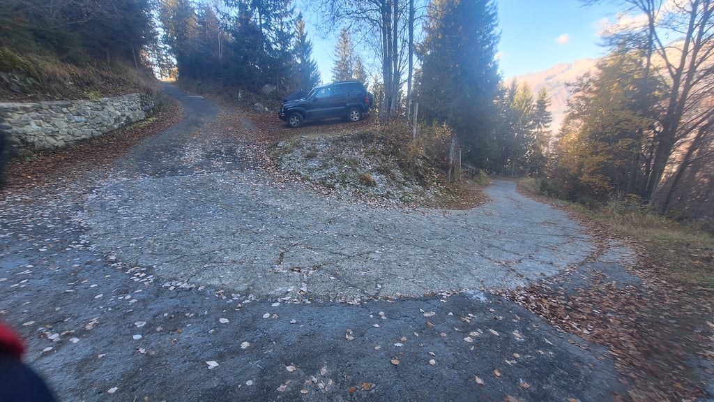
3.0 by GabrieleC74This is an automatic translation, the original language is: Italian.Extremely demanding ascent, I strongly recommend very agile ratios such as 36x32 or 34x32. The road surface is very bumpy and rough, so particular care must be taken on the descent. The climb is rewarding but ends in a fairly anonymous place. The vegetation is moderately dense so it protects against the hottest days, but there is no lack of more exposed and scenic stretches. Traffic is sufficiently sparse, while water can be refuelled thanks to two fountains in the second part of the climb, the ... read more
Welcome! Please activate your account if you would like to share something. Look for the verification email in your inbox.
If you want to upload your photos, you need to create an account. It only takes 1 minute and it's completely free.
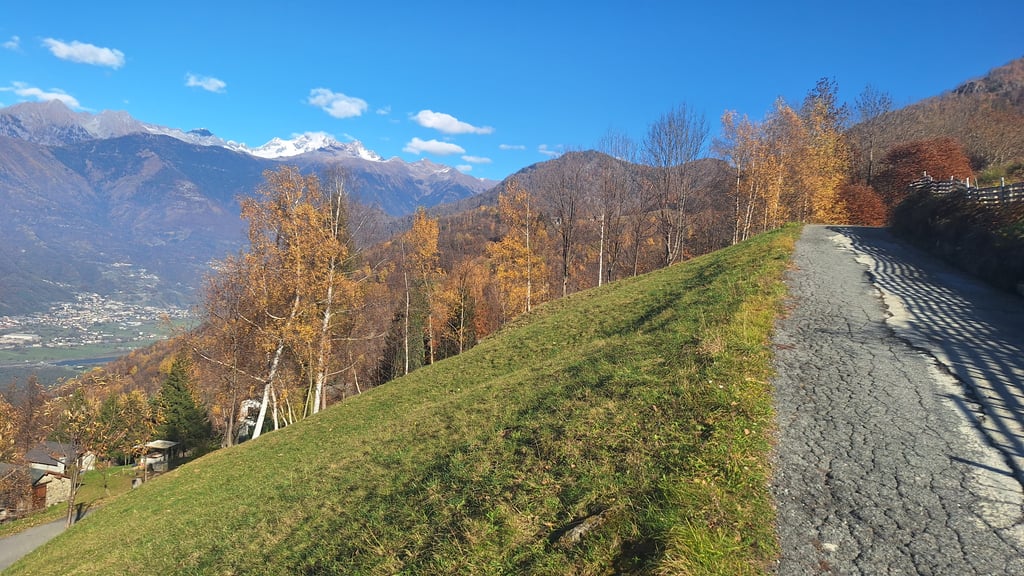
Steep, narrow, rough.
Lonely, quiet, mysterious.
This climb is a lonely corner where you can fight with gravity holding you back through irregular slopes, giving opportunities to pedal out of saddle, with rewarding panorama on mountains.
Extremely demanding ascent, I strongly recommend very agile ratios such as 36x32 or 34x32. The road surface is very bumpy and rough, so particular care must be taken on the descent. The climb is rewarding but ends in a fairly anonymous place. The vegetation is moderately dense so it protects against the hottest days, but there is no lack of more exposed and scenic stretches. Traffic is sufficiently sparse, while water can be refuelled thanks to two fountains in the second part of the climb, the last one just over a kilometre from the summit. To those who want to try their hand at this climb, I wish good luck and good legs.
Salita estremamente impegnativa, consiglio vivamente rapporti molto agili come 36x32 o 34x32. Il manto stradale è molto sconnesso e ruvido, per cui bisogna prestare particolare attenzione in discesa. La salita è appagante ma termina in un luogo abbastanza anonimo. La vegetazione è moderatamente fitta quindi protegge dalle giornate più calde, ma non mancano tratti più esposti e panoramici. Il traffico è sufficientemente scarso, mentre si può fare rifornimento idrico grazie a due fontane presenti nella seconda parte della salita, l'ultima a poco più di un chilometro dalla vetta. A chi vuole cimentarsi su questa erta auguro buona fortuna e buone gambe
| 7 km/h | 01:14:07 |
| 11 km/h | 00:47:09 |
| 15 km/h | 00:34:35 |
| 19 km/h | 00:27:18 |
This page is better in the app