View on map
© MapLibre | OpenStreetMap contributors
1%
2%
4%
6%
8%
10%
12%
15%
20%

Kohlscheid via Am Langenberg

3.3
4 reviews | Elevation profile | 12 photos
Tips nearby
Kohlscheid via Am Langenberg
Your achievable time
Calculating based on your best performances...
Relaxed
Maximum
W/kg
W/kg
W/kg
Analyse your climbing performance
Detailed insight into your climbing performance & automatically check off climbs
Based on your best performances.
Your best attempt:
Number of attempts:
Elevation profile Kohlscheid via Am Langenberg

Statistics

Difficulty points 45
Length 0.7 km
Average gradient 7.5%
Steepest 100 metres 13.7%
Total ascent 50 m

Short recap

Beautiful scenery
1 hairpin turn
Feedback about this climb?
Show climbs nearby Export to GPS device

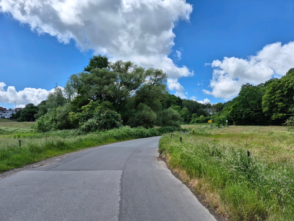
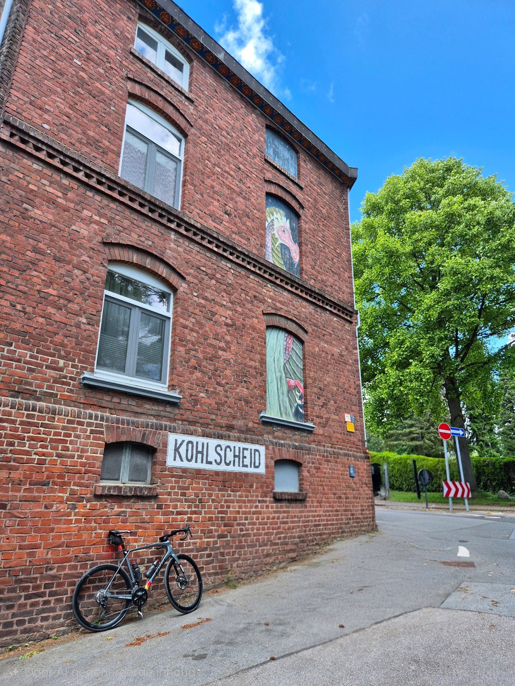
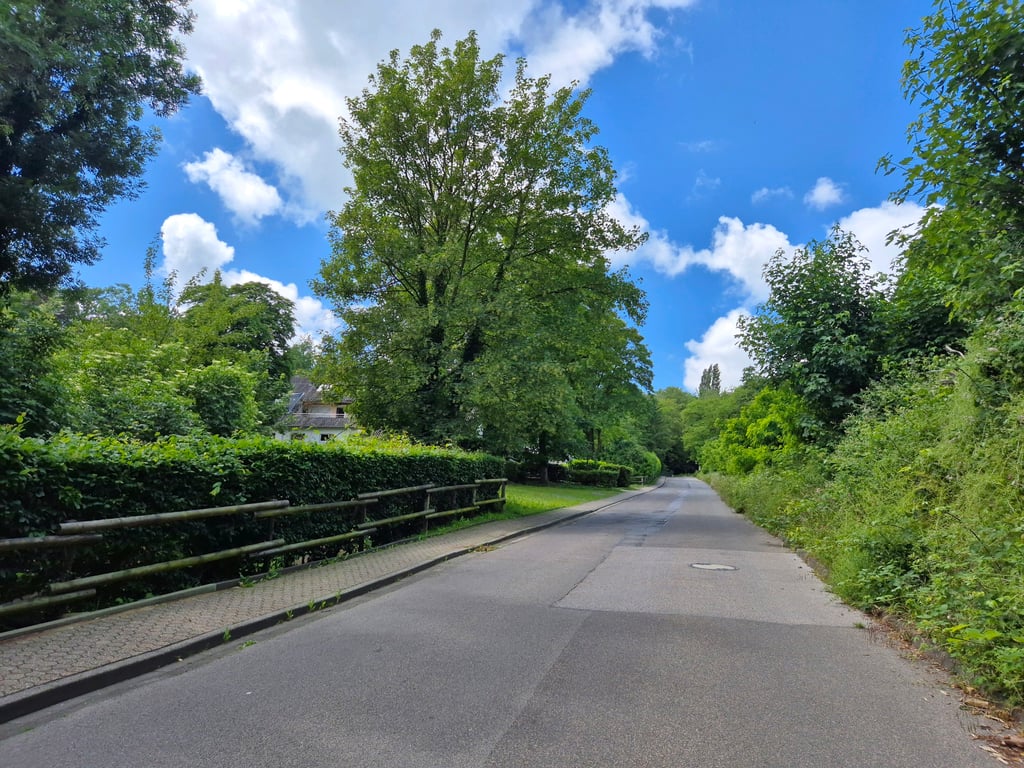
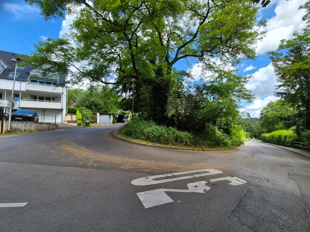
Kohlscheid via Am Langenberg is a climb in the region Cologne. It is 0.7 km long and bridges 50 m of vertical ascent with an average gradient of 7.5%, resulting in a difficulty score of 45. The top of the ascent is located at 171 m above sea level. Climbfinder users shared 4 reviews of this climb and uploaded 12 photos.

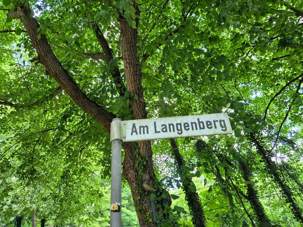
Road names: Am Langenberg & Am Langenberg
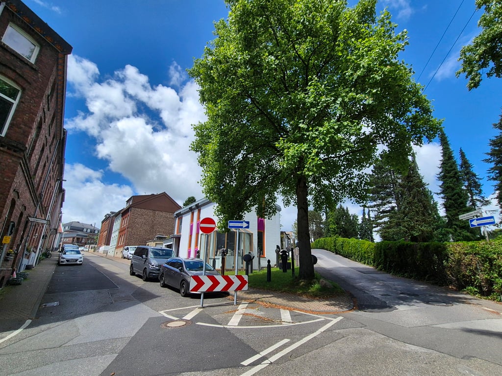
3.0 by Jarin
This is an automatic translation, the original language is: Dutch.
Nice climb that starts very rural in an otherwise built-up area. After a considerable descent, you climb up the Langenberg from the valley. It is a smooth climb over good asphalt. At the end of the climb is you have to follow one-way traffic.... read more

Photos (12)

Kohlscheid via Am Langenberg

Your uploads (max 4)

Welcome! Please activate your account if you would like to share something. Look for the verification email in your inbox.

If you want to upload your photos, you need to create an account. It only takes 1 minute and it's completely free.

  • Receive free climbfinder goodies for your reviews & photos.
  • Create a bucket list and check off conquered climbs.
  • Add missing climbs.
Continue with GoogleContinue with Google Continue with FacebookContinue with Facebook Continue with AppleContinue with Apple Sign up with email
By signing up you agree to our terms of service and confirm that you have read our privacy & content policy.

Reviews (4)

5.0
4.0
3.0
2.0
1.0
Jarin
4 h 3.0 via the Climbfinder app
This is an automatic translation, the original language is: Dutch. Show original

Nice climb that starts very rural in an otherwise built-up area. After a considerable descent, you climb up the Langenberg from the valley. It is a smooth climb over good asphalt. At the end of the climb is you have to follow one-way traffic.

Mooie klim die heel landelijke begint in een verder toch wel bebouwde omgeving. Na een flinke afdaling klim je vanuit de vallei de Langenberg op. Het is een goedlopende klim over goed asfalt. Op het eind van de klim is moet je het eenrichtingsverkeer volgen.

Kohlscheid via Am Langenberg
Dashboard
BikerJohan
1 y 3.0
This is an automatic translation, the original language is: Dutch. Show original

Short climb into the built-up area of Kohlscheid from the direction of Bardenberg. In the first 300 metres the gradient is double digits, but after that it flattens out a bit but you have to keep pedalling to avoid stalling.

Korte klim de bebouwde kom van Kohlscheid in vanuit de richting Bardenberg. In de eerste 300 meter dubbele cijfers v.w.b. het stijgingspercentage. daarna vlakt het wat af maar is blijven trappen wel een "must" om niet stil te vallen.

Dashboard
XaviElSchwalbo
1 y 4.0
This is an automatic translation, the original language is: German. Show original

Initially a nice start from the Wurmtal valley, up to the hairpin bend with high percentages. After the hairpin bend, in the built-up area, the last ramp flattens out with higher percentages.
Relatively quiet and nice to climb.

Zunächst ein schöner Start aus dem Wurmtal, bis zur Kehre mit hohen Prozenten. Nach der Kehre, im bebauten Gebiet zunächst abgeflacht die letzte Rampe mit höheren Prozenten.
Relativ ruhig und schön zu klettern.

Dashboard
Fedor
4 y 3.0
This is an automatic translation, the original language is: Dutch. Show original

From a beautiful valley you cycle up and soon you will be confronted with steep percentages. This then decreases slightly but you are on a straight road which feels quite long. In the sharp turn to the right the percentages are low but not if you keep to the right. Then straight on because of the one-way road where you have to climb up against a bump, after which it quickly flattens out.
The valley of the Wurm is very beautiful but the road offers no further views.

Vanuit een mooi dal fiets je omhoog waarbij je al al snel flinke percentages voor je kiezen krijgt. Dat neemt daarna iets af maar je zit dan op een recht stuk weg wat best lang aanvoelt. In de scherpe bocht naar rechts zijn de percentages laag maar niet als je netjes rechts blijft fietsen. Daarna rechtdoor vanwege de eenrichtingsweg waar je nog tegen een bult omhoog moet, waarna het snel afvlakt.
Het dal van de Wurm is erg fraai maar de weg biedt verder geen uitzicht meer.

Kohlscheid via Am Langenberg
Dashboard

Climbing times

7 km/h 00:05:43
11 km/h 00:03:38
15 km/h 00:02:40
19 km/h 00:02:06

Road surface condition

100% 0% 0%
Based on 1 vote
Share your knowledge. What was the road condition during your ascent?

Traffic

0% 100% 0%
Based on 1 vote
Your experience counts. How much traffic did you encounter during the climb?

Frequently Asked Questions

Kohlscheid can be cycled from 2 sides. Kohlscheid via Oststrasse is the most popular side, but the summit can also be reached via Kohlscheid via Am Langenberg.

You don't need special gearing for Kohlscheid via Am Langenberg. The slope isn't long or steep enough to require much shifting down. You can conquer this climb on power alone. However, a compact gearing system with a smallest front chainring of 34 and largest rear sprocket of 28 or 30 is always nice if you enjoy cycling uphill. This helps maintain a smooth cadence.

Kohlscheid via Am Langenberg falls into the 5th category. With good fitness, you can ride it up with speed and power. If you have less training, shift down and climb smoothly.

Kohlscheid via Am Langenberg is 0.7 km long.

The average gradient of Kohlscheid via Am Langenberg is 7.5%.

Kohlscheid via Am Langenberg has a steepest segment with an average gradient of 13.7%.

The summit of Kohlscheid via Am Langenberg is at 171 m.

At a slow pace of 7 km/h, it takes about 00:05:43 to climb Kohlscheid via Am Langenberg. At 11 km/h the time is 00:03:38, and at 15 km/h 00:02:40. For the fastest cyclists, 00:02:06 is an achievable time.

Kohlscheid via Am Langenberg is located in the region Cologne in Germany.

This page is better in the app

Climbfinder app
Climbfinder
(Free)
Open