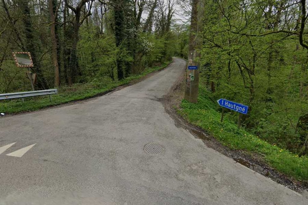
Hautgné is a climb in the region Valleys of the Vesdre, de l'Amblève et de l'Ourthe. It is 3 km long and bridges 160 m of vertical ascent with an average gradient of 5.3%, resulting in a difficulty score of 103. The top of the ascent is located at 242 m above sea level. Climbfinder users shared 5 reviews of this climb and uploaded 4 photos.
This is an automatic translation, the original language is: Dutch.
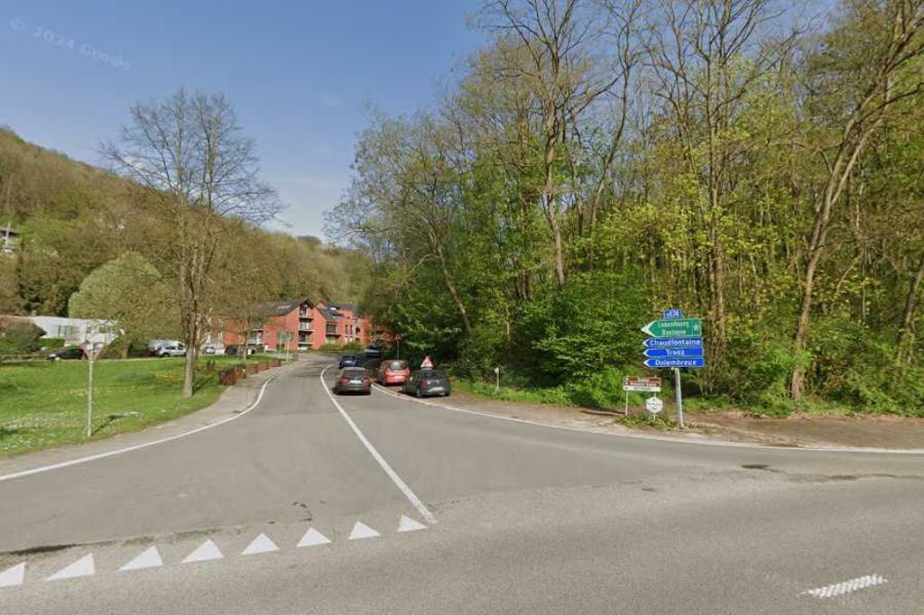
The first half is known by everyone as a descent deep into the final of Liège-Bastogne-Liège, just before the riders start the final climb (Roche Aux Faucons). Nice, but very busy road.
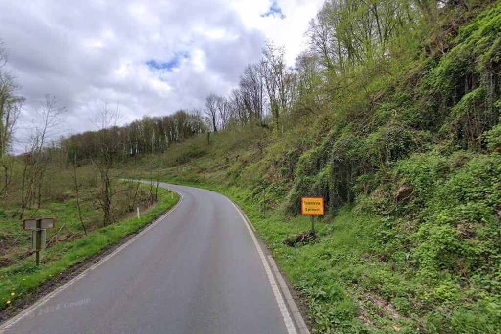
As soon as you leave the main road everything changes: road surface less, percentages higher, and hardly any traffic.
Nice climb...read more
Photos (4)
Welcome! Please activate your account if you would like to share something. Look for the verification email in your inbox.
This is an automatic translation, the original language is: Dutch.
Show original
Nice climb from Méry to Hautgné. First about 800 metres it goes up quite a bit. Then it flattens out and is a nice run. After more than 2 kilometres, the toughest part follows, touching 10%. At the end, it then flattens out again until the top.
Mooie klim vanuit Méry naar Hautgné. Eerste circa 800 meter loopt het aardig omhoog. Daarna vlakte het af en is het een lekkere loper. Na ruim 2 kilometer volgt het zwaarste deel en wordt de 10% aangetikt. Op het einde vlakt het tot de top dan weer af.
This is an automatic translation, the original language is: French.
Show original
I discovered this climb during a participation in the Géants des Ardennes. I was expecting to go to the end of the classic Dolembreux climb, but we took this "alternate route", which was actually quite pleasant because it was in the countryside and much less frequented.
J'ai découvert cette côte lors d'une édition du Géants des Ardennes. Alors que je m'attendais à ce qu'on aille au bout de la côte de Dolembreux classique, on avait emprunté cet « itinéraire bis », finalement assez agréable car champêtre et beaucoup moins fréquenté.
This is an automatic translation, the original language is: Dutch.
Show original
The first half is known by everyone as a descent deep into the final of Liège-Bastogne-Liège, just before the riders start the final climb (Roche Aux Faucons). Nice, but very busy road.
As soon as you leave the main road everything changes: road surface less, percentages higher, and hardly any traffic.
Nice climb
De eerste helft kent iedereen als afdaling diep in de finale van Luik-Bastenaken-Luik, vlak voor de renners de laatste klim (Roche Aux Faucons) aanvatten. Mooie, maar zeer drukken weg.
Van zodra je de hoofdweg verlaat verandert alles: wegdek stuk minder, percentages omhoog, en amper nog verkeer.
This is an automatic translation, the original language is: Dutch.
Show original
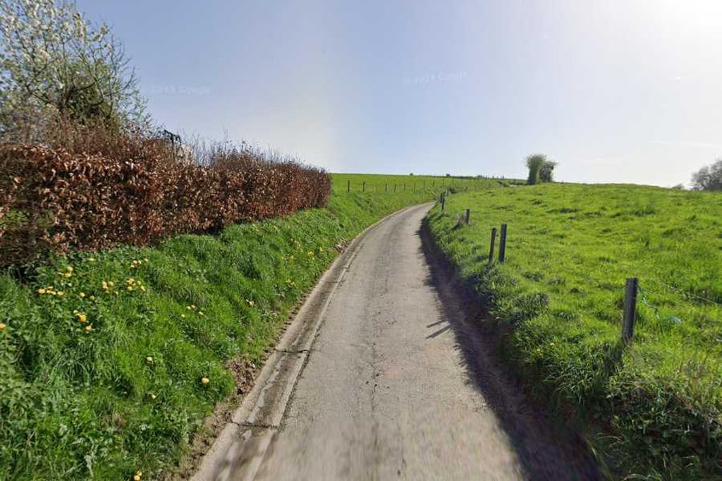
A nice climb starting from Mery out of the valley of the Ourthe; opposite to the Roche aux Faucons which goes up from the other bank. First you cycle on the main road in the direction of Trooz, after which you take the road to the right that goes through the hamlet of Hautgné. After leaving the houses behind you the path climbs on for a while, with nice views to the north on your right.
Een mooie klim die vanuit Mery uit het dal van de Ourthe vertrekt; tegenovergesteld aan de Roche aux Faucons die vanuit de andere oever omhoog loopt. Eerst fiets je nog op de doorgaande weg richting Trooz, waarna je even later de weg naar rechts neemt die door het buurtschap Hautgné loopt. Waarna je de huizen achter je laat klimt het nog eventjes door met mooie vergezichten noordwaarts ter rechterzijde.
You don't need special gearing for Hautgné. The slope isn't long or steep enough to require much shifting down. You can conquer this climb on power alone. However, a compact gearing system with a smallest front chainring of 34 and largest rear sprocket of 28 or 30 is always nice if you enjoy cycling uphill. This helps maintain a smooth cadence.
Hautgné is a 4th-category climb. A sprint to the top is usually not an option, and untrained riders will definitely feel it in their legs. For trained cyclists, it is a great training climb.
Hautgné is 3 km long.
The average gradient of Hautgné is 5.3%.
Hautgné has a steepest segment with an average gradient of 13%.
The summit of Hautgné is at 242 m.
At a slow pace of 7 km/h, it takes about 00:25:40 to climb Hautgné. At 11 km/h the time is 00:16:20, and at 15 km/h 00:11:58. For the fastest cyclists, 00:09:27 is an achievable time.