View on map
© MapLibre | OpenStreetMap contributors
1%
2%
4%
6%
8%
10%
12%
15%
20%

Greyertweg from Bingelrade

3.0
3 reviews | Elevation profile | 9 photos
Tips nearby
Greyertweg from Bingelrade
Your achievable time
Calculating based on your best performances...
Relaxed
Maximum
W/kg
W/kg
W/kg
Analyse your climbing performance
Detailed insight into your climbing performance & automatically check off climbs
Based on your best performances.
Your best attempt:
Number of attempts:
Elevation profile Greyertweg from Bingelrade

Statistics

Difficulty points 8
Length 1.3 km
Average gradient 2.3%
Steepest 100 metres 3.5%
Total ascent 30 m
Feedback about this climb?
Show climbs nearby Export to GPS device

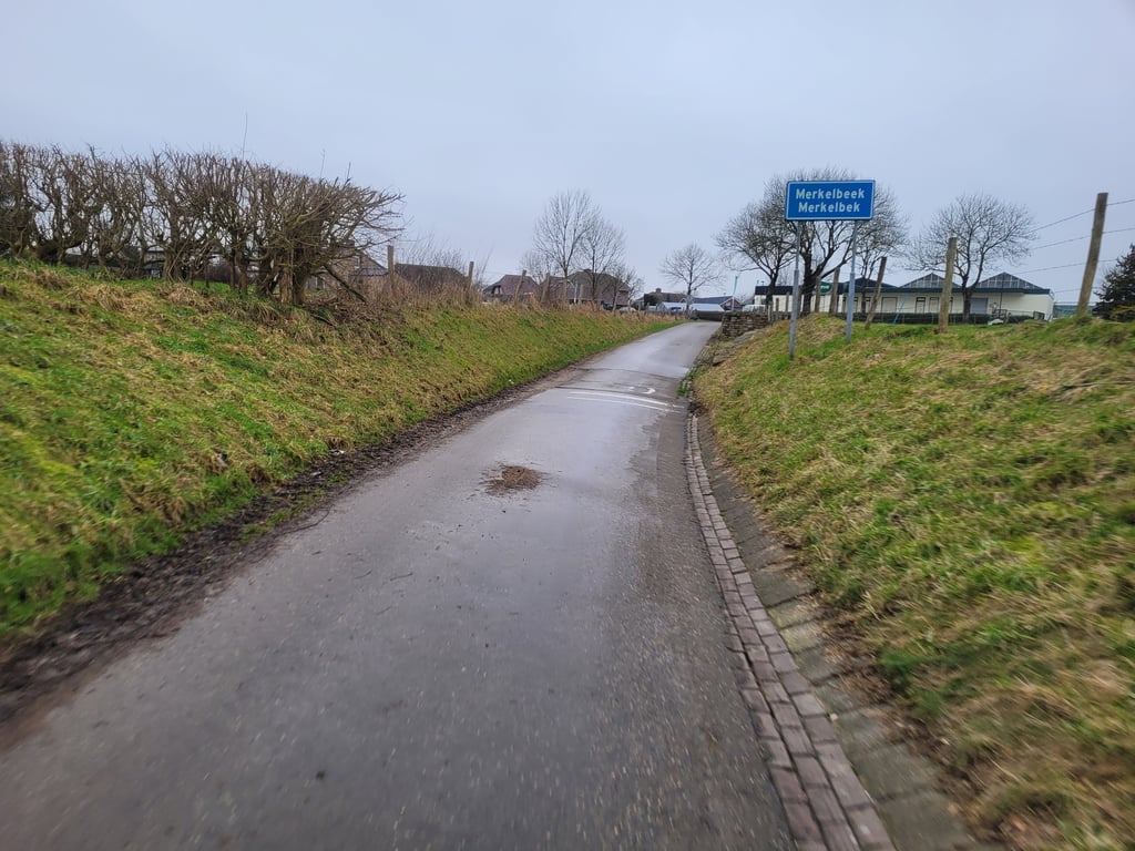
Greyertweg from Bingelrade is a climb in the region South Limburg. It is 1.3 km long and bridges 30 m of vertical ascent with an average gradient of 2.3%, resulting in a difficulty score of 8. The top of the ascent is located at 108 m above sea level. Climbfinder users shared 3 reviews of this climb and uploaded 9 photos.

Road names: Greyertweg & Belenweg

3.0 by BikerJohan
This is an automatic translation, the original language is: Dutch.
Nice run of over 1 kilometre in the countryside from Bingelrade towards Merkelbeek. After rain as well as during/after harvest period it can be quite wet/muddy.... read more

Photos (9)

Greyertweg from Bingelrade
transparant thumb
transparant thumb
transparant thumb

Your uploads (max 4)

Welcome! Please activate your account if you would like to share something. Look for the verification email in your inbox.

If you want to upload your photos, you need to create an account. It only takes 1 minute and it's completely free.

  • Receive free climbfinder goodies for your reviews & photos.
  • Create a bucket list and check off conquered climbs.
  • Add missing climbs.
Continue with GoogleContinue with Google Continue with FacebookContinue with Facebook Continue with AppleContinue with Apple Sign up with email
By signing up you agree to our terms of service and confirm that you have read our privacy & content policy.

Reviews (3)

5.0
4.0
3.0
2.0
1.0
BikerJohan
10 Mo 3.0
This is an automatic translation, the original language is: Dutch. Show original

Nice run of over 1 kilometre in the countryside from Bingelrade towards Merkelbeek. After rain as well as during/after harvest period it can be quite wet/muddy.

Lekkere loper van ruim 1 kilometer in het buitengebied vanuit Bingelrade richting Merkelbeek. Na regen alsmede tijdens/na oogstperiode kan het er wel flink nat/modderig zijn.

Dashboard
Jarin
1 y 3.0
This is an automatic translation, the original language is: Dutch. Show original

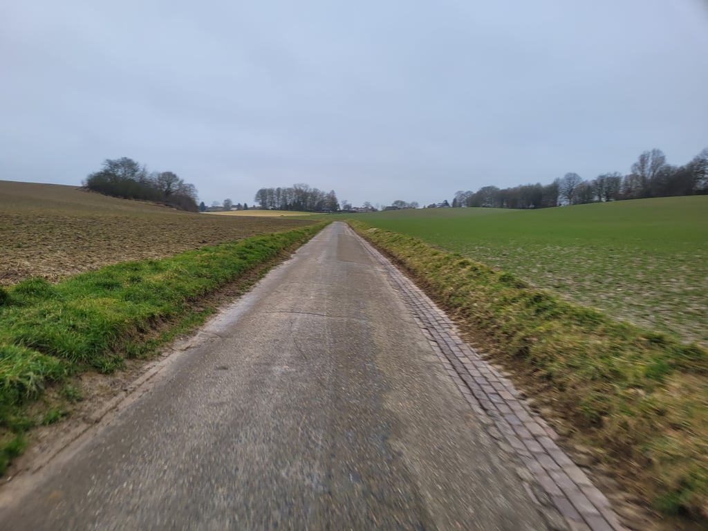
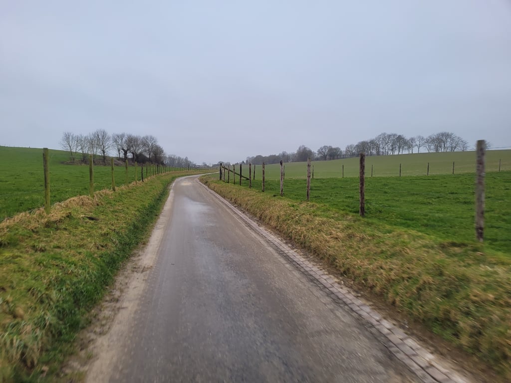
Easy runner through a pretty valley with ascending grasslands on both sides. Narrow car-free tarmac road. You can see the road winding nicely through the landscape ahead of you.

Eenvoudige loper door een mooie vallei met omhooglopende graslanden aan beide zijdes. Smalle autoluwe asfaltweg. Je ziet de weg mooi voor je door het landschap kronkelen.

Greyertweg from Bingelrade
Dashboard
Fedor
4 y 3.0
This is an automatic translation, the original language is: Dutch. Show original

Light runner up. Nothing sensational, but nice scenery because you ride up through a little valley. The road is used for rainwater drainage and can be muddy especially down below. At the top nice view to the rear.

Lichte loper omhoog. Niets opzienbarends, wel een mooie omgeving omdat je door een valleitje omhoog rijdt. De weg wordt gebruikt voor de afvoer van regenwater en kan vooral beneden modderig zijn. Bovenin aardig uitzicht naar achteren.

Greyertweg from Bingelrade
Dashboard

Climbing times

7 km/h 00:10:57
11 km/h 00:06:58
15 km/h 00:05:06
19 km/h 00:04:02

Road surface condition

0% 0% 0%
Based on 0 votes
Share your knowledge. What was the road condition during your ascent?

Traffic

0% 0% 0%
Based on 0 votes
Your experience counts. How much traffic did you encounter during the climb?

Frequently Asked Questions

You don't need special gearing for Greyertweg from Bingelrade. The slope isn't long or steep enough to require much shifting down. You can conquer this climb on power alone. However, a compact gearing system with a smallest front chainring of 34 and largest rear sprocket of 28 or 30 is always nice if you enjoy cycling uphill. This helps maintain a smooth cadence.

Greyertweg from Bingelrade is not tough enough to be assigned a mountain category. This means that even untrained cyclists can reach the top without any problems on this climb.

Greyertweg from Bingelrade is 1.3 km long.

The average gradient of Greyertweg from Bingelrade is 2.3%.

Greyertweg from Bingelrade has a steepest segment with an average gradient of 3.5%.

The summit of Greyertweg from Bingelrade is at 108 m.

At a slow pace of 7 km/h, it takes about 00:10:57 to climb Greyertweg from Bingelrade. At 11 km/h the time is 00:06:58, and at 15 km/h 00:05:06. For the fastest cyclists, 00:04:02 is an achievable time.

Greyertweg from Bingelrade is located in the region Limburg in Netherlands.

This page is better in the app

Climbfinder app
Climbfinder
(Free)
Open