View on map
© MapLibre | OpenStreetMap contributors
1%
2%
4%
6%
8%
10%
12%
15%
20%

Graulsbüsch from Mühlenbach

3.0
1 review/story | Elevation profile | 2 photos
Tips nearby
Graulsbüsch from Mühlenbach
transparant thumb
transparant thumb
transparant thumb
transparant thumb
transparant thumb
transparant thumb
Your achievable time
Calculating based on your best performances...
Relaxed
Maximum
W/kg
W/kg
W/kg
Analyse your climbing performance
Detailed insight into your climbing performance & automatically check off climbs
Based on your best performances.
Your best attempt:
Number of attempts:
Elevation profile Graulsbüsch from Mühlenbach

Statistics

Difficulty points 44
Length 2.8 km
Average gradient 2.9%
Steepest 100 metres 11.2%
Total ascent 83 m
Feedback about this climb?
Show climbs nearby Export to GPS device

Graulsbüsch from Mühlenbach is a climb in the region Eifel. It is 2.8 km long and bridges 83 m of vertical ascent with an average gradient of 2.9%, resulting in a difficulty score of 44. The top of the ascent is located at 346 m above sea level. Climbfinder users shared 1 review/story of this climb and uploaded 2 photos.
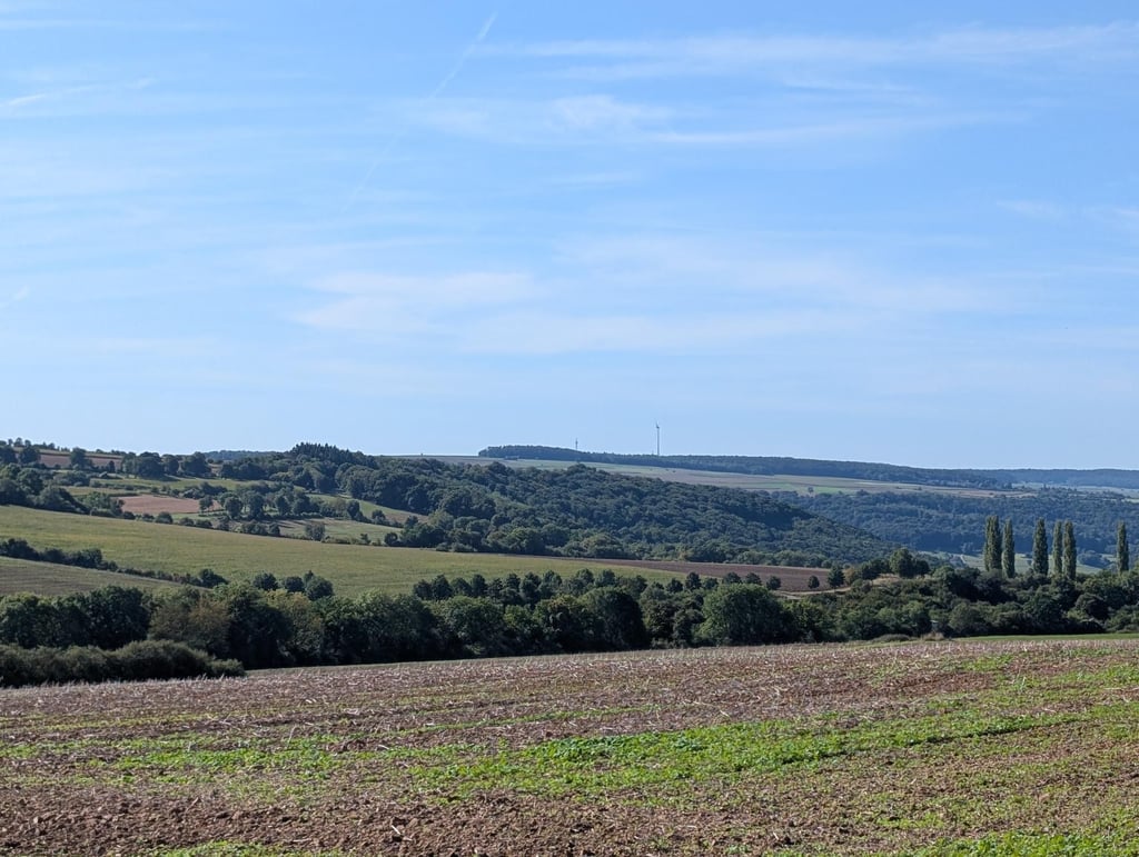
This is an automatic translation, the original language is: Dutch.
If you load this climb into your route, you might get the message, that there might be unpaved strips on the climb. Totally untrue. The last 450 metres is just bad road surface. For the rest, the road surface is fine and the traffic quiet. If you just ride straight and don't take the turn to the last few hundred metres (and actually don't take any more altimeters there). Then this is a fine climb. Relatively nice views at the top.... read more

Photos (2)

Graulsbüsch from Mühlenbach
transparant thumb
transparant thumb
transparant thumb
transparant thumb

Your uploads (max 4)

Welcome! Please activate your account if you would like to share something. Look for the verification email in your inbox.

If you want to upload your photos, you need to create an account. It only takes 1 minute and it's completely free.

  • Receive free climbfinder goodies for your reviews & photos.
  • Create a bucket list and check off conquered climbs.
  • Add missing climbs.
Continue with GoogleContinue with Google Continue with FacebookContinue with Facebook Continue with AppleContinue with Apple Sign up with email
By signing up you agree to our terms of service and confirm that you have read our privacy & content policy.

Reviews (1)

5.0
4.0
3.0
2.0
1.0
Joeri_Laureys
9 Mo 3.0
This is an automatic translation, the original language is: Dutch. Show original

If you load this climb into your route, you might get the message, that there might be unpaved strips on the climb. Totally untrue. The last 450 metres is just bad road surface. For the rest, the road surface is fine and the traffic quiet. If you just ride straight and don't take the turn to the last few hundred metres (and actually don't take any more altimeters there). Then this is a fine climb. Relatively nice views at the top.

Als je deze klim oplaadt in je route, krijg je misschien de melding, dat er mogelijk onverharde stroken op de klim liggen. Helemaal waar is dat niet. De laatste 450 meter is gewoon slecht wegdek. Voor de rest is het wegdek prima en het verkeer rustig. Rij je gewoon rechtdoor en pak je de afslag naar de laatste paar honderd meter niet (en eigenlijk pak je daar ook geen hoogtemeters meer). Dan is dit een prima klim. Relatief mooi uitzicht boven.

Dashboard

Climbing times

7 km/h 00:24:16
11 km/h 00:15:27
15 km/h 00:11:19
19 km/h 00:08:56

Road surface condition

0% 0% 100%
Based on 1 vote
Share your knowledge. What was the road condition during your ascent?

Traffic

100% 0% 0%
Based on 1 vote
Your experience counts. How much traffic did you encounter during the climb?

Frequently Asked Questions

Graulsbüsch can be cycled from 2 sides. Graulsbüsch from Niederweis via Fankenberg is the most popular side, but the summit can also be reached via Graulsbüsch from Mühlenbach.

You don't need special gearing for Graulsbüsch from Mühlenbach. The slope isn't long or steep enough to require much shifting down. You can conquer this climb on power alone. However, a compact gearing system with a smallest front chainring of 34 and largest rear sprocket of 28 or 30 is always nice if you enjoy cycling uphill. This helps maintain a smooth cadence.

Graulsbüsch from Mühlenbach falls into the 5th category. With good fitness, you can ride it up with speed and power. If you have less training, shift down and climb smoothly.

Graulsbüsch from Mühlenbach is 2.8 km long.

The average gradient of Graulsbüsch from Mühlenbach is 2.9%.

Graulsbüsch from Mühlenbach has a steepest segment with an average gradient of 11.2%.

The summit of Graulsbüsch from Mühlenbach is at 346 m.

At a slow pace of 7 km/h, it takes about 00:24:16 to climb Graulsbüsch from Mühlenbach. At 11 km/h the time is 00:15:27, and at 15 km/h 00:11:19. For the fastest cyclists, 00:08:56 is an achievable time.

Graulsbüsch from Mühlenbach is located in the region Rhineland-Palatinate in Germany.

This page is better in the app

Climbfinder app
Climbfinder
(Free)
Open