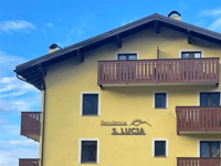
Forte di Oga from Santa Lucia is a climb in the region Sondrio. It is 7 km long and bridges 544 m of vertical ascent with an average gradient of 7.8%, resulting in a difficulty score of 503. The top of the ascent is located at 1720 m above sea level. Climbfinder users shared 8 reviews of this climb and uploaded 11 photos.
Road names: SP28 delle Motte di Oga & Via al Forte
3.0 by hardloper_marcoThis is an automatic translation, the original language is: Dutch.Fine climb, part of what they now call in Bormio the 'epic rides'. Especially after Oga (very) bad tarmac. On the steep sections down there really have to be careful. At the top is a restaurant with a fine terrace. Fairly busy at weekends due to visits to the fort, but usually little traffic.... read more

Welcome! Please activate your account if you would like to share something. Look for the verification email in your inbox.
If you want to upload your photos, you need to create an account. It only takes 1 minute and it's completely free.
Fine climb, part of what they now call in Bormio the 'epic rides'. Especially after Oga (very) bad tarmac. On the steep sections down there really have to be careful. At the top is a restaurant with a fine terrace. Fairly busy at weekends due to visits to the fort, but usually little traffic.
Prima klim, hoort bij wat ze nu in Bormio de ‘epic rides’ noemen. Vooral na Oga (zeer) slecht asfalt. Op de steile stukken daar naar beneden echt even oppassen. Boven is een restaurant met een prima terras. In de weekend redelijk druk door bezoek aan het fort, maar meestal weinig verkeer.
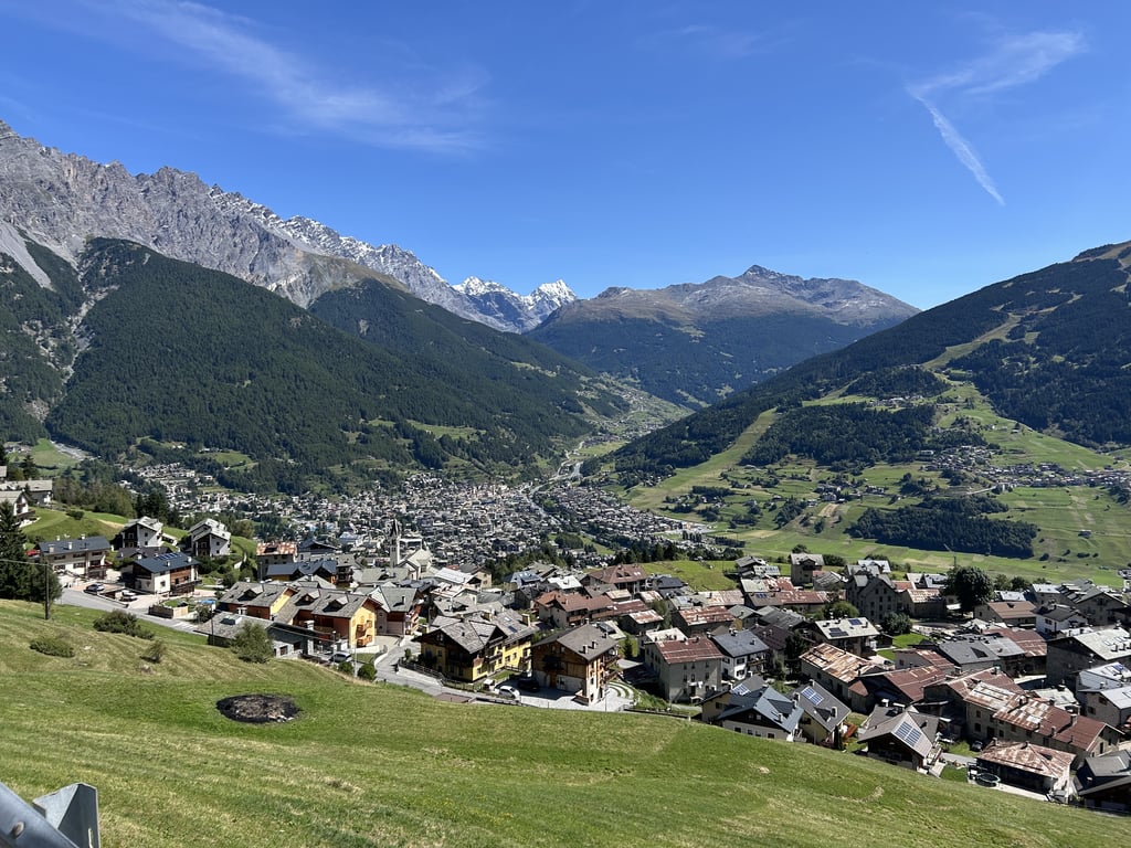
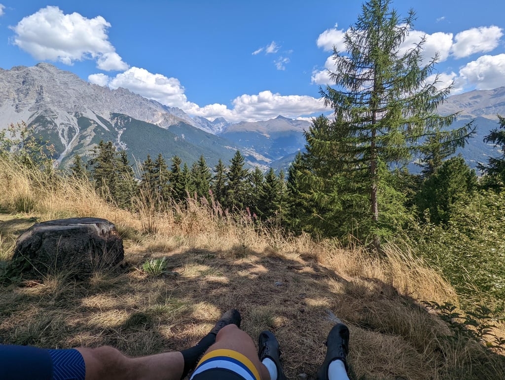
Cycled up this one during a rest day in Bormio, nice climb with interesting finish, and great views of Bormio from yet another angle.
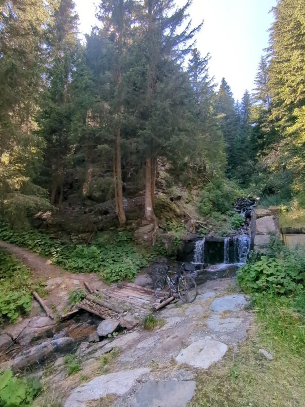
In one of the hairpin bends, a waterfall can be heard, and seen if you go a few metres down the road. (see photo)
Deze op gefietst tijdens een rustdag in Bormio, mooie klim met interessante finish, en een prachtig uitzicht over Bormio vanuit weer een andere hoek.
In een van de haarspeldbochten is een waterval te horen, en te zien als je een paar meter de weg af gaat. (zie foto)
Nice warm-up for the Stelvio . Road surface not too good.
Mooie opwarmer voor de Stelvio . Wegdek niet al te best.
Nice detour. Higher up, the tarmac is bad, which is a bigger problem going down. Fantastic views - on Bormio - along the route
This is a fun climb to do, especially as a warm-up before or as a recup between bigger tours. You cycle first on a through road before turning onto a smaller cul-de-sac. The village of Oga is idyllic and after it gets trickier and you get occasional bad tarmac and steeper sections interspersed with easier sections. There is unfortunately little at the top to keep your attention, but from there it is a quick descent to the foot of the Cancano, another one's warm-up climb
Dit is een leuke klim om te doen, vooral als opwarming voor of als recup tussen grotere tochten. Je fietst eerst op een doorgaande weg om daarna op een kleinere doodlopende weg te gaan. Het dorpje Oga is idyllisch en erna wordt het lastiger en krijg je af en toe slecht asfalt en steilere stukken afgewisseld met makkelijkere stukken. Er is boven jammer genoeg weinig om je aandacht vast te houden, maar vandaar uit is het een snelle afdaling naar de voet van de Cancano, nog zo'n opwarmingsklim
A nice climb near Bormio, great for warming up before the other major climbs nearby, or as a recovery ride.
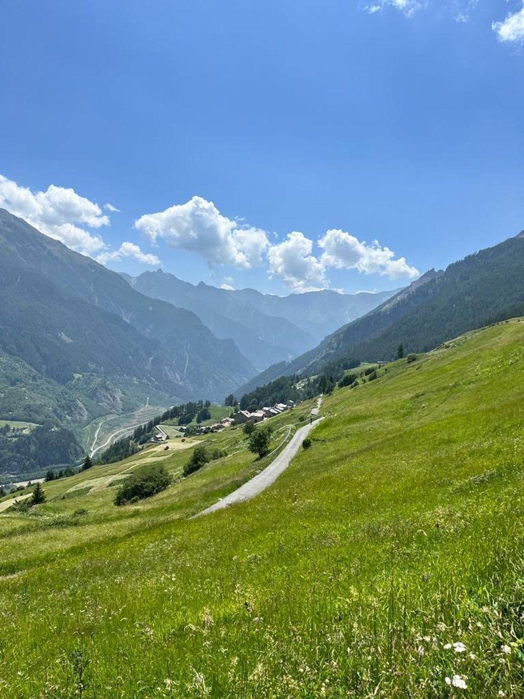
The road gets much quieter once you go past the village of Oga, unfortunately so does the quality of the tarmac. From Oga you can take scenic photos of Bormio and Valfurva. Once at the top, you cannot go further (unless you are on a mountain bike or gravel bike).
Nice climb, a bit more traffic on a wide road in the beginning, but as you get closer to the top it gets quieter. After the villages, the tarmac does get worse. Views are beautiful and it's a nice climb to get into it a bit.
Mooie klim, in het begin wat meer verkeer op een brede weg, maar naarmate je dichter bij de top komt wordt het rustiger. Na de dorpjes wordt het asfalt wel slechter. Uitzicht is prachtig en het is een leuke klim om er een beetje in te komen.
The ascent to the fortress, built between 1908 and 1914 to defend the important Alpine route, starts in Santa Lucia, just outside the town, where you turn right off the main road (SS38 to Sondrio) to climb steeply through the first 3 hairpin bends in quick succession. Followed by a wide road up the valley slope with fantastic panoramic views of Bormio and its four valleys. The climbing route, initially the same as to Le Motte (see climbfinder), then turns left to cycle past the Sanctuario/Bemorial Cemetery through the upper residential area of the village of Oga in a few hairpin bends. After the crossing the road becomes narrower and the asphalt worse and winds up through pine woods to end at the Albergo Al Forte (supply station), right at the entrance to the fortress/museum.
Ideal warming up, with some short 10% stretches along the way, for more solid cycling on the Stelvio and Gavia nearby.
Klim naar het tussen 1908 en 1914 gebouwde fort ter verdediging van belangrijke alpenroute start in Santa Lucia, even buiten de stad, waar je rechts de grote rijksweg (SS38 naar Sondrio) afdraait om direct via de eerste 3 haarspeldbochten kort na elkaar stevig te klimmen. Gevolgd door brede weg tegen de valleiflank omhoog met fantastisch panoramisch uitzicht op Bormio en zijn vier dalen. De klimroute, aanvankelijk dezelfde als naar Le Motte (zie climbfinder), draait dan linksaf om voorbij het Sanctuario/Begraafplaats via enkele haarspeldbochten het hoger gelegen woongedeelte van het dorpje Oga door te fietsen. Na de doortocht wordt de weg smaller en het asfalt slechter en slingert zich door dennenbossen naar omhoog om te eindigen aan de Albergo Al Forte (bevoorrading),vlak aan de toegang van het fort/museum.
Ideale opwarming, met onderweg enkele korte 10% stroken, voor steviger fietswerk op de Stelvio en Gavia daar in de buurt.
| 7 km/h | 01:00:02 |
| 11 km/h | 00:38:12 |
| 15 km/h | 00:28:00 |
| 19 km/h | 00:22:07 |
This page is better in the app