Erensteinerstraat via Kerkvoetpad is a climb in the region South Limburg. It is 1.1 km long and bridges 40 m of vertical ascent with an average gradient of 3.7%, resulting in a difficulty score of 22. The top of the ascent is located at 157 m above sea level. Climbfinder users shared 2 reviews of this climb and uploaded 13 photos.
Road names: Kerkvoetpad, Erensteinerstraat & Zonstraat
3.0 by TjaartThis is an automatic translation, the original language is: Dutch.Nice climb from the Anselerbeek valley. You first climb through the tunnel under the railway embankment, then into the park with some curves. You cycle into the residential area with a steep bit left in it.... read more

Welcome! Please activate your account if you would like to share something. Look for the verification email in your inbox.
If you want to upload your photos, you need to create an account. It only takes 1 minute and it's completely free.
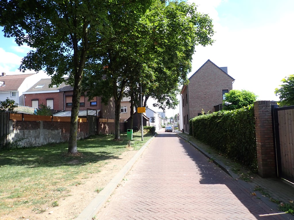
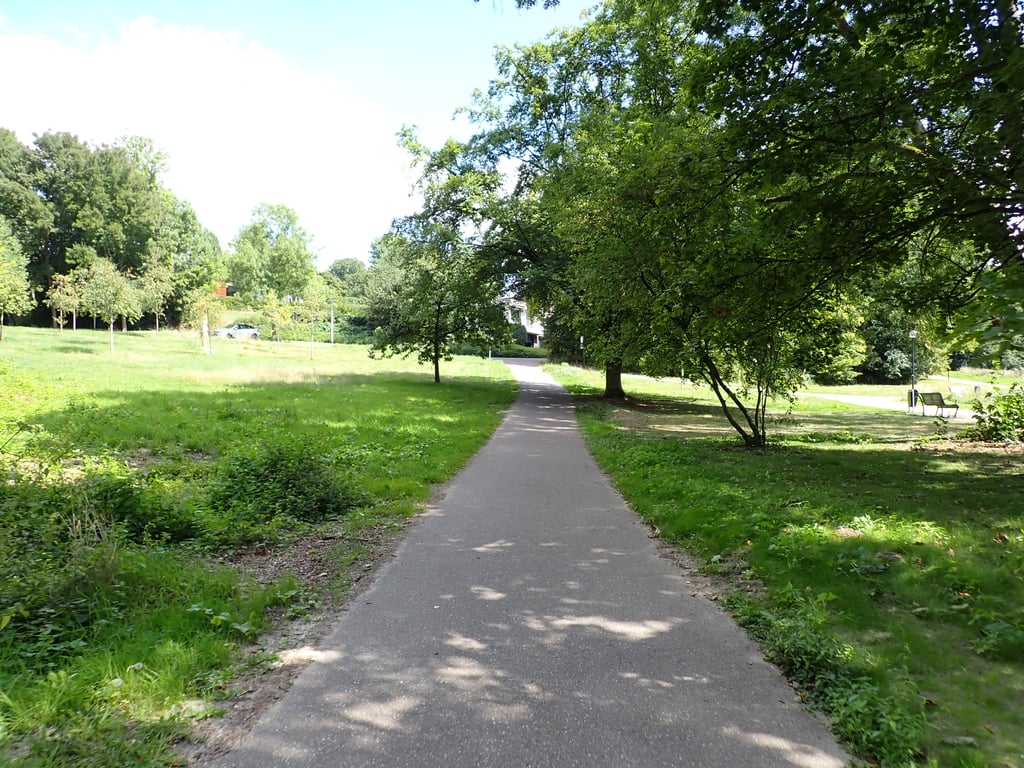
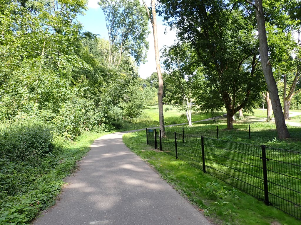
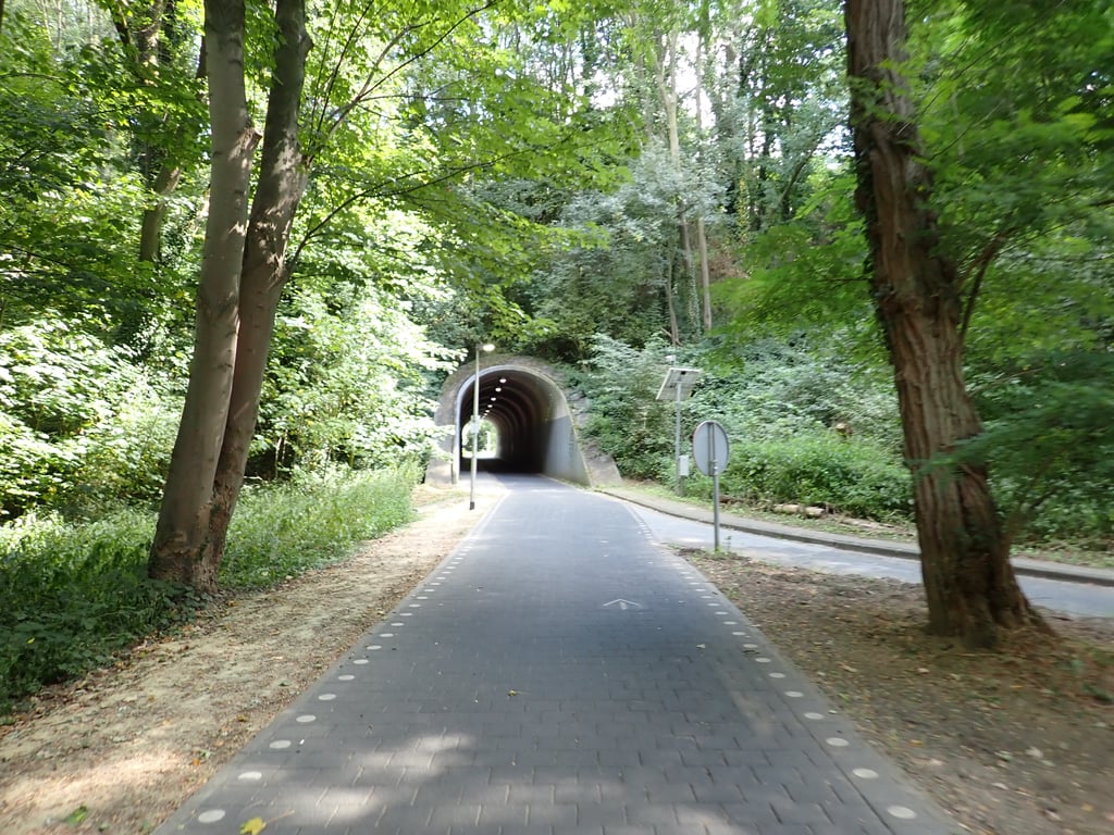
Nice climb from the Anselerbeek valley. You first climb through the tunnel under the railway embankment, then into the park with some curves. You cycle into the residential area with a steep bit left in it.
Aardige klim vanuit het dal van de Anselerbeek. Je klimt eerst door de tunnel onder het spoortalud, en daarna het park in met wat bochten. Je fietst de woonwijk in met een steil stukje er nog in.
Definitely a nice climb at the start, which also runs through green surroundings. First gently uphill through the - quite long - cycle tunnel, then left into another cycle path through a park and along a pond which first descends slightly and then climbs really steeply. After the park, turn left (straight ahead looks good but is not allowed) which climbs slightly less steeply but after the right-angled bend follows another tough bit. After this incline, follow the road through a residential area, descending slightly but towards the end the road rises again clearly visible to the summit.
Zeker in het begin een leuke klim die ook door een groene omgeving loopt. Eerst rustig hellend door de - best lange - fietstunnel, daarna linksaf een ander fietspad in door een park en langs een vijver wat eerst lichtjes daalt en daarna echt stevig omhoog loopt. Na het park linksaf (rechtdoor ziet er goed uit maar is niet toegestaan) wat iets minder steil klimt maar na de haakse bocht volgt nog een pittig stukje. Na deze helling de weg volgen door een woonwijk, lichtjes dalend maar tegen het eind loopt de weg weer duidelijk zichtbaar op tot de top.
| 7 km/h | 00:09:26 |
| 11 km/h | 00:06:00 |
| 15 km/h | 00:04:24 |
| 19 km/h | 00:03:28 |
This page is better in the app