Duister Gatsken is a climb in the region South Limburg. It is 0.9 km long and bridges 38 m of vertical ascent with an average gradient of 4%, resulting in a difficulty score of 19. The top of the ascent is located at 96 m above sea level. Climbfinder users shared 4 reviews of this climb and uploaded 15 photos.
Road name: Duister Gatsken
3.0 by BikerJohanThis is an automatic translation, the original language is: Dutch.Nice climb from the hamlet of Daniken to Sweikhuizen. A short/steepier section at the start and then a long stretch of false flat. Towards the end, the gradient then increases. Is a car-free road but depending on the time of year there may be mud on the road due to agricultural works.... read more

Welcome! Please activate your account if you would like to share something. Look for the verification email in your inbox.
If you want to upload your photos, you need to create an account. It only takes 1 minute and it's completely free.
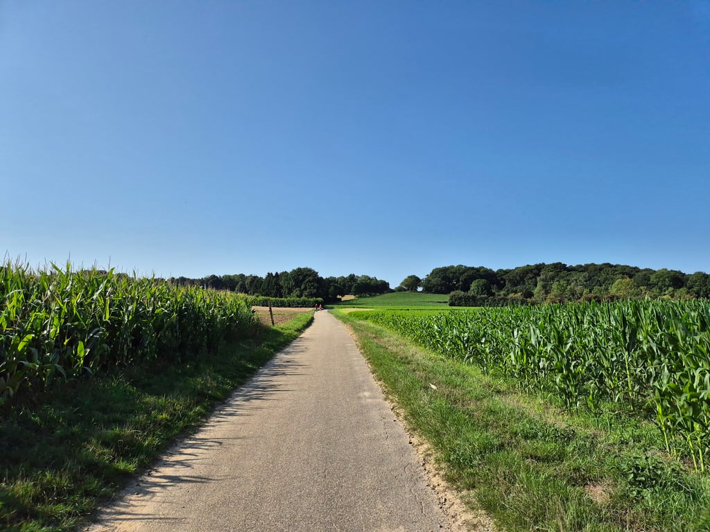
Nice climb from the hamlet of Daniken to Sweikhuizen. A short/steepier section at the start and then a long stretch of false flat. Towards the end, the gradient then increases. Is a car-free road but depending on the time of year there may be mud on the road due to agricultural works.
Leuke klim vanuit het buurtschap Daniken naar Sweikhuizen. In het begin even een kort/steiler stukje en daarna een lang stuk vals plat. Tegen het einde loopt het stijgingspercentage dan op. Is een autovrije weg maar afhankelijk van het jaargetijde kan er door landbouwwerkzaamheden modder op de weg liggen.
Relaxed climb through beautiful surroundings and you see the road ahead of you. Very quiet approach, at the end you feel the road clearly rise. Traffic-free road with good asphalt, but there may be mud on the road.
Relaxte klim door een fraaie omgeving en je ziet de weg mooi voor je uit liggen. Zeer rustig aanloop, aan het eind voel je de weg wel duidelijk stijgen. Verkeersvrije weg met goed asfalt, wel kan er modder op de weg liggen.
A good running climb. If you turn left at the top on the Hogeweg you get a few extra altimeters. Nice area for cycling.
Een goed lopende klim. Als je op de top linksaf verder gaat over de Hogeweg krijg je nog paar extra hoogtemeters erbij. Mooi gebied om te fietsen.
Scenically beautiful climb towards Sweikhuizen on a field road. There may be some mud on the road. No traffic. A bit steeper at the end, but it may not have a name.
Landschappelijk mooi klimmetje richting Sweikhuizen over een veldweg. Kan wel wat modder op de weg liggen. Geen autoverkeer. Op het eind wat steiler, maar mag geen naam hebben.
| 7 km/h | 00:08:07 |
| 11 km/h | 00:05:09 |
| 15 km/h | 00:03:47 |
| 19 km/h | 00:02:59 |
This page is better in the app