View on map
© MapLibre | OpenStreetMap contributors
1%
2%
4%
6%
8%
10%
12%
15%
20%

Côte des Abreuvoirs

4.5
2 reviews | Elevation profile | 1 photo
Tips nearby
Côte des Abreuvoirs
transparant thumb
transparant thumb
transparant thumb
transparant thumb
transparant thumb
transparant thumb
transparant thumb
Your achievable time
Calculating based on your best performances...
Relaxed
Maximum
W/kg
W/kg
W/kg
Analyse your climbing performance
Detailed insight into your climbing performance & automatically check off climbs
Based on your best performances.
Your best attempt:
Number of attempts:
Elevation profile Côte des Abreuvoirs

Statistics

Difficulty points 131
Length 1.8 km
Average gradient 8.3%
Steepest 100 metres 12.5%
Total ascent 147 m
Feedback about this climb?
Show climbs nearby Export to GPS device

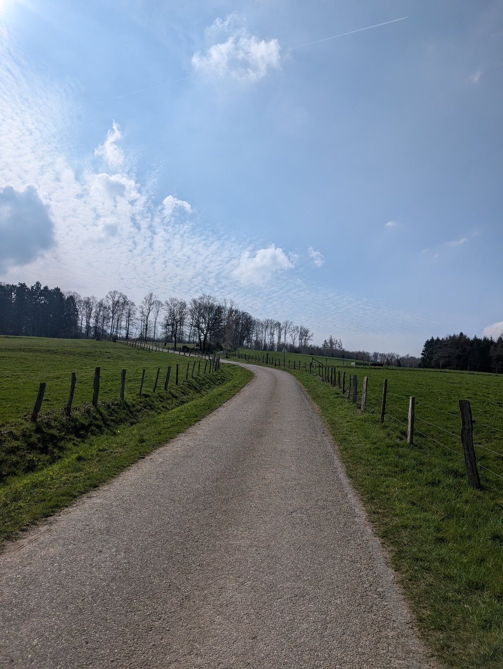
Côte des Abreuvoirs is a climb in the region Valleys of the Vesdre, de l'Amblève et de l'Ourthe. It is 1.8 km long and bridges 147 m of vertical ascent with an average gradient of 8.3%, resulting in a difficulty score of 131. The top of the ascent is located at 389 m above sea level. Climbfinder users shared 2 reviews of this climb and uploaded 1 photo.

Road names: Rue du Chaffour, Rue de Chézy, Rue des Abreuvoirs & Rue des Tilleuls

This is an automatic translation, the original language is: Dutch.
Nice and short, but powerful. Funny how in such'a short distance you can go from a residential area to a green meadow and eventually a 'dark' forest. That makes it interesting besides the percentages! The descent can be a bit mindful because you ride through a residential area.... read more

Photos (1)

Côte des Abreuvoirs
transparant thumb
transparant thumb
transparant thumb
transparant thumb
transparant thumb

Your uploads (max 4)

Welcome! Please activate your account if you would like to share something. Look for the verification email in your inbox.

If you want to upload your photos, you need to create an account. It only takes 1 minute and it's completely free.

  • Receive free climbfinder goodies for your reviews & photos.
  • Create a bucket list and check off conquered climbs.
  • Add missing climbs.
Continue with GoogleContinue with Google Continue with FacebookContinue with Facebook Continue with AppleContinue with Apple Sign up with email
By signing up you agree to our terms of service and confirm that you have read our privacy & content policy.

Reviews (2)

5.0
4.0
3.0
2.0
1.0
JurneSleddens
2 Mo 4.0
This is an automatic translation, the original language is: Dutch. Show original

Nice and short, but powerful. Funny how in such'a short distance you can go from a residential area to a green meadow and eventually a 'dark' forest. That makes it interesting besides the percentages! The descent can be a bit mindful because you ride through a residential area.

Lekker kort maar krachtig. Grappig hoe je in zo'n korte afstand van een woonwijk naar een groene weide en uiteindelijk een 'donker' bos kunt gaan. Dat maakt het naast de percentages interessant! De afdaling kan wat opletten zijn omdat je door een woonwijk rijdt.

Côte des Abreuvoirs
Dashboard
Pieter394
1 y 5.0
This is an automatic translation, the original language is: Dutch. Show original

A real gem, a hidden gem. Good steepness, miles of descent on a moderate road surface (especially on the descent pay attention!). Very quiet, ending in a bush. It was especially gruelling because of the headwind. Much better than the busy course of the Werbomont. This one is unknown, but you really must have done it, it deserves it!

Een echt pareltje, een verborgen juweeltje. Goed steil, kilometer lang afzien op een matig wegdek (vooral in de afdaling opletten!). Zeer rustig, eindigend in een bosje. Het was vooral ook afzien door de tegenwind. Veel beter dan de drukke baan van de Werbomont. Deze is onbekend, maar moet je echt gedaan hebben, hij verdient het!

Dashboard

Climbing times

7 km/h 00:15:07
11 km/h 00:09:37
15 km/h 00:07:03
19 km/h 00:05:34

Road surface condition

0% 0% 0%
Based on 0 votes
Share your knowledge. What was the road condition during your ascent?

Traffic

0% 0% 0%
Based on 0 votes
Your experience counts. How much traffic did you encounter during the climb?

Frequently Asked Questions

You don't need special gearing for Côte des Abreuvoirs. The slope isn't long or steep enough to require much shifting down. You can conquer this climb on power alone. However, a compact gearing system with a smallest front chainring of 34 and largest rear sprocket of 28 or 30 is always nice if you enjoy cycling uphill. This helps maintain a smooth cadence.

Côte des Abreuvoirs is a 4th-category climb. A sprint to the top is usually not an option, and untrained riders will definitely feel it in their legs. For trained cyclists, it is a great training climb.

Côte des Abreuvoirs is 1.8 km long.

The average gradient of Côte des Abreuvoirs is 8.3%.

Côte des Abreuvoirs has a steepest segment with an average gradient of 12.5%.

The summit of Côte des Abreuvoirs is at 389 m.

At a slow pace of 7 km/h, it takes about 00:15:07 to climb Côte des Abreuvoirs. At 11 km/h the time is 00:09:37, and at 15 km/h 00:07:03. For the fastest cyclists, 00:05:34 is an achievable time.

Côte des Abreuvoirs is located in the region Valleys of the Vesdre, de l'Amblève et de l'Ourthe in Belgium.

This page is better in the app

Climbfinder app
Climbfinder
(Free)
Open