View on map
© MapLibre | OpenStreetMap contributors
1%
2%
4%
6%
8%
10%
12%
15%
20%

Côte de Thimister

3.0
2 reviews | Elevation profile | 12 photos
Tips nearby
Côte de Thimister
Côte de Thimister
Côte de Thimister
Côte de Thimister
Côte de Thimister
Côte de Thimister
Côte de Thimister
Côte de Thimister
Your achievable time
Calculating based on your best performances...
Relaxed
Maximum
W/kg
W/kg
W/kg
Analyse your climbing performance
Detailed insight into your climbing performance & automatically check off climbs
Based on your best performances.
Your best attempt:
Number of attempts:
Elevation profile Côte de Thimister

Statistics

Difficulty points 63
Length 2.3 km
Average gradient 4.7%
Steepest 100 metres 8.3%
Total ascent 107 m

Short recap

Beautiful scenery
Feedback about this climb?
Show climbs nearby Export to GPS device

Côte de Thimister is a climb in the region Pays de Herve. It is 2.3 km long and bridges 107 m of vertical ascent with an average gradient of 4.7%, resulting in a difficulty score of 63. The top of the ascent is located at 315 m above sea level. Climbfinder users shared 2 reviews of this climb and uploaded 12 photos.

Road names: Bèfve, Croix Henri-Jacques, Elseroux & Rue Cavalier Fonck
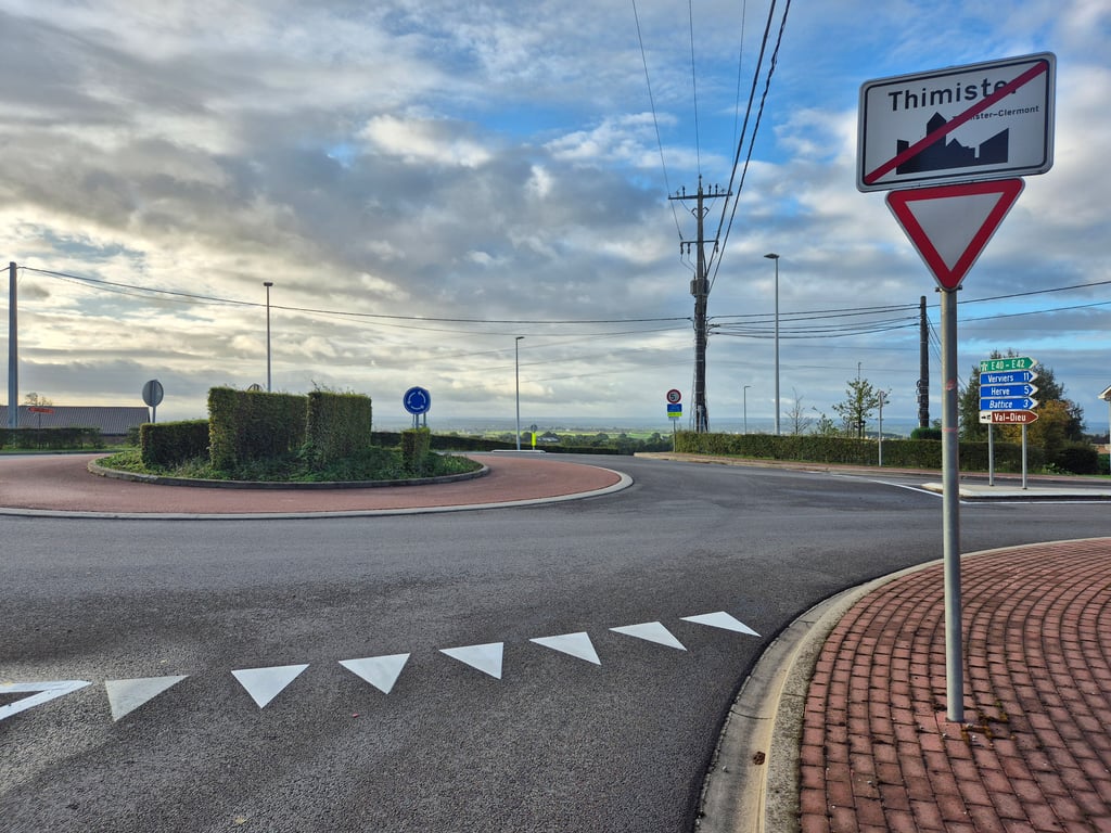
3.0 by Fedor
This is an automatic translation, the original language is: Dutch.
Longer climb that starts in green but soon comes between ribbon buildings and remains so until the end. After the first climb, turn right at the roundabout and then keep following the road until the end, where the last part is nice and fast. Good asphalt.... read more

Photos (12)

Côte de Thimister
Côte de Thimister
Côte de Thimister
Côte de Thimister
Côte de Thimister
Côte de Thimister
Côte de Thimister
Côte de Thimister
Côte de Thimister
Côte de Thimister
Côte de Thimister
Côte de Thimister

Your uploads (max 4)

Welcome! Please activate your account if you would like to share something. Look for the verification email in your inbox.

If you want to upload your photos, you need to create an account. It only takes 1 minute and it's completely free.

  • Receive free climbfinder goodies for your reviews & photos.
  • Create a bucket list and check off conquered climbs.
  • Add missing climbs.
Continue with GoogleContinue with Google Continue with FacebookContinue with Facebook Continue with AppleContinue with Apple Sign up with email
By signing up you agree to our terms of service and confirm that you have read our privacy & content policy.

Reviews (2)

5.0
4.0
3.0
2.0
1.0
Fedor
3 y 3.0
This is an automatic translation, the original language is: Dutch. Show original

Longer climb that starts in green but soon comes between ribbon buildings and remains so until the end. After the first climb, turn right at the roundabout and then keep following the road until the end, where the last part is nice and fast. Good asphalt.

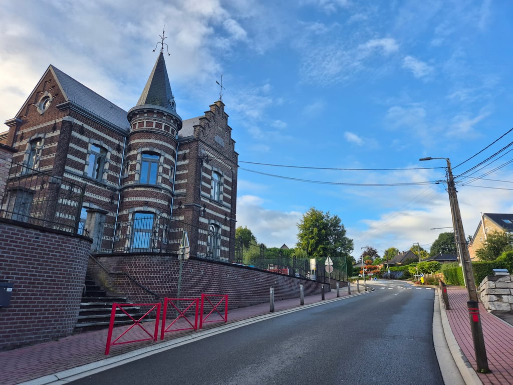
Langere klim die in het groen begint maar als snel tussen lintbebouwing komt en dit blijft zo tot het eind. Toch is het niet slecht fietsen want je passeert het leuke centrum van Thimister waarbij je ook onder de voormalige spoorlijn komt. na de eerste klim rechtsaf bij de rotonde en dan alsmaar de weg blijven volgen tot het eind waarbij het laatste stuk lekker aanzetten is. Prima asfalt.

Côte de Thimister
Côte de Thimister
Côte de Thimister
Côte de Thimister
Côte de Thimister
Dashboard
KarelOverbeeke
3 y 3.0
This is an automatic translation, the original language is: Dutch. Show original

The average of this climb is somewhat depressed by a short descent at the beginning of the climb. You don't have to take this climb for the beautiful scenery as it runs mostly through ribbon development. The climb is not steep but you still pick up 100 altitude metres

Het gemiddelde van deze klim wordt wat gedrukt door een korte afdaling in het begin vd klim. Voor het mooie landschap hoef je deze klim niet te nemen want hij loopt grotendeels door de lintbebouwing. De klim is niet steil maar je pakt toch weer 100 hoogtemeters

Dashboard

Climbing times

7 km/h 00:19:18
11 km/h 00:12:17
15 km/h 00:09:00
19 km/h 00:07:06

Road surface condition

0% 100% 0%
Based on 1 vote
Share your knowledge. What was the road condition during your ascent?

Traffic

0% 100% 0%
Based on 1 vote
Your experience counts. How much traffic did you encounter during the climb?

Frequently Asked Questions

Côte de Thimister can be cycled from 5 sides. Côte de Thimister is the most popular side, but the summit can also be reached via Serezé from Houlteau, Verte Voie via Rue du Tennis, Côte de Thimister via Rue de l’Egalité & Thimister via Margensault.

You don't need special gearing for Côte de Thimister. The slope isn't long or steep enough to require much shifting down. You can conquer this climb on power alone. However, a compact gearing system with a smallest front chainring of 34 and largest rear sprocket of 28 or 30 is always nice if you enjoy cycling uphill. This helps maintain a smooth cadence.

Côte de Thimister falls into the 5th category. With good fitness, you can ride it up with speed and power. If you have less training, shift down and climb smoothly.

Côte de Thimister is 2.3 km long.

The average gradient of Côte de Thimister is 4.7%.

Côte de Thimister has a steepest segment with an average gradient of 8.3%.

The summit of Côte de Thimister is at 315 m.

At a slow pace of 7 km/h, it takes about 00:19:18 to climb Côte de Thimister. At 11 km/h the time is 00:12:17, and at 15 km/h 00:09:00. For the fastest cyclists, 00:07:06 is an achievable time.

Côte de Thimister is located in the region Liège Province in Belgium.

This page is better in the app

Climbfinder app
Climbfinder
(Free)
Open