View on map
© MapLibre | OpenStreetMap contributors
1%
2%
4%
6%
8%
10%
12%
15%
20%

Côte de Menil-Favay / Sur Waha from Hampteau

4.0
5 reviews | Elevation profile | 2 photos
Tips nearby
Côte de Menil-Favay / Sur Waha from Hampteau
transparant thumb
transparant thumb
transparant thumb
transparant thumb
transparant thumb
transparant thumb
Your achievable time
Calculating based on your best performances...
Relaxed
Maximum
W/kg
W/kg
W/kg
Analyse your climbing performance
Detailed insight into your climbing performance & automatically check off climbs
Based on your best performances.
Your best attempt:
Number of attempts:
Elevation profile Côte de Menil-Favay / Sur Waha from Hampteau

Statistics

Difficulty points 185
Length 3.9 km
Average gradient 5.7%
Steepest 100 metres 14.8%
Total ascent 225 m

Short recap

Hidden gem
#64 toughest climb of Belgium
#32 most elevation gain of Belgian Luxembourg
#41 longest climb of Heart of the Ardennes
#75 average steepest climb of Heart of the Ardennes
Feedback about this climb?
Show climbs nearby Export to GPS device

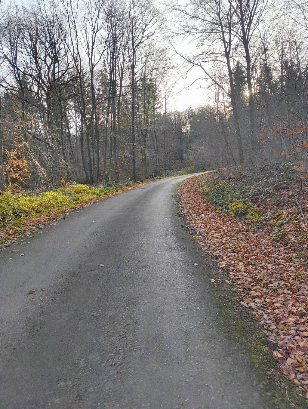
Côte de Menil-Favay / Sur Waha from Hampteau is a climb in the region Heart of the Ardennes. It is 3.9 km long and bridges 225 m of vertical ascent with an average gradient of 5.7%, resulting in a difficulty score of 185. The top of the ascent is located at 404 m above sea level. Climbfinder users shared 5 reviews of this climb and uploaded 2 photos.

Road names: Rue Chavée, Rue de la Chapelle & Rue du Bois

4.0 by Bob
This is an automatic translation, the original language is: Dutch.
The climb really starts in Menil-Favay, where the road immediately rises steeply. The road is nicely tarmacked and leads steeply into the forest. In the forest, the climb flattens out, but then try to change gears again. The road surface of the descent to Grimbiemont is less good.... read more

Photos (2)

Côte de Menil-Favay / Sur Waha from Hampteau
transparant thumb
transparant thumb
transparant thumb
transparant thumb

Your uploads (max 4)

Welcome! Please activate your account if you would like to share something. Look for the verification email in your inbox.

If you want to upload your photos, you need to create an account. It only takes 1 minute and it's completely free.

  • Receive free climbfinder goodies for your reviews & photos.
  • Create a bucket list and check off conquered climbs.
  • Add missing climbs.
Continue with GoogleContinue with Google Continue with FacebookContinue with Facebook Continue with AppleContinue with Apple Sign up with email
By signing up you agree to our terms of service and confirm that you have read our privacy & content policy.

Reviews (5)

5.0
4.0
3.0
2.0
1.0
GillesM87
11 Mo 3.0
This is an automatic translation, the original language is: Dutch. Show original

Currently working (2 July 2025). Will take some time in my opinion.

Momenteel werken (2 juli 2025). Zal volgens mij nog even duren.

Dashboard
Janusius
2 y 4.0
This is an automatic translation, the original language is: Dutch. Show original

As mentioned, the first stretch runs nicely and only starts from Menil-favay onwards. In the wonderfully quiet forest, and on a very decent road, I still saw 14-15% passing on the counter for quite a while. Definitely worth it!

Zoals gezegd, loopt het eerste stuk lekker door en begint het pas vanaf Menil-favay. In het heerlijk rustige bos, en op een zeer behoorelijke weg, zag ik toch nog best een tijdje 14-15% op de teller voorbijkomen. Zeker de moeite waard!

Dashboard
BartC
3 y 5.0

I was surprised to find an asphalt road, in such a quiet and big forest - usually you need a gravel bike or MTB to access the forests. Therefore, if by road bike, this climb is highly recommended

Côte de Menil-Favay / Sur Waha from Hampteau
Dashboard
Dannes
5 y 4.0
This is an automatic translation, the original language is: Dutch. Show original

Nice climb but listed on Strava as two separate segments. Fairly good tarmac and of course enjoying the surroundings!

Mooie klim maar staat op Strava vermeld als twee aparte segmenten. Redelijk goed asfalt en natuurlijk genieten van de omgeving!

Dashboard
Bob
5 y 4.0 00:07:00 (33.8 km/h)
This is an automatic translation, the original language is: Dutch. Show original

The climb really starts in Menil-Favay, where the road immediately rises steeply. The road is nicely tarmacked and leads steeply into the forest. In the forest, the climb flattens out, but then try to change gears again. The road surface of the descent to Grimbiemont is less good.

De klim begint pas echt in Menil-Favay, waar de weg meteen stijl omhoog loopt. De weg is mooi geasfalteerd en loopt stijl door naar het bos. In het bos vlakt de klim af, maar probeer dan maar nog eens bij te schakelen. Wegdek van de afdaling naar Grimbiemont is minder goed.

Dashboard

Climbing times

7 km/h 00:33:48
11 km/h 00:21:30
15 km/h 00:15:46
19 km/h 00:12:27

Road surface condition

67% 33% 0%
Based on 3 votes
Share your knowledge. What was the road condition during your ascent?

Traffic

100% 0% 0%
Based on 3 votes
Your experience counts. How much traffic did you encounter during the climb?

Frequently Asked Questions

Côte de Menil-Favay / Sur Waha can be cycled from 3 sides. Côte de Menil-Favay / Sur Waha from Hampteau is the most popular side, but the summit can also be reached via Côte de Menil-Favay / Sur Waha from Menil-Favay & Côte de Menil-Favay / Sur Waha via Bois de Grimbièmont.

You don't need special gearing for Côte de Menil-Favay / Sur Waha from Hampteau. The slope isn't long or steep enough to require much shifting down. You can conquer this climb on power alone. However, a compact gearing system with a smallest front chainring of 34 and largest rear sprocket of 28 or 30 is always nice if you enjoy cycling uphill. This helps maintain a smooth cadence.

Côte de Menil-Favay / Sur Waha from Hampteau is a 3rd-category climb. Almost anyone can handle this climb, as long as you have a bike with climbing gears. If you have little training, you will probably need to shift down significantly. For experienced riders, Côte de Menil-Favay / Sur Waha from Hampteau is not a problem.

Côte de Menil-Favay / Sur Waha from Hampteau is 3.9 km long.

The average gradient of Côte de Menil-Favay / Sur Waha from Hampteau is 5.7%.

Côte de Menil-Favay / Sur Waha from Hampteau has a steepest segment with an average gradient of 14.8%.

The summit of Côte de Menil-Favay / Sur Waha from Hampteau is at 404 m.

At a slow pace of 7 km/h, it takes about 00:33:48 to climb Côte de Menil-Favay / Sur Waha from Hampteau. At 11 km/h the time is 00:21:30, and at 15 km/h 00:15:46. For the fastest cyclists, 00:12:27 is an achievable time.

Côte de Menil-Favay / Sur Waha from Hampteau is located in the region Heart of the Ardennes in Belgium.

This page is better in the app

Climbfinder app
Climbfinder
(Free)
Open