View on map
© MapLibre | OpenStreetMap contributors
1%
2%
4%
6%
8%
10%
12%
15%
20%

Côte de Blaschette

4.5
2 reviews | Elevation profile | 7 photos
Tips nearby
Côte de Blaschette
Côte de Blaschette
Côte de Blaschette
Côte de Blaschette
Côte de Blaschette
Côte de Blaschette
Côte de Blaschette
transparant thumb
Your achievable time
Calculating based on your best performances...
Relaxed
Maximum
W/kg
W/kg
W/kg
Analyse your climbing performance
Detailed insight into your climbing performance & automatically check off climbs
Based on your best performances.
Your best attempt:
Number of attempts:
Elevation profile Côte de Blaschette

Statistics

Difficulty points 93
Length 2.5 km
Average gradient 5.9%
Steepest 100 metres 8.1%
Total ascent 148 m

Short recap

#40 toughest climb of Gutland
#22 most elevation gain of Gutland
#37 longest climb of Gutland
#68 average steepest climb of Gutland
Feedback about this climb?
Show climbs nearby Export to GPS device

Côte de Blaschette is a climb in the region Valleys of the Mamer and Eisch / Valley of the Seven Castles. It is 2.5 km long and bridges 148 m of vertical ascent with an average gradient of 5.9%, resulting in a difficulty score of 93. The top of the ascent is located at 376 m above sea level. Climbfinder users shared 2 reviews of this climb and uploaded 7 photos.

Road names: Rue de Blaschette & CR 122
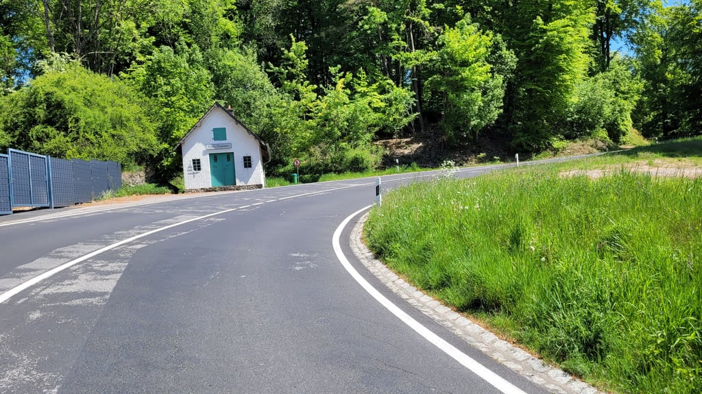
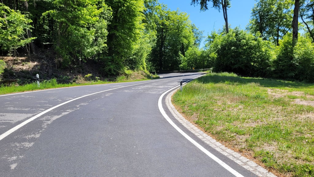
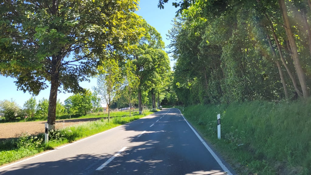
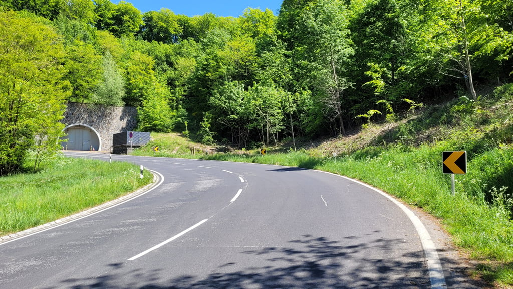
4.0 by elbowboy
This is an automatic translation, the original language is: German.
A less frequented alternative to get from Lorentzweiler to the heights. From the Alzetteradweg cycle path, pass under the subway at the tennis courts and then turn right, then immediately left. Good road surface and harmonious gradient. Beautiful area in the forest up to Blaaschent. Be careful if you ride this climb as a descent: the first hairpin bend really closes up and is only separated from the slope by a crash barrier. ... read more

Photos (7)

Côte de Blaschette
Côte de Blaschette
Côte de Blaschette
Côte de Blaschette
Côte de Blaschette
Côte de Blaschette
Côte de Blaschette
transparant thumb
transparant thumb
transparant thumb
transparant thumb
transparant thumb

Your uploads (max 4)

Welcome! Please activate your account if you would like to share something. Look for the verification email in your inbox.

If you want to upload your photos, you need to create an account. It only takes 1 minute and it's completely free.

  • Receive free climbfinder goodies for your reviews & photos.
  • Create a bucket list and check off conquered climbs.
  • Add missing climbs.
Continue with GoogleContinue with Google Continue with FacebookContinue with Facebook Continue with AppleContinue with Apple Sign up with email
By signing up you agree to our terms of service and confirm that you have read our privacy & content policy.

Reviews (2)

5.0
4.0
3.0
2.0
1.0
elbowboy
1 y 4.0
This is an automatic translation, the original language is: German. Show original

A less frequented alternative to get from Lorentzweiler to the heights. From the Alzetteradweg cycle path, pass under the subway at the tennis courts and then turn right, then immediately left. Good road surface and harmonious gradient. Beautiful area in the forest up to Blaaschent. Be careful if you ride this climb as a descent: the first hairpin bend really closes up and is only separated from the slope by a crash barrier.

Wenig befahrene Alternative um von Lorentzweiler auf die Höhe zu kommen. Vom Alzetteradweg aus in Höhe der Tennisplätze unter der Unterführung durch und dann rechts, danach direkt links. Guter Straßenbelag und harmonische Steigung. Schöne Gegend im Wald bis nach Blaaschent hoch. Vorsicht, wenn man diesen Anstieg als Abfahrt befährt : Die erste Haarnadelkurve macht richtig zu und ist nur durch eine Leitplanke vom Abhang getrennt.

Dashboard
dwelleke
2 y 5.0
This is an automatic translation, the original language is: Dutch. Show original

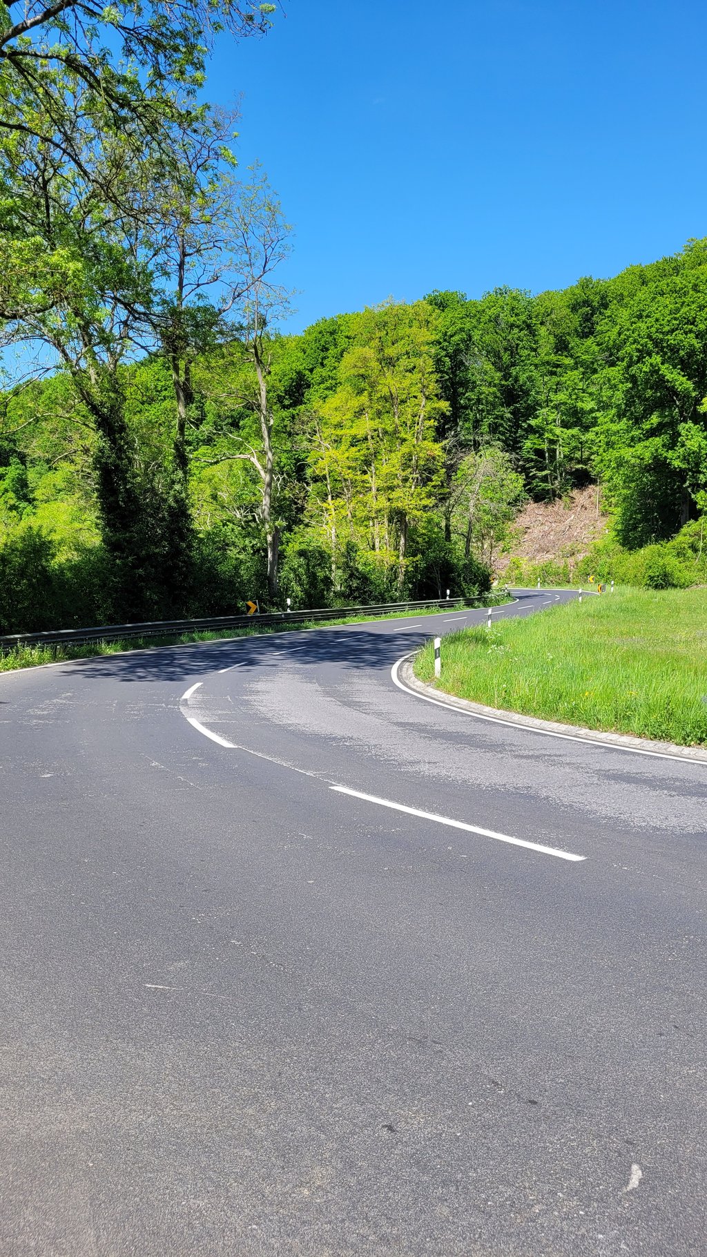
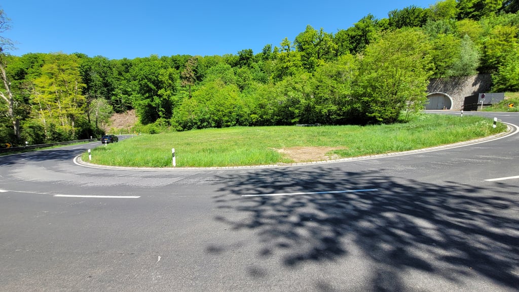
What a blissful climb. Actually, I had a bit of an Alpine feeling: starting in a village, where the buildings slowly disappear and you can climb up in peace. Then two lovely hairpin bends, what more could you want! Moreover, the percentages are very constant, making it ideal as training for the real thing.

Wat een zalige klim. Eigenlijk had ik een beetje een Alpen gevoel: starten in een dorpje, waarbij de bebouwing langzaamaan verdwijnt en je in alle rust naar boven kan klimmen. Dan twee heerlijke haarspeldbochten, wat wil je nog meer?! Bovendien zijn de percentages heel constant en is deze dus ideaal als training voor het echte werk.

Dashboard

Climbing times

7 km/h 00:21:40
11 km/h 00:13:47
15 km/h 00:10:06
19 km/h 00:07:58

Road surface condition

0% 100% 0%
Based on 1 vote
Share your knowledge. What was the road condition during your ascent?

Traffic

100% 0% 0%
Based on 1 vote
Your experience counts. How much traffic did you encounter during the climb?

Frequently Asked Questions

You don't need special gearing for Côte de Blaschette. The slope isn't long or steep enough to require much shifting down. You can conquer this climb on power alone. However, a compact gearing system with a smallest front chainring of 34 and largest rear sprocket of 28 or 30 is always nice if you enjoy cycling uphill. This helps maintain a smooth cadence.

Côte de Blaschette is a 4th-category climb. A sprint to the top is usually not an option, and untrained riders will definitely feel it in their legs. For trained cyclists, it is a great training climb.

Côte de Blaschette is 2.5 km long.

The average gradient of Côte de Blaschette is 5.9%.

Côte de Blaschette has a steepest segment with an average gradient of 8.1%.

The summit of Côte de Blaschette is at 376 m.

At a slow pace of 7 km/h, it takes about 00:21:40 to climb Côte de Blaschette. At 11 km/h the time is 00:13:47, and at 15 km/h 00:10:06. For the fastest cyclists, 00:07:58 is an achievable time.

Côte de Blaschette is located in the region Valleys of the Mamer and Eisch / Valley of the Seven Castles in Luxembourg.

This page is better in the app

Climbfinder app
Climbfinder
(Free)
Open