Colle San Zeno from Lavone is a climb in the region Brescia. It is 14 km long and bridges 927 m of vertical ascent with an average gradient of 6.6%, resulting in a difficulty score of 748. The top of the ascent is located at 1418 m above sea level. Climbfinder users shared 4 reviews of this climb and uploaded 2 photos.
Road names: SP52 & Via Venti Settembre
3.0 by MauroR2This is an automatic translation, the original language is: Italian.Done today, road surface not always even, on the contrary. On the other hand, a lot of peace and quiet and decent gradients.... read more
Welcome! Please activate your account if you would like to share something. Look for the verification email in your inbox.
If you want to upload your photos, you need to create an account. It only takes 1 minute and it's completely free.
Done today, road surface not always even, on the contrary. On the other hand, a lot of peace and quiet and decent gradients.
Fatta oggi, manto stradale non sempre omogeneo, anzi. In compenso tanta tranquillità e discrete pendenze.
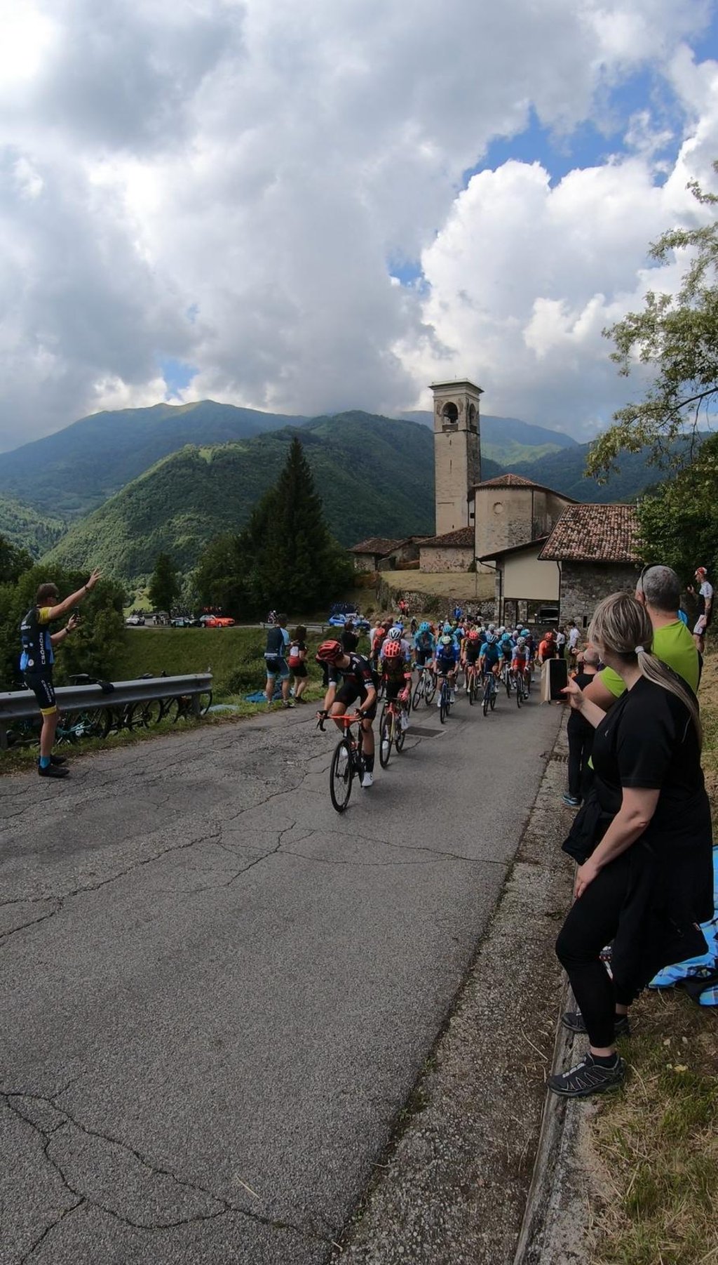
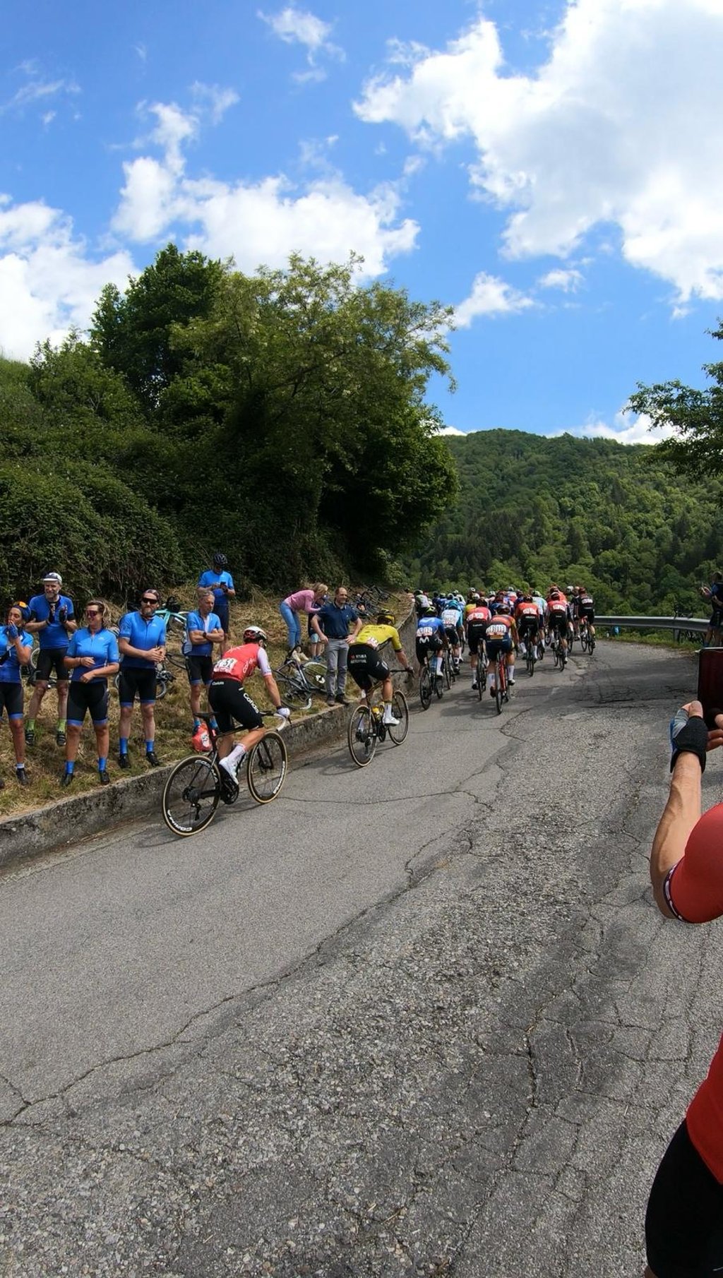
I completed this climb before Stage 15 of the 2024 Giro d'Italia. It is one of my favourite climbs in the Trompia Valley. The first few kilometers have a gentle gradient allowing you a nice warmup, and then once you reach Pezzaze the gradient increases, and remaons steep throughout the climb, aside from a flatter section that is about half way up the climb. Overall the road surface is not great (there were many repairs that had been freshly done for the Giro). Generally the road does not have much traffic, aside from weekends in the summer when it is usually more busy.
Challenging ascent, the gradient is average is offset by the first 3.5 km easy slightly uphill; the real difficulties start from Pezzaze there are 10km at 8% average with peaks of 14-15% . Beautiful scenery during the climb and at the top , moderate traffic on the weekend low during the week
Ascesa impegnativa, la pendenza è media è sfalsata dai primi 3.5 km facili in leggera salita ; le veri difficoltà iniziano da Pezzaze li sono 10km al 8% medio con punte del 14-15% . Paesaggi belli durante la salita e in cima , traffico moderato il weekend basso durante la settimana
Done with the road closed for the Giro. Asphalt resurfaced in many places for the Giro, but you can see that the surface is not good in many parts. Descent to Iseo with uneven and shady spots. At the top it doesn't offer much in the way of views, the part is after the descent towards the lake.
Fatta con la strada chiusa per il Giro. Asfalto rifatto in molti punti per il Giro, ma si vede che il fondo non è buono in molte parti. Discesa verso Iseo cona punti punti sconnessi e in ombra. In cima non offre molti spunti panoramici, la parte ella è dopo la discesa verso il lago.
| 7 km/h | 01:59:51 |
| 11 km/h | 01:16:16 |
| 15 km/h | 00:55:56 |
| 19 km/h | 00:44:09 |
This page is better in the app