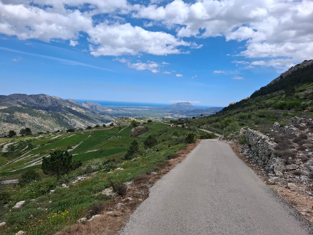
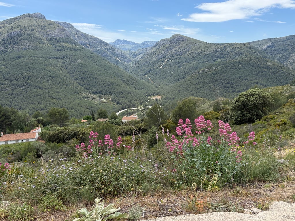
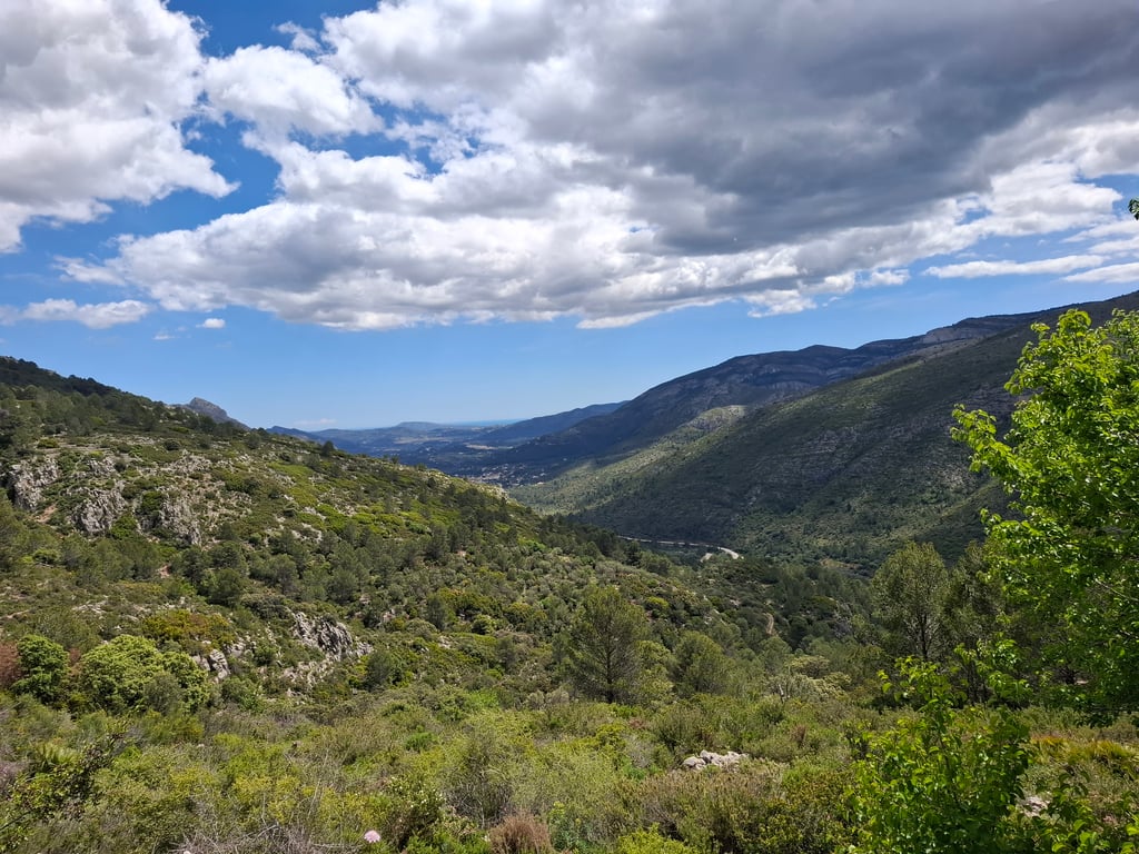
| Beautiful scenery |
| 9 hairpin turns |
| #57 toughest climb of Costa Blanca |
| #65 most elevation gain of Costa Blanca |
| #92 longest climb of Costa Blanca |
| #61 average steepest climb of Costa Blanca |
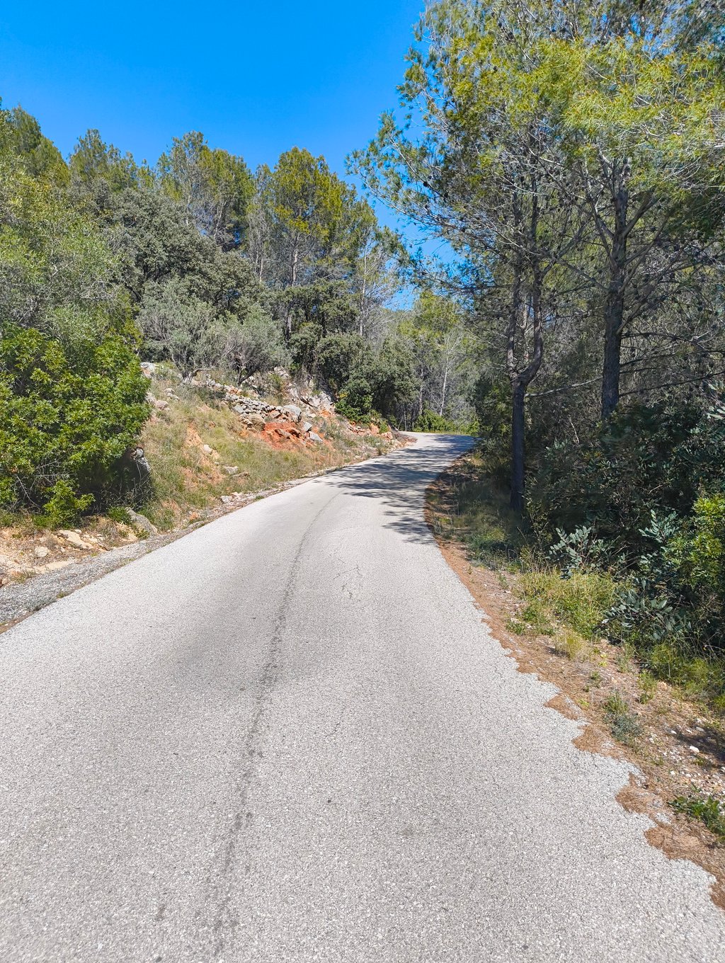
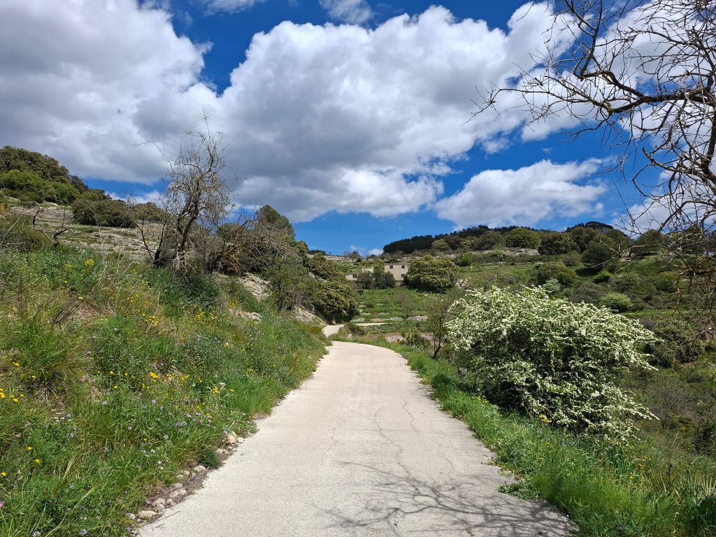
Coll de la Garga from Riu de Xaló is a climb in the region Costa Blanca. It is 5.6 km long and bridges 383 m of vertical ascent with an average gradient of 6.8%, resulting in a difficulty score of 334. The top of the ascent is located at 765 m above sea level. Climbfinder users shared 7 reviews of this climb and uploaded 8 photos.
Road names: Partida Olivar & Camí del Collao
5.0 by haroldslegersThis is an automatic translation, the original language is: Dutch.The road surface is in fairly good condition (March 2022), but in the lower part some stretches are made of bumpy concrete. There may also be stones on the road. Furthermore, there are about six speed bumps on the road surface. I wonder why, as I have not come across any vehicles. You cycle here in a beautiful landscape and the climb is steep at times, the road meanders through the landscape.... read more

Welcome! Please activate your account if you would like to share something. Look for the verification email in your inbox.
If you want to upload your photos, you need to create an account. It only takes 1 minute and it's completely free.
Is really very irregular and steep. Can't get into rhythm. Patches of ribbed concrete (watercourses). Views beautiful (but prettier over the top). Restaurant at the top fully booked and lots of traffic around lunchtime on the road trying to overtake you on this VERY narrow road on both sides of the col
Is echt heel onregelmatig en steil. Kunt niet in ritme komen. Stukken geribbeld beton (waterlopen). Uitzicht prachtig (maar over de top heen mooier). Restaurant boven volgeboekt en veel verkeer rond lunchtijd op de weg die je proberen in te halen op deze aan beide zijden van de col ZEER smalle weg
This climb follows a narrow concrete path and is very nice and quiet. You need that, because the climb has tough steep sections. If you like irregular climbs, this is your climb, as it constantly goes up and up. The scenery is gorgeous and you always have something to look at. At the top is a little restaurant where you can get something to eat. (But was very busy on this Easter Monday). The descent on the other side is lovely on smooth tarmac.
Deze klim loopt over een smal betonpaadje en is heel erg lekker rustig. Dat heb je ook wel nodig, want de klim heeft pittige steile stukken. Als je van onregelmatige klimmen houdt is dit je klim, want het gaat constant op en opper. De omgeving is beeldschoon en je hebt altijd wat te kijken. Bovenop ligt een restaurantje waar je wat kunt eten. (Maar op deze paasmaandag erg druk was). De afdaling aan de andere kant loopt heerlijk over glad asfalt.
Irregular climb where steep sections alternate with less steep sections where you can recuperate for a while. Road surface is not equally good everywhere. There is even a steep stretch with grainy concrete instead of asphalt. The descent through Vall de Laguar is very steep at first. After the village of Benimaurell, you whiz down on wide roads.
Onregelmatige klim waarbij steile stroken afgewisseld worden met minder steile stukken waar je even kan recupereren. Wegdek is niet overal even goed. Er is zelfs een steile strook met korrelig beton in plaats van asfalt. De afdaling door Vall de Laguar is in het begin erg steil. Na het dorpje Benimaurell zoef je over brede wegen naar beneden.
Some steep sections along the way. Really very quiet, no other traffic and only two descending cyclists. So ideal for going deep for a change. Beautiful views at the summit. Unfortunately, the reward of a tough climb, namely the descent, is somewhat killed by the lethal plastic thresholds scattered here and there. So take care!
Een aantal steile stukken onderweg. Echt heel erg rustig, geen ander verkeer en slechts twee afdalende fietsers. Ideaal dus om eens lekker diep te gaan. Prachtig uitzicht op de top. Helaas is de beloning van een zware klim, namelijk de afdaling, een beetje om zeep geholpen door de linke plastic drempeltjes die her en der verspreid liggen. Pas dus goed op!
A tough one from this side but well worth it, especially if you are here in Late January to early Feb with the Almond blossom out. There is an excellent restaurant at the top thats not too pricy with some tasty local grilled meats...well worth planning a stop here if the sun is out as its probably a cold descent down the northern flank in the shade ;-)
Nice climb! Seemed heavier than shown on the profile (may be due to my legs).
Be careful in the beginning of the descent, good asphalt and disastrous concrete pieces alternate, here and there a small speed bump. Unfortunately I broke my collarbone :/
Mooie beklimming! Leek in het echt zwaarder dan op het profiel is weergegeven (kan ook aan de benen liggen).
Wel oppassen in het begin van de afdaling, degelijk asfalt en rampzalige stukken beton wisselen elkaar af, hier en daar ook een drempeltje. Jammer genoeg mijn sleutelbeen gebroken :/
The road surface is in fairly good condition (March 2022), but in the lower part some stretches are made of bumpy concrete. There may also be stones on the road. Furthermore, there are about six speed bumps on the road surface. I wonder why, as I have not come across any vehicles. You cycle here in a beautiful landscape and the climb is steep at times, the road meanders through the landscape.
Het wegdek is in vrij goede toestand (maart 2022), maar in het onderste gedeelte zijn enkele stukken wegdek uitgevoerd in hobbelig beton. Er kunnen ook stenen op de weg liggen. Verder liggen er een zestal drempels op het wegdek. Ik vraag me af waarom, omdat ik er geen enkel voertuig ben tegen gekomen. Je fietst hier in een schitterend landschap en de klim is bij vlagen steil, de weg slingert flink door het landschap.
| 7 km/h | 00:48:24 |
| 11 km/h | 00:30:48 |
| 15 km/h | 00:22:35 |
| 19 km/h | 00:17:49 |
This page is better in the app