Tips nearby


| Beautiful scenery |
| #89 longest climb of Vaucluse |
Les Astauds from Malaucène is a climb in the region Vaucluse. It is 3.6 km long and bridges 150 m of vertical ascent with an average gradient of 4.2%, resulting in a difficulty score of 79. The top of the ascent is located at 467 m above sea level. Climbfinder users shared 3 reviews of this climb and uploaded 2 photos.
Road name: Route de Veaux
3.0 by Paul-PThis is an automatic translation, the original language is: Dutch.Nice climb from Malaucene, down to the Toulourenc and up again to Pierevon. From there you can choose where to go. This area has so many beautiful climbs worthwhile, this is also one of them.... read more
Welcome! Please activate your account if you would like to share something. Look for the verification email in your inbox.
If you want to upload your photos, you need to create an account. It only takes 1 minute and it's completely free.
Nice climb from Malaucene, down to the Toulourenc and up again to Pierevon. From there you can choose where to go. This area has so many beautiful climbs worthwhile, this is also one of them.
Mooie klim vanuit Malaucene, afdalen tot aan de Toulourenc en weer omhoog tot Pierevon. Vandaar kun je kiezen waar je naar toe wil. Deze omgeving heeft zoveel mooie beklimmingen die de moeite waard zijn, dit is er ook een van.
I did this one after the Ventoux and it was a really nice road though that wasn't too hard I found it to be gantically hot here though
Ik deed deze na de Ventoux en het was wel echt een leuke weg die niet te zwaar was ik vond het hier wel gegantisch warm
Did this climb as a connection from mont ventoux (Malaucene) to the campsite.
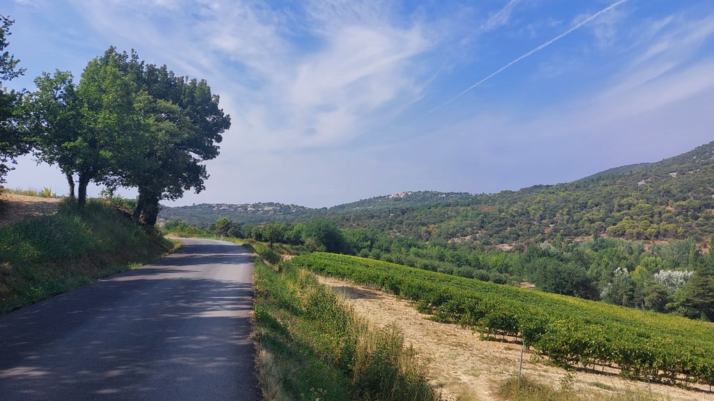
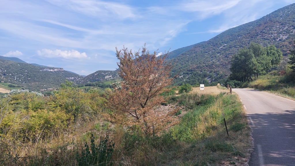
Road was very quiet, road surface was good and meandered nicely through the landscape.
The road leads to the Gorges de Toulourenc. As a cyclist, you don't see any of this. You come to a little bridge with a lot of people walking under it. I expected more of this.
Climb was doable despite it already being hot.
Heb deze klim gedaan als verbinding van mont ventoux (Malaucene) naar de camping.
Weg was erg rustig, wegdek was goed en slingerde mooi door het landschap.
De weg loopt naar de Gorges de Toulourenc. Als wielrenner zie je hier niks van. Je komt bij een bruggetje waar een hoop mensen onder door lopen. Ik had hier meer van verwacht.
Klim was goed te doen ondanks dat het al warm was.
| 7 km/h | 00:30:36 |
| 11 km/h | 00:19:28 |
| 15 km/h | 00:14:17 |
| 19 km/h | 00:11:16 |
This page is better in the app