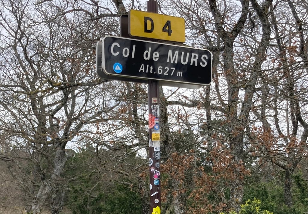
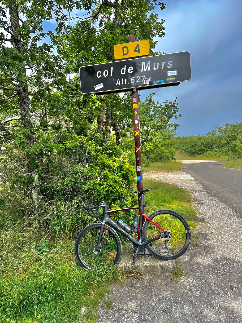
Col de Murs is a climb in the region Vaucluse. It is 10.5 km long and bridges 451 m of vertical ascent with an average gradient of 4.3%, resulting in a difficulty score of 205. The top of the ascent is located at 628 m above sea level. Climbfinder users shared 10 reviews of this climb and uploaded 5 photos.
Road name: D4
4.0 by PiersEyre-WalkerGreat climb. Almost entirely 4% for the entire 11km... read more
Welcome! Please activate your account if you would like to share something. Look for the verification email in your inbox.
If you want to upload your photos, you need to create an account. It only takes 1 minute and it's completely free.
Great climb. Almost entirely 4% for the entire 11km
Very nice climb, not too steep. Some passing traffic but not disturbing. Descent along the other side also with beautiful views.
zeer mooie beklimming, niet te stijl. Wel wat doorrijdend verkeer maar niet storend. Afdaling langs de andere kant ook met prachtige vergezichten.
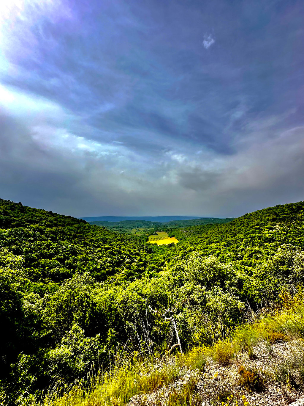
The whole climb from the bottom is fairly long, though pleasant. From Venasque it's a big road, but it's possible to go through the village (albeit at a high gradient) and join the main road much further up the compulsory lane for lorries, which is higher up and gives a better view and avoids the cars. The top of the climb is on a poor surface, although suitable for road bikes.
L’enesemble de la montée depuis le bas est assez long, quoique plaisant. Depuis Venasque c’est une grosse route, il est possible de passer par le village (moyennant de gros pourcentage) et rejoindre la route principale bien plus haut par la voie obligatoire pour les camions, plus en hauteur, elle permet d’avoir un meilleur panorama et surto un d’éviter les voitures. Le haut de la montée se fait sur un revêtement mauvais, quoique convenable pour les vélo de routes.
Col de murs from Robion to St Didier, then to Venasque and off into the mountains. I like the valley with the vineyards and now 2024, super tarmac. The mountain is good to ride, the heat was the problem, pass at 11 o'clock reached 32 degrees
Col de murs von Robion nach St. Didier, dann nach Venasque und ab in den Berg. Ich mag das Tal mit den Weinbergen und jetzt 2024, super Asphalt. Der Berg ist gut zu fahren, die Hitze war das Problem, pass um 11 Uhr erreicht 32 Grad
The road surface from the junction with the Col des Trois Termes seems to be completed, as road markings have already been placed in the middle (2/8/2024). A good running top layer has not been added, so in the final section it is best to take into account some gravel and a slightly less pleasant convex road surface.
Especially in the morning, you still have plenty of shade here and, combined with the winding roads and running percentages, this is still a topper for all enthusiasts who have already climbed the bald 'elephant in the room' enough and are looking for the lesser-known splendours in the area.
Het wegdek vanaf de splitsing met de Col des Trois Termes lijkt voltooid te zijn, aangezien er al wegmarkeringen in het midden zijn aangebracht (2/8/2024). Een goed lopende toplaag is er niet meer bijgekomen, dus in het laatste deel houd je best nog rekening met wat grind en een iets minder aangenaam bollend wegdek.
Vooral in de ochtend heb je hier nog veel schaduw en in combinatie met de kronkelende wegen en lopende percentages is dit nog steeds een topper voor alle liefhebbers die de kale 'elephant in the room' al genoeg beklommen hebben en op zoek zijn naar de minder bekende pracht en praal in de omgeving.
beautiful climb. Especially in the valley in the forest. Just not a breath of wind .
Road surface they were repairing, lots of grid .
It is running climb .
mooie beklimming. Vooral in de vallei in het bos. Alleen geen zuchtje wind .
Wegdek waren ze bezig om te reparen, veel grid .
Het is lopende klim.
11-06-2023
Before you start don't forget to go to Venasque, a shame to miss.
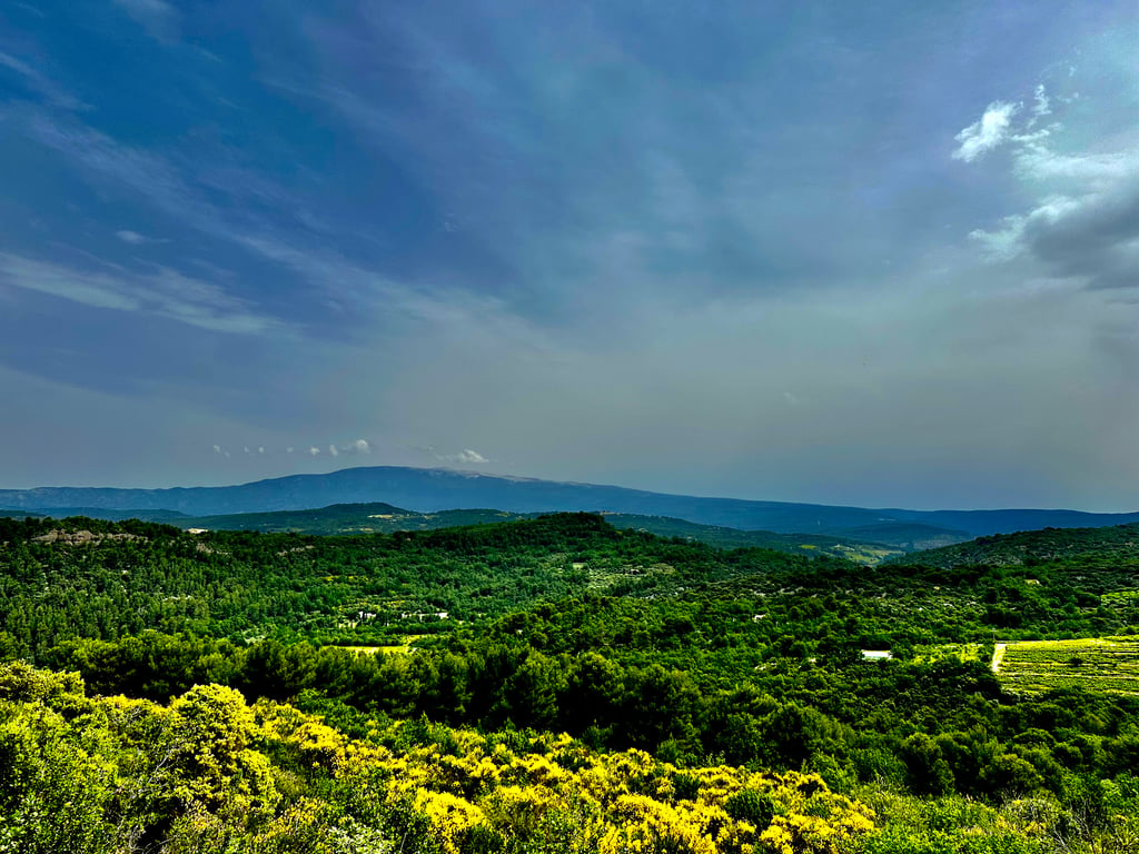
The first part is fairly open with a long straight part where it can be quite tough when the wind is against. After the exit Murs the col shows its true character, it winds between the rocks in a Gorge where it is only turning and turning. At the end a nice hairpin turn so you can look back at what you have accomplished. Really super fun. In the summer, the piece through the Gorge is very hot, no shade / wind.
Vergeet voordat je begint niet even naar Venasque te gaan, jammer om te missen.
Ondanks de Col nergens steil wordt is dit een erg fraaie klim, Het eerste stuk is redelijk open met een lang recht stuk waar het als de wind tegenstaat best even pittig kan worden. Na de afslag Murs toont de col zijn ware karakter, hij slingert tussen de rotsen door in een Gorge waarbij het alleen maar draaien en keren is. Tegen het einde nog een mooie haarspeldbocht waardoor je terug kunt kijken naar wat je hebt volbracht. Echt super leuk. In de zomer kan het stuk door de Gorge wel erg heet worden, geen schaduw/wind.
Nice gradual climb, beautiful scenery, especially if you add col de la ligne afterwards. You have a total of 17 km of climbing, on a very quiet road. Sign at the top is present August 2017
Leuke geleidelijke klim, prachtige omgeving, zeker als je daarna nog even col de la ligne aan vastknoopt. Heb je in totaal 17 klimkilometers, op een heel rustige gelegen weg. Bordje op de top is heden augustus 2017 wel aanwezig
Beautiful climb, nice warming-up for the Ventoux. Starts on perfect tarmac with often nice views, about halfway you come in a forest where you mainly cycle between high rock walls. Then occasionally bad road surface on the inside but generally good asphalt. Descent easy to do.
Prachtige klim, lekker opwarmertje voor de Ventoux. Begint op perfect asfalt met veelal nog mooi uitzicht, ongeveer halverwege kom je in een bos waar je vooral tussen hoog opgetrokken rotswanden fietst. Dan af en toe slecht wegdek aan de binnenkant maar over het algemeen prima asfalt. Afdaling goed te doen.
Beautiful climb! Nice quiet (winding) road with good asphalt. Col sign at the top is missing, top is on one of the poles indicated.
Prachtige klim! Mooie rustige (bochtige) weg met prima asfalt. Col-bordje op de top ontbreekt, top staat op een van de wandelpaaltjes aangegeven.
| 7 km/h | 01:29:52 |
| 11 km/h | 00:57:11 |
| 15 km/h | 00:41:56 |
| 19 km/h | 00:33:06 |
This page is better in the app