| 8 hairpin turns |
| #66 toughest climb of Haute Savoie |
| #47 most elevation gain of Haute Savoie |
| #62 longest climb of Haute Savoie |
| #86 average steepest climb of Annecy |
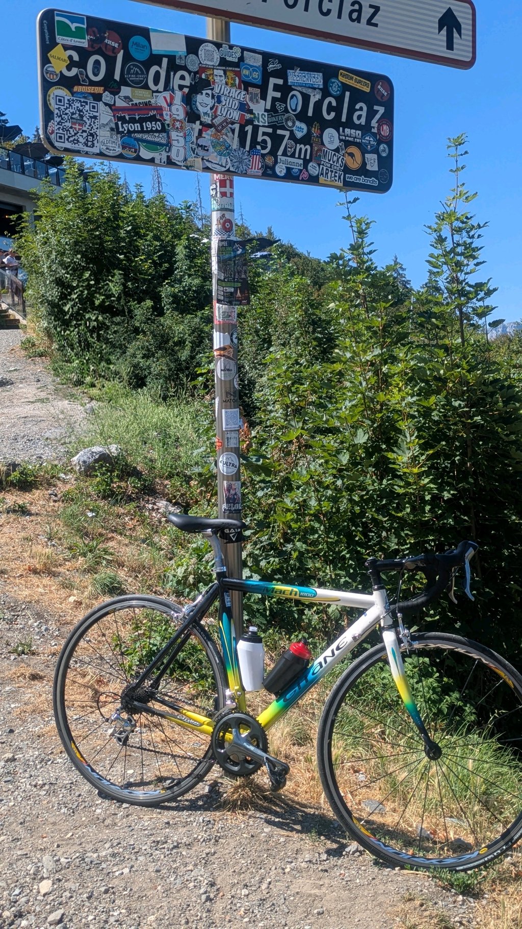
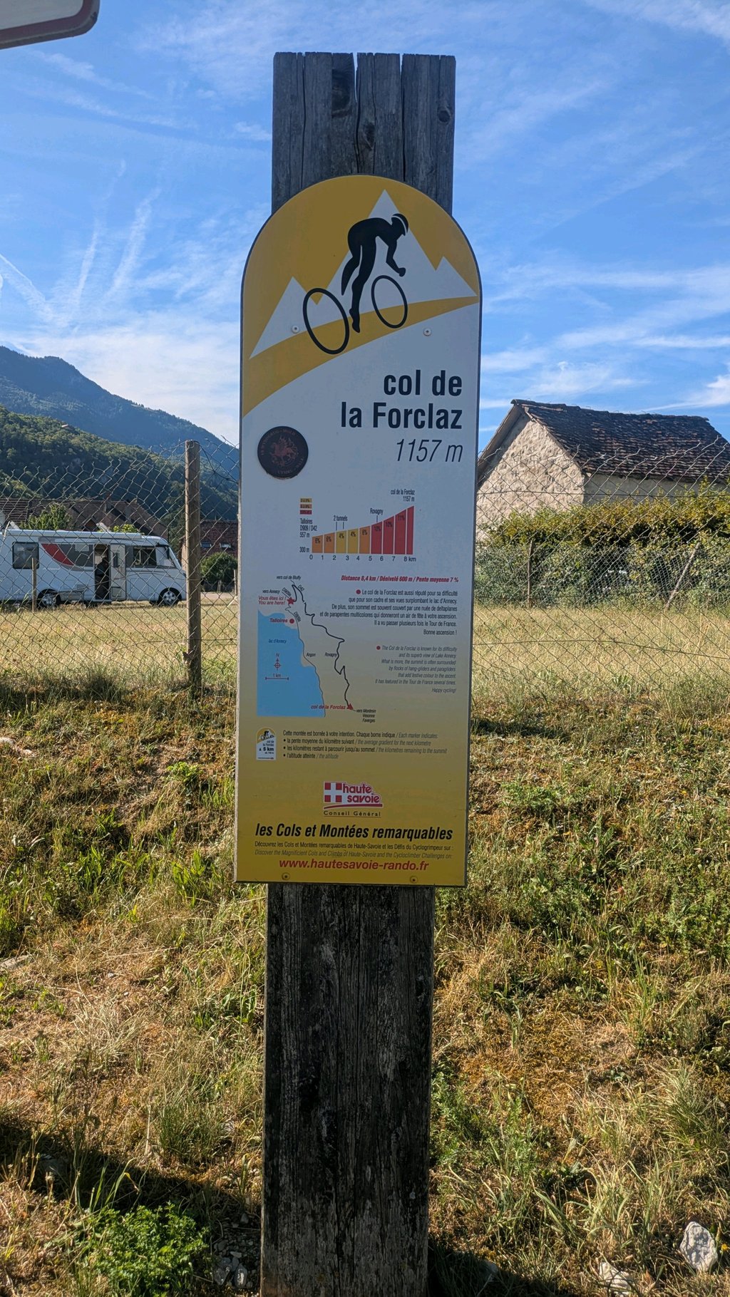
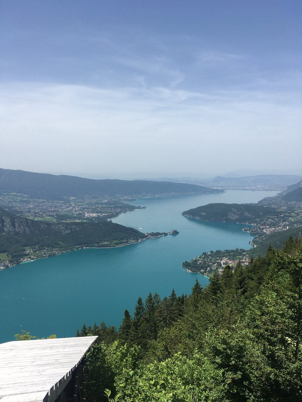
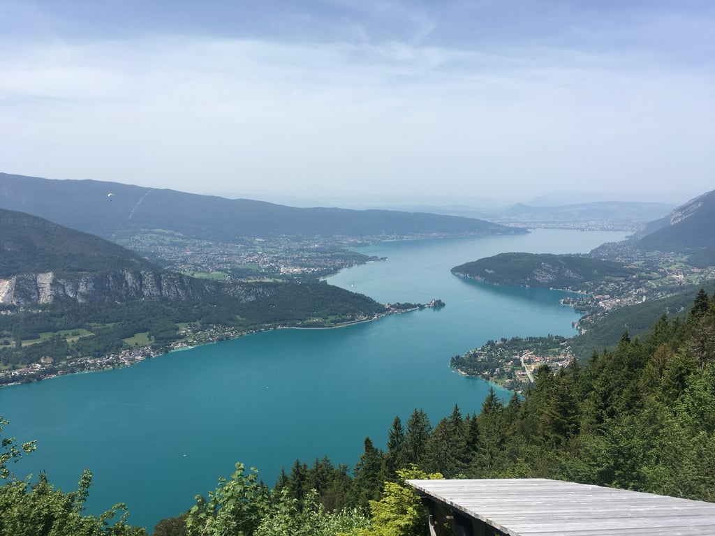
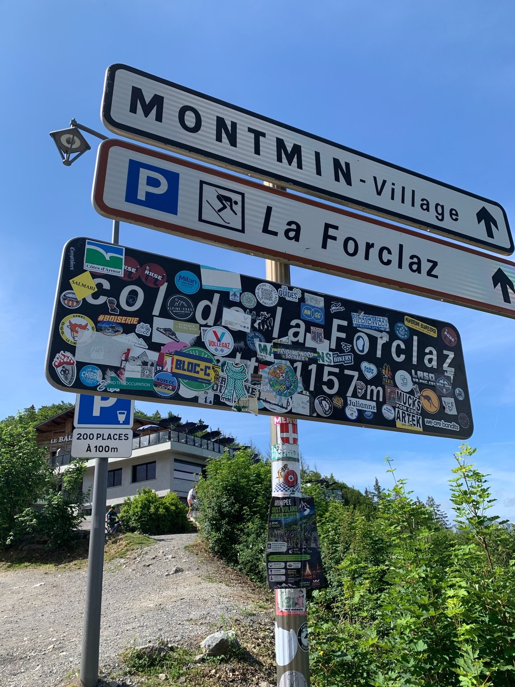
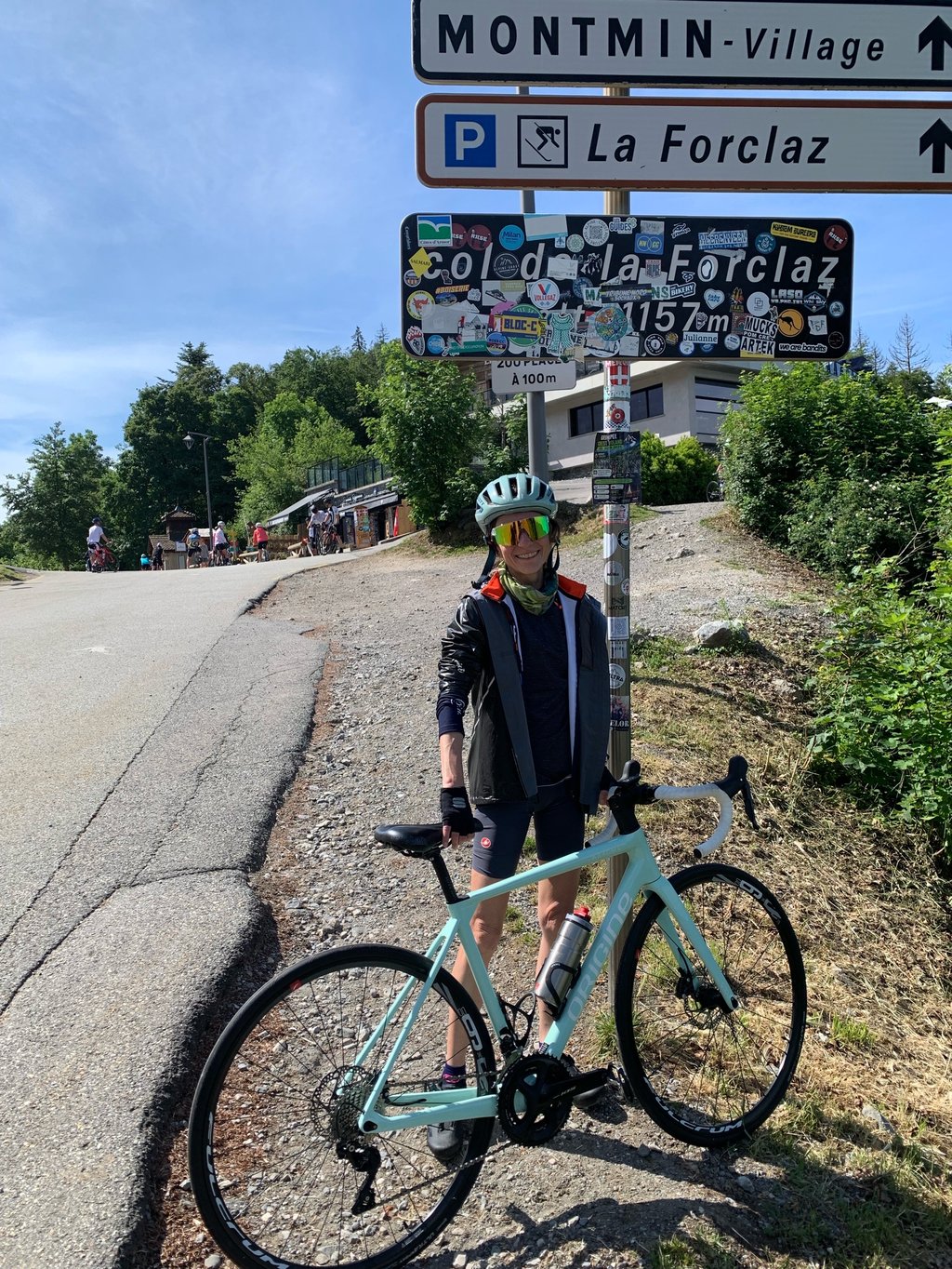
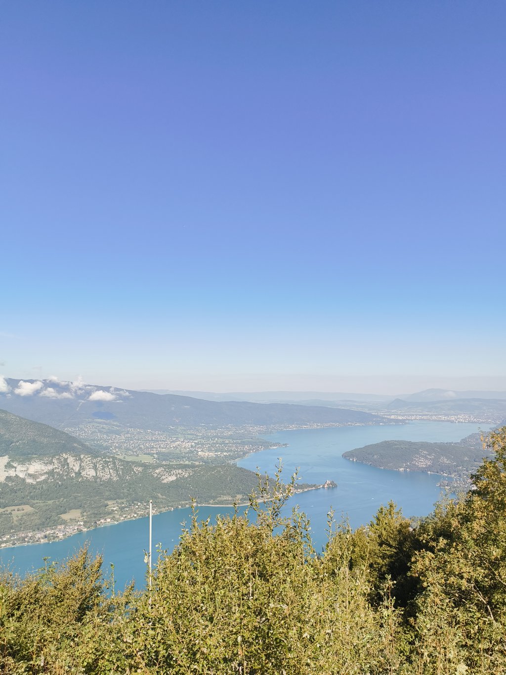
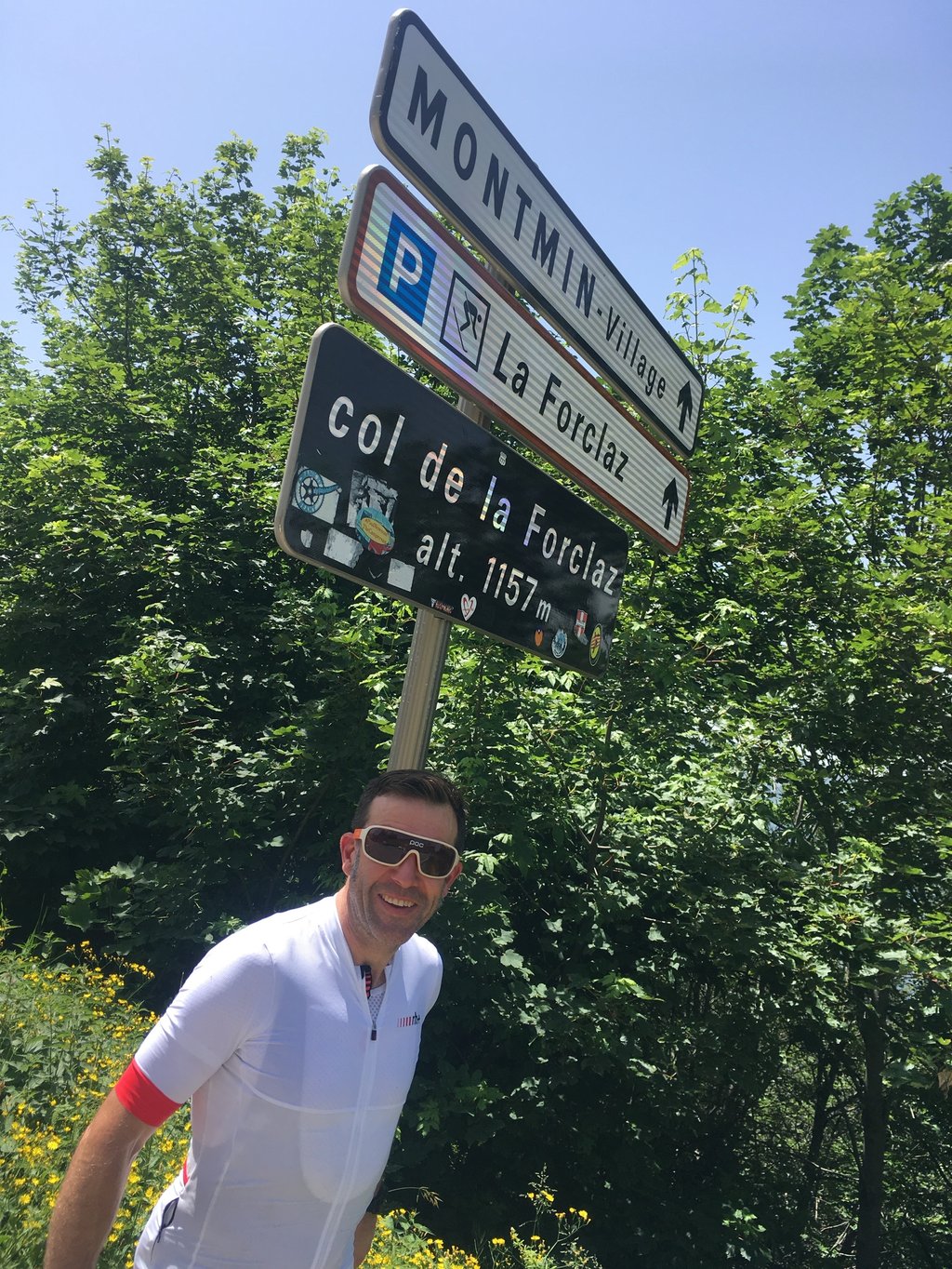
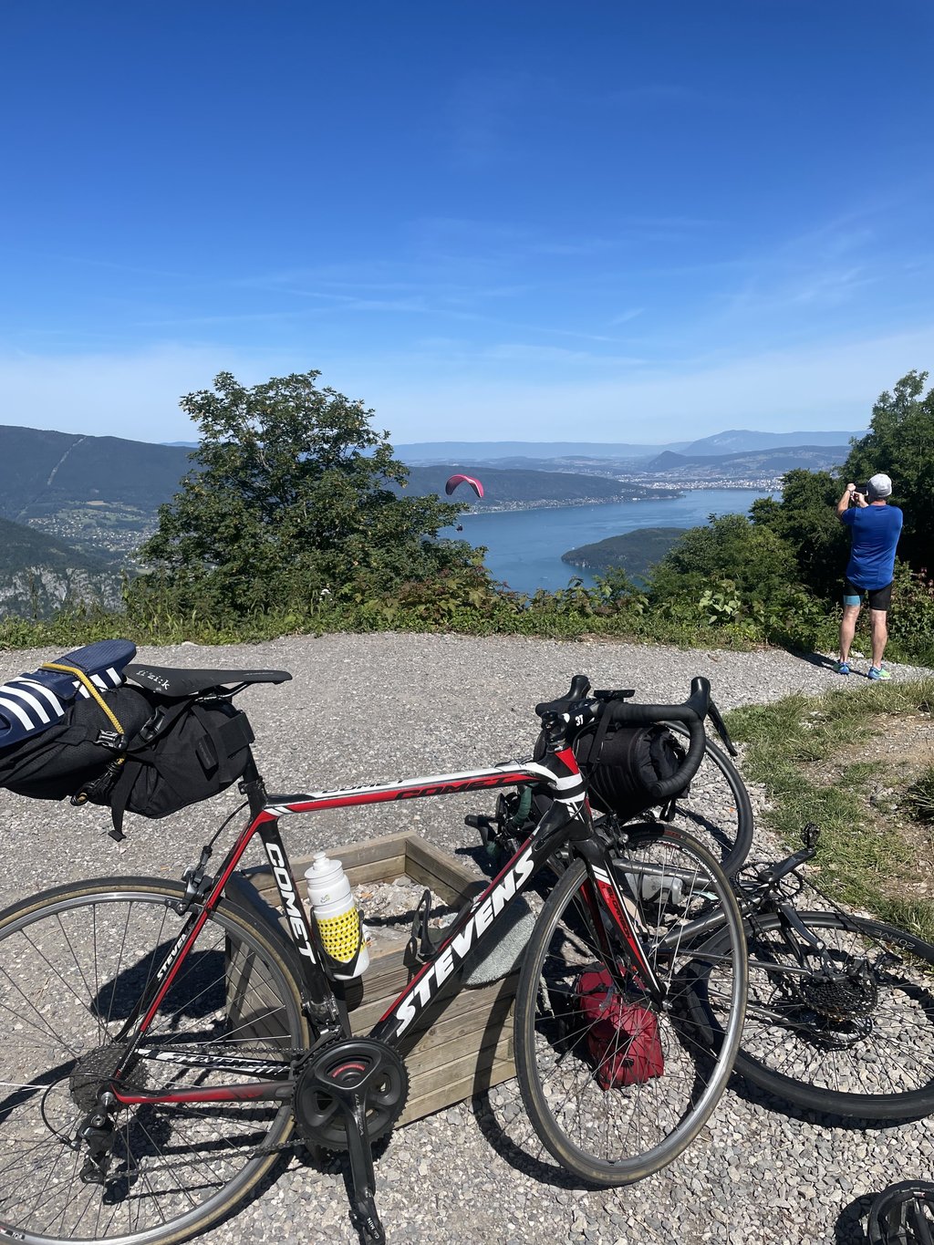
Col de la Forclaz Montmin from Talloires is a climb in the region Annecy. It is 10 km long and bridges 700 m of vertical ascent with an average gradient of 7%, resulting in a difficulty score of 580. The top of the ascent is located at 1147 m above sea level. Climbfinder users shared 14 reviews of this climb and uploaded 27 photos.
Road names: Route du Col de la Forclaz & Route de Rovagny
5.0 by JohanAssez brutal, court mais intense surtout les 2 derniers km qui sont interminable. Mais quelle vue une fois en haut. Trop de circulation a mon gout et des automobilistes/non cycliste , qui sont un peu dangereux.... read more
Welcome! Please activate your account if you would like to share something. Look for the verification email in your inbox.
If you want to upload your photos, you need to create an account. It only takes 1 minute and it's completely free.
Quite gruelling – short but intense, especially the last 2 km, which seem to go on forever. But what a view once you’re at the top! Too much traffic for my liking, and motorists and non-cyclists who are a bit of a hazard.
Assez brutal, court mais intense surtout les 2 derniers km qui sont interminable. Mais quelle vue une fois en haut. Trop de circulation a mon gout et des automobilistes/non cycliste , qui sont un peu dangereux.
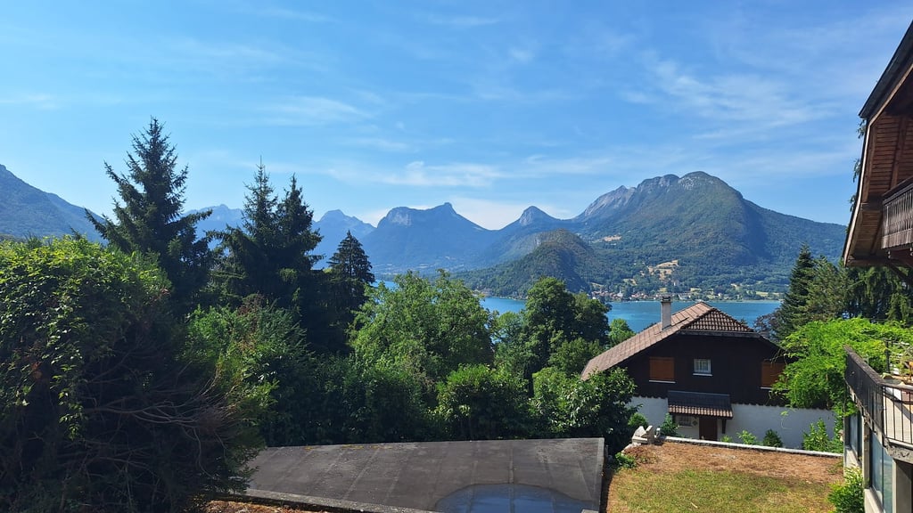
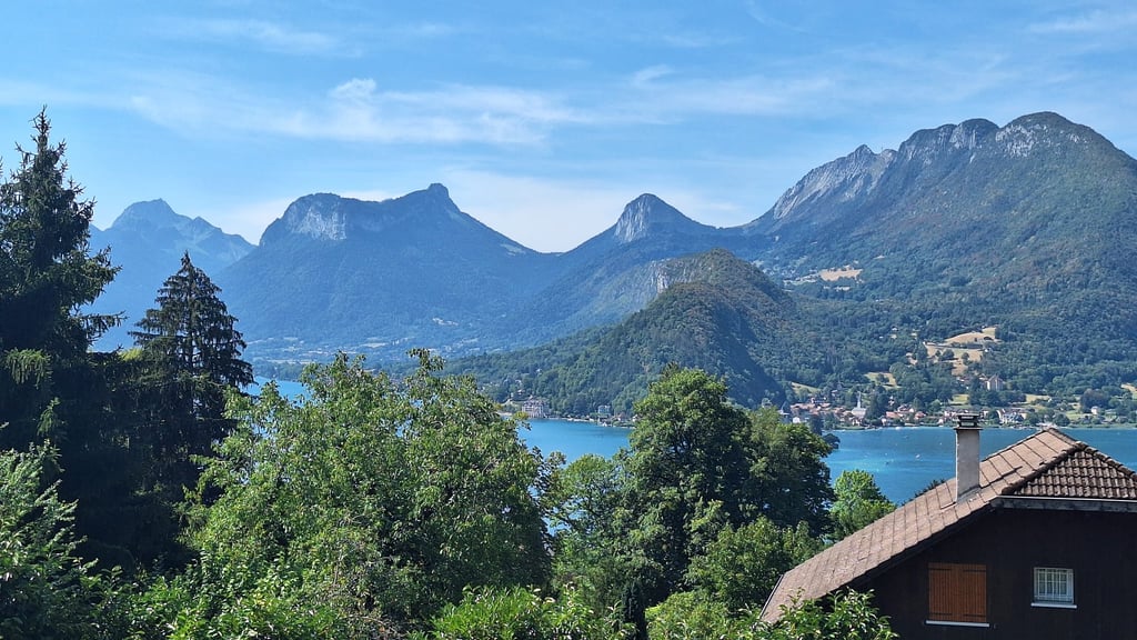
Rode this during the heatwave in June 2019, from what I remember the climb was a pretty stable gradient but then it ramps up to 10 percent for the last 3 kilometres. A few cafes/shops to get a drink at the top and the views of the lake make the trip worthwhile. Descended down the opposite side which was fast and fun
I set off from Doussard and took the climb from Talloires. The first few kilometres were easy, with plenty of shade; the last 3 at 10% were a little more strenuous. The view over the lake is superb. There are plenty of cafés and restaurants.
Partie depuis Doussard, j’ai pris la montée depuis Talloires. Premiers kms sans difficulté, bien ombragés ; les 3 derniers à 10 % piquent un peu plus. La vue au dessus du lac est superbe. Il y a de nombreux cafés et restaurants.
Very nice climb that gives you sporadic glimpses of the lake between the trees. After which you have to work up unrelentingly by 10% for the view at the top. There you can lavish yourself on all things liquid; enough cafes for an entertainment district.
Zeer mooie klim die je sporadisch tussen de bomen een glimp op het meer gunt. Waarna je onaflatend tegen 10% omhoog moet werken voor het uitzicht op de top. Daar kan je uzelf laven aan alles wat vloeibaar is; genoeg cafés voor een uitgaansbuurt.
Good climb with pleasing start but the last three kilometers are very steep.
Started by warming up on the (busy) bike path along t lake. Once we turned up the climb, t was quickly calmer. Good road surface. It was very hot though, already 28 degrees at 9 in the morning. Col climbs fairly constantly, but gets tough the last few kilometres, until you reach the top quite unexpectedly. Unfortunately the cafés and restaurants were not yet open, so after leaving some parapants and taking photos of the beautiful view, we immediately descended to the valley and cooled off in the lake.
Gestart met warmtrappen op het (drukke) fietspad langs t meer. Eenmaal de klim opgedraaid was t snel rustiger. Prima wegdek. Het was wel erg warm, ‘s morgens om 9 uur al 28 graden. Col klimt vrij constant, wordt de laatste kilometers wel zwaar, totdat je vrij onverwachts boven bent. Helaas was de horeca nog niet open, dus na het vertrek van een aantal parapants en foto’s van het prachtige uitzicht gelijk afgedaald naar t het dal en de verkoeling van het meer opgezocht.
Did not expect those gradients late on. My bike packing set up and poor gearing choice put a lot of fatigue in my legs ahead of the madeleine.
The climb as a whole isn't very complicated, but you need to have enough energy to tackle the last three sections, which are particularly difficult because of the lack of flat areas.
Ascension qui dans sa globalité n'est pas très compliquée mais il faut en garder pour attaquer les trois derniers qui sont particulièrement difficiles à cause notamment du peu de replats
The climb is beautiful, really in the mountains, although there's no view all the way, but the final one is clearly worth giving it your all for the last few kilometres, which are tough!
La montée est belle, vraiment dans la montagne, bien qu’il n’y ais pas de vue tout du long, par contre celle finale vaut clairement le coup de se donner sur les dernier kilomètres qui sont rudes !
Nice climb, beautiful among the trees in the shade, if you go reasonably early at least.
Steep in some parts but at least then 7% feels like driving down again ;-)
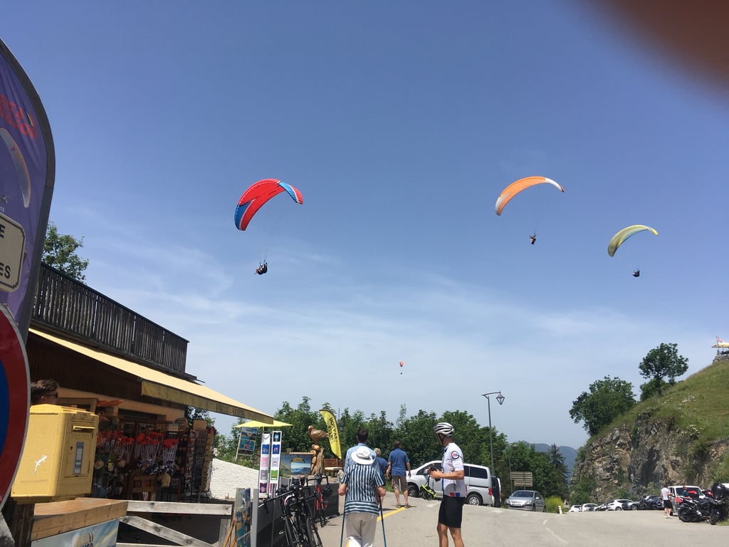
Superb views at the summit, continue for 300 metres ( very steep) to the starting point of the paragliding launch site.
I descended towards Talloires and that descent runs beautifully, yes can really descend fast.
Nice to combine with a tour of Annecy.
In short, a brilliant climb, definitely ride it if you're in the area
Mooie klim, prachtig tussen de bomen in de schaduw, als je redelijk vroeg gaat in ieder geval.
Wel stijl op sommige delen maar dan voelt 7% tenminste weer aan als naar beneden rijden ;-)
Schitterend uitzicht op de top, rijd nog even 300 meter door ( erg stijl) naar het startpunt van de parapente lanceer plaats.
Ik daalde af richting Talloires en die afdaling loopt prachtig, ja kan echt lekker hard dalen.
Mooi te combineren met een rondje Annecy.
Kortom een schitterende klim, zeker rijden als je in de buurt bent
Superb climb with some breathtaking views over Lake Annecy... and the last 3 kilometres to put your cardio to the test (10% average, with no flat spots)
Superbe montée avec quelques points de vue à couper le souffle sur le lac d'Annecy... et les 3 derniers kilomètres pour mettre le cardio à l'épreuve (10% de moyenne, sans replat)
(temps pris depuis les granges)
Ascent made on 11 July 2024 at least 15 years after the first.
From the bottom of Talloires to Rovagny the gradient is manageable but not regular between 4 and 7% in places.
Just before Rovagny the % become steep and it's fireworks all the way to the pass, in this part you really have to manage to the finest not to put your feet on the ground.
Beautiful views of the lake and the Bauge massif from the first tunnel to Vérel, then you have to be patient before enjoying the scenery again.
I can't take note of the traffic because depending on the time of day and also the time of year, it can be either moderate or intense. This morning at 8-9am there was already quite a bit of traffic... but it's July.
Ps: I climbed up to the paragliding take-off area on a slope averaging 15.4% for the last 400 metres with a passage at 17-20% (I finished on foot).
I would advise against doing this as normally the Rte is reserved for authorised vehicles only, i.e. those transporting paragliders.
Ascension effectuée le 11 juillet 2024 au moins 15 ans après la première.
Du bas de Talloires jusqu'à Rovagny la pente est gérable mais pas régulière entre 4 et 7% par endroits.
Juste avant Rovagny les % deviennent abruptes et c'est le feu d'artifice jusqu'au col, dans cette partie il faut vraiment gérer au plus fin pour ne pas poser pieds à terre.
De belles vues sur le lac et le massif des Bauges depuis le premier tunnel jusqu'à Vérel, ensuite il faudra patienter avant de profiter à nouveau des paysages.
Je ne peux pas noter la circulation car suivant les périodes de la journée et aussi de l'année elle peut être soit modérée soit intense, ce matin à 8-9h ça circulait déjà pas mal... mais c'est le mois de juillet.
Ps : Je suis monté jusqu'à l'aire d'envol des parapentes dans une pente à 15,4% de moyenne sur les 400 derniers mètres avec passage à 17-20% ( j'ai fini à pieds )
Je vous déconseille de le faire car normalement la Rte est réservée uniquement aux véhicules autorisés c'est à dire ceux qui transporte les parapentistes.
Quite an intense climb. Beautiful slopes and a great viewpoint at the end to reward you.
Une montée assez intense. De belles pentes et un super point de vue à la fin pour la récompense
Climbed this one on a hot day in July. Save your energy for last because you get drained. The start at the lake is doable and fairly busy in high season, you pass a campsite where you see many a tourist walking next to his's bike. Pretty steep there for a while but after that it fortunately becomes less steep and a lot quieter. Until the forest (where it gets steep on the profile) you can ride nicely. Road surface is in good shape because of this year's Tour. Then it's a kilometre and a half of raking through the forest, if you're lucky you can enjoy the shade. Then you are almost at the top and can stop for a nice view of the lake and a drink. The descent via the other side is much braking and passes quickly, unfortunately.
Deze beklommen op een hete dag in juli. Bewaar je energie voor het laatst want je wordt leeggezogen. Het begin bij het meer is goed te doen en redelijk druk in het hoogseizoen, je rijdt een camping voorbij waar je menig toerist naast z'n fiets ziet lopen. Vrij steil daar even maar daarna wordt het gelukkig minder steil en een stuk rustiger. Tot het bos (waar het steil wordt op het profiel) kun je lekker rijden. Wegdek ligt er goed bij door de Tour van dit jaar. Daarna is het een kilometer of anderhalf harken door het bos, als je geluk hebt kun je genieten van de schaduw. Daarna ben je bijna boven en kun je even stoppen voor een mooi uitzicht op het meer en een drankje. De afdaling via de andere kant is veel remmen en gaat snel voorbij helaas.
| 7 km/h | 01:25:20 |
| 11 km/h | 00:54:18 |
| 15 km/h | 00:39:49 |
| 19 km/h | 00:31:26 |
This page is better in the app