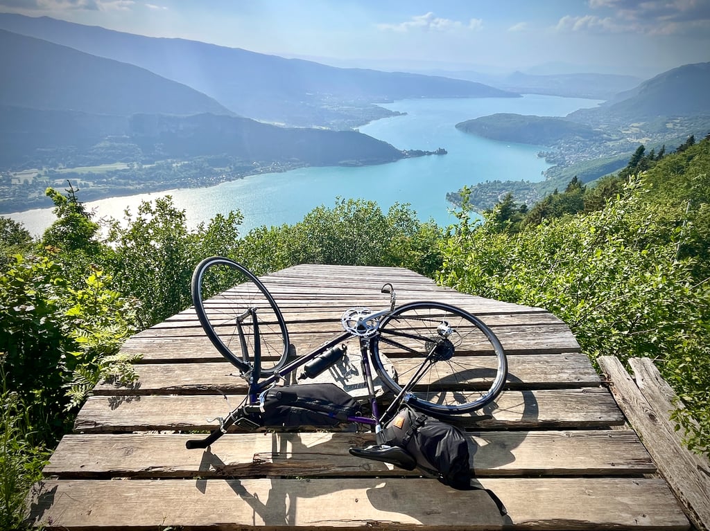
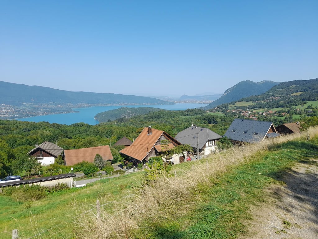
| Beautiful scenery |
| 4 hairpin turns |
| #91 toughest climb of Haute Savoie |
| #91 most elevation gain of Haute Savoie |
| #68 longest climb of Annecy |
| #64 average steepest climb of Annecy |
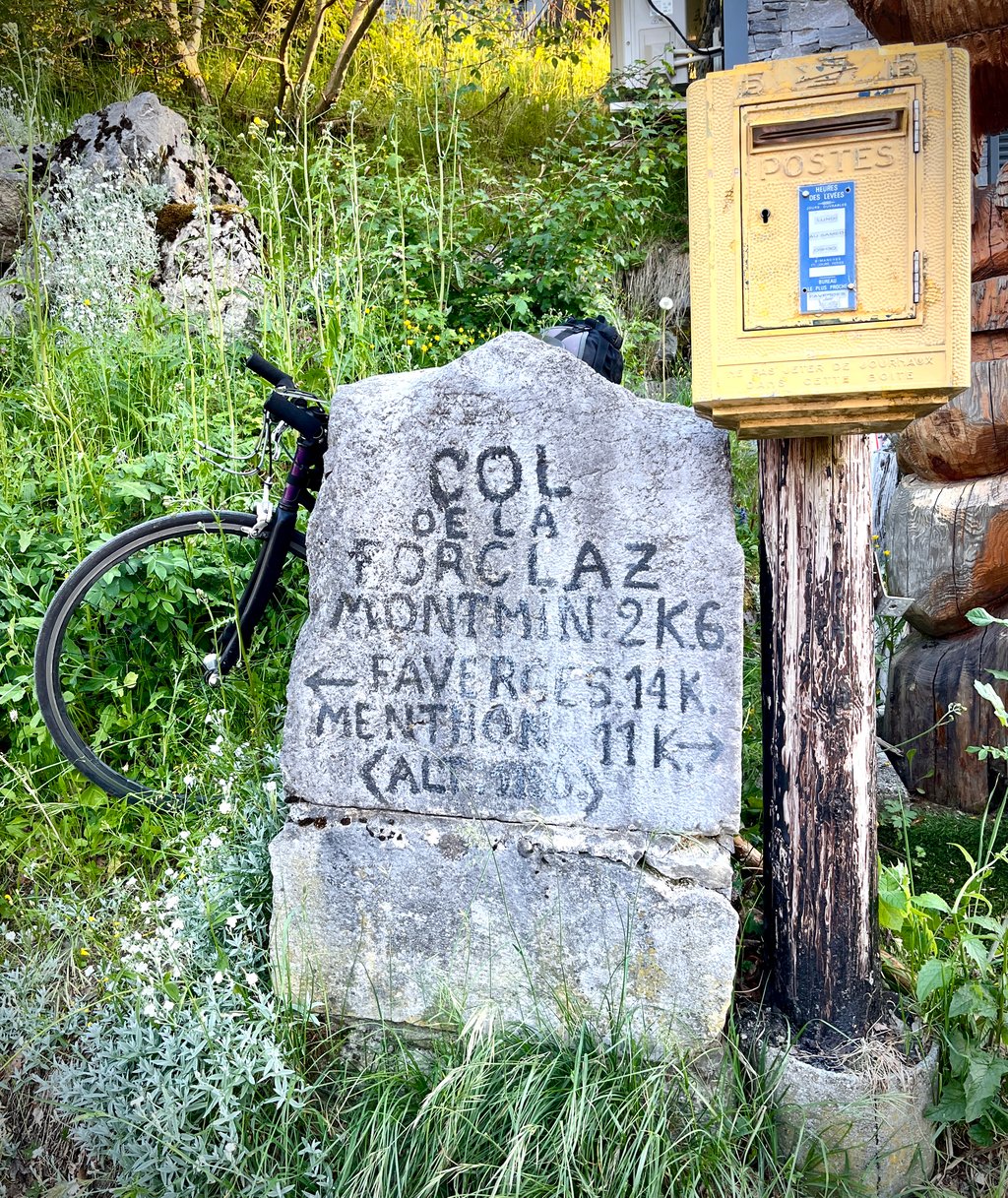
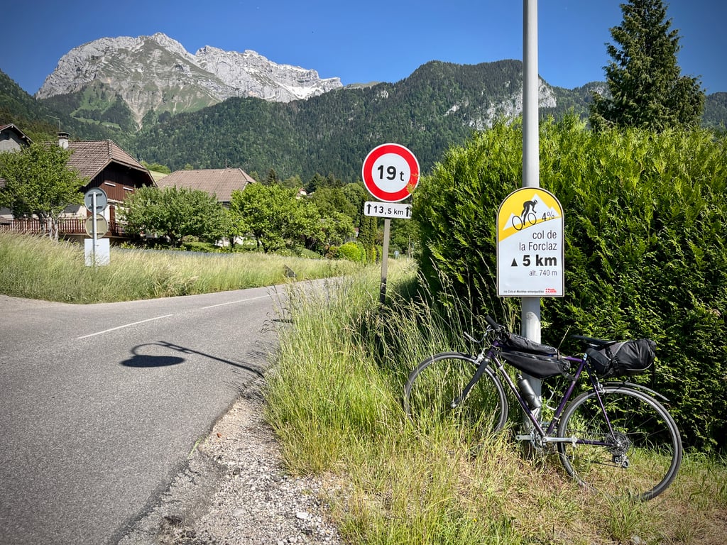
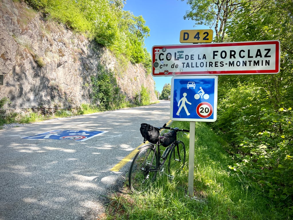
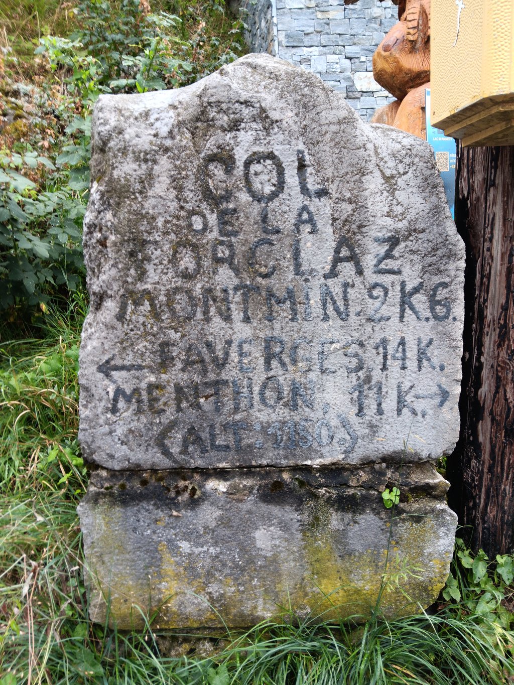
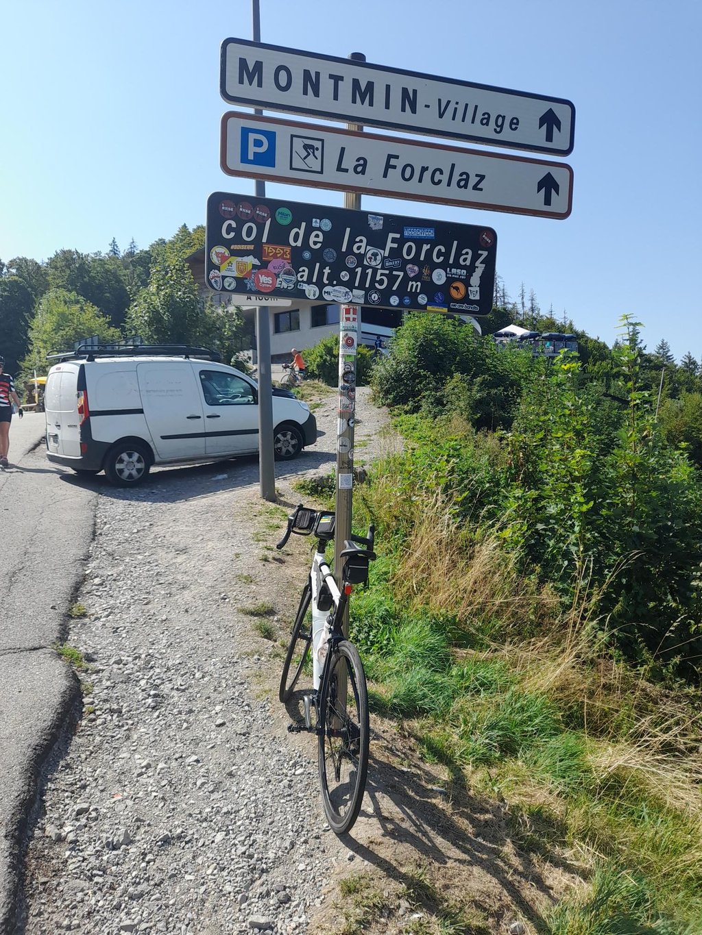
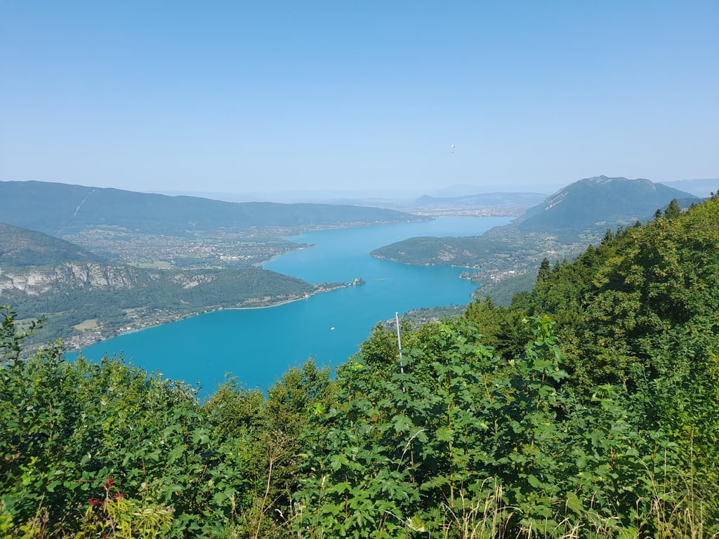
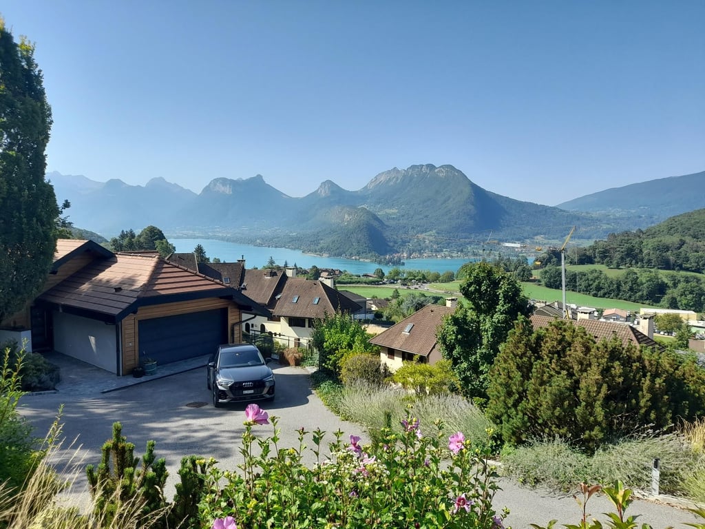
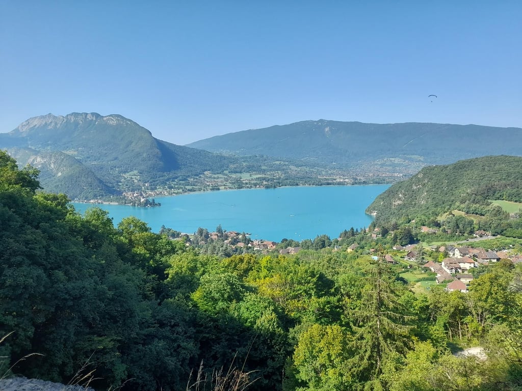
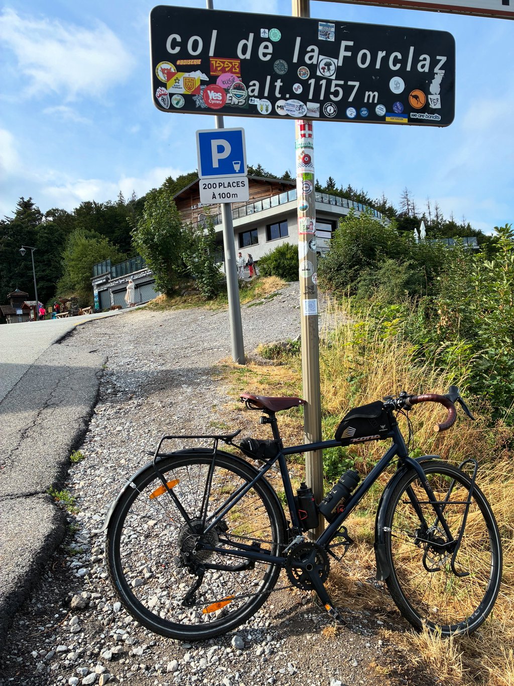
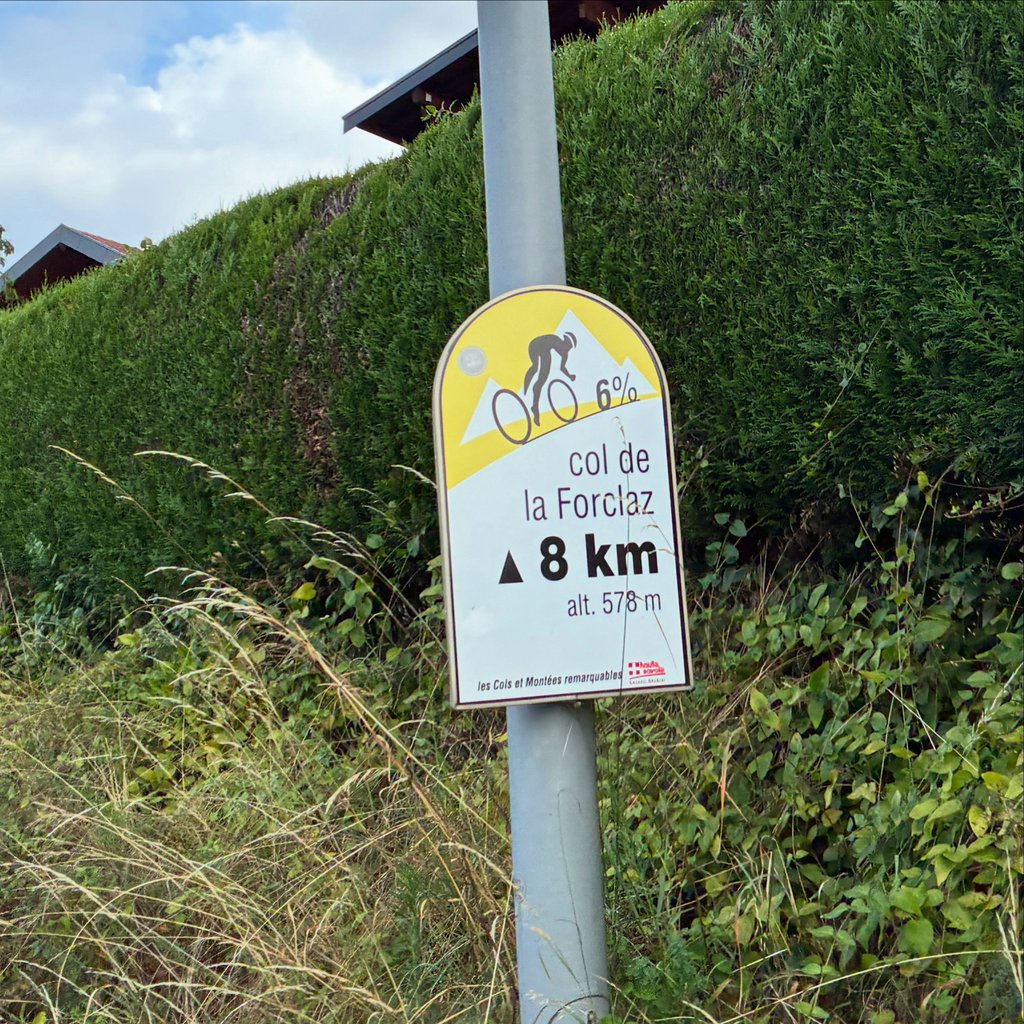
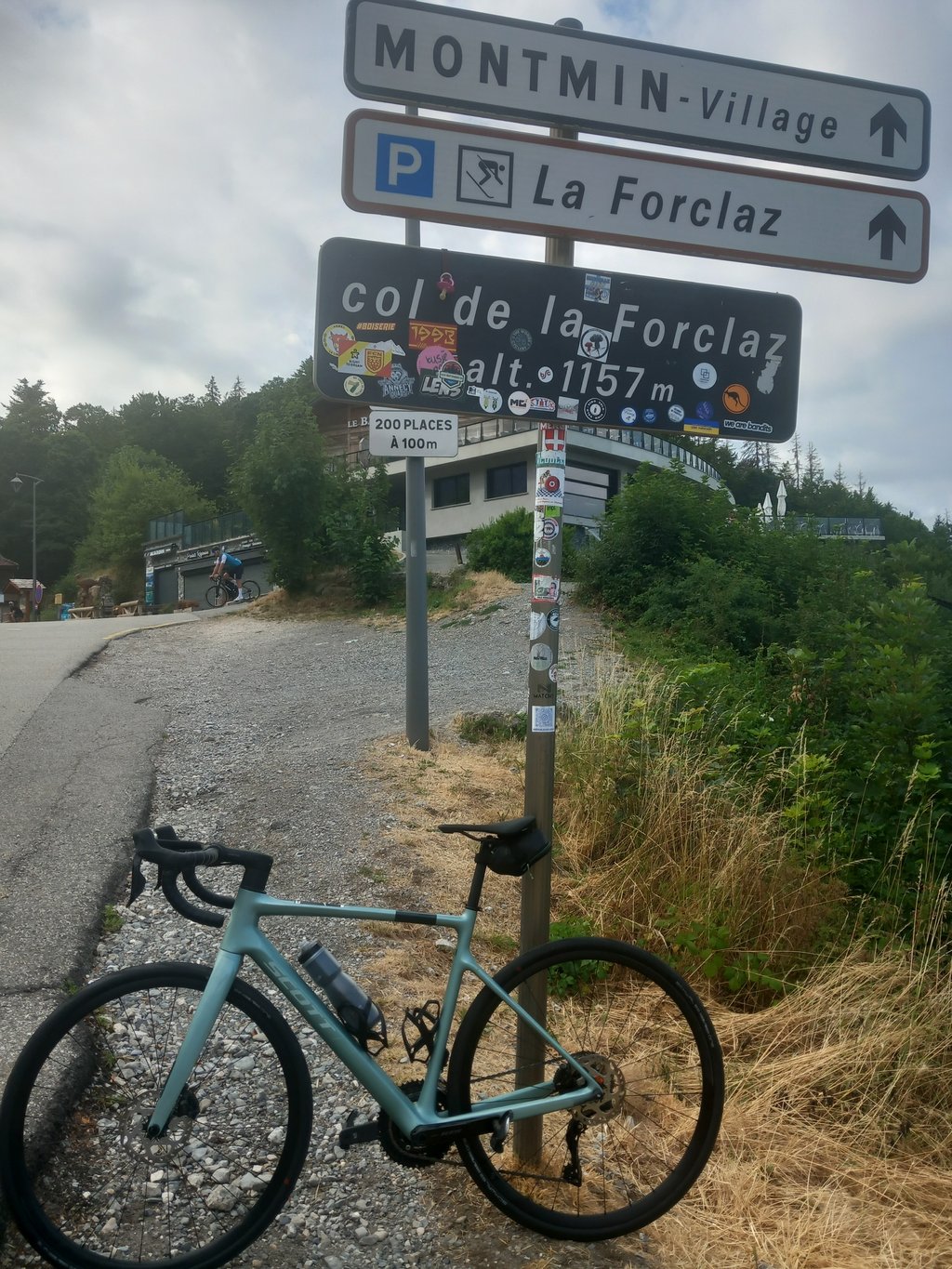
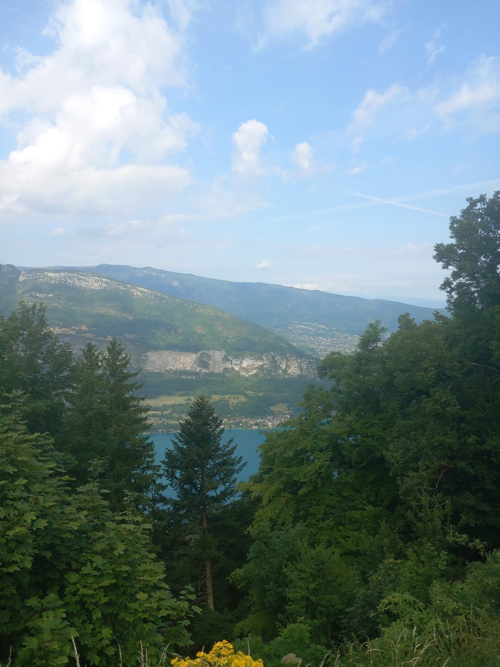
Col de la Forclaz de Montmin from Menthon-Saint-Bernard is a climb in the region Annecy. It is 7.3 km long and bridges 537 m of vertical ascent with an average gradient of 7.4%, resulting in a difficulty score of 470. The top of the ascent is located at 1147 m above sea level. Climbfinder users shared 21 reviews of this climb and uploaded 36 photos.
Road name: D42
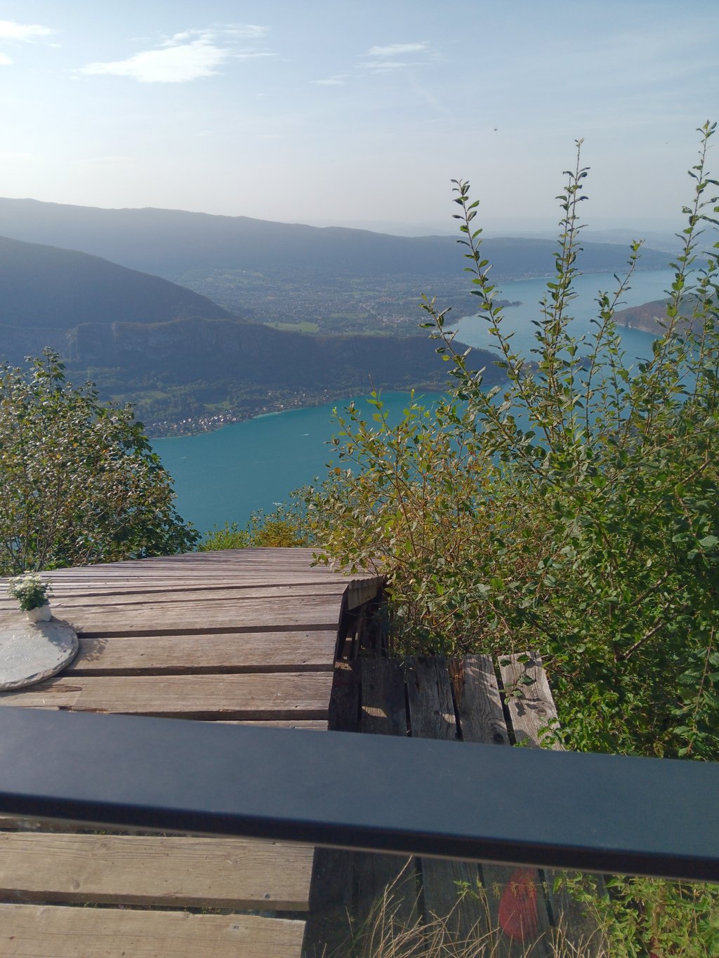
4.0 by Raphael_BougardThis is an automatic translation, the original language is: French.Normally a 2nd category climb but my God it's hard! We get straight into the thick of things with the 1st kilometre at an average of 8-9% then the road levels out and becomes regular and pleasant. The absolutely magnificent scenery of Lake Annecy comes into view from time to time, much to our delight. Then comes the last 3 kilometres at an average of 10%. Contrary to what is said the gradient doesn't weaken and remains at 10 all the way to the summit. The wheel sticks to the tarmac ... read more
Welcome! Please activate your account if you would like to share something. Look for the verification email in your inbox.
If you want to upload your photos, you need to create an account. It only takes 1 minute and it's completely free.
Yes, the last three km are really serious. It's real 10% and it never lets up. The rest is pretty easy. The surface is good. The traffic is not annoying. At the beginning or end of the day, the trees provide protection from the sun. There are views of the lake and the Bauges.
Up there, chalets offer food and coffee galore, as well as all sorts of trinkets and souvenirs of questionable taste. There is also a fresh water point and toilets. The view of the lake is beautiful, but far less pure than the one awaiting you at the top of rue de la Rochette. The descent is fantastic. A very pleasant pass!
Oui, les trois derniers km sont vraiment sérieux. C’est du vrai 10% et ça ne s’apaise jamais. Le reste est plutôt facile. Le revêtement est bon. La circulation n’est pas gênante. En début ou fin de journée, les arbres protègent du soleil. Quelques vues sur le lac et sur les Bauges.
Là-haut, des chalets offrent restauration et cafés à gogo ainsi que toutes sortes de babioles et souvenirs de goût discutable. On a aussi droit à un point d’eau fraîche et à des toilettes. La vue sur le lac est très belle, mais bien moins pure que celle qui vous attend en haut de la rue de la Rochette. La descente est fantastique.
Un col bien sympathique !
A very beautifull climb with steep roads, luckily the climb isn't too long it's a good preparation for the other bigger climbs in the region, once you make it to the top your awarded with a nice resting place where you can eat/drink something with a view over lake annecy, the roads are silky smooth, there is quite a lot of traffic but the drivers are used to the cyclists.
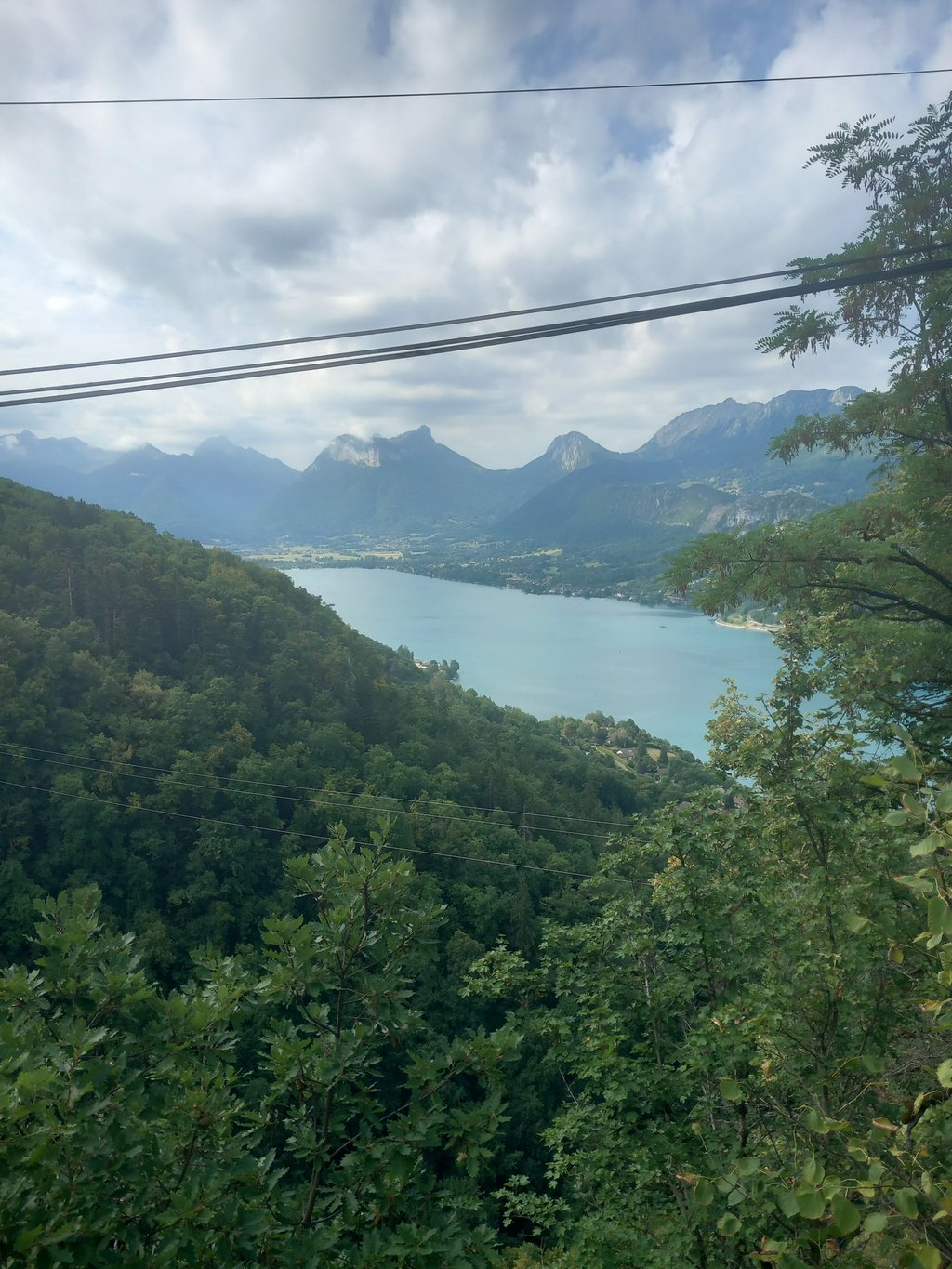
It starts off smoothly, but the last few km get tougher and are a "horror" with gradients constantly above 10-11% for several km, fortunately under cover. Watch out for the cars, some of which don't seem to like cyclists (in 5 km I nearly got run over 3 times by some rather irresponsible Haute Savoyards...). Otherwise, the view from the summit is magnificent, and as you climb, the view of Lake Annecy below gets better and better.
Démarrage roulant, mais les derniers km se corsent et sont une "horreur" avec des pentes constamment au-dessus de 10-11% sur plusieurs km, heureusement à couvert. Attention aux voitures, dont certains ne semblent pas aimer les cyclistes (en 5 km j'ai failli me faire écraser 3 fois par des hauts savoyards un peu irresponsables...). Sinon la vue au sommet est magnifique et tout au long de l'ascension vous aurez une vue de plus en plus belle sur le Lac d'Annecy en contrebas.
A beautiful pass, a fairly steep start and an intense finish! But really beautiful!
Très beau col, un démarrage assez raide et un final intense !! Mais vraiment très beau !!
A short but challenging climb, tough 2km start averaging around 8% then 3km where you have the chance to recover and prepare for a gruelling final 3km averaging 10%, but not dipping below 9% at any point. If you are counting down the signs to the top there is no 1km to go sign! The pain is worth it for the view
Normally a 2nd category climb but my God it's hard! We get straight into the thick of things with the 1st kilometre at an average of 8-9% then the road levels out and becomes regular and pleasant. The absolutely magnificent scenery of Lake Annecy comes into view from time to time, much to our delight. Then comes the last 3 kilometres at an average of 10%. Contrary to what is said the gradient doesn't weaken and remains at 10 all the way to the summit. The wheel sticks to the tarmac but the scenery at the top is worth it. A must do!
Montée normalement de 2eme catégorie mais mon Dieu que c'est dur ! On rentre tout de suite dans le vif du sujet avec le 1er kilomètre à 8-9% de moyenne puis la route s'aplanit et devient régulière et agréable. Le paysage absolument magnifique sur le lac d'Annecy se découvre par moment pour notre plus grand plaisir. Puis viennent les 3 derniers kilomètres à 10% de moyenne. Contrairement à ce qui est dit la pente ne faiblit et reste à 10 jusqu'au sommet. La roue reste collée au bitume mais le paysage en haut en vaut la peine. A faire !!
Challenging climb, last 3 km it stays above 10%, contrary to the picture. Up top nice view, see what you suffered for. Road surface is excellent, perhaps because the tour has already passed over it this year (2023). Descent is doable, but nice if you have disc brakes, sometimes you have to squeeze the brakes firmly.
Uitdagend klimmetje, laatste 3 km blijft het boven de 10%, in tegenstelling tot het plaatje. Bovenop mooi uitzicht, zie je waarvoor je geleden hebt. Wegdek is uitstekend, misschien omdat de tour dit jaar (2023) er al overheen is gekomen. Afdaling is goed te doen, maar wel fijn als je schijfremmen hebt, soms moet je stevig in de remmen knijpen.
Beautiful steep climb (if you come from Villard/Vésonne).
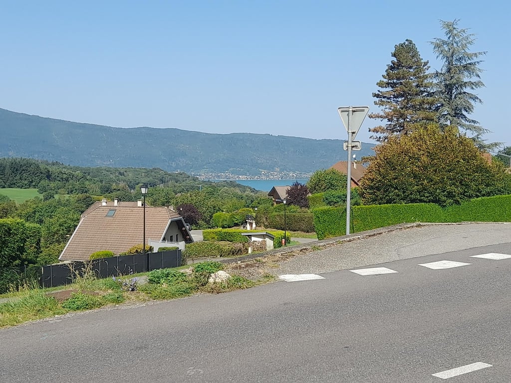
Nice view of Lac d'Annecy.
Route along the lake itself also fun but can be very busy.
Mooie pittige klim (als je komt vanaf Villard/Vésonne).
Aardig uitzicht op Lac d'Annecy.
Route langs het meer zelf ook leuk maar kan zeer druk zijn.
From the Lake of Annecy first 2 times (sometimes steep) climb/descend before this climb starts. First km's are nice and warm cycling with beautiful views. It's not really quiet in terms of traffic, but don't let that deter you.
I already had quite a few altimeters in my legs before I started this climb. The last few kilometers are really hard. Contrary to the map on the website, it remains in double digits all the way to the top.
Descending on the other side is really enjoyable. After the first part quite technical, but often clear and always with excellent asphalt. Even for a cowardly descender like me it was really enjoyable.
Vanaf het Meer van Annecy eerst al 2 keer (soms steil) klimmen/dalen voordat deze klim begint. Eerste km’s zijn lekker warm fietsen met mooie uitzichten. Echt rustig qua verkeer is het jammer genoeg niet, maar laat je dat niet afschrikken.
Zelf had ik al aardig wat hoogtemeters in de benen voordat ik aan deze klim begon. De laatste kilometers is het af en toe echt harken. In tegenstelling tot het kaartje op de website blijft het helemaal tot aan de top in de dubbele cijfers lopen.
Afdalen aan de andere kant is echt genieten. Na het eerste stuk behoorlijk technisch, maar vaak overzichtelijk en altijd met uitstekend asfalt. Zelfs voor een laffe daler zoals ik was het echt genieten.
Fine climb. The last 3 km are indeed steep, but because the previous nice walk you're through it so quickly. Beautiful views of the lake. The descent I would like to do again. That was really great. But in the thunderstorm back up we did not think that's a good idea.
Fijne klim. De laatste 3 km zijn inderdaad steil, maar omdat het voorgaande lekker loopt ben je er zo doorheen. Prachtig uitzicht op het meer. De afdaling zou ik nog een keer willen doen. Die was echt geweldig. Maar in de onweer terug naar boven vonden we niet zo'n goed idee.
Great climb because of the view at the top over the lake and the steep parts at the end of the climb. Technical descent and make sure you have good brakes.
Geweldige klim vanwege het uitzicht op de top over het meer en de steile stukken op het einde van de klim. Technische afdaling en zorg voor goede remmen.
Beautiful climb with stunning views over Lake Annecy when you get to the top of the house.
The climb starts nice but becomes towards the end a lot steeper.
You can also do it through the other side, which is even more difficult.
Personally in terms of environment, this is the most beautiful side.
Prachtige Klim met een prachtig uitzicht over het meer van Annecy als je boven bent bij het huisje.
De klim begint lekker maar word naar het einde een stuk steiler.
Je kan hem ook via de andere kant doen, deze is nog wat lastiger.
Persoonlijk qua omgeving is dit wel de mooiste kant.
From the village to the start of the climb it is a bit steep but the first few kilometers of the climb itself are easy to do. Beautiful surroundings to enjoy. Last 3 km I didn't see much more than the tarmac in front of me because I found that quite tough. But since I first cycled last week via the other side of the Forclaz, this was a relief.
Vanaf het dorp tot de start van de klim is het even wat steil maar de eerste kilometers van de klim zelf zijn prima te doen. Mooie omgeving waar je ook nog eens van kan genieten. Laatste 3 kilometers weinig meer gezien dan het asfalt voor me want dat vond ik toch best pittig. Maar aangezien ik afgelopen week eerst via de andere kant de Forclaz op ben gefietst was dit een verademing.
Today (22-08-17) I climbed this col! The first kilometers are fantastic because of the views and the increasing percentages. Then it gets really hard, 3,5 km of very steep climbing (parts up to 15/16 percent), and nowhere the tension of the legs! In terms of experience, I like this side of the col better than the other side!
Vandaag (22-08-17) deze col beklommen! De eerste kilometers zijn fantastisch vanwege het uitzicht en de oplopende percentages. Daarna wordt het echt zwaar, 3,5 km zeer steil klimwerk (stukken tot 15/16 procent), en nergens even de spanning van de benen! Qua beleving vind ik deze kant van de col mooier dan de andere kant!
I think it was seven years ago that I climbed it for the first time, when I was 10 years old. It was only my second mountain ever, but along the way I often stopped with my father. If you want to take your son or daughter up a mountain, I would definitely recommend this one!
Volgens mij was het zeven jaar geleden dat ik deze voor het eerst beklom, toen was ik 10 jaar. Het pas mijn tweede berg ooit, maar onderweg ben ik samen met mijn vader vaak gestopt. Mocht je je zoon of dochter een keertje mee willen nemen een berg op, dan zou ik deze zeker aanraden!
Climbed it twice this summer. Nice build up of steepness, becomes more and more difficult. Tempo so not too high in the beginning, because then it will break you at the end. Beautiful scenery with great views at the top. Drink on the panorama terrace is best. The descent on the steeper side is fantastic. Nice and technical, brake pads worked well. ;-)
Twee keer beklommen deze zomer. Heerlijke opbouw van steilte, wordt steeds stukje pittiger. Tempo dus niet te hoog in het begin, want dan gaat het je opbreken op het einde. Prachtige omgeving met geweldig uitzicht op de top. Drankje op het panoramaterras gaat er best in. De afdaling aan de steilere zijde is fantastisch. Lekker technisch, remblokken deden het goed. ;-)
Personally I didn't find it that hard but that might be because it was the first climb of the day. Mountain gear is indeed welcome the last part but most (experienced) cyclists will not be as impressed as the description would have you believe. View is fantastic (grabbing a terrace is a must). Descent from the other side is quite technical, with steep parts, and with the vans full of paragliders that tear up the mountain in high season you have to be careful.
Vond het persoonlijk reuze meevallen met de zwaarte van de klim maar dat zal zijn omdat het de eerste klim van de dag was. Bergverzetje is inderdaad welkom het laatste stuk maar de meeste (geoefende) wielrenners zullen volgens mij niet zo heel erg onder de indruk zijn als de omschrijving wil doen geloven. Uitzicht is fantastisch (terrasje pakken is een aanrader). Afdaling andere kant is vrij technisch, met steile stukken, en met de busjes vol parapenters die in het hoogseizoen naar boven scheuren is het wel uitkijken geblazen.
Story above is exactly right, last part is really tough. For me it was the first time I climbed a mountain by bike, I don't know the other side because we moved on because of the rain.
Verhaal hierboven klopt precies,laatste stuk is echt zwaar. Was voor mij de eerste keer dat ik een berg met de fiets beklom, andere kant weet ik niet want we zijn vanwege de regen verder getrokken.
| 7 km/h | 01:02:23 |
| 11 km/h | 00:39:42 |
| 15 km/h | 00:29:06 |
| 19 km/h | 00:22:59 |
This page is better in the app