Tips nearby


| Beautiful scenery |
| 10 hairpin turns |
| #96 most elevation gain of Savoie |
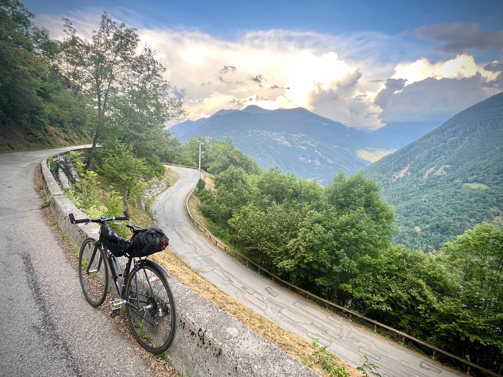
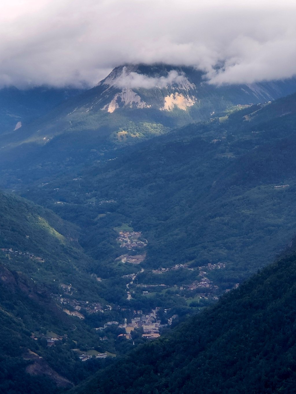
Col de la Coche from Moûtiers is a climb in the region Savoie. It is 13.3 km long and bridges 945 m of vertical ascent with an average gradient of 7.1%, resulting in a difficulty score of 751. The top of the ascent is located at 1437 m above sea level. Climbfinder users shared 2 reviews of this climb and uploaded 15 photos.
Road names: D 117 & Route du Col
3.0 by CromagnonThis is an automatic translation, the original language is: French.This climb is divided into two distinct sections. The first follows the D117 departmental road, which descends to Val-Thorens and, most notably, to the unmissable Col de Tougnète. It is a fairly well-maintained road, but busy. The gradients are moderate. The tarmac is in good condition, but there are a few fine cracks in places, which you’ll want to watch out for on the descent. After 5 kilometres, you turn right towards the Coche Dam and Fontaine-le-Puits. A pleasant little village with a wa... read more

Welcome! Please activate your account if you would like to share something. Look for the verification email in your inbox.
If you want to upload your photos, you need to create an account. It only takes 1 minute and it's completely free.
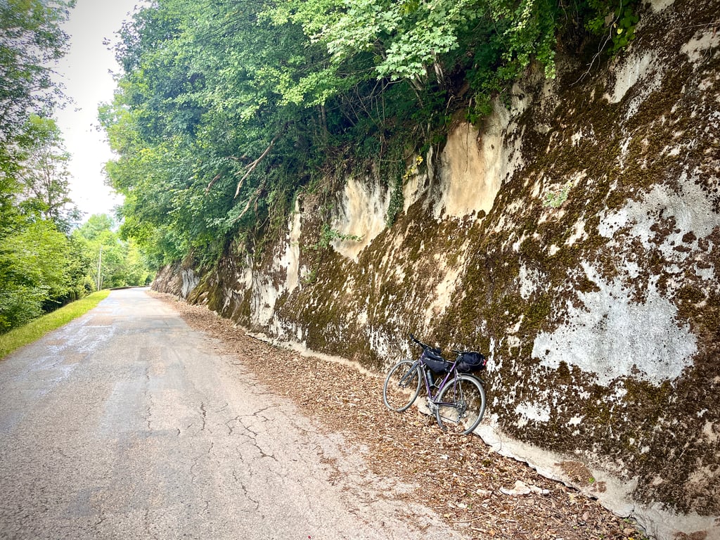
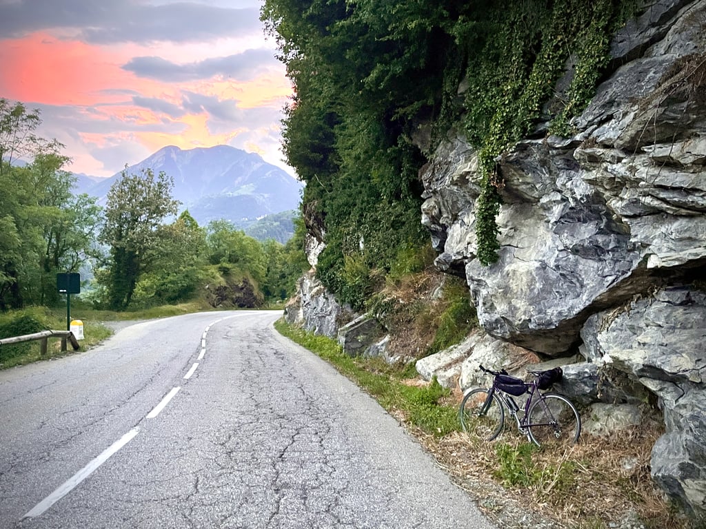
This climb is divided into two distinct sections. The first follows the D117 departmental road, which descends to Val-Thorens and, most notably, to the unmissable Col de Tougnète. It is a fairly well-maintained road, but busy. The gradients are moderate. The tarmac is in good condition, but there are a few fine cracks in places, which you’ll want to watch out for on the descent. After 5 kilometres, you turn right towards the Coche Dam and Fontaine-le-Puits. A pleasant little village with a water source.
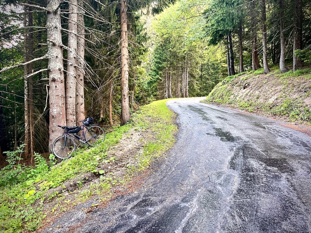
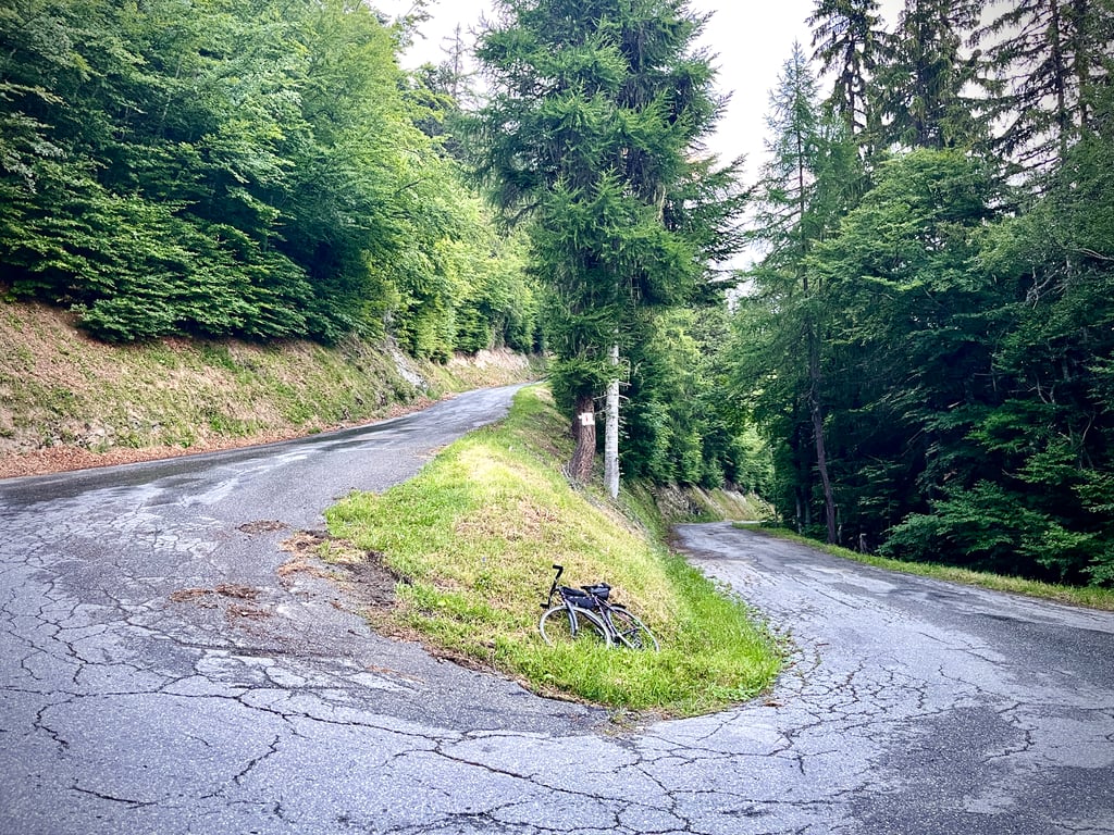
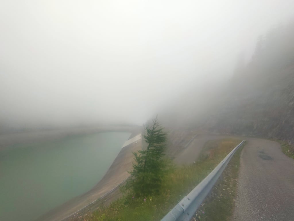
The road surface deteriorates, becoming a typical mountain road. There are a few patches of gravel and some minor imperfections, but nothing to worry about. However, the gradients are significantly steeper. The final 4 kilometres are well worth the effort. The 10% gradients are certainly there. This stretch through the forest is very pleasant. No traffic.
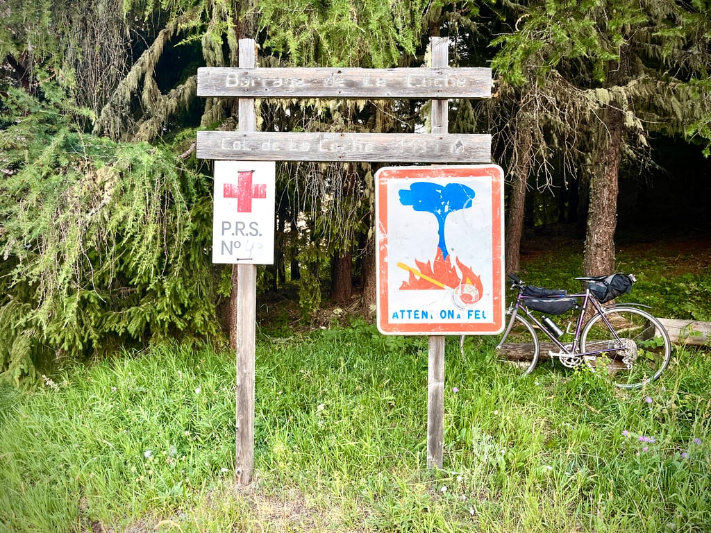
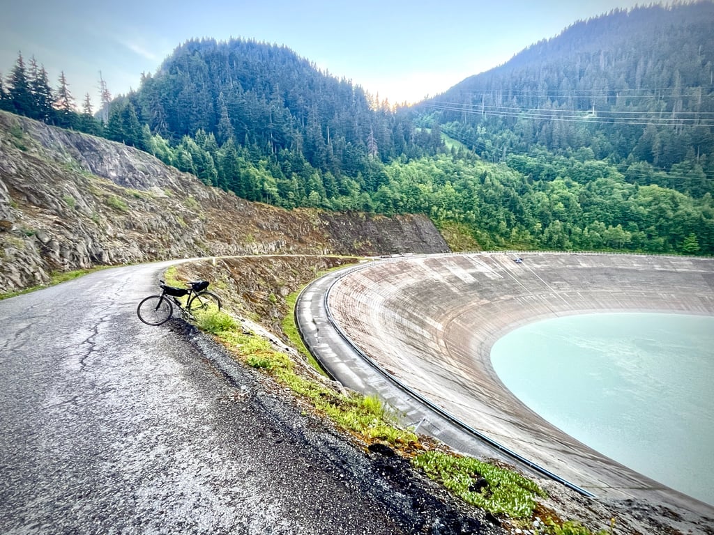
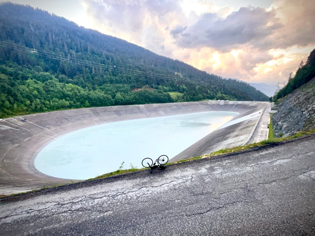
Do feel free to go through the barrier to take a look at the dam and the reservoir, which looks rather like a tempting velodrome.
Cette ascension se scinde en deux parties bien distinctes. La première emprunte la route départementale D117, qui descend à Val-Thorens et surtout à l’immanquable col de Tougnète. Une route assez propre, mais fréquentée. Les pourcentages sont contenus. Le macadam est bon, mais certains passages montrent quelques fines crevasses dont on se méfiera en descente. Apres 5 kilomètres, on bifurque à droite en direction du barrage de la Coche et de Fontaine-le-Puits. Petit village agréable et point d’eau.
La qualité de la route se dégrade pour devenir une route de montagne typique. Quelques marbrures, quelques petites imperfections, mais rien d’alarmant. Par contre, les pourcentages sont nettement plus épicés. Les 4 derniers kilomètres se méritent. Les 10% sont bien au rendez-vous. Ce passage dans la forêt est bien plaisant. Pas de circulation.
N’hésitez pas à passer la barrière pour aller jeter un œil sur le barrage et la retenue d’eau qui ressemble à un vélodrome bien tentant.
You first take the main road towards Val Thorens for a good 5 km.
Then you go straight towards la coche which fortunately cannot be missed.
Immediately you come to a steep section! The start of the climb is nicely regular but once you head towards la coche you have irregular sections which makes it tough.
The views vary from forest to beautiful vistas.
Personally I prefer this climb far above fall towers once you head towards la coche you have peace and quiet, enjoy the birds crickets butterflies and salamanders.
Pure enjoyment instead of the busy through road.
Je pakt eerst de doorgaande weg richting Val Thorens voor een goede 5 km.
Dan ga je rechtdoor richting la coche wat gelukkig niet te missen is.
Gelijk kom je op een steil stuk! Het begin van de klim is mooi regelmatig maar eenmaal richting la coche heb je onregelmatige stukken wat het zwaar maakt.
De uitzichten variëren van bos naar mooie vergezichten.
Persoonlijk verkies ik deze klim ver boven val torens zodra je richting la coche gaat heb je rust en stilte, geniet van de vogels krekels vlinders en salamanders.
Puur genieten in plaats van de drukke doorgaande weg.
| 7 km/h | 01:53:37 |
| 11 km/h | 01:12:18 |
| 15 km/h | 00:53:01 |
| 19 km/h | 00:41:51 |
This page is better in the app