View on map
© MapLibre | OpenStreetMap contributors
1%
2%
4%
6%
8%
10%
12%
15%
20%

Talltendre from Bellver de Cerdanya

3.0
1 review/story | Elevation profile | 6 photos
Tips nearby
Talltendre from Bellver de Cerdanya
transparant thumb
transparant thumb
Your achievable time
Calculating based on your best performances...
Relaxed
Maximum
W/kg
W/kg
W/kg
Analyse your climbing performance
Detailed insight into your climbing performance & automatically check off climbs
Based on your best performances.
Your best attempt:
Number of attempts:
Elevation profile Talltendre from Bellver de Cerdanya
paved
gravel
paved

Statistics

Difficulty points 610
Length 8 km
Average gradient 7.7%
Steepest 100 metres 14.3%
Total ascent 615 m

Short recap

Beautiful scenery
Hidden gem
21 hairpin turns
#44 toughest climb of Catalonia
#84 average steepest climb of Catalonia
Feedback about this climb?
Show climbs nearby Export to GPS device

Talltendre from Bellver de Cerdanya is a climb in the region Spanish Pyrenees. It is 8 km long and bridges 615 m of vertical ascent with an average gradient of 7.7%, resulting in a difficulty score of 610. The top of the ascent is located at 1587 m above sea level. Climbfinder users shared 1 review/story of this climb and uploaded 6 photos.

Road names: Carretera d'Ordèn

This is an automatic translation, the original language is: Dutch.
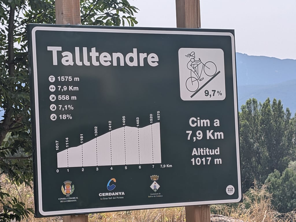
Actually, the profile of this climb on Climbfinder isn’t quite right. Personally, I think that if they’ve gone to the trouble of putting up ‘col’ signs in a region, that’s the definitive definition of the climb. There are signs, so this climb is actually the TALLTENDRE. This means you have to keep climbing for a few more kilometres than the profile on Climbfinder suggests. There’s a short descent along the way. But just keep going. The entire climb has some real calf-burner section... read more

Photos (6)

Talltendre from Bellver de Cerdanya

Your uploads (max 4)

Welcome! Please activate your account if you would like to share something. Look for the verification email in your inbox.

If you want to upload your photos, you need to create an account. It only takes 1 minute and it's completely free.

  • Receive free climbfinder goodies for your reviews & photos
  • Create a bucket list and check off conquered climbs
  • Add missing climbs
Continue with GoogleContinue with Google Continue with FacebookContinue with Facebook Continue with AppleContinue with Apple Sign up with email
By signing up you agree to our terms of service and confirm that you have read our privacy & content policy.

Reviews (1)

5.0
4.0
3.0
2.0
1.0
Joeri Laureys
1 w 3.0
This is an automatic translation, the original language is: Dutch. Show original

Actually, the profile of this climb on Climbfinder isn’t quite right. Personally, I think that if they’ve gone to the trouble of putting up ‘col’ signs in a region, that’s the definitive definition of the climb.
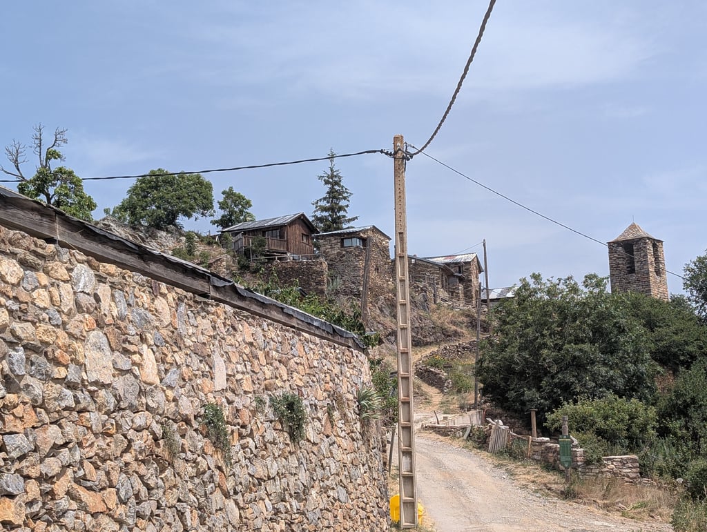
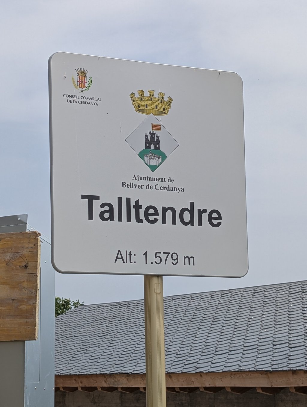
There are signs, so this climb is actually the TALLTENDRE. This means you have to keep climbing for a few more kilometres than the profile on Climbfinder suggests. There’s a short descent along the way. But just keep going.
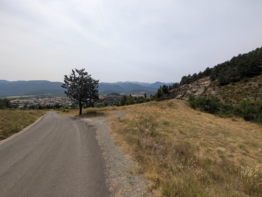
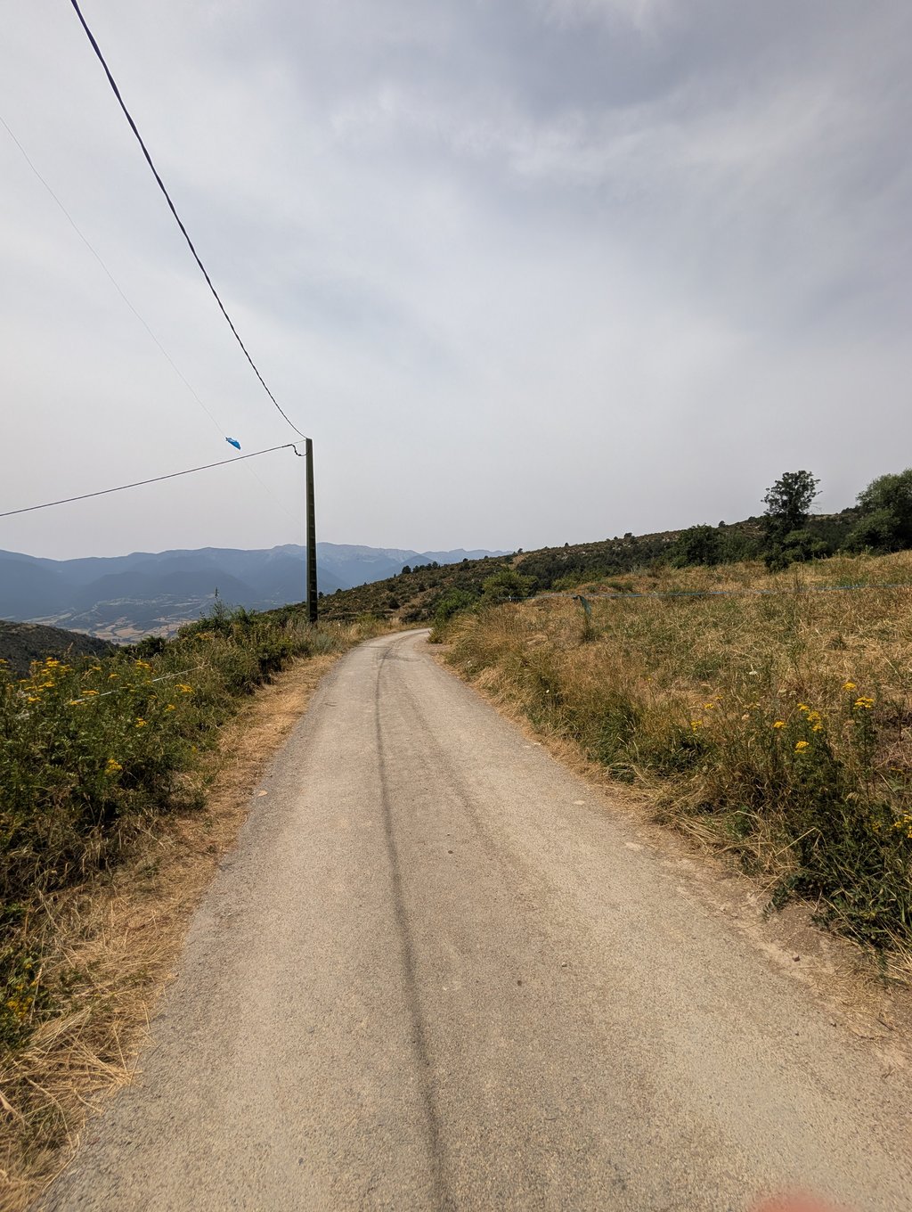
The entire climb has some real calf-burner sections. But most cyclists will make it to the top. Along the way, Hennie, there are some lovely views and you can look out over the Cerdanya.

Eigenlijk klopt het profiel van deze klim op climbfinder niet helemaal. Persoonlijk vind ik dat als ze in een regio de moeite doen om col-bordjes te zetten, dat dat de finale definitie van de klim is.l
Er staan bordjes dus deze klim is eigenlijk de TALLTENDRE. Je moet dus nog enkele kilometers verder klimmen dan het profiel op climbfinder. Er zit een kleine afdaling in. Maar zet toch maar door.
De totale klim heeft kuitenbijter stroken. Maar een beetje fietsers haalt de top wel. Tussendoor Hennie mooie vergezichten en kijk je uit over de Cerdanya.

Dashboard

Climbing times

7 km/h 01:08:10
11 km/h 00:43:22
15 km/h 00:31:48
19 km/h 00:25:06

Road surface condition

0% 100% 0%
Based on 1 vote
Share your knowledge. What was the road condition during your ascent?

Traffic

100% 0% 0%
Based on 1 vote
Your experience counts. How much traffic did you encounter during the climb?

Frequently Asked Questions

Talltendre from Bellver de Cerdanya is a challenging ascent. For this type of climbing, we recommend mountain gearing, specifically a compact system. This means a small front chainring of 34 teeth, combined with a rear cassette where, depending on your level, strength, and experience, you choose a sprocket with 30, 32, or even 34 teeth. Remember that a smooth cadence is always more efficient!

Talltendre from Bellver de Cerdanya is a first-category climb: long and tough. Do not underestimate this climb. Many famous Tour de France cols fall into this category. Prepare for a long, challenging ride. Only well-trained riders will reach the top smoothly. Make sure you have a road bike with climbing gears and enough training; otherwise, it will be a struggle.

Talltendre from Bellver de Cerdanya is 8 km long.

The average gradient of Talltendre from Bellver de Cerdanya is 7.7%.

Talltendre from Bellver de Cerdanya has a steepest segment with an average gradient of 14.3%.

The summit of Talltendre from Bellver de Cerdanya is at 1587 m.

At a slow pace of 7 km/h, it takes about 01:08:10 to climb Talltendre from Bellver de Cerdanya. At 11 km/h the time is 00:43:22, and at 15 km/h 00:31:48. For the fastest cyclists, 00:25:06 is an achievable time.

Talltendre from Bellver de Cerdanya is located in the region Catalonia in Spain.

This page is better in the app

Climbfinder app
Climbfinder
(Free)
Open