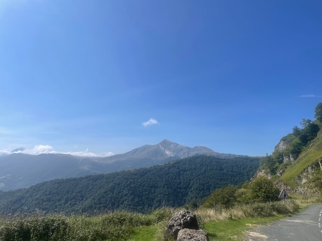
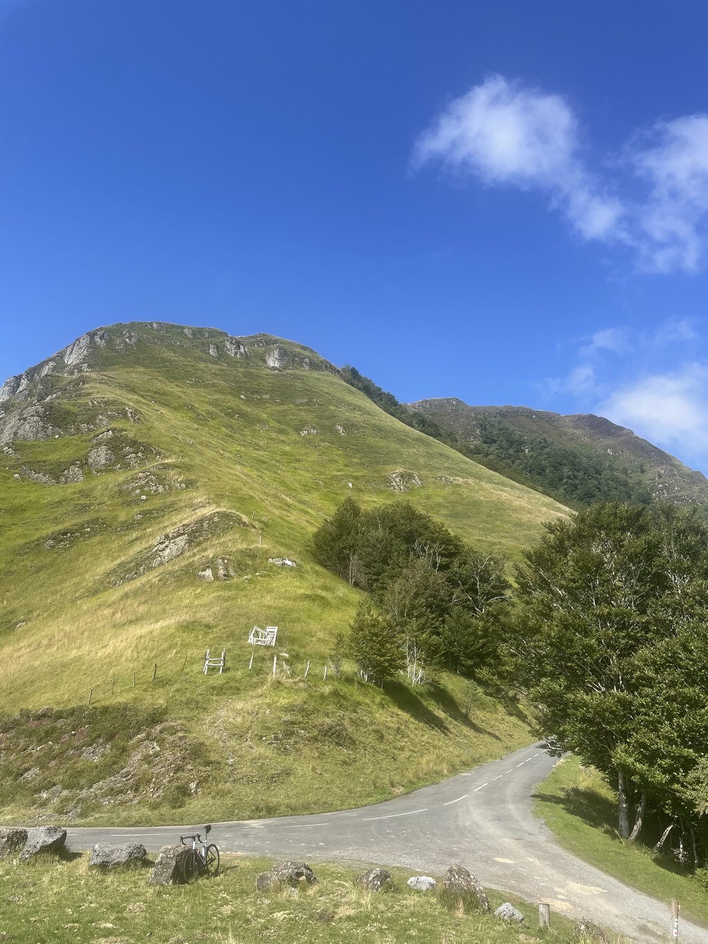
Col Sensibilé from Alçay is a climb in the region Pyrénées-Atlantiques. It is 26.3 km long and bridges 1477 m of vertical ascent with an average gradient of 5.6%, resulting in a difficulty score of 1198. The top of the ascent is located at 1544 m above sea level. Climbfinder users shared 1 review/story of this climb and uploaded 5 photos.
This is an automatic translation, the original language is: Dutch.
This was definitely a special trip, to the col Sensibile.
The route actually consists of several parts.
The 1st part follows the Ahusquy (https://climbfinder.com/nl/beklimmingen/ahusquy-tardets) from Tardets/Alcabehety.
It then turns south and follows a narrow road of about 12 km, where you don't really feel like you're gaining much altitude, as you descend several long stretches here as well. Here you really are in the middle of nowhere, not a human, car, cyclist or hiker to be see...read more
Photos (5)
Welcome! Please activate your account if you would like to share something. Look for the verification email in your inbox.
This is an automatic translation, the original language is: Dutch.
Show original
This was definitely a special trip, to the col Sensibile.
The route actually consists of several parts.
The 1st part follows the Ahusquy (https://climbfinder.com/nl/beklimmingen/ahusquy-tardets) from Tardets/Alcabehety.
It then turns south and follows a narrow road of about 12 km, where you don't really feel like you're gaining much altitude, as you descend several long stretches here as well. Here you really are in the middle of nowhere, not a human, car, cyclist or hiker to be seen, only the occasional cow blocking the road:). Road surface moderate at times.
Then you come out of the main road from Larrau to Iraty (right on the col de Bargagi), follow this for a few 100 metres, until Chalets d'Iraty. No cafe/terrace oid here, by the way, but a sort of visitor centre with a coffee machine :)
There you turn off the main road to the left, and another km or 3 up to the col Sensibile. It was that I had looked up where it was beforehand, because there was no sign at the spot itself. But maybe I looked over it because of the fog and bad weather.
Finally down to St Jean Pied de Port via Iraty and the col de Burdincurutcheta . Great and beautiful descent.
In summary, a very nice, beautiful, surprising and peaceful route. Really enjoy the hills, mountains and views in the French Pays Basque. Highly recommended!
Dit was zeker een bijzondere tocht, naar de col Sensibile.
De route bestaat eigenlijk uit meerdere delen.
Het 1e deel volgt de Ahusquy (https://climbfinder.com/nl/beklimmingen/ahusquy-tardets) vanaf Tardets/Alcabehety.
Vervolgens buigt ie naar het zuiden af, en volgt er een smalle weg van een km of 12, waarbij je niet echt het idee hebt dat je veel hoogte wint, omdat je hier meerdere lange stukken ook weer daalt. Hier zit je overigens echt in the middle of nowhere, geen mens, auto fietser of wandelaar te bekennen, alleen af en toe een koe de de weg blokkeert:). Wegdek af en toe matig.
Dan kom je op uit de doorgaande weg vanuit Larrau naar Iraty (precies op de col de Bargagi), deze volg je een paar 100 meter, tot Chalets d'Iraty. Hier overigens geen cafe/terras oid maar een soort bezoekerscentrum met een koffieautomaat:)
Daar ga je van de hoofdweg af naar links, en nog een km of 3 omhoog naar de col Sensibile. Het was dat ik van te voren had opgezocht waar ie was, want op de plek zelf was geen enkele aanduiding te zien. Maar misschien keek ik eroverheen door de mist en het slechte weer.
Tenslotte naar beneden naar St Jean Pied de Port via Iraty en de col de Burdincurutcheta . Geweldige en prachtige afdaling.
Samengevat, een erg leuke, mooie, verrassende en rustige route. Echt genieten van de heuvels, bergen en uitzichten in het franse Pays Basque. Aanrader!
Share your knowledge. What was the road condition during your ascent?
Traffic
0% 0% 0%
Based on 0 votes
Your experience counts. How much traffic did you encounter during the climb?
Frequently Asked Questions
You don't need special gearing for Col Sensibilé from Alçay. The slope isn't long or steep enough to require much shifting down. You can conquer this climb on power alone. However, a compact gearing system with a smallest front chainring of 34 and largest rear sprocket of 28 or 30 is always nice if you enjoy cycling uphill. This helps maintain a smooth cadence.
Col Sensibilé from Alçay belongs to the Hors Catégorie, the top category. These are legendary and very tough climbs. A solid cycling condition, experience, and a good climbing gear ratio are essential to maintain a smooth cadence and complete the climb comfortably.
Col Sensibilé from Alçay is 26.3 km long.
The average gradient of Col Sensibilé from Alçay is 5.6%.
Col Sensibilé from Alçay has a steepest segment with an average gradient of 11.9%.
The summit of Col Sensibilé from Alçay is at 1544 m.
At a slow pace of 7 km/h, it takes about 03:45:25 to climb Col Sensibilé from Alçay. At 11 km/h the time is 02:23:26, and at 15 km/h 01:45:11. For the fastest cyclists, 01:23:02 is an achievable time.