View on map
© MapLibre | OpenStreetMap contributors
1%
2%
4%
6%
8%
10%
12%
15%
20%

Chindonne from Massongex

4.0
1 review/story | Elevation profile | 2 photos
Tips nearby
Chindonne from Massongex
transparant thumb
transparant thumb
transparant thumb
transparant thumb
transparant thumb
transparant thumb
Your achievable time
Calculating based on your best performances...
Relaxed
Maximum
W/kg
W/kg
W/kg
Analyse your climbing performance
Detailed insight into your climbing performance & automatically check off climbs
Based on your best performances.
Your best attempt:
Number of attempts:
Elevation profile Chindonne from Massongex

Statistics

Difficulty points 1091
Length 15.6 km
Average gradient 7.7%
Steepest 100 metres 15.1%
Total ascent 1211 m

Short recap

12 hairpin turns
#95 toughest climb of Switzerland
#82 most elevation gain of Switzerland
#47 longest climb of Valais
#72 average steepest climb of Valais
Feedback about this climb?
Show climbs nearby Export to GPS device

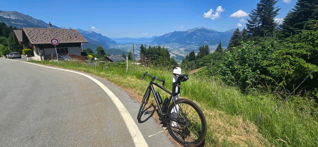
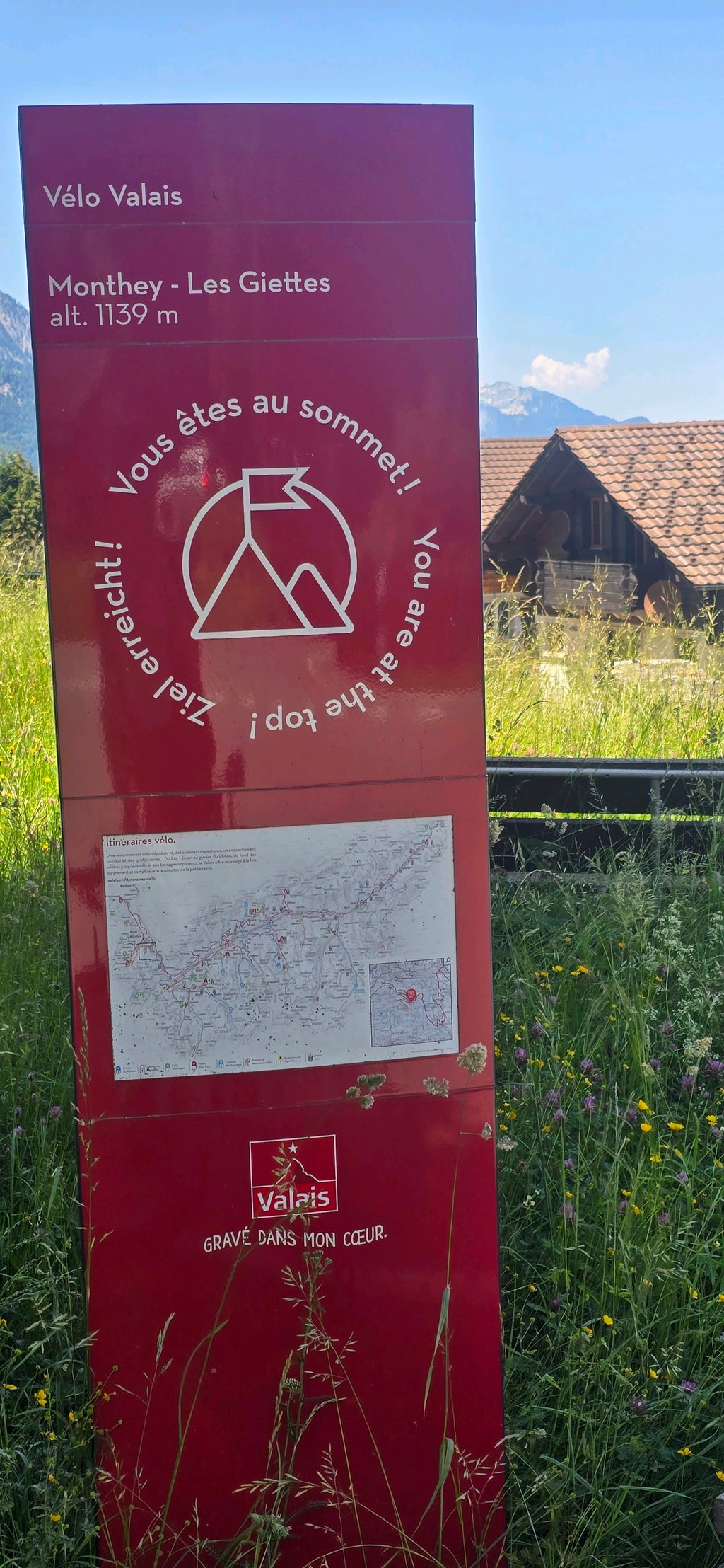
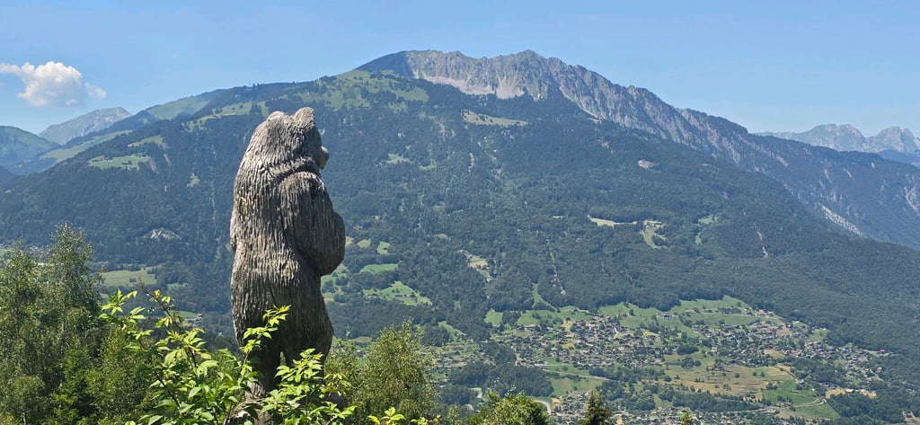
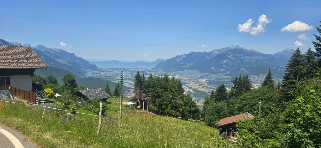
Chindonne from Massongex is a climb in the region Valais. It is 15.6 km long and bridges 1211 m of vertical ascent with an average gradient of 7.7%, resulting in a difficulty score of 1091. The top of the ascent is located at 1603 m above sea level. Climbfinder users shared 1 review/story of this climb and uploaded 2 photos.

Road names: Route de Vérossaz, Route de Daviaz, Route de la Cime de l'Est, Route de l'Ecole, Route de la Doey, Route de Vérossaz & Route des Cerniers

4.0 by LorenzoGbr
I did this to Les Giettes: it's a signposted climb, there should be panels at each km, but I took the steeper secondary path up to Vérossaz. There is a fountain at the Giettes. The gradients in the first half are quite steep, often around 13%, but the climb itself was in a pleasant shade with almost no traffic. At the Giettes (nice view of the Rhône valley!) you can either continue climbing up to Chindonne, or descend to Monthey or towards Champéry (chemin des Rives).... read more

Photos (2)

Chindonne from Massongex
transparant thumb
transparant thumb
transparant thumb
transparant thumb

Your uploads (max 4)

Welcome! Please activate your account if you would like to share something. Look for the verification email in your inbox.

If you want to upload your photos, you need to create an account. It only takes 1 minute and it's completely free.

  • Receive free climbfinder goodies for your reviews & photos.
  • Create a bucket list and check off conquered climbs.
  • Add missing climbs.
Continue with GoogleContinue with Google Continue with FacebookContinue with Facebook Continue with AppleContinue with Apple Sign up with email
By signing up you agree to our terms of service and confirm that you have read our privacy & content policy.

Reviews (1)

5.0
4.0
3.0
2.0
1.0
LorenzoGbr
1 y 4.0

I did this to Les Giettes: it's a signposted climb, there should be panels at each km, but I took the steeper secondary path up to Vérossaz. There is a fountain at the Giettes.
The gradients in the first half are quite steep, often around 13%, but the climb itself was in a pleasant shade with almost no traffic. At the Giettes (nice view of the Rhône valley!) you can either continue climbing up to Chindonne, or descend to Monthey or towards Champéry (chemin des Rives).

Chindonne from Massongex
Dashboard

Climbing times

7 km/h 02:13:56
11 km/h 01:25:14
15 km/h 01:02:30
19 km/h 00:49:20

Road surface condition

100% 0% 0%
Based on 1 vote
Share your knowledge. What was the road condition during your ascent?

Traffic

100% 0% 0%
Based on 1 vote
Your experience counts. How much traffic did you encounter during the climb?

Frequently Asked Questions

Chindonne can be cycled from 2 sides. Chindonne from Massongex is the most popular side, but the summit can also be reached via Chindonne from Monthey.

Chindonne from Massongex is a challenging ascent. For this type of climbing, we recommend mountain gearing, specifically a compact system. This means a small front chainring of 34 teeth, combined with a rear cassette where, depending on your level, strength, and experience, you choose a sprocket with 30, 32, or even 34 teeth. Remember that a smooth cadence is always more efficient!

Chindonne from Massongex belongs to the Hors Catégorie, the top category. These are legendary and very tough climbs. A solid cycling condition, experience, and a good climbing gear ratio are essential to maintain a smooth cadence and complete the climb comfortably.

Chindonne from Massongex is 15.6 km long.

The average gradient of Chindonne from Massongex is 7.7%.

Chindonne from Massongex has a steepest segment with an average gradient of 15.1%.

The summit of Chindonne from Massongex is at 1603 m.

At a slow pace of 7 km/h, it takes about 02:13:56 to climb Chindonne from Massongex. At 11 km/h the time is 01:25:14, and at 15 km/h 01:02:30. For the fastest cyclists, 00:49:20 is an achievable time.

Chindonne from Massongex is located in the region Valais in Switzerland.

This page is better in the app

Climbfinder app
Climbfinder
(Free)
Open