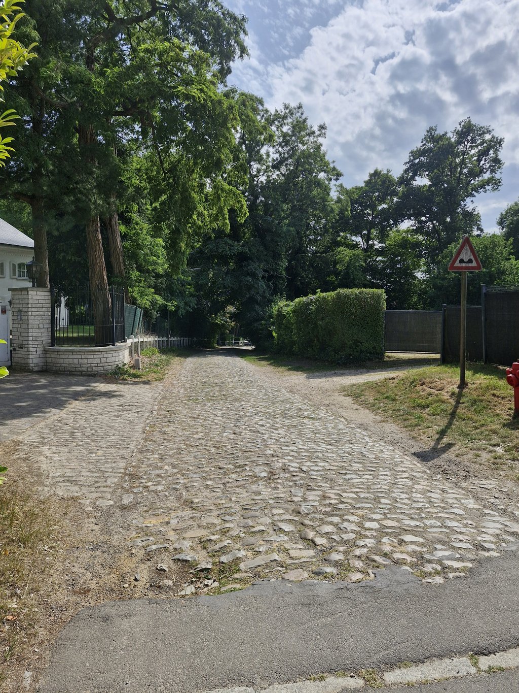
View on map
© MapLibre | OpenStreetMap contributors
1%
2%
4%
6%
8%
10%
12%
15%
20%

Chemin des Sept Fontaines from Dworp

1.5
2 reviews | Elevation profile | 3 photos
In some places the road surface of this climb is bad, but it can be ridden with a road bike.
Tips nearby
Chemin des Sept Fontaines from Dworp
transparant thumb
transparant thumb
transparant thumb
transparant thumb
transparant thumb
Your achievable time
Calculating based on your best performances...
Relaxed
Maximum
W/kg
W/kg
W/kg
Analyse your climbing performance
Detailed insight into your climbing performance & automatically check off climbs
Based on your best performances.
Your best attempt:
Number of attempts:
Elevation profile Chemin des Sept Fontaines from Dworp
cobbles (along the entire length)

Statistics

Difficulty points 28
Length 1.3 km
Average gradient 2.4%
Steepest 100 metres 9.8%
Total ascent 31 m

Short recap

Cobbles
Bad road
#83 toughest climb of Pajottenland
#98 longest climb of Pajottenland
Feedback about this climb?
Show climbs nearby Export to GPS device

Chemin des Sept Fontaines from Dworp is a climb in the region Pajottenland. It is 1.3 km long and bridges 31 m of vertical ascent with an average gradient of 2.4%, resulting in a difficulty score of 28. The top of the ascent is located at 107 m above sea level. Climbfinder users shared 2 reviews of this climb and uploaded 3 photos.

Road names: Rue du Meunier - Mulderstraat & Chemin des 7 Fontaines

2.0 by WouterDK
This is an automatic translation, the original language is: Dutch.
Heavy cobbled track do probably as old as Belgium. If you have an mtb or gravel bike I would still recommend this one. If only for the beautiful scenery that is Sept-Fontaines!... read more

Photos (3)

Chemin des Sept Fontaines from Dworp
transparant thumb
transparant thumb
transparant thumb

Your uploads (max 4)

Welcome! Please activate your account if you would like to share something. Look for the verification email in your inbox.

If you want to upload your photos, you need to create an account. It only takes 1 minute and it's completely free.

  • Receive free climbfinder goodies for your reviews & photos.
  • Create a bucket list and check off conquered climbs.
  • Add missing climbs.
Continue with GoogleContinue with Google Continue with FacebookContinue with Facebook Continue with AppleContinue with Apple Sign up with email
By signing up you agree to our terms of service and confirm that you have read our privacy & content policy.

Reviews (2)

5.0
4.0
3.0
2.0
1.0
WouterDK
2 y 2.0
This is an automatic translation, the original language is: Dutch. Show original

Heavy cobbled track do probably as old as Belgium. If you have an mtb or gravel bike I would still recommend this one. If only for the beautiful scenery that is Sept-Fontaines!

Zware kasseibaan die waarschijnlijk even oud als België is en niet onderhouden wordt, denk ik. Als je een mtb of gravelfiets hebt zou ik deze nog wel aanraden. Al is het enkel voor de prachtige omgeving die Sept-Fontaines is!

Dashboard
Franck_Pastor
2 y 1.0
This is an automatic translation, the original language is: French. Show original

To be avoided, and even shunned if your road bike is fitted with thin tyres. The cobbles are particularly rough and disjointed, and in low season they are covered in mud and dead leaves in many places, which makes getting over them a balancing act...

À éviter, et même à fuir si votre vélo de route est muni de pneus fins. Les pavés sont particulièrement grossiers et disjoints, et en basse saison ils sont tapissés de boue et de feuilles mortes à de nombreux endroits, ce qui transforme leur passage en numéro d'équilibriste…

Dashboard

Climbing times

7 km/h 00:11:13
11 km/h 00:07:08
15 km/h 00:05:14
19 km/h 00:04:08

Road surface condition

0% 0% 100%
Based on 2 votes
Share your knowledge. What was the road condition during your ascent?

Traffic

100% 0% 0%
Based on 2 votes
Your experience counts. How much traffic did you encounter during the climb?

Frequently Asked Questions

You don't need special gearing for Chemin des Sept Fontaines from Dworp. The slope isn't long or steep enough to require much shifting down. You can conquer this climb on power alone. However, a compact gearing system with a smallest front chainring of 34 and largest rear sprocket of 28 or 30 is always nice if you enjoy cycling uphill. This helps maintain a smooth cadence.

Chemin des Sept Fontaines from Dworp falls into the 5th category. With good fitness, you can ride it up with speed and power. If you have less training, shift down and climb smoothly.

Chemin des Sept Fontaines from Dworp is 1.3 km long.

The average gradient of Chemin des Sept Fontaines from Dworp is 2.4%.

Chemin des Sept Fontaines from Dworp has a steepest segment with an average gradient of 9.8%.

The summit of Chemin des Sept Fontaines from Dworp is at 107 m.

At a slow pace of 7 km/h, it takes about 00:11:13 to climb Chemin des Sept Fontaines from Dworp. At 11 km/h the time is 00:07:08, and at 15 km/h 00:05:14. For the fastest cyclists, 00:04:08 is an achievable time.

Chemin des Sept Fontaines from Dworp is located in the region Walloon Brabant in Belgium.

This page is better in the app

Climbfinder app
Climbfinder
(Free)
Open