View on map
© MapLibre | OpenStreetMap contributors
1%
2%
4%
6%
8%
10%
12%
15%
20%

Bois des Houlpais from Jupille-sur-Meuse

3.0
5 reviews | Elevation profile | 4 photos
Tips nearby
Bois des Houlpais from Jupille-sur-Meuse
transparant thumb
transparant thumb
transparant thumb
transparant thumb
Your achievable time
Calculating based on your best performances...
Relaxed
Maximum
W/kg
W/kg
W/kg
Analyse your climbing performance
Detailed insight into your climbing performance & automatically check off climbs
Based on your best performances.
Your best attempt:
Number of attempts:
Elevation profile Bois des Houlpais from Jupille-sur-Meuse

Statistics

Difficulty points 57
Length 2.2 km
Average gradient 5%
Steepest 100 metres 6.1%
Total ascent 110 m
Feedback about this climb?
Show climbs nearby Export to GPS device

Bois des Houlpais from Jupille-sur-Meuse is a climb in the region Pays de Herve. It is 2.2 km long and bridges 110 m of vertical ascent with an average gradient of 5%, resulting in a difficulty score of 57. The top of the ascent is located at 174 m above sea level. Climbfinder users shared 5 reviews of this climb and uploaded 4 photos.

Road name: Rue de la Forêt

3.0 by WouterDK
This is an automatic translation, the original language is: Dutch.
A new road surface is currently being laid so it is currently a gravel climb. Definitely doable with a racing bike. Hopefully there will be a nice new layer of asphalt here soon, because then you can definitely ride up this one at high speed.... read more

Photos (4)

Bois des Houlpais from Jupille-sur-Meuse
transparant thumb
transparant thumb

Your uploads (max 4)

Welcome! Please activate your account if you would like to share something. Look for the verification email in your inbox.

If you want to upload your photos, you need to create an account. It only takes 1 minute and it's completely free.

  • Receive free climbfinder goodies for your reviews & photos.
  • Create a bucket list and check off conquered climbs.
  • Add missing climbs.
Continue with GoogleContinue with Google Continue with FacebookContinue with Facebook Continue with AppleContinue with Apple Sign up with email
By signing up you agree to our terms of service and confirm that you have read our privacy & content policy.

Reviews (5)

5.0
4.0
3.0
2.0
1.0
WouterDK
3 Mo 3.0
This is an automatic translation, the original language is: Dutch. Show original

A new road surface is currently being laid so it is currently a gravel climb. Definitely doable with a racing bike. Hopefully there will be a nice new layer of asphalt here soon, because then you can definitely ride up this one at high speed.

Er wordt momenteel een nieuw wegdek gelegd dus momenteel is het een gravelklim. Zeker doenbaar met een koersfiets. Hopelijk komt hier binnenkort een mooie nieuwe laag asfalt, want dan kan je deze zeker aan hoog tempo op rijden.

Dashboard
_superver
8 Mo 3.0
This is an automatic translation, the original language is: Dutch. Show original

Easy nice running climb. If you don't want steep walls (because there are plenty of them here), this slope is a very good one.

Gemakkelijke mooi lopende klim. Als je geen steile wanden wil (want die zijn hier genoeg) dan heb je aan deze helling een zeer goede.

Dashboard
lukad
9 Mo 3.0 via the Climbfinder app
This is an automatic translation, the original language is: Dutch. Show original

Due to work I had the track to myself, wouldn't go through with thin tyres though. A nice climb where you can pay good attention to cadence.

Door werken had ik de baan voor mezelf, zou er wel niet doorgaan met dunne bandjes. Een mooie klim waar je goed op cadans kan letten.

Dashboard
BikerJohan
1 y 3.0
This is an automatic translation, the original language is: Dutch. Show original

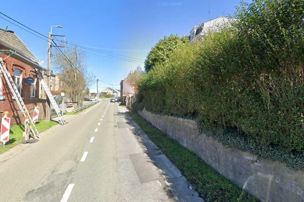
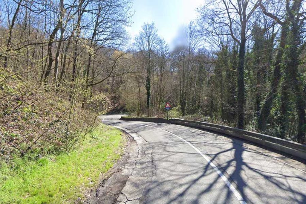
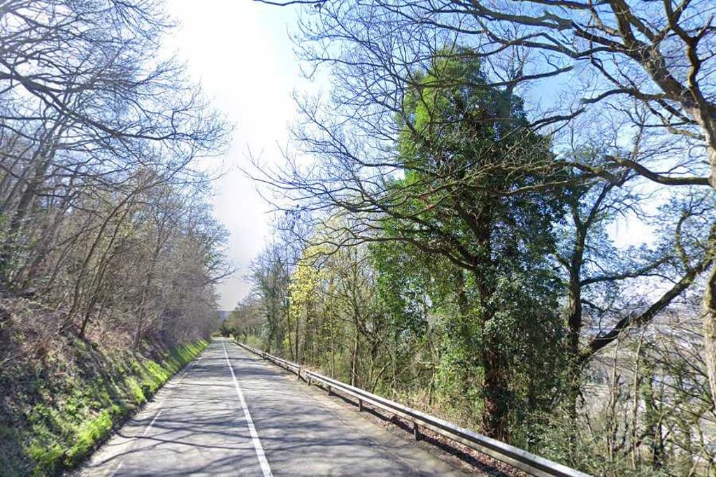
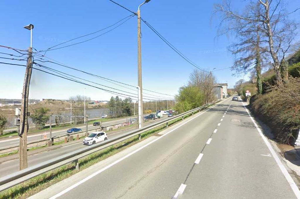
Climb of over 2 kilometres on the (especially on weekdays) busy road from Jupille-sur-Meuse to Xhamée. The steepest part is in the first 600 metres. This is followed by a stretch of over 1 kilometre with a tight gradient of 4-5%. The last 400 metres level off to the top as false flat.

Klim van ruim 2 kilometer over de (zeker doordeweeks) drukke weg van Jupille-sur-Meuse naar Xhamée. Het steilste stuk zit in de eerste 600 meter. Daarna volgt een stuk van ruim 1 kilometer met een strak stijgingspercentage van 4-5%. De laatste 400 meter vlak het tot de top af als vals plat.

Dashboard
Tryphon_04
2 y 3.0
This is an automatic translation, the original language is: French. Show original

It's a climb with a constant, fairly gentle gradient, and is the least difficult ascent to the heights of Cheratte-Wandre. It is more or less the same as the Côte de Forêt at Trooz, the only difference being that there are a lot more fast-moving cars on this climb.
The road has recently been resurfaced and is therefore in very good condition.

C'est une montée avec une pente constante et assez faible, c'est la montée la moins difficile pour accéder aux hauteurs de Cheratte-Wandre. Elle est plus ou moins semblable à la côte de Forêt à Trooz, à la seule différence qu'il y a beaucoup plus de voitures qui roulent vite dans cette montée-ci.
La route a été récemment refaite et elle est donc dans un très bon état.

Dashboard

Climbing times

7 km/h 00:18:41
11 km/h 00:11:53
15 km/h 00:08:43
19 km/h 00:06:53

Road surface condition

0% 0% 100%
Based on 1 vote
Share your knowledge. What was the road condition during your ascent?

Traffic

100% 0% 0%
Based on 1 vote
Your experience counts. How much traffic did you encounter during the climb?

Frequently Asked Questions

You don't need special gearing for Bois des Houlpais from Jupille-sur-Meuse. The slope isn't long or steep enough to require much shifting down. You can conquer this climb on power alone. However, a compact gearing system with a smallest front chainring of 34 and largest rear sprocket of 28 or 30 is always nice if you enjoy cycling uphill. This helps maintain a smooth cadence.

Bois des Houlpais from Jupille-sur-Meuse falls into the 5th category. With good fitness, you can ride it up with speed and power. If you have less training, shift down and climb smoothly.

Bois des Houlpais from Jupille-sur-Meuse is 2.2 km long.

The average gradient of Bois des Houlpais from Jupille-sur-Meuse is 5%.

Bois des Houlpais from Jupille-sur-Meuse has a steepest segment with an average gradient of 6.1%.

The summit of Bois des Houlpais from Jupille-sur-Meuse is at 174 m.

At a slow pace of 7 km/h, it takes about 00:18:41 to climb Bois des Houlpais from Jupille-sur-Meuse. At 11 km/h the time is 00:11:53, and at 15 km/h 00:08:43. For the fastest cyclists, 00:06:53 is an achievable time.

Bois des Houlpais from Jupille-sur-Meuse is located in the region Liège Province in Belgium.

This page is better in the app

Climbfinder app
Climbfinder
(Free)
Open