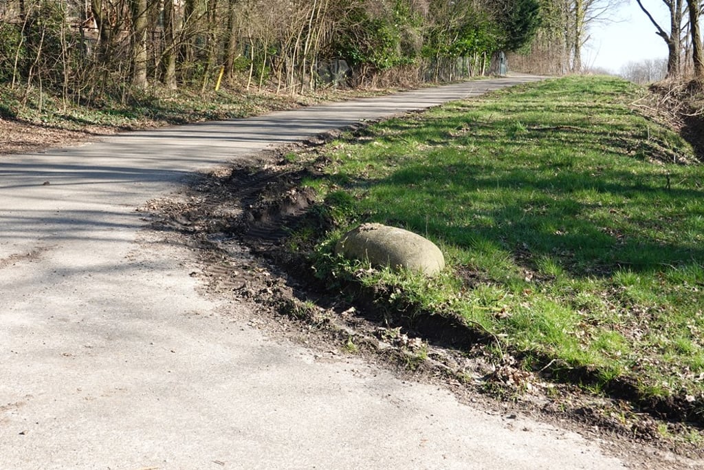
View on map
© MapLibre | OpenStreetMap contributors
1%
2%
4%
6%
8%
10%
12%
15%
20%

Blokweg via Stevensweg

2.3
3 reviews | Elevation profile | 6 photos
This climb contains both pieces of bad road surface and gravel sections, but can be ridden with a road bike.
Tips nearby
Blokweg via Stevensweg
transparant thumb
transparant thumb
Your achievable time
Calculating based on your best performances...
Relaxed
Maximum
W/kg
W/kg
W/kg
Analyse your climbing performance
Detailed insight into your climbing performance & automatically check off climbs
Based on your best performances.
Your best attempt:
Number of attempts:
Elevation profile Blokweg via Stevensweg
paved
gravel

Statistics

Difficulty points 45
Length 2.1 km
Average gradient 3.4%
Steepest 100 metres 9%
Total ascent 72 m

Short recap

Gravel
Bad road
#64 toughest climb of Netherlands
#74 most elevation gain of Netherlands
#54 longest climb of Limburg
Feedback about this climb?
Show climbs nearby Export to GPS device

Blokweg via Stevensweg is a climb in the region South Limburg. It is 2.1 km long and bridges 72 m of vertical ascent with an average gradient of 3.4%, resulting in a difficulty score of 45. The top of the ascent is located at 137 m above sea level. Climbfinder users shared 3 reviews of this climb and uploaded 6 photos.

Road names: Meerssenderweg, Stevensweg & Blokweg
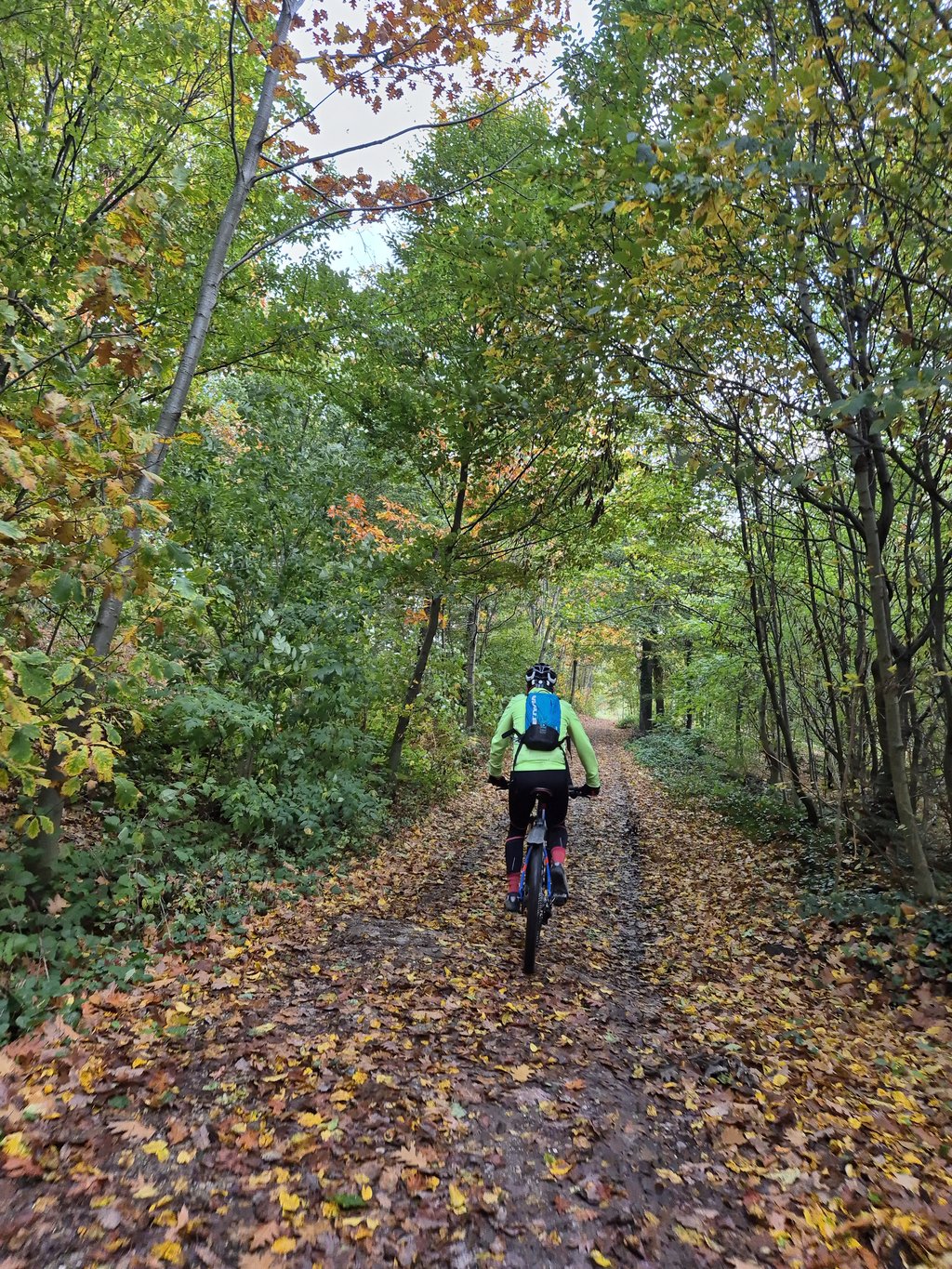
1.0 by Jarin
This is an automatic translation, the original language is: Dutch.
This climb is absolutely NOT RECOMMENDED for cyclists. The Valkenburg (Houthem) MTB route also takes this climb and for a reason; this climb is thus only suitable for gravel bikes and MTB's. Therefore only 1 star.... read more

Photos (6)

Blokweg via Stevensweg

Your uploads (max 4)

Welcome! Please activate your account if you would like to share something. Look for the verification email in your inbox.

If you want to upload your photos, you need to create an account. It only takes 1 minute and it's completely free.

  • Receive free climbfinder goodies for your reviews & photos.
  • Create a bucket list and check off conquered climbs.
  • Add missing climbs.
Continue with GoogleContinue with Google Continue with FacebookContinue with Facebook Continue with AppleContinue with Apple Sign up with email
By signing up you agree to our terms of service and confirm that you have read our privacy & content policy.

Reviews (3)

5.0
4.0
3.0
2.0
1.0
Jarin
3 Mo 1.0 via the Climbfinder app
This is an automatic translation, the original language is: Dutch. Show original

This climb is absolutely NOT RECOMMENDED for cyclists. The Valkenburg (Houthem) MTB route also takes this climb and for a reason; this climb is thus only suitable for gravel bikes and MTB's. Therefore only 1 star.

Deze klim is absoluut AF TE RADEN voor wielrenners. De Valkenburg (Houthem) MTB route neemt deze klim ook en voor een reden; deze klim is dus enkel geschikt voor gravelfietsen en MTB's. Daarom maar 1 ster.

Dashboard
DennisColijn
5 Mo 3.0 via the Climbfinder app
This is an automatic translation, the original language is: Dutch. Show original

The road surface is terrible, but the plateau where you eventually reach the top is totally worth it.

Het wegdek is verschrikkelijk, maar het plateau waar je uiteindelijk boven komt is het helemaal waard.

Dashboard
Fedor
7 Mo 3.0
This is an automatic translation, the original language is: Dutch. Show original

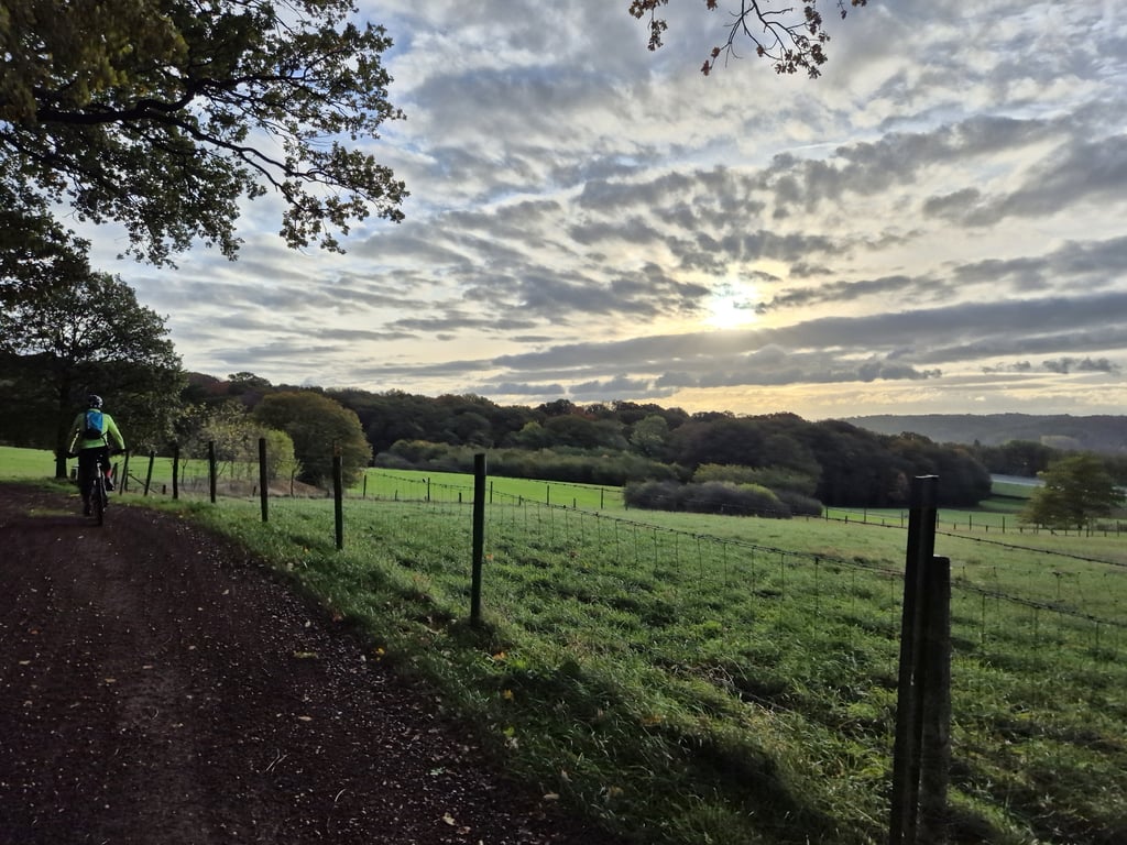
Although the first part runs alongside the motorway, you don't notice it much and ride uphill on a car-free road through nice surroundings. Further on, the tarmac ends at the left-hand bend near a castle and the road changes into a sometimes rough gravel road with a considerable rise in the forest. After turning left and then right, a route through open agricultural land follows. At the fifth junction, turn left to quickly join the asphalt again.

Hoewel het eerste deel langs de snelweg loopt, merk je daar weinig van en rijdt je over een autovrij weggetje door een leuke omgeving omhoog. Verderop houdt in de haakse bovht naar links bij een kasteel het asfalt op en gaat de weg over in een soms wat grove gravelweg waarbij het in het bos behoorlijk oploopt. Na links- en daarna rechtsaf te zijn geslagen volgt een route door open agrarisch gebied. Op de 5-sprong schuin links om weer snel op asfalt uit te komen.

Blokweg via Stevensweg
Dashboard

Climbing times

7 km/h 00:18:09
11 km/h 00:11:33
15 km/h 00:08:28
19 km/h 00:06:41

Road surface condition

0% 0% 0%
Based on 0 votes
Share your knowledge. What was the road condition during your ascent?

Traffic

0% 0% 0%
Based on 0 votes
Your experience counts. How much traffic did you encounter during the climb?

Frequently Asked Questions

You don't need special gearing for Blokweg via Stevensweg. The slope isn't long or steep enough to require much shifting down. You can conquer this climb on power alone. However, a compact gearing system with a smallest front chainring of 34 and largest rear sprocket of 28 or 30 is always nice if you enjoy cycling uphill. This helps maintain a smooth cadence.

Blokweg via Stevensweg falls into the 5th category. With good fitness, you can ride it up with speed and power. If you have less training, shift down and climb smoothly.

Blokweg via Stevensweg is 2.1 km long.

The average gradient of Blokweg via Stevensweg is 3.4%.

Blokweg via Stevensweg has a steepest segment with an average gradient of 9%.

The summit of Blokweg via Stevensweg is at 137 m.

At a slow pace of 7 km/h, it takes about 00:18:09 to climb Blokweg via Stevensweg. At 11 km/h the time is 00:11:33, and at 15 km/h 00:08:28. For the fastest cyclists, 00:06:41 is an achievable time.

Blokweg via Stevensweg is located in the region Limburg in Netherlands.

This page is better in the app

Climbfinder app
Climbfinder
(Free)
Open