View on map
© MapLibre | OpenStreetMap contributors
1%
2%
4%
6%
8%
10%
12%
15%
20%

Baanhaag from Lattenheuer

3.0
1 review/story | Elevation profile | 4 photos
Tips nearby
Baanhaag from Lattenheuer
transparant thumb
transparant thumb
transparant thumb
transparant thumb
Your achievable time
Calculating based on your best performances...
Relaxed
Maximum
W/kg
W/kg
W/kg
Analyse your climbing performance
Detailed insight into your climbing performance & automatically check off climbs
Based on your best performances.
Your best attempt:
Number of attempts:
Elevation profile Baanhaag from Lattenheuer

Statistics

Difficulty points 10
Length 0.3 km
Average gradient 5.9%
Steepest 100 metres 8.3%
Total ascent 16 m
Feedback about this climb?
Show climbs nearby Export to GPS device

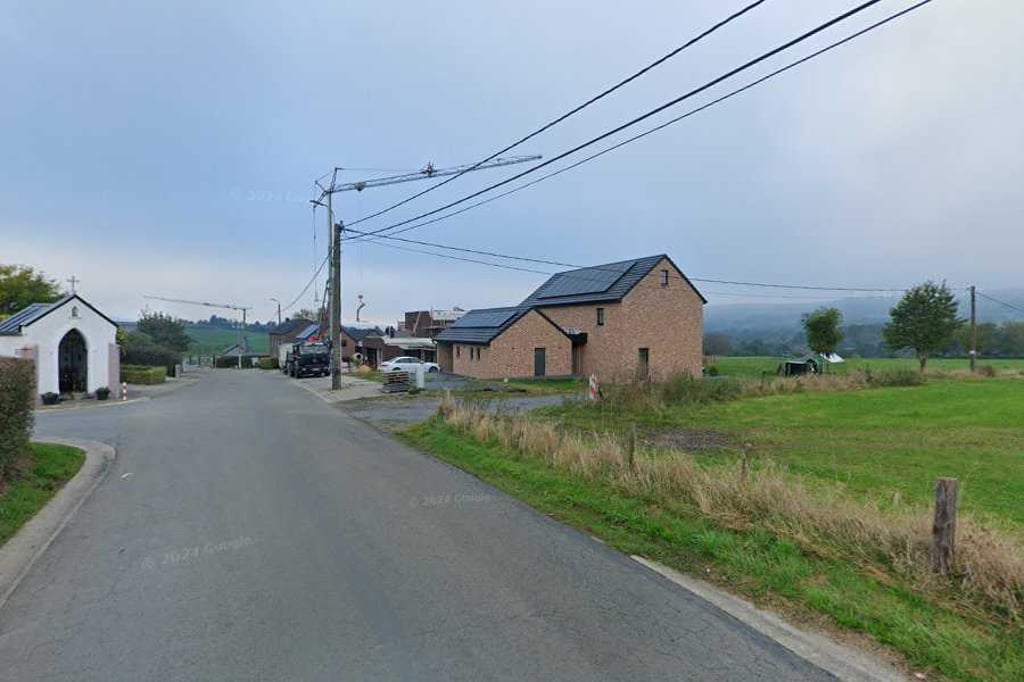
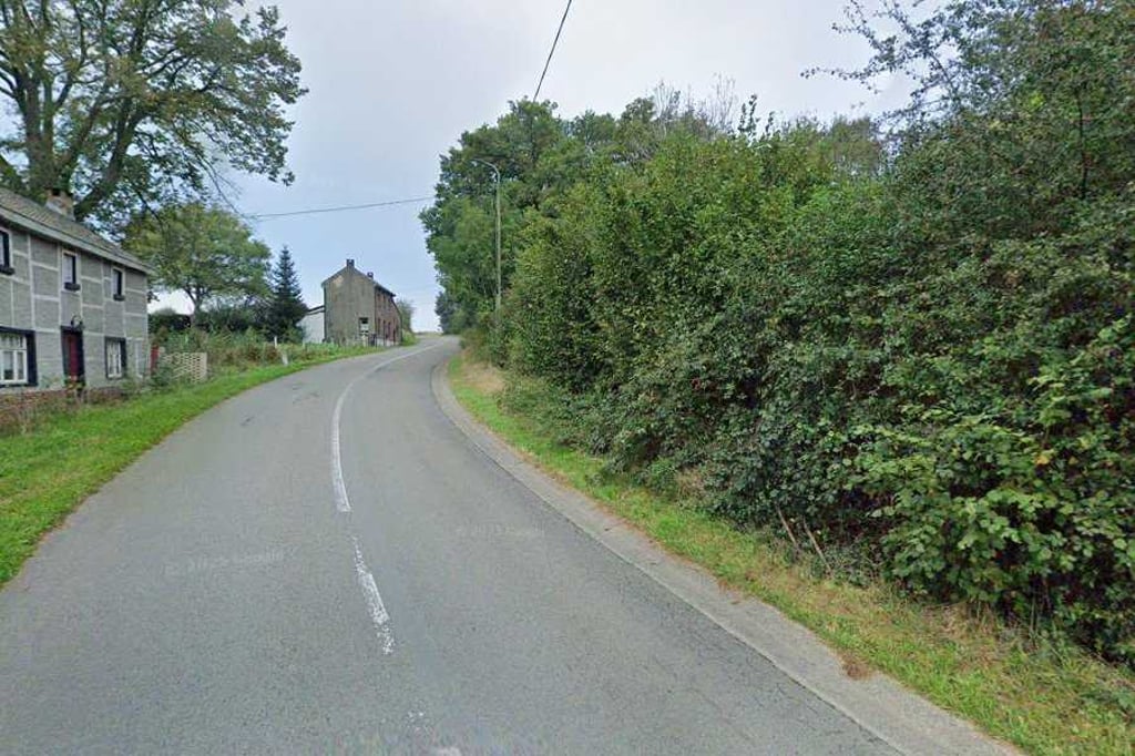
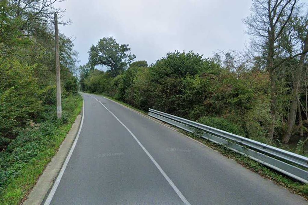
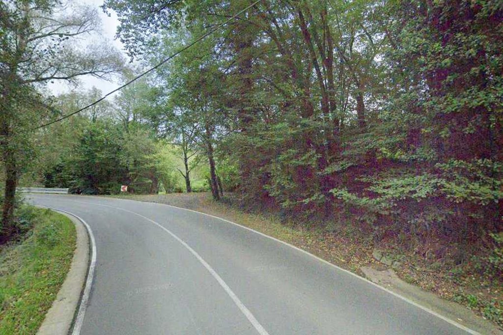
Baanhaag from Lattenheuer is a climb in the region Pays de Herve. It is 0.3 km long and bridges 16 m of vertical ascent with an average gradient of 5.9%, resulting in a difficulty score of 10. The top of the ascent is located at 161 m above sea level. Climbfinder users shared 1 review/story of this climb and uploaded 4 photos.

Road name: Baanhaag

3.0 by BikerJohan
This is an automatic translation, the original language is: Dutch.
Short and spirited climb from the valley of a tributary of the Geul. From Rue Hack, you first descend Rue de Lattenheuer. If you then turn left in the valley, the climb begins. At the fork near the little chapel, you are at the top. Climb is on the road to Sippenaeken. ... read more

Photos (4)

Baanhaag from Lattenheuer
transparant thumb
transparant thumb

Your uploads (max 4)

Welcome! Please activate your account if you would like to share something. Look for the verification email in your inbox.

If you want to upload your photos, you need to create an account. It only takes 1 minute and it's completely free.

  • Receive free climbfinder goodies for your reviews & photos.
  • Create a bucket list and check off conquered climbs.
  • Add missing climbs.
Continue with GoogleContinue with Google Continue with FacebookContinue with Facebook Continue with AppleContinue with Apple Sign up with email
By signing up you agree to our terms of service and confirm that you have read our privacy & content policy.

Reviews (1)

5.0
4.0
3.0
2.0
1.0
BikerJohan
1 y 3.0
This is an automatic translation, the original language is: Dutch. Show original

Short and spirited climb from the valley of a tributary of the Geul. From Rue Hack, you first descend Rue de Lattenheuer. If you then turn left in the valley, the climb begins. At the fork near the little chapel, you are at the top. Climb is on the road to Sippenaeken.

Kort en pittig klimmetje vanuit het dal van een zijtak van de Geul. Vanaf Rue Hack daal je eerst Rue de Lattenheuer af. Als je vervolgens in het dal de bocht naar links hebt gehad begint de klim. Op de splitsing bij het kapelletje ben je op de top. Klim ligt op de weg naar Sippenaeken.

Dashboard

Climbing times

7 km/h 00:02:20
11 km/h 00:01:29
15 km/h 00:01:05
19 km/h 00:00:51

Road surface condition

0% 0% 0%
Based on 0 votes
Share your knowledge. What was the road condition during your ascent?

Traffic

0% 0% 0%
Based on 0 votes
Your experience counts. How much traffic did you encounter during the climb?

Frequently Asked Questions

Baanhaag can be cycled from 4 sides. Rue de la Forge from Sippenaeken is the most popular side, but the summit can also be reached via Baanhaag from Lattenheuer, Terbruggen & Terbruggen from Vieux Moulin.

You don't need special gearing for Baanhaag from Lattenheuer. The slope isn't long or steep enough to require much shifting down. You can conquer this climb on power alone. However, a compact gearing system with a smallest front chainring of 34 and largest rear sprocket of 28 or 30 is always nice if you enjoy cycling uphill. This helps maintain a smooth cadence.

Baanhaag from Lattenheuer is not tough enough to be assigned a mountain category. This means that even untrained cyclists can reach the top without any problems on this climb.

Baanhaag from Lattenheuer is 0.3 km long.

The average gradient of Baanhaag from Lattenheuer is 5.9%.

Baanhaag from Lattenheuer has a steepest segment with an average gradient of 8.3%.

The summit of Baanhaag from Lattenheuer is at 161 m.

At a slow pace of 7 km/h, it takes about 00:02:20 to climb Baanhaag from Lattenheuer. At 11 km/h the time is 00:01:29, and at 15 km/h 00:01:05. For the fastest cyclists, 00:00:51 is an achievable time.

Baanhaag from Lattenheuer is located in the region Liège Province in Belgium.

This page is better in the app

Climbfinder app
Climbfinder
(Free)
Open