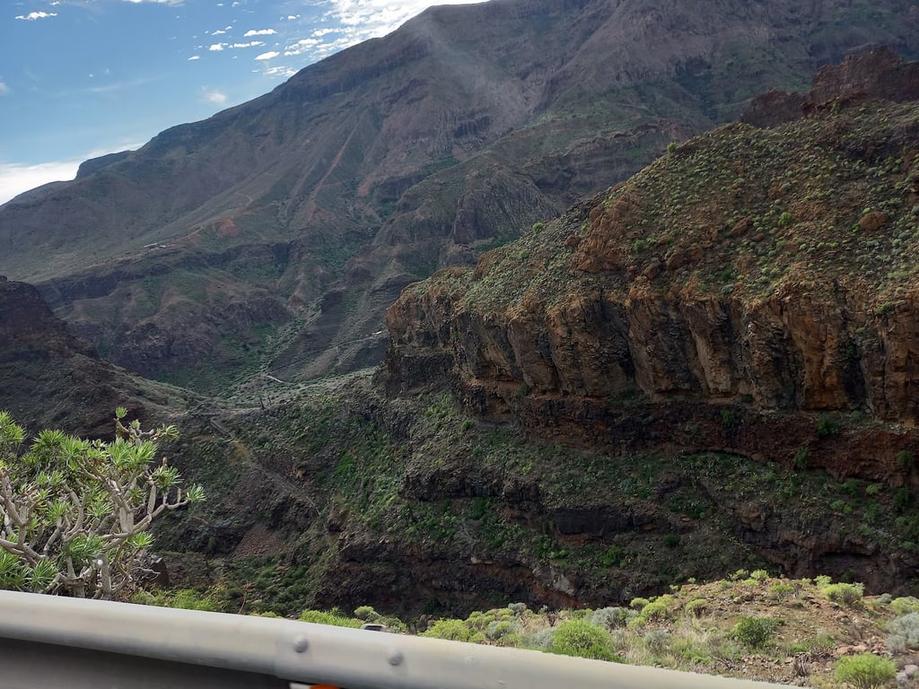
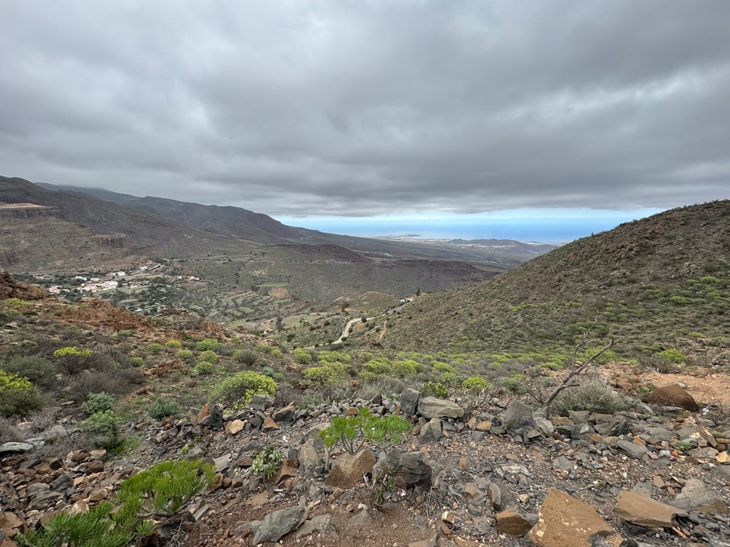
View on map
© MapLibre | OpenStreetMap contributors
1%
2%
4%
6%
8%
10%
12%
15%
20%

Alto de Temisas from Santa Lucía de Tirajana

3.0
3 reviews | Elevation profile | 5 photos
Tips nearby
Alto de Temisas from Santa Lucía de Tirajana
transparant thumb
transparant thumb
transparant thumb
Your achievable time
Calculating based on your best performances...
Relaxed
Maximum
W/kg
W/kg
W/kg
Analyse your climbing performance
Detailed insight into your climbing performance & automatically check off climbs
Based on your best performances.
Your best attempt:
Number of attempts:
Elevation profile Alto de Temisas from Santa Lucía de Tirajana

Statistics

Difficulty points 68
Length 6.7 km
Average gradient 2.4%
Steepest 100 metres 8.6%
Total ascent 157 m

Short recap

Beautiful scenery
8 hairpin turns
#62 toughest climb of Gran Canaria
#51 most elevation gain of Gran Canaria
#37 longest climb of Gran Canaria
#66 average steepest climb of Gran Canaria
Feedback about this climb?
Show climbs nearby Export to GPS device

Alto de Temisas from Santa Lucía de Tirajana is a climb in the region Gran Canaria. It is 6.7 km long and bridges 157 m of vertical ascent with an average gradient of 2.4%, resulting in a difficulty score of 68. The top of the ascent is located at 823 m above sea level. Climbfinder users shared 3 reviews of this climb and uploaded 5 photos.

Road name: GC-550

4.0 by johs78
Santa Lucia is a must do when in GC. This climb is a nice alternative on the way "back".... read more

Photos (5)

Alto de Temisas from Santa Lucía de Tirajana
transparant thumb

Your uploads (max 4)

Welcome! Please activate your account if you would like to share something. Look for the verification email in your inbox.

If you want to upload your photos, you need to create an account. It only takes 1 minute and it's completely free.

  • Receive free climbfinder goodies for your reviews & photos.
  • Create a bucket list and check off conquered climbs.
  • Add missing climbs.
Continue with GoogleContinue with Google Continue with FacebookContinue with Facebook Continue with AppleContinue with Apple Sign up with email
By signing up you agree to our terms of service and confirm that you have read our privacy & content policy.

Reviews (3)

5.0
4.0
3.0
2.0
1.0
johs78
1 y 4.0

Santa Lucia is a must do when in GC. This climb is a nice alternative on the way "back".

Dashboard
jakubp123
1 y 2.0 via the Climbfinder app

Easy climb, just have to get over the initial ramp and them its almost flat. The problem is when you keep going towards Aguimes the tarmac on the following descent is terrible, very rough and bumpy. The road is also very exposed so you can expect some wind here

Dashboard
antodippo
1 y 3.0

Not a long one, that starts a bit steep but then it get easier. Good for the views at the end, with an observatory. The start from Santa Lucia is nice (you can stop at a small pastry shop to get some water and food). The descent to Aguimes can be windy, but the town itself is worth visiting.

Alto de Temisas from Santa Lucía de Tirajana
Dashboard

Climbing times

7 km/h 00:57:05
11 km/h 00:36:19
15 km/h 00:26:38
19 km/h 00:21:02

Road surface condition

100% 0% 0%
Based on 1 vote
Share your knowledge. What was the road condition during your ascent?

Traffic

0% 100% 0%
Based on 1 vote
Your experience counts. How much traffic did you encounter during the climb?

Frequently Asked Questions

Alto de Temisas can be cycled from 2 sides. Alto de Temisas from Agüimes is the most popular side, but the summit can also be reached via Alto de Temisas from Santa Lucía de Tirajana.

You don't need special gearing for Alto de Temisas from Santa Lucía de Tirajana. The slope isn't long or steep enough to require much shifting down. You can conquer this climb on power alone. However, a compact gearing system with a smallest front chainring of 34 and largest rear sprocket of 28 or 30 is always nice if you enjoy cycling uphill. This helps maintain a smooth cadence.

Alto de Temisas from Santa Lucía de Tirajana falls into the 5th category. With good fitness, you can ride it up with speed and power. If you have less training, shift down and climb smoothly.

Alto de Temisas from Santa Lucía de Tirajana is 6.7 km long.

The average gradient of Alto de Temisas from Santa Lucía de Tirajana is 2.4%.

Alto de Temisas from Santa Lucía de Tirajana has a steepest segment with an average gradient of 8.6%.

The summit of Alto de Temisas from Santa Lucía de Tirajana is at 823 m.

At a slow pace of 7 km/h, it takes about 00:57:05 to climb Alto de Temisas from Santa Lucía de Tirajana. At 11 km/h the time is 00:36:19, and at 15 km/h 00:26:38. For the fastest cyclists, 00:21:02 is an achievable time.

Alto de Temisas from Santa Lucía de Tirajana is located in the region Gran Canaria in Spain.

This page is better in the app

Climbfinder app
Climbfinder
(Free)
Open