100k+ climbers track their ascents in the Climbfinder App
Discover
Map
Regions
Ranking
Analytics
Premium
Climbs
No results found
Regions
No results found
Places
No results found
US
English
English (US units)
Nederlands
Français
Deutsch
Italiano
Español
Polski
Dashboard
My routes
My climbs
Climbfinder goodies
Settings
Log out
Continue with Google
Continue with Facebook
Continue with Apple
or
Log in
Sign up
Home
Ranking
Most popular climbs - Lower Franconia
The ultimate climbing rankings
Most popular
Most popular
Toughest
Steepest
Longest
Elevation gain
Highest
Hairpins
Best rated
Lower Franconia
Regions
No results found
Places
No results found
My location
Retrieving location...
Browser location not shared
Remove current selection
All
Bucket list
1.900
climbs
0.0
% ridden
Previous
Next
Loading...
No climbs found
1226
Your best attempt:
Climbed
Bucket list climb
Not yet climbed
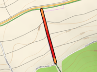
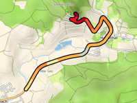
Grosslangheimer Schwanleite
0.2 mi
7.8%
23
98 ft
1076 ft
1227
Your best attempt:
Climbed
Bucket list climb
Not yet climbed
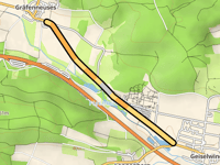
Gräfenneuses from Geiselwind
1.5 mi
1.8%
10
144 ft
1283 ft
1228
Your best attempt:
Climbed
Bucket list climb
Not yet climbed
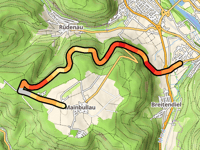
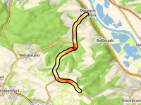
Mainbullau from Miltenberg via Steinkopf
4.9 mi
4.3%
200
1099 ft
1493 ft
1
3
1229
Your best attempt:
Climbed
Bucket list climb
Not yet climbed
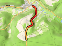
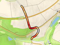
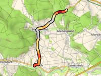
Fatschenbrunner Berg from Unterschleichach
1 mi
6.4%
72
328 ft
1417 ft
5
1230
Your best attempt:
Climbed
Bucket list climb
Not yet climbed
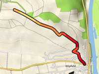
Speiersberg from Wipfeld
1 mi
5.9%
75
328 ft
994 ft
4
1231
Your best attempt:
Climbed
Bucket list climb
Not yet climbed
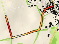
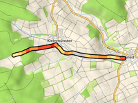
Eckert from Heimbach
0.6 mi
4.6%
29
154 ft
1161 ft
5
1232
Your best attempt:
Climbed
Bucket list climb
Not yet climbed
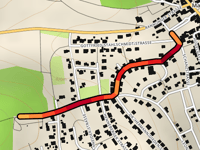
Dora-Müller-Strasse from Massbach
0.5 mi
8.1%
54
210 ft
1135 ft
5
1233
Your best attempt:
Climbed
Bucket list climb
Not yet climbed
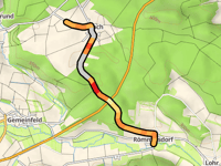
Röten via Ringweg
0.5 mi
5.0%
24
125 ft
1066 ft
1234
Your best attempt:
Climbed
Bucket list climb
Not yet climbed
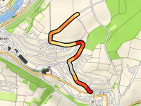
Vogeltränke from Obernbreit via Sonnenstrasse
1.3 mi
4.1%
50
285 ft
889 ft
5
1235
Your best attempt:
Climbed
Bucket list climb
Not yet climbed
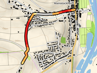
Haselberg from Mainstockheim via Mühlweg
0.9 mi
4.8%
49
233 ft
840 ft
5
1236
Your best attempt:
Climbed
Bucket list climb
Not yet climbed
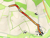
Anstieg von Ruppach from Ruppach
0.7 mi
4.7%
26
164 ft
1027 ft
5
1237
Your best attempt:
Climbed
Bucket list climb
Not yet climbed
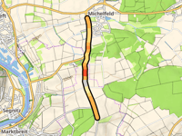
Gertholz from Michelfeld
1.8 mi
2.4%
24
230 ft
906 ft
1238
Your best attempt:
Climbed
Bucket list climb
Not yet climbed
Rathausstrasse from Rothausen
0.4 mi
5.9%
26
135 ft
1053 ft
5
1239
Your best attempt:
Climbed
Bucket list climb
Not yet climbed
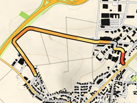
Schrottenberg from Römmelsdorf
2 mi
3.2%
50
338 ft
1204 ft
5
1240
Your best attempt:
Climbed
Bucket list climb
Not yet climbed
Jahnstrasse from Estenfeld
1 mi
2.6%
15
138 ft
915 ft
1241
Your best attempt:
Climbed
Bucket list climb
Not yet climbed
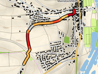
Haselberg from Mainstockheim via Im Tännig
0.8 mi
5.0%
44
220 ft
840 ft
5
1242
Your best attempt:
Climbed
Bucket list climb
Not yet climbed
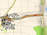
Hergolshausen from Main
0.8 mi
2.8%
13
118 ft
791 ft
1243
Your best attempt:
Climbed
Bucket list climb
Not yet climbed
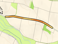
Lembacher Höhe from Dippach am Main
3.2 mi
2.7%
64
443 ft
1191 ft
5
1244
Your best attempt:
Climbed
Bucket list climb
Not yet climbed
Gärtenberg from Bundorf
0.6 mi
2.8%
9
89 ft
1142 ft
1245
Your best attempt:
Climbed
Bucket list climb
Not yet climbed
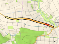
Kerbfeld from Lendershausen
1.4 mi
2.6%
21
197 ft
1030 ft
1246
Your best attempt:
Climbed
Bucket list climb
Not yet climbed
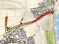
Eichelberg from Buchbrunn
1.1 mi
4.4%
46
249 ft
860 ft
5
1247
Your best attempt:
Climbed
Bucket list climb
Not yet climbed
Handthaler Stollberg via Handthal
2 mi
4.0%
88
433 ft
1319 ft
4
1248
Your best attempt:
Climbed
Bucket list climb
Not yet climbed
Tannenberg / Pfarrwald from Birkach
2.5 mi
3.0%
73
397 ft
1220 ft
5
1249
Your best attempt:
Climbed
Bucket list climb
Not yet climbed
Am Haag from Mechenried
1.7 mi
3.8%
57
331 ft
1194 ft
5
1250
Your best attempt:
Climbed
Bucket list climb
Not yet climbed
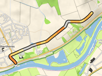
Lange Beut from Obertheres
1.4 mi
2.4%
18
174 ft
866 ft
Previous
Next
Your best attempt:
Climbed
Bucket list climb
Not yet climbed
a
This page is better in the app
Climbfinder
(Free)
Open